
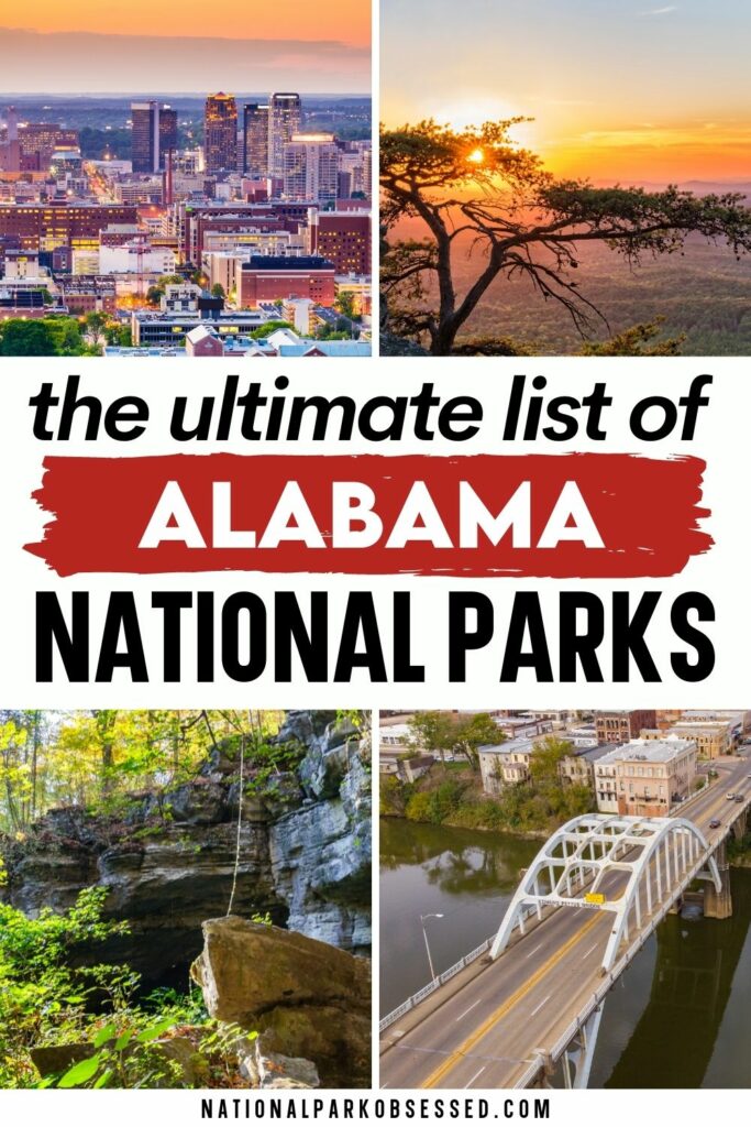

Post Summary: National Parks in Alabama
The 22nd state admitted to the Union, Alabama was originally part of the Alabama territory that included neighboring state Mississippi until it earned statehood status on December 14, 1819. Historical events have both commemorated but left lasting impressions over the decades. From the historical World War II Tuskegee Airmen to the Civil Rights Movement, Alabama has often found itself at the forefront of National headlines that have been made famous through historical accounts in media and publications. These are the National Parks of Alabama.
This post may contain affiliate links, meaning if you book or buy something through one of these links, I may earn a small commission at no extra cost to you! Read the full disclosure policy here

Map of Alabama National Parks
Alabama National Parks
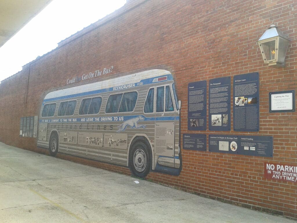
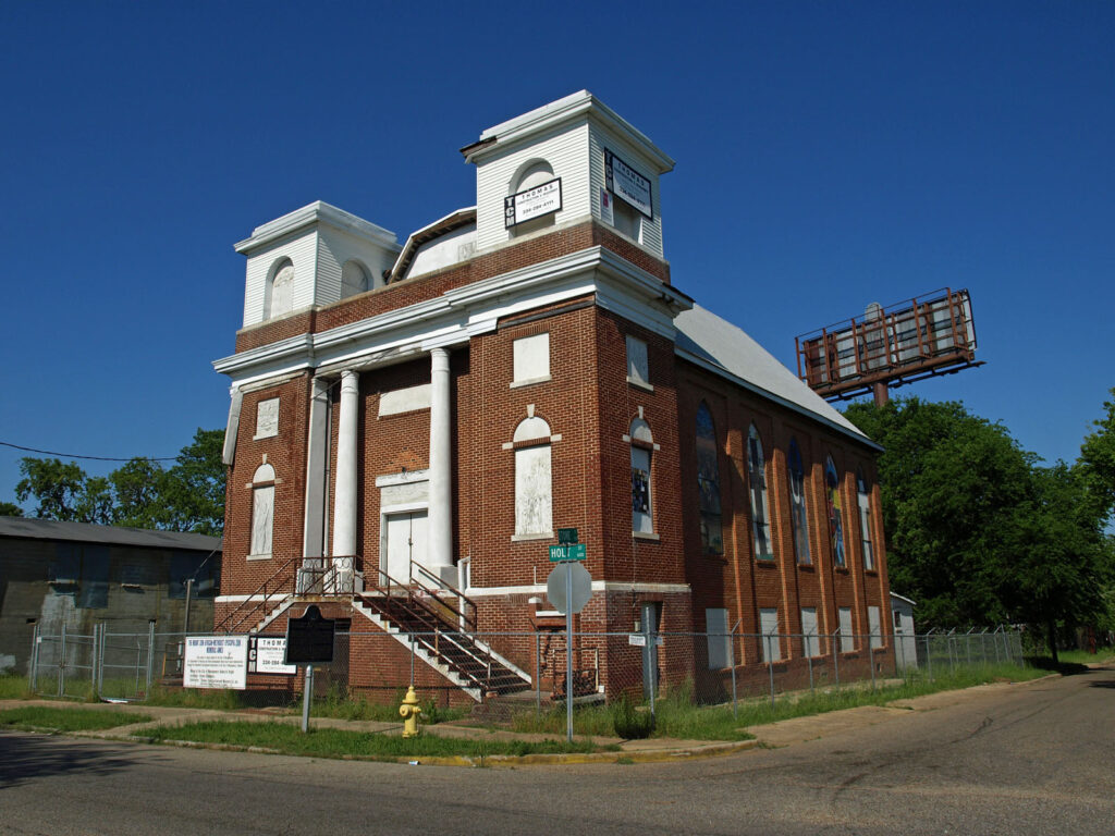
Birmingham Civil Rights National Monument
A relatively new National Park Service unit, the Birmingham Civil Rights National Monument preserves and commemorates the Civil Rights Movement.
The A.G. Gaston Motel was a historical property during the Civil Rights Movement. Built in 1954, the motel was the site of civil rights strategy meetings, playing an important role in the movement. Dr. Martin Luther King Jr. stayed at the property during the spring of 1963 to show solidarity with the protesters that would see him jailed for defying the court’s injunction, leading to his “Letter from Birmingham Jail”. The motel made further history in May 1963 following the explosion of two bombs near King’s room in response to a truce between city officials and white business leaders. Little Richard and Stevie Wonder performed at the motel’s lounge, while Duke Ellington, Aretha Franklin and Jackie Robinson were guests.
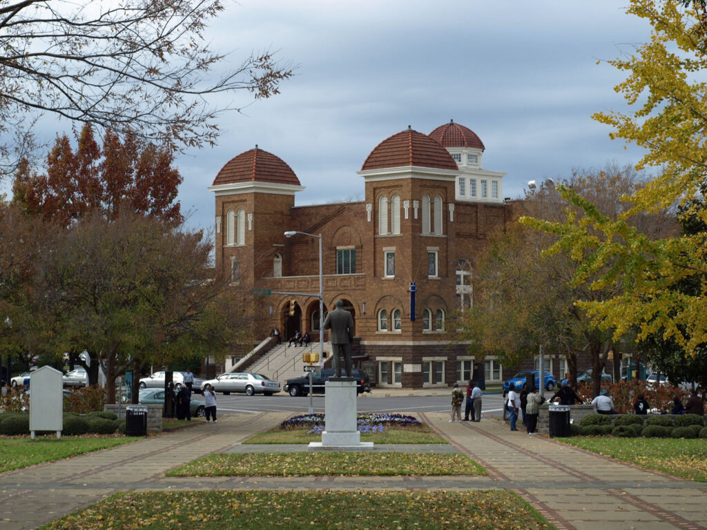
The 16th Street Baptist Church served as a rallying point for African American demonstrators during the Birmingham campaign between April-May 1963. The church was bombed on September 15, 1963 by two KKK members who planted 19 sticks of dynamite underneath the east side stairs, killing four children twenty-two others. This event is credited for pushing forward the 1964 Civil Rights Act.
The Birmingham Civil Rights National Monument was established on January 12, 2017.
Things to do: Birmingham Civil Rights Institute, A.G. Gaston Motel, 16th Street Baptist Church, St. Paul Methodist Church.
How to get there: Located just two hours west of Atlanta, GA, there are multiple transportation options available for reaching the national monument.
From Atlanta: The I-20 W merges into the I-59 S. Exit 22nd Street and make a left. Then a right on 6th Avenue N to 16th St.
From Tuscaloosa: Head North from the I-20/59 towards Atlanta/Gadsden. Take the 17th Street exit to 6th Avenue N.
Where to Stay: There are multiple lodging options available in the city of Birmingham.
Entrance Fee: Free
Official Website: Click Here
Map: Download
Freedom Riders National Monument
The Freedom Rivers National Monument preserves and commemorates the Freedom Riders during the Civil Rights Movement. It is composed of two locations in the town of Anniston and just outside of the town.
The former Greyhound Bus Station is the site where a mob attacked an integrated group of white and black Freedom Riders on May 14, 1961. The Freedom Rivers were demanding an end to racial segregation on interstate buses. The bus tires were slashed and windows broke as the mob pursued them upon them departing the station.
The second site of the monument is 6-miles west of the bus station. Here, the bus broke down along the side of the highway from a flat tire experienced upon departing the station. The mob threw flaming rags into the bus, causing it to explode as passengers were attacked upon fleeing it. This event was captured through the photography of Joseph “Little Joe” Postiglione, becoming an icon of the Civil Rights Movement.
The Freedom Riders National Monument was established on January 12, 2017.
Things to do: Greyhound Bus Station, Site of the bus burning
How to get there:
Former Greyhound Bus Station: Located in Anniston, AL, the bus station can be reached from the I-20 and the US-431 S. It is located along East Eleventh Street and Gurnee Avenue.
Bus Burning Site: The site is located 6-miles west of the former Greyhound bus station along Old Birmingham Highway/State Route 202. Please note that the site is commemorated by an Alabama Historical Marker and is located within a private area. No parking is available.
Where to Stay: There are multiple lodging options located near the monument in the city of Anniston, AL.
Entrance Fee: Free
Official Website: Click Here
Map: Download
Horseshoe Bend National Military Park
Horseshoe Bend National Military Park honors the 800 soldiers lost fighting for freedom during the final battle of the War of 1812. Future US President, General Andrew Jackson led over 3,300 members of the Tennessee militia, Cherokee, and Lower Creek allies into the fortified Horseshoe Bend against the Red Sticks of the Creek Indian tribe on March 27, 1814.
The Treaty of Fort Jackson was signed by the Creeks on August 9, 1814 which seeded 23 million acres of present-day Alabama and Georgia to the US government. The battle was the largest loss of Native American life in a single battle in US history.
Horseshoe Bend National Military Park was established on July 25, 1956.
Things to do: Guided tours, hiking, visitor center film, boating, bicycling, tour road loop
How to get there: The park is located 12-miles north of the town of Dadeville in east-central Alabama. Located alongside state highway 49. The nearest airport is 65-miles south in Montgomery, AL.
Where to Stay: There are no lodging options available within the park. The nearest lodging is 12-miles west in the town of Alexander City, AL.
Entrance Fee: Free
Official Website: Click Here
Map: Download
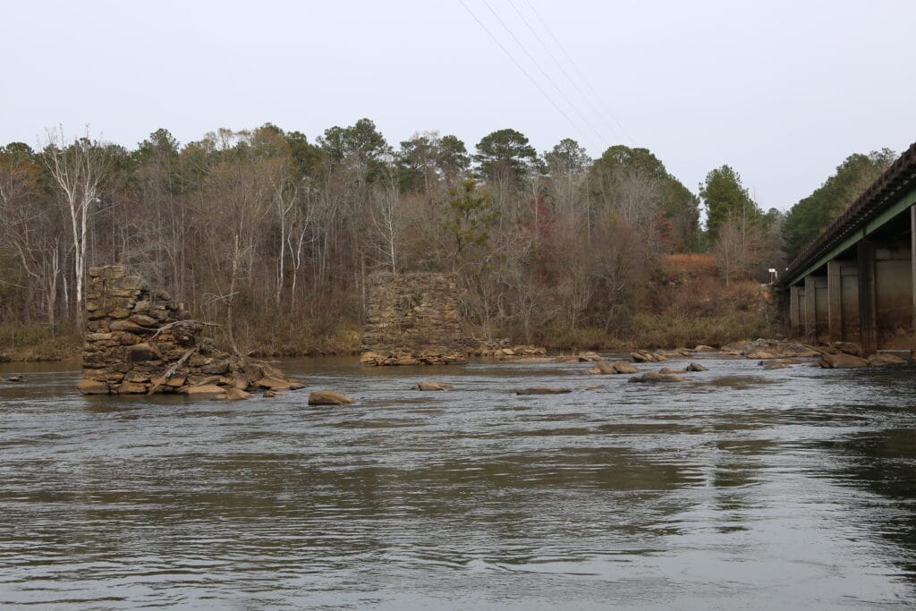
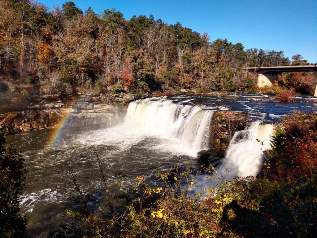
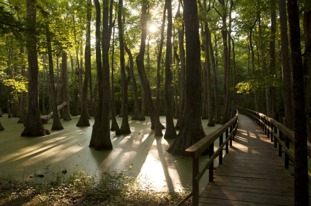
Little River Canyon National Preserve
Little River Canyon National Preserve is located in northeastern Alabama near the border with Georgia. The nearest major cities are Atlanta, GA to the southeast and Chattanooga, TN to the north.
Historically known as “May’s Gulf”, the preserve protects what is dubbed the nation’s longest mountaintop river, the Little River. DeSoto Falls, Little River Falls, and Alabama’s highest waterfall (seasonal) at 133 feet tall, Grace’s High Falls are located within the preserve. The preserve is commonly known for its abundance of recreation activities.
Little River Canyon National Preserve was established on October 21, 1992.
Things to do: Bird watching, bicycling, fishing, horseback riding, kayaking, photography, rock climbing, scenic driving
How to get there: The Little River Canyon Center is located along Alabama Highway 35 near the Alabama/Georgia border. Relying upon GPS navigation is not reliable and the address below is an alternative.
472 Alabama Highway 35
Fort Payne, AL 35967
Where to Stay: There is no lodging offered within the preserve. Camping is also not permitted. DeSoto State Park 7-miles north of the canyon center provides tent, trailer and RV camping.
Entrance Fee: Entrance fees are only collected at Canyon Mouth Park. Only cash payments are accepted at the fee machine for $15.00. America the Beautiful Passes are also accepted for admission.
Official Website: Click Here
Map: Download
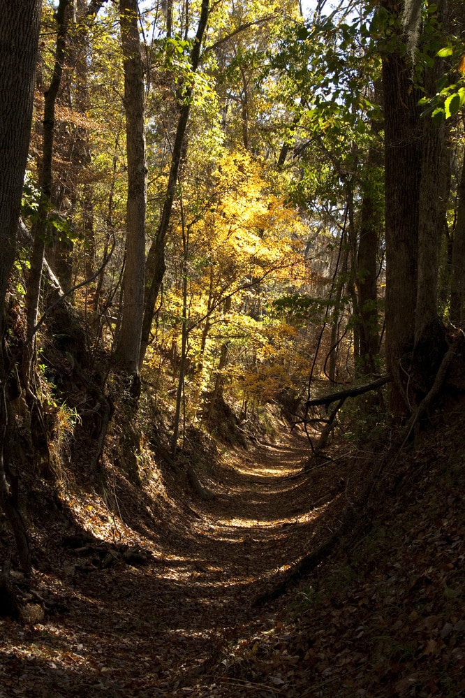
Natchez Trace National Scenic Trail
The Natchez Trace National Scenic Trail is a 444-mile long route through Tennessee, Alabama and Mississippi. The trail follows sections of the historic Natchez Trace, an ancient path that began as a Native American and wildlife trail.
There are five segments of the trail that are over 60-miles in length, primarily developed for hiking and horseback riding. The trail relies heavy upon volunteers to maintenance and construction.
The Natchez Trace National Scenic Trail was established in 1983.
Things to do: The Alabama portion of the scenic trail is 33-miles in length. Located in northwestern Alabama, it is considered part of the original middle section of the Natchez Trace spanning from milepost 341.8 near the Tennessee state line to milepost 308.9, the Mississippi state line.
How to get there: The Alabama portion of the trail is located near the city of Florence near State Highway 20.
Where to Stay: There is no lodging available within the trail, but the city of Florence to the east has multiple options available.
Entrance Fee: Free
Official Website: Click Here
Map: Download
Natchez Trace Parkway
Stretching 444-miles from Natchez, MI to Nashville, TV, the Natchez Trace Parkway preserves sections of the original Natchez Trace. The trail was created by the Native Americans and later used by early European and American settlers and immigrants between the late 18th century and early 19th century. Goods were transported as the easiest way to connect the frontier with New Orleans, until the creation of steamboats along the Mississippi River.
During the War of 1812, General Andrew Jackson utilized the trail heading south to defend against the Red Sticks and British army from invasion. One of the first examples of land-based organized-crime in the US occurred through the actions of John Murrell and Samuel Mason. It is also along the trace in October 1809 where Meriwether Clark of the Lewis and Clark Expedition died and is buried near the town of Hohenwald, TN
The Natchez Trace Parkway was established on May 18, 1938.
Things to do: Colbert Ferry, Rock Spring Nature Trail
How to get there: The parkway is accessible from Highway 72 near Cherokee, AL.
Where to Stay: There is no lodging available along the parkway. The city of Florence is several miles to the east of the parkway with lodging available.
Entrance Fee: Free
Official Website: Click Here
Map: Download
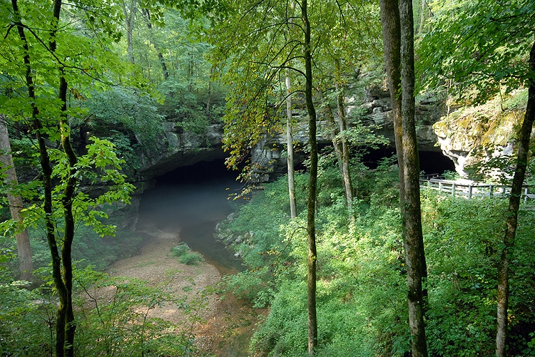
Russell Cave National Monument
Russell Cave National Monument is a historic archeological site used by prehistoric Indians for thousands of years as a means for shelter from 6500 BCE to 1650 CE. The cave and its surrounding area were used to gather produce, hunt and stone. At a mapped length of 7.2 miles, it is the third longest cave in Alabama.
Each year during the first weekend of May, the monument hosts a Native American Festival. Live performances of storytelling, dancing and Native American flute playing occur along with demonstrations of Native American lifestyles and weapon making.
Russell Cave National Monument was May 11, 1961 after the land was donated by the National Geographic Society.
Things to do: Visitor Center, cave tours, cave boardwalk, hiking, nature walking
How to get there: Located northeastern Alabama near the Tennessee border, it is 42-miles west of Chattanooga, TN. The entrance can be reached from US-72 to Co Rd 98 for 3.7 miles
Where to Stay: There is no lodging available at the monument. There are several lodging options a few miles to the southwest in the city of Stevenson., AL
Entrance Fee: Free
Official Website: Click Here
Map: Download
Tuskegee Airmen National Historic Site
Tuskegee Airmen National Historic Site commemorates the historic achievements of African-American airmen during World War II. The historic pilots known as the “Red Tails” began their flight training at Moton Field that was known as the “Tuskegee Experiment” which began in 1941.
The success of the program paved the way for full integration of the US military. Pilots, navigators, maintenance, bombardiers, and instructors were all included as Tuskegee Airmen. They made national news in March 1941, when the first lady, Eleanor Roosevelt visited the area and was taken up in an aircraft piloted by C. Alfred “Chief” Anderson, Tuskegee Institute’s chief instructor pilot.
Tuskegee Airmen National Historic Site was established November 6, 1998.
Things to do: 20 exhibits, scenic overlook, Hangar #1 and Hangar #2 Museum
How to get there: The nearest major cities are Montgomery, AL to the west and Atlanta, GA to the east. Each city has a major airport located within the area and can be reached by car.
From Montgomery: I-85 N for 40-minutes into Tuskegee, AL
From Atlanta: I-85 S towards Montgomery, AL for 1-hour 45-minutes
Where to Stay: Lodging in the area is very limited in the area. The two best options are the Days Inn by Wyndham Shelter to the west and the Kellogg Conference Center in Tuskegee.
Entrance Fee: Free
Official Website: Click Here
Map: Download

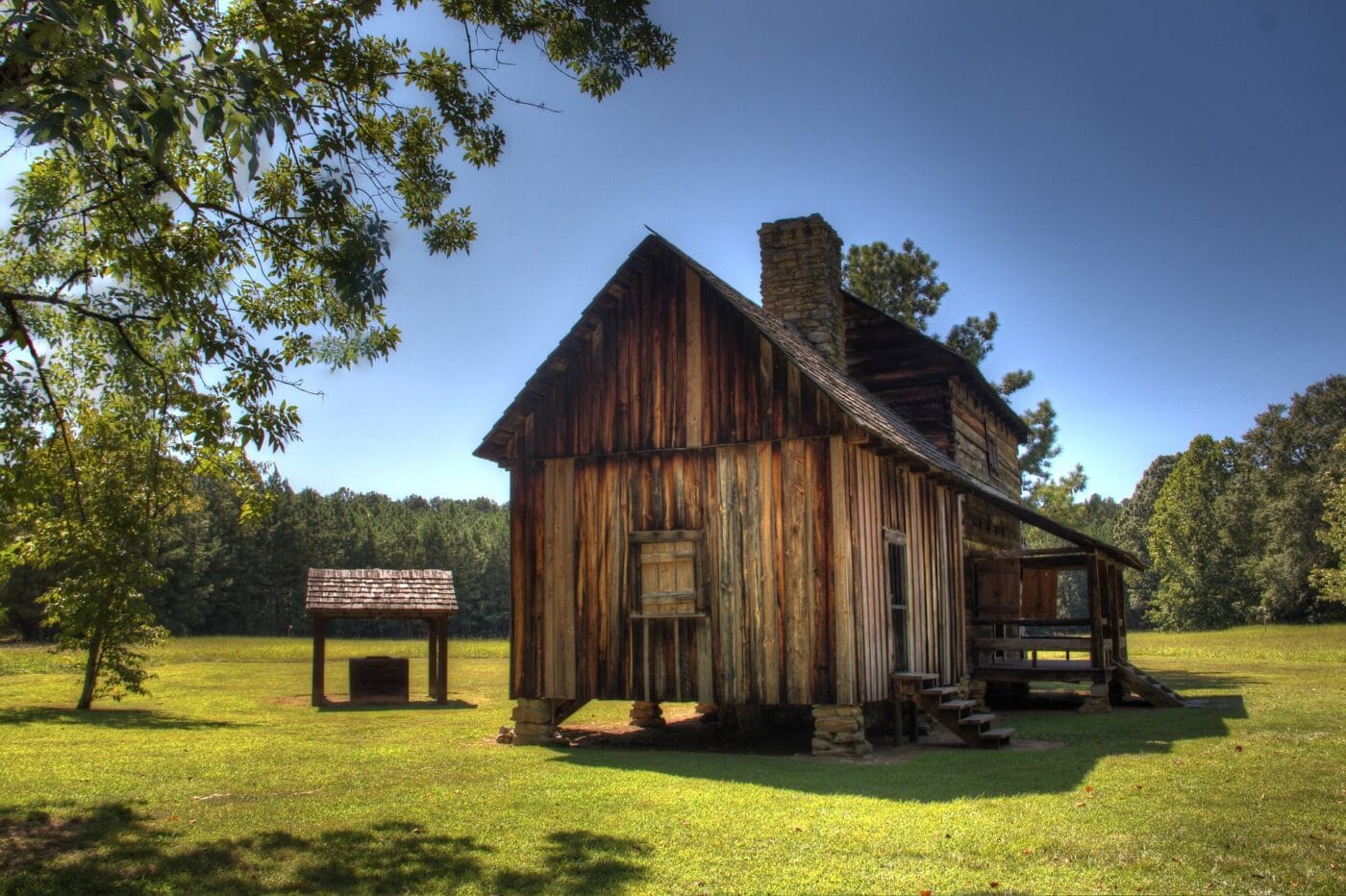
Tuskegee Institute National Historic Site
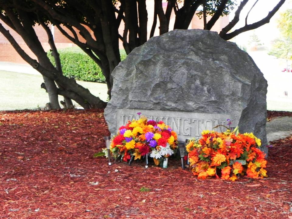
Founded by Booker T. Washington on July 4, 1881, recruiting the brightest teachers, the Tuskegee Institute National Historic Site played a role in higher education for African-Americans. The present-day Tuskegee University was home to scientist George Washington Carver and World War’s II’s the Tuskegee Airmen.
Many buildings within the site were built by students under the direction of Robert Thompson, the first African-American to graduate from MIT.
Things to do: George Washington Carver Museum, “The Oaks” – Home of Booker T. Washington, Tuskegee Institute, Grave of Booker T. Washington, Grave of George Washington Carver
How to get there: The nearest major city and airport is located 35-miles west in Montgomery, AL. The site can be reached from Montgomery by I-85 N to the Pleasant Drive Exit for 4-miles onto Franklin Drive.
Where to Stay: Limited lodging is available at the Kellogg Conference Center adjacent to the site and nearby at the Days Inn by Wyndham Shorter.
Entrance Fee: Free
Official Website: Click Here
Map: Download
Affiliate Sites of Alabama
Muscle Shoals National Heritage Area
Muscle Shoals National Heritage Area is the only of its kind in Alabama and one of the 55 within the US that promotes cultural tourism through the preservation of resources in the Tennessee River basin.
Music, Native American heritage and the Tennessee River are the three main areas of focus in the area that serve to educate its visitors on the country’s evolution.
The Muscle Shoals National Heritage Area was signed into law in 2002 and designated in 2009 with the passage of the Omnibus Public Land Management Act of 2009.
Things to do: Wheeler Dam, Wilson Dam, Ivy Green, Rosenbaum House, Barton Hall
How to get there: The area is located within the city of Florence, AL adjacent to the University of North Alabama. The nearest major town is Huntsville, AL located east of the area off State Highway 72.
Where to Stay: There are lodging options available within the city of Florence, AL.
Entrance Fee: Entrance fees in the area vary throughout the area.
Official Website: Click Here
Map: Download

Selma to Montgomery National Historic Trail
The Selma to Montgomery National Historic Trail is a 54-mile historic trail. The trail commemorates the Selma to Montgomery March in March 1965 led by Dr. Martin Luther King Jr.
The trail begins in Selma where the events of Bloody Sunday occurred on March 7, 1965, at the Edmund Pettus Bridge. Following these events, President Lyndon B. Johnson ordered 1,900 members of the Alabama National Guard and members of the FBI to protect the marchers during their third walk from March 21 – 25, where 25,000 people supported equal voting rights at the Alabama State Capitol of Montgomery. Later that year on August 6, 1965, the Voting Rights Act of 1965 became law.
The historical events of the march were portrayed in the 2014 Academy Award-winning film, Selma.
The Selma to Montgomery National Historical Trail was established in 1996.
Things to do: Cahawba (Alabama’s first capital), Old Depot Museum in Selma, AL, Old Live Oak Cemetery, Sturdivant Hall, Edmund Pettus Bridge
How to get there: The trail follows along US-80 from Selma to Montgomery for 54-miles.
Where to Stay: There is no lodging on the trail itself, but multiple options are located along the route in Selma and Montgomery.
Entrance Fee: Free
Official Website: Click Here
Map: Download
Trail of Tears National Historic Trail
The Trail of Tears National Historic Trail follows the different routes members of the Cherokee, Muscogee (Creek), Seminole, Chickasaw, Choctaw, Ponca, and Ho-Chunk/Winnebago nations were forced to march for resettlement as part of the Indian Removal Act. The Trail of Tears follows the four main routes from Tennessee, North Carolina, and Georgia through Kentucky, Illinois, Missouri, Alabama, Mississippi, Arkansas on their way to Oklahoma.
The Trail of Tears National Historic Trail stands as a reminder of the horrific treatment the American Indians suffered at the hands of the U.S government. It is estimated between 2,000 – 8,000 Cherokee died along the trail (that doesn’t include deaths of any of the other tribes or deaths in the Seminole wats).
Today, visitors to the Trail of Tears can drive any one of the four main autoroutes and visit sites such as the Cherokee County Historical Museum, Brainerd Mission Cemetery, Cherokee National Museum, and Fort Payne Cabin Site to learn more about the journey the American Indians were forced to make and the challenges they faced.
Trail of Tears National Historic Trail was created in 1987.
Things to do: Historical Sites, Museums, auto touring, walking
How to get there: The trail follows several routes as it pass through Tennessee, North Carolina, and Georgia through Kentucky, Illinois, Missouri, Alabama, Mississippi, Arkansas, and Oklahoma
Where to Stay: There is no lodging on the trail itself, but multiple options are located along the route the trail.
Entrance Fee: Free
Official Website: Click Here
Map: Download
List of National Parks in Alabama
There are 9 National Parks in Alabama and they received 1.4 million visitors in 2021 and generated over $78.2 million in tourism economic benefits.
- Birmingham Civil Rights National Monument
- Freedom Riders National Monument
- Horseshoe Bend National Military Park
- Little River Canyon National Preserve
- Natchez Trace National Scenic Trail
- Natchez Trace Parkway
- Russell Cave National Monument
- Tuskegee Airmen National Historic Site
- Tuskegee Institute National Historic Site
Associated sites of Alabama
- Muscle Shoals National Heritage Area
- Selma to Montgomery National Historic Trail
- Trail of Tears National Historic Trail
Alabama National Parks also provides support and management to 1 other National Trail as well as 1,329 National Register of Historic Places Listings.
There are 38 National Historic Landmarks, 7 National Natural Landmarks, 1,254 Places recorded by the Heritage Documentation Program, and over 430,000 objects in the Alabama National Parks Museum Collections. There are 6,124 Archaeological Sites in the Alabama National Parks.
Alabama is home to 24 State Parks.
List of National Forests in Alabama
National Forests are not managed by the National Park Service and are not part of the National Park System. The National Forests are managed by the U.S. Forest Service under the U.S. Department of Agriculture. Typically, these areas focus on protecting forest areas for present and future use. Due to the different management mandates, National Forest usually allows for outdoor recreational activities such as mountain biking, ATV, and more horseback riding options.
Here are the four National Forests of Alabama:
- Conecuh
- Talladega
- Tuskegee
- William B. Bankhead
Frequently Asked Questions about Alabama National Parks
How many national parks are in Alabama?
There are 9 national parks in Alabama. None of these units hold the coveted title of National Park. These units include 3 National Monuments, 2 National Historic Sites, 1 National Military Park, 1 National Scenic Trail, 1 National Preserve, and 1 Parkway. These
What are the 8 national parks in Alabama?
There are actually 9 National Parks in Alabama. They are Birmingham Civil Rights National Monument, Freedom Riders National Monument, Horseshoe Bend National Military Park, Little River Canyon National Preserve, Natchez Trace National Scenic Trail, Natchez Trace Parkway, Russell Cave National Monument, Tuskegee Airmen National Historic Site, and Tuskegee Institute National Historic Site.
What is the most famous national park in Alabama?
Little River Canyon National Preserve is the most popular national park in Alabama. It gets about 850,000 visitors a year. The second most popular is the Natchez Trace Parkway with 450,000 visitors. The other units get between 5,000 and 60,000.
What national parks are in the state of Alabama?
The national parks of Alabama are Birmingham Civil Rights National Monument, Freedom Riders National Monument, Horseshoe Bend National Military Park, Little River Canyon National Preserve, Natchez Trace National Scenic Trail, Natchez Trace Parkway, Russell Cave National Monument, Tuskegee Airmen National Historic Site, and Tuskegee Institute National Historic Site.
Alabama’s Neighboring States
Planning to visit a few of the National Parks in Alabama and wondering about what national parks are in neighboring states. Here are the list of National Parks in surrounding states:
- National Parks of Florida – Florida is home to Biscayne, Dry Tortugas, and Everglades National Parks as well as 8 other NPS units.
- National Parks of Georgia – Georgia is home to 11 national park units.
- National Parks of Mississippi – Mississippi is home to 9 NPS units.
- National Parks of Tennessee – Tennesse shares Great Smoky Mountains National Park with North Carolina and has 12 other units.
Final Thoughts on the National Parks of Alabama
I hope this guide to the National Parks of Alabama is helpful as you plan to explore these amazing National Parks.
Do you have any questions about Alabama’s National Parks or need help planning your National Park trips. Let me know in the comments or join me in my National Park Trip Planning Community!
Pin it to Share: Alabama National Parks: 9 Epic National Parks in Alabama (2021 Update)

Hi, I'm Jennifer!

Welcome to the wonderful world of National Parks. I'm here to help you plan your NEXT amazing adventure through the United States National Parks and beyond. I want the national parks to be accessible to all.
I live in Tennessee, and when I'm home, you can find me hiking in the Smokies and the Cumberland Plateau.
58/63 National Parks
250+/423 National Park Units
Want to know more? Start Here.
Snag one of my National Park Ebooks and Downloadable Itineraries

Talk with an Expert

Share your love of the parks with a shirt, ornaments, hoodies, frames, and more.
