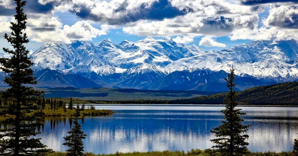
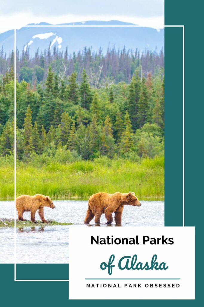
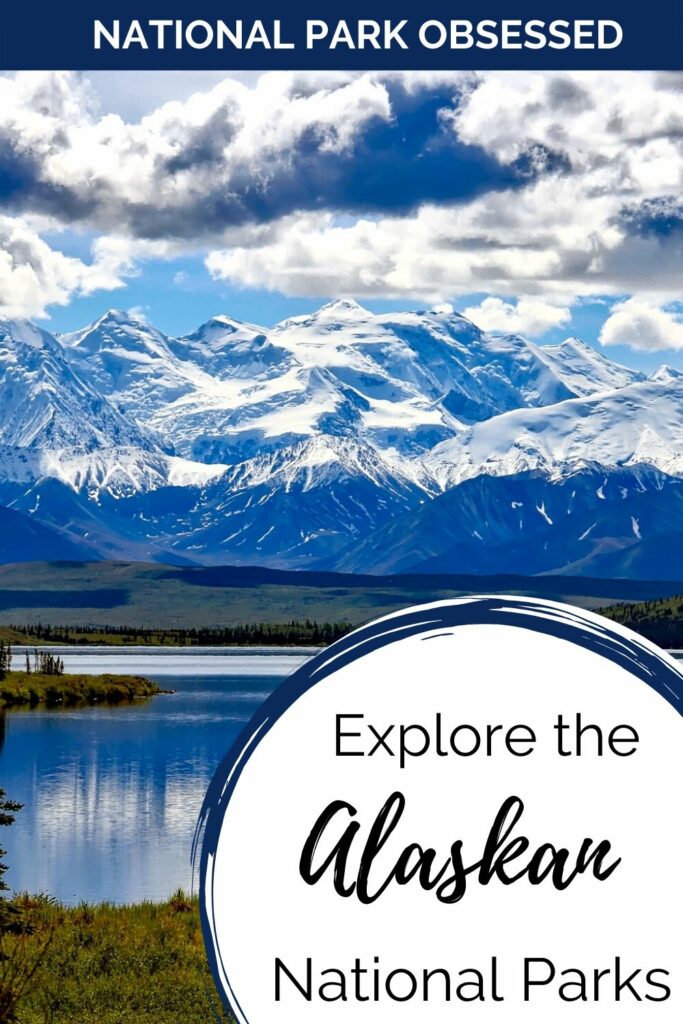
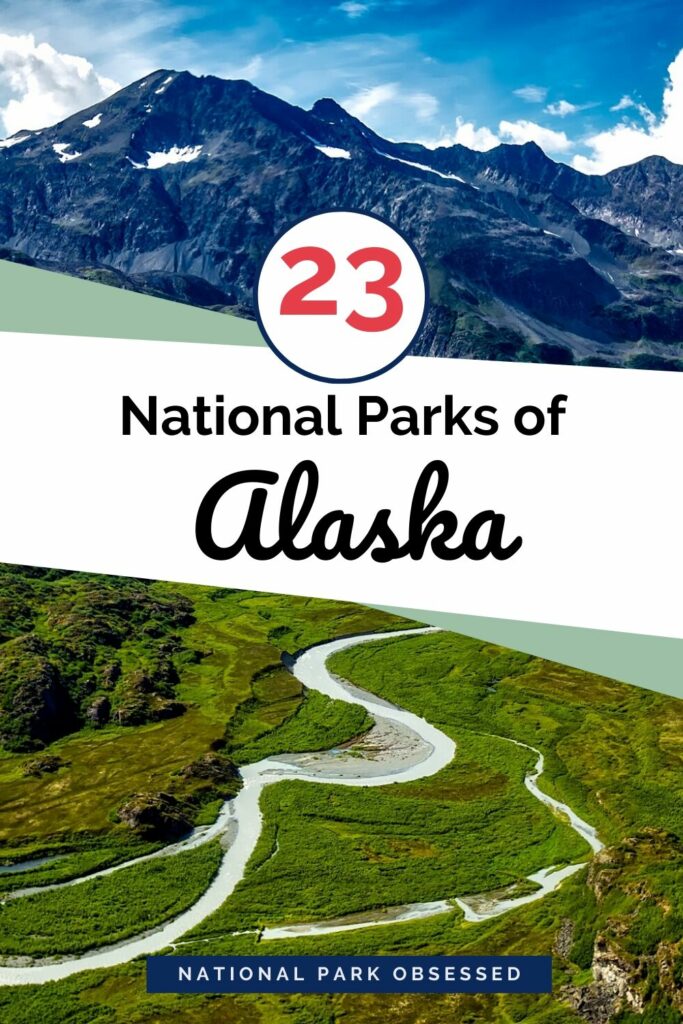
Alaska is called the Last Frontier for a reason. It is a massive state with a diverse landscape that ranges from temperate ranges to the Arctic tundra. It has North America’s tallest mountain along with a whole host of mountain ranges. The National Parks of Alaska protects millions of acres of this remote landscape. There are currently twenty-three National Park Service Site in Alaska and two associated sites.
Fourteen of Alaska’s National Parks are two units that are treated as a single unit. Basically, Alaska has seven parks that are a National Preserve attached to another NPS Unit. Most park visitors do not differentiate these duel units as two units and when they visit one unit of the park, they count that visit as a visit to both units. For this reason some consider Alaska to have 16 National Parks Services Units while others consider Alaska to have 23 National Parks Units.
Official National Parks of Alaska
- Alagnak Wild River
- Aniakchak National Monument
- Aniakchak National Preserve
- Bering Land Bridge National Preserve
- Cape Krusenstern National Monument
- Denali National Park
- Denali National Preserve
- Gates of the Arctic National Park
- Gates of the Arctic National Preserve
- Glacier Bay National Park
- Glacier Bay National Preserve
- Katmai National Park
- Katmai National Preserve
- Kenai Fjords National Park
- Klondike Gold Rush National Historical Park
- Kobuk Valley National Park
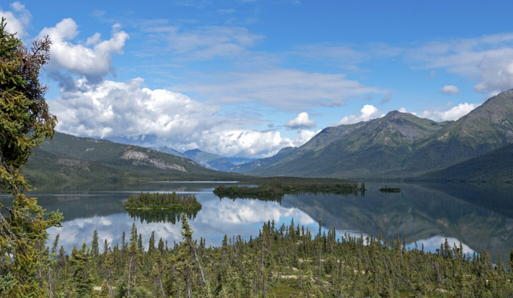
- Lake Clark National Park
- Lake Clark National Preserve
- Noatak National Preserve
- Sitka National Historical Park
- Wrangell-St. Elias National Park
- Wrangell-St. Elias National Preserve
- Yukon-Charley Rivers National Preserve
Associated sites of Alaska
- Aleutian World War II National Historic Area
- Inupiat Heritage Center
This post may contain affiliate links, meaning if you book or buy something through one of these links, I may earn a small commission at no extra cost to you! Read the full disclosure policy here
Does Alaska Trip Planning Leave You Feeling Overwhelmed?
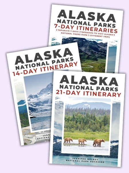
Jump right into booking your Alaska National Parks trip with our expertly designed, pre-made, downloadable National Park itineraries.
Map of National Parks in Alaska
[show-map id=”4″]
Alaska National Parks
Alaska is part of the West Coast Region.
Alagnak Wild River
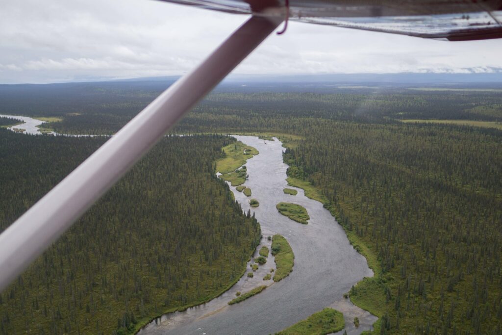
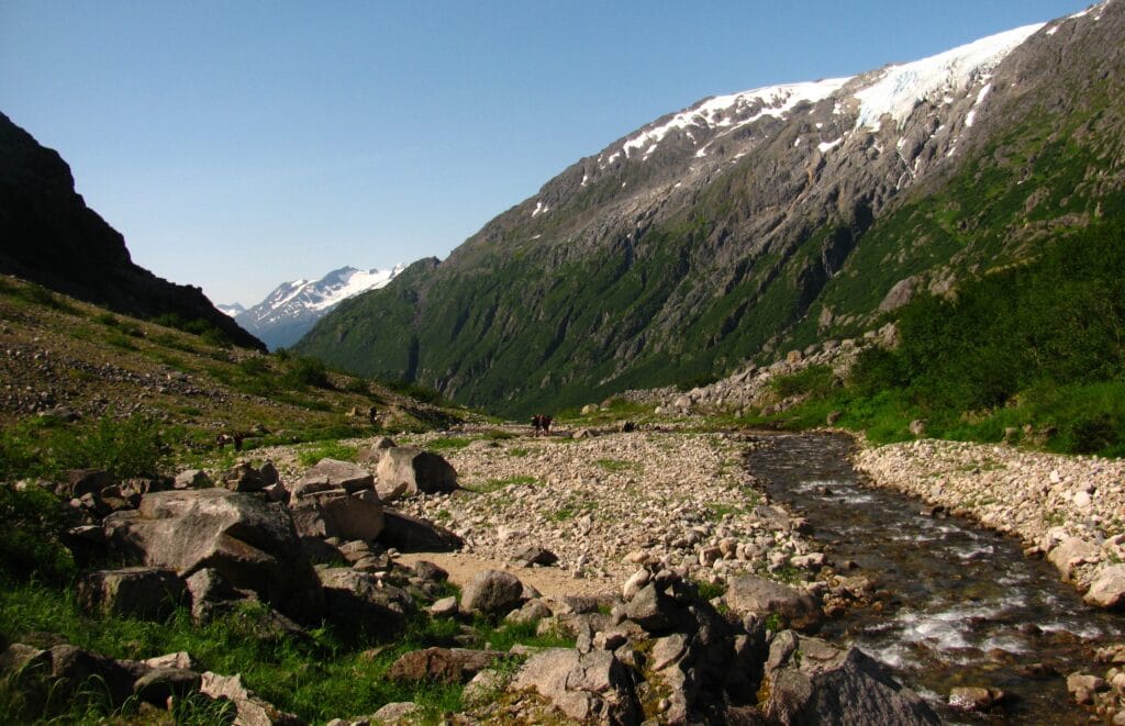
Alagnak Wild River protects a 64-mile Alanak River that runs from Kukaklek Lake in Katmai National Park and Preserve and flows into the Kvichak River and then on to Bristol Bay. This remote Alaskan river fills with salmon during the summer and fall. The salmon feast attracts a large population of grizzly and black bears. Other Alaskan wildlife such as foxes, beavers, wolverines, otters, and minks can be found on the river corridor.
Visitors to Alagnak come to enjoy its water and wild landscape. Most visitors will spend their time on the river either wildlife viewing of fly fishing.
Alagnak Wild River was established in 1980 by the Alaska National Interest Lands Conservation Act (ANILCA).
Things to do in Alagnak Wild River: Boating, camping, fishing, hunting, wildlife viewing
How to get to Alagnak Wild River: There are no roads to Alagnak Wild River. Alagnak Wild River can only be reached via air taxi. Please check the list of authorized air taxis.
Alagnak Wild River’s visitor center is located in King Salmon, Alaska. King Salmon is the main visitor center for most southwestern Alaska National Parks including Aniakchak, Katmai, Lake Clark, , and the NPS-affiliated Aleutian World War II Heritage Area
Where to Stay in Alagnak Wild River: There only lodging in Alagnak is Alaska Trophy Adventure Lodge and Alagnak Wilderness Camps. There are several other wilderness lodges in the surrounding area. Lodging is available in King Salmon.
Alagnak Wild River Entrance Fee: Free
Alagnak Wild River Official Website: Click Here
Map of Alagnak Wild River: Download
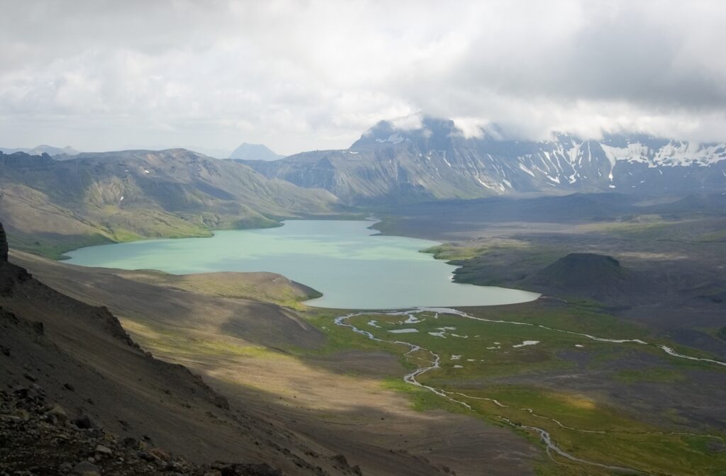
Aniakchak National Monument and Preserve
Aniakchak National Monument and Preserve is two National Park Service Units and constantly holds the title as least visited National Park Service Unit. In 2017 and 2018, the monument only saw 100 visitors. The park is notorious for this weather. Rangers will tell stories of being stuck weeks longer than planned and visitors tell of spending days in King Salmon waiting for their weather window to fly in.
The most popular feature of the park is the 6-mile wide Aniakchak Caldera. This caldera was formed by a volcanic eruption 3,500 years ago. Most of the park is made of volcanic coastal and mountain habitats. It’s the weather is cool and wet and the region is home to most of Alaska’s major wildlife including caribou, moose, brown bears, wolves and wolverines.
Aniakchak National Monument was established on December 1, 1978. In 1980, the monument was expanded and the national preserve around it was established with the passage of the Alaska National Interest Lands Conservation Act (ANILCA).
Things to do in Aniakchak National Monument and Preserve: Backpacking, boating, camping, flightseeing, hiking, hunting, wildlife viewing
How to get to Aniakchak National Monument and Preserve: There are no roads to Aniakchak. Aniakchak can only be reached via air taxi. Please check the list of authorized air taxis. Visiting is a challenge on a good day. Aniakchak’s weather is unpredictable and finding a weather window to fly into/out of the monument can be a challenge. Plan for extra time in King Salmon or Aniakchak on your visit.
Aniakchak National Monument and Preserve’s visitor center is located in King Salmon, Alaska. King Salmon is the main visitor center for most southwestern Alaska National Parks including Alagnak, Katmai, Lake Clark, , and the NPS-affiliated Aleutian World War II Heritage Area.
Where to Stay in Aniakchak National Monument and Preserve: There are no lodges in Aniakchak. The only way to spend the night is to camp. Lodging is available in King Salmon.
Aniakchak National Monument and Preserve Entrance Fee: Free
Aniakchak National Monument and Preserve Official Website: Click Here
Map of Aniakchak National Monument and Preserve: Download
Bering Land Bridge National Preserve
Bering Land Bridge National Preserve is one of the most remote units in Alaska. The Preserve is located in Western Alaska on the Seward Peninsula. This preserve protects the remnants of the Bering Land Bridge. The Bering Land Bridge connected the North American and Asia continents during the Pleistocene ice age more than 13,000 years ago.
Visitors to the preserve find a vast tundra terrain with thickets of willow and alder bushes and volcanic features such as granite tors and lava flows. The most popular spot in the parrk is the Serpentine Hot Springs.
Bering Land Bridge National Preserve was created as a National Monument in 1978. It was elevated to a National Preserve in 1980 by the Alaska National Interest Lands Conservation Act (ANILCA).
Things to do in Bering Land Bridge National Preserve: Backpacking, birding, camping, fishing, flightseeing, hiking, hunting, snowmobiling, wildlife viewing
How to get to Bering Land Bridge National Preserve: There are no roads to the Bering Land Bridge National Preserve. The Preserve can be accessed by foot, boat, small airplane, or snowmobile (during winter). Here is a list of NPS approved air taxies.
Bering Land Bridge National Preserve’s visitor center is located in Nome, Alaska. Nome is about 100 miles away from the preserve. The closest road gets within about 30 miles of the preserve boundary.
Where to Stay in Bering Land Bridge National Preserve: There are no lodges in Bering Land Bridge. The only way to spend the night is to camp. Lodging is available in Nome, Shishmaref, Wales, or Teller.
Bering Land Bridge National Preserve Entrance Fee: Free
Bering Land Bridge National Preserve Official Website: Click Here
Map of Bering Land Bridge National Preserve: Download
Cape Krusenstern National Monument
Sharing 70 miles of coastline with the Chukchi Sea, Cape Krusenstern National Monument protects both beaches and mountainous terrain. Here, you can find evidence of humans dating back 5,000 years. Frolicking through fields of wildflowers will divulge unique shorebirds, some making their way north all the way from South America, and the qiviut (inner wool layer) of muskoxen. Furthermore, there are many activities for visitors to enjoy in this remote Alaskan national park.
This is another national historic landmark that was included in the list of national park service sites in Alaska. The monument is centered on Cape Krusenstern located in northwestern Alaska. It is a coastal plain interspersed with limestone rolling hills and large lagoons. In addition to this, the park features 114 beach ridges that range between gravelly and sandy in nature. The area covered by the park is located above the Arctic Circle region.
Bering Land Bridge National Preserve is one of the most remote units in Alaska. The Preserve is located in Western Alaska on the Seward Peninsula. This preserve protects the remnants of the Bering Land Bridge. The Bering Land Bridge connected the North American and Asia continents during the Pleistocene ice age more than 13,000 years ago.
Visitors to the preserve find a vast tundra terrain with thickets of willow and alder bushes and volcanic features such as granite tors and lava flows. The most popular spot in the parrk is the Serpentine Hot Springs.
Bering Land Bridge National Preserve was created as a National Monument in 1978. It was elevated to a National Preserve in 1980 by the Alaska National Interest Lands Conservation Act (ANILCA).
Things to do in Cape Krusenstern National Monument: Backpacking, birding, boating, camping, flightseeing
How to get to Cape Krusenstern National Monument: There are no roads to the Cape Krusenstern National Monument. The monument can be reached via watercraft, aircraft, or for the highly adventurous by foot. Bush flights depart from Kotzebue or Bettles, Alaska. Here is a list of NPS approved air taxies.
Cape Krusenstern National Monument’s visitor center is known as the Northwest Arctic Heritage Center. It is located in Kotzebue, Alaska, and serves as the main visitor center for Kobuk Valley, Noatak, Gates of the Arctic, and a second visitor center for Bering Land Bridge.
Where to Stay in Cape Krusenstern National Monument: There are no lodges in Cape Krusenstern. The only way to spend the night is to camp. Lodging is available in Kotzebue and Bettles.
Cape Krusenstern National Monument Entrance Fee: Free
Cape Krusenstern National Monument Official Website: Click Here
Map of Cape Krusenstern National Monument: Download
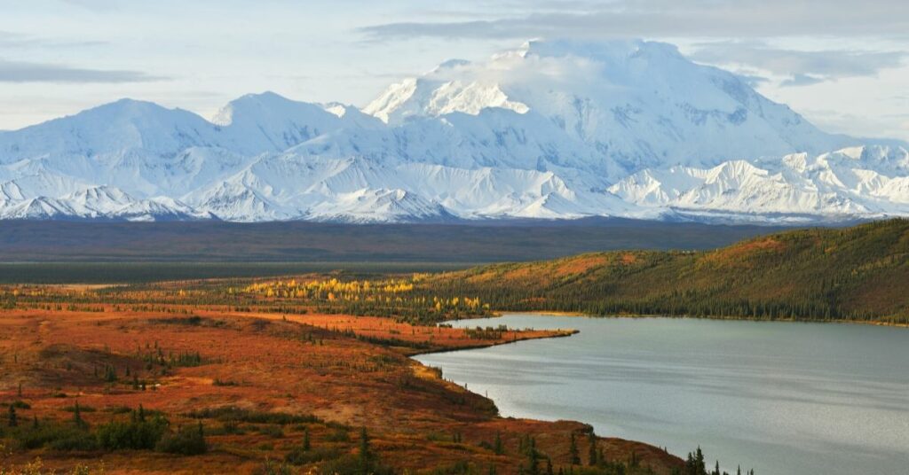
Denali National Park and Preserve
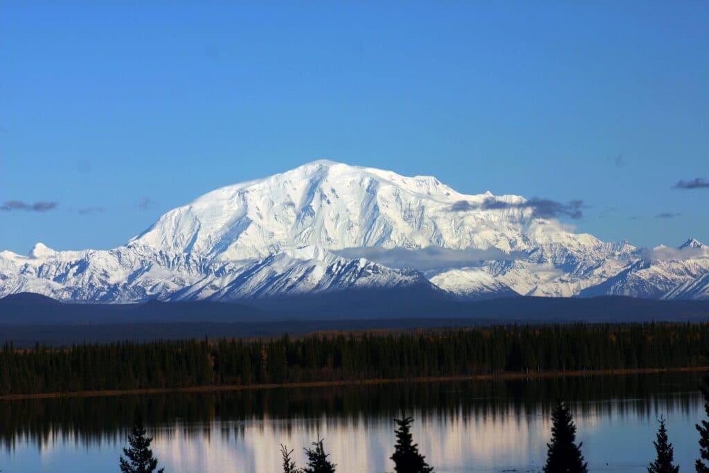
Denali National Park and Preserve is actually two different NPS units but they are treated as one. This park protects the vast tundra landscape and part of Alaska Mountain Range. The center piece of the park is Denali (formerly known as Mount McKinley). At 20,310 ft, Denali is the tallest mountain in North America.
Visitors to Denali find a 6 million acre national park and preserve. As big as the park is it only has which only has a 92-mile road. Only the first 15 miles are accessible to private vehicles, the remaining road is only accessible via guided tours and transit buses. While most visitors only take the bus tours, more adventurous visitors will backpack in the remote areas of the park and a select few will attempt to climb Denali the mountain.
Denali National Park was established on February 26, 1917 as Mount McKinley National Park. On December 1, 1978, as nearby track of land was declared Denali National Monument. As part of the 1980 Alaska National Interest Lands Conservation Act, Mount McKinley National Park and Denali National Monument were combined to form Denali National Park and Preserve. The Park was created an international biosphere reserve in 1976.
Things to do in Denali National Park and Preserve: Boating, camping, fishing, hunting
How to get to Denali National Park and Preserve: Denali National Park is located on the road system and is accessible from the Parks Highway. The Park is about five hours from Anchorage and two hours from Fairbanks. The park can also be reached by the Alaska Railroad.
Where to Stay in Denali National Park and Preserve: Denali has six campgrounds and several lodges located in the park. Additional lodging can be found in nearby McKinely Park, Cantwell, and Healy.
Denali National Park and Preserve Entrance Fee: $15 per person valid for 7 days
Denali National Park and Preserve Official Website: Click Here
Denali National Park and Preserve Map: Download
Get help planning your trip to Denali National Park
- National Parks of Alaska
- All About Denali National Park and Preserve
- How to Get to Denali National Park
- 10 Things to Know Before Visiting Denali National Park
- 8 Books to Read Before Visiting Denali National Park and Preserve
- The Ultimate Guide to Camping in Denali National Park
- Denali Road Lottery – Everything You Need to Know
Gates of the Arctic National Park and Preserve
Gates of the Arctic National Park and Preserve is the northernmost national park and the second largest national park in the United States. The rugged peaks of the Brooks Mountain Range make up most of the park. This wilds and untamed park is home to an amazing array of wildlife including wolves, caribou, moose, muskoxen, brown bears, black bears, porcupines, wolverines, and many more. Gates of the Arctic is the least visited National Park of the 62 National Parks.
Visitors to Gates of the Arctic will find a park a wild and untamed wilderness. There are no developed trails or infrastructure. The park is a backpacker and hikers dreamland.
Gates of the Arctic National Park and Preserve was established on December 1, 1978 as a National Monument. As part of the 1980 Alaska National Interest Lands Conservation Act, it was redesignated as a National Park and Preserve. This is another park that is technically two NPS units. When combined with Noatak Wilderness, this region is the largest contiguous wilderness in the USA.
Things to do in Gates of the Arctic National Park and Preserve: Backpacking, birding, boating, camping, hiking, hunting, wildlife viewing
How to get to Gates of the Arctic National Park and Preserve: There are no roads into Gates of the Arctic National Park and Preserve. Gates can be accessed via foot, boat or small airplane.
If trying to arrive by foot, it is a four-mile hike from Dalton Highway near the town of Coldfoot. There are several rivers that run through the park and you can arrange a float trip into the park. The easiest way to enter the park is to fly. Flights can be arranged from Fairbanks or Bettles. There is regular air service from Fairbanks to Anaktuvuk Pass or you can arrange an air taxi to the more remote areas of the park. Here is a list of NPS approved air taxies.
Where to Stay in Gates of the Arctic National Park and Preserve: There are no lodges in Gates of the Arctic. The only way to spend the night is to camp.
Lodging is available in Fairbanks, Bettles and Coldfoot.
Gates of the Arctic National Park and Preserve Entrance Fee: Free
Gates of the Arctic National Park and Preserve Official Website: Click Here
Map of Gates of the Arctic National Park and Preserve: Download
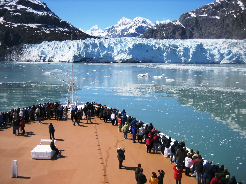
Glacier Bay National Park and Preserve
Glacier Bay National Park and Preserve is one of the most visited National Parks of Alaska. This rugged park is a diverse mix of rainforests, ocean, mountains, glaciers, and glacier fjords. This park has an amazing range of wildlife from grizzly and black bears to orca whales.
Most visitors arrive in the park on a cruise ships during a tour of the Inside Passage. The park can also be explored via small boats, kayaking, hiking and backpacking. It isn’t uncommon for backpackers to take a water taxi out and spend a few days hiking in the park.
Glacier Bay National Park and Preserve was established on February 25, 1925 as a National Monument. As part of the 1980 Alaska National Interest Lands Conservation Act, it was redesignated and expanded as a National Park and Preserve. Glacier Bay is part of the Kluane / Wrangell–St. Elias / Glacier Bay / Tatshenshini-Alsek UNESCO World Heritage Site established in 1979 and in 1986 became a Biosphere Reserve. This is another park that is technically two NPS units.
Things to do in Glacier Bay National Park and Preserve: Birding, camping, fishing, flight-seeing, hiking, hunting, kayaking, rafting
How to get to Glacier Bay National Park and Preserve: The only road to Glacier Bay National Park and Preserve is the short 10-mile road between Gustavus and Bartlett Cove (park headquarters). Gustavus, Alaska is only accessible by plane or ferry.
Most visitors visit this park as part of an Alaska Cruise, but it is possible to visit the park on your own using the ferries or flights. Flights and ferries depart from Juneau. The park’s visitor center is located in Gustavus at the Glacier Bay Lodge.
Where to Stay in Glacier Bay National Park and Preserve: Bartlett Cove offers the only in park lodging and has a campround. More lodging is avaialble in Gustavus. All other in-park lodging is limited to camping.
Glacier Bay National Park and Preserve Entrance Fee: Free
Glacier Bay National Park and Preserve Official Website: Click Here
Map of Glacier Bay National Park and Preserve: Download
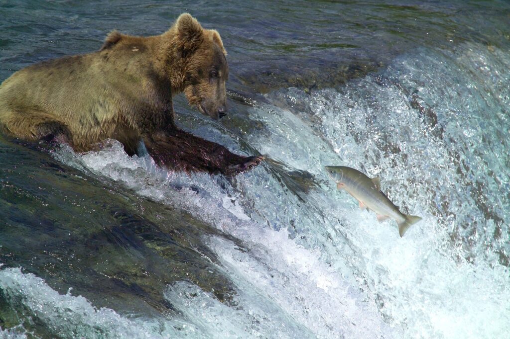
Katmai National Park and Preserve
Katmai National Park and Preserve is most famous for it’s fishing Alaskan Brown Bears, but Katami is more than just one waterfall where the bears congregate. Katami protects both parts of the Aleutian Mountain Range and its volcanos, the coastline along the Shelikof Strait, and a series of large lakes. The park is home to 18 volcanos of which 7 are considered to be active. The park was actually created to protect Valley of Ten Thousand Smokes and not the bears. The Valley of Ten Thousand Smokes was created after the June 1912 eruptions of Mount Katmai and Novarupta.
Most visitors to Katmai come for to enjoy the amazing salmon runs that attract a upwards of 70 bears to Brooks Falls. NPS has installed bear viewing platforms at Brooks Falls. Visitors can also take flight seeing tours and bus tours to the Valley of Ten Thousand Smokes. Other popular activities in Katmai include fishing and backpacking.
Katmai National Park and Preserve was established on September 24, 1918 as a National Monument. As part of the 1980 Alaska National Interest Lands Conservation Act, it was redesignated and expanded as a National Park and Preserve. This is another park that is technically two NPS units.
Things to do in Katmai National Park and Preserve: Backpacking, bear viewing, boating, camping, fishing, flight-seeing, hiking, hunting, trapping
How to get to Katmai National Park and Preserve: There are no roads to the Katmai National Park and Preserve. Katmai can be reached via seaplane or water taxi. All seaplanes depart out of Kind Salmon. Most flights go to Brooks Camp but flights can be arranged to other destinations in Katmai. Here is a list of NPS approved air taxies.
Katmai National Park and Preserve’s visitor center is located in King Salmon, Alaska. King Salmon is the main visitor center for most southwestern Alaska National Parks including Alagnak, Aniakchak, Lake Clark, , and the NPS-affiliated Aleutian World War II Heritage Area.
Where to Stay in Katmai National Park and Preserve: There are several private lodges in and around Katmai. The only campground in the park is at Brooks Fall. There is backcountry camping available in the park. Lodging is available in King Salmon.
Katmai National Park and Preserve Entrance Fee: Free
Katmai National Park and Preserve Official Website: Click Here
Map of Katmai National Park and Preserve: Download
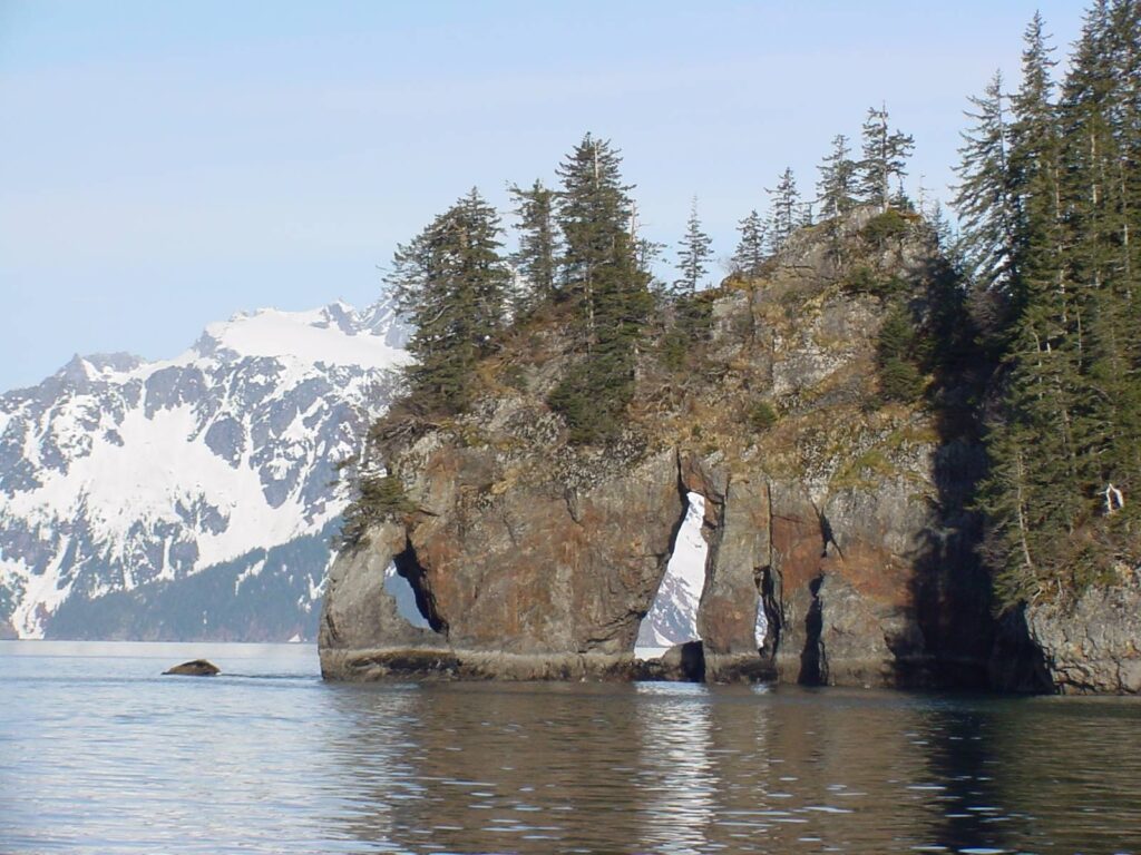
Kenai Fjords National Park
Kenai Fjords National Park is a National Park located in the Kenai Peninsula near the town of Seward. This park protects a unique marine ecosystem, coastal region, the massive Harding Icefield. The Harding Icefield is one of the largest ice fields in the United States. The Harding Icefield has spent the last couple of million years carving an amazing collection of fjords. The park is home to a range of Alaskan wildlife and marine life.
Visitors to Kenai Fjords have the opportunity to hike along Exit Glacier and the Harding Icefield or take a boat tour of the fjords. As one of the few national parks in Alaska connected to the Alaska road system.
Kenai Fjords National Park was established in 1980 by the Alaska National Interest Lands Conservation Act (ANILCA).
Things to do in Kenai Fjords National Park: Boat tours, fishing, flight-seeing, hiking, kayaking, mountaineering
How to get to Kenai Fjords National Park: Kenai Fjords is about a 2.5-hour drive from Anchorage. The park can also be reached via cruise ship or the Alaska Railroad.
Where to Stay in Kenai Fjords National Park: There are no lodges in Kenai Fjords but there are several public use cabins in the area and a campground at Exit Glacier. Additional lodging and camping is available in and around Seward.
Kenai Fjords National Park Entrance Fee: Free
Kenai Fjords National Park Official Website: Click Here
Map of Kenai Fjords National Park: Download
Klondike Gold Rush National Historical Park
Klondike Gold Rush National Historical Park preserves the United States portion of the route miners took during the Klondike Gold Rush. Over a 3 years period, 100,000 miners would follow this route on their way to the Klondike goldfields. The park is made up of four units – Skagway Historic District, Dyea Townsite and Chilkoot Trail, White Pass Unit, and the Seattle Unit. All but the Seattle unit are located in Alaska. The Seattle Unit is in Washington.
Most of the park visitors explore the Skagway Historic District since this unit is part of a unique partnership with the town of Skagway and so far 21 buildings have been restored. Visitors can walk around town and explore.
Dyea Townsite and Chilkoot Trail unit is about 9 miles from Skagway. Dyea was a bustling little town during the Klondike Gold Rush and the last stop for minors before heading up the Chilkoot Trail. The Chilkoot Trail is a 33-mile footpath that minors followed on their way to Klondike. +
The White Pass Unit is the least visited unit as there are no roads or trails to this unit. This unit is only seen as part of the White Pass & Yukon Route railroad train excursion.
The Seattle Unit has several Gold Rush Era buildings that you can take a self-guided walking tour of.
Klondike Gold Rush National Historical Park was established on June 30, 1976. The park was created with the intent to develop an International Historical Park that celebrated both the US and Canadian history on the Klondike Gold Rush. In 1987, the Canadian section of the Chilkoot Trail was declared a Historical Site of Canada. Finally, in 1998, the US and Canadian Units were merged to create the Klondike Gold Rush International Historical Park. The International Park includes Klondike Gold Rush National Historical Park and the Candian sites of Chilkoot Trail National Historic Site, Dawson Historical Complex National Historic Site, and “The Thirty Mile” stretch of the Yukon River.
Things to do in Klondike Gold Rush National Historical Park: Backpacking, hiking, sightseeing
How to get to Klondike Gold Rush National Historical Park: The Alaska Klondike Units can be reached by driving, flying or boat to Skagway. Skagway is connected to the rest of Alaska via the Alaska Highway and Klondike Highway which goes through Canada. Most passager arrive in Skagway via cruise ship. The Seattle unit is located in downtown Seattle and can be reached by car.
Where to Stay in Klondike Gold Rush National Historical Park: There are many hotel options in Skagway and Seattle.
Klondike Gold Rush National Historical Park Entrance Fee: Free
Klondike Gold Rush National Historical Park Official Website: Click Here
Map of Klondike Gold Rush National Historical Park: Download
Kobuk Valley National Park
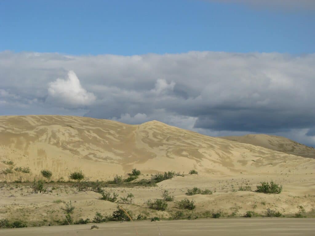
Kobuk Valley National Park is a surprising place given its location above the Arctic Circle. The park is home to the continent’s northernmost sand dunes. These massive dunes are just a small part of the park. The park includes part of the Kobuk River and the southern edge of the western Brooks Range. This region is an important migration route for caribou. Some of the park’s archeological areas dated back at least 12,500 years.
Kobuk Valley National Park was created as a National Monument in 1978. It was elevated to a National Park in 1980 by the Alaska National Interest Lands Conservation Act (ANILCA).
Things to do in Kobuk Valley National Park: Backpacking, boating, camping, fishing, flight-seeing, hiking
How to get to Kobuk Valley National Park: There are no roads to the Kobuk Valley. The Preserve can be accessed by floating the Kobuk River or via a small airplane. Flights can be arranged from Bettles, Kotzebue, or Nome. Here is a list of NPS approved operators.
Kobuk Valley National Park’s visitor center is known as the Northwest Arctic Heritage Center. It is located in Kotzebue, Alaska, and serves as the main visitor center for Cape Krusenstern, Noatak, Gates of the Arctic, and a second visitor center for Bering Land Bridge.
Where to Stay in Kobuk Valley National Park: There are no lodges in Kobuk Valley. The only way to spend the night is to camp. Lodging is available in Kotzebue and Bettles.
Kobuk Valley National Park Entrance Fee: Free
Kobuk Valley National Park Official Website: Click Here
Map of Kobuk Valley National Park: Download
Lake Clark National Park and Preserve
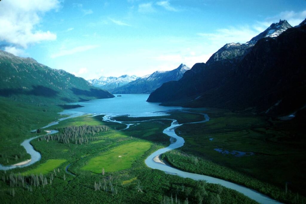
Lake Clark National Park and Preserve is the headwaters of the largest sockeye salmon fishery in the world. The park is made up of three mountain ranges, has a plethora of glaciers and glacial lakes, volcanoes, alpine tundra, and a coastline rainforest. The last volcanic eruption in the park was 2009. The park is home to a large population of Brown Bears.
Most park visitors fly into Port Alswroth on the shores of Lake Clark. From there they will kayak or fly to other sections of the park. A popular spot in the park is the Richard Proenneke cabin.
Lake Clark National Park and Preserve was established on December 1, 1978 as a National Monument. As part of the 1980 Alaska National Interest Lands Conservation Act, it was redesignated and expanded as a National Park and Preserve. This is another park that is technically two NPS units.
Things to do in Lake Clark National Park and Preserve: Backpacking, bear viewing, birding, biking, camping, fishing, hiking, hunting, kayaking, rafting
How to get to Lake Clark National Park and Preserve: There are no roads to the Lake Clark National Park and Preserve. The park can only be accessed via air or boat. Most visitors arrive via air. Flights can be arranged from Anchorage or King Salmon. Here is a list of NPS approved air taxies.
Lake Clark National Park and Preserve’s visitor center is located in King Salmon, Alaska. King Salmon is the main visitor center for most southwestern Alaska National Parks including Alagnak, Aniakchak, Katmai, and the NPS-affiliated Aleutian World War II Heritage Area.
Where to Stay in Lake Clark National Park and Preserve: There are several public-use cabins private lodges operating on private land within the park.
Lake Clark National Park and Preserve Entrance Fee: Free
Lake Clark National Park and Preserve Official Website: Click Here
Map of Lake Clark National Park and Preserve: Download
Noatak National Preserve
Noatak National Preserve protects the Noatak River Basin. It is considered to be the last unaltered river system in the US. The preserve is one of the most bio-diverse National Parks in Alaska. Noatak has a transition from Arctic to subarctic environments as well as boreal forest and tundra. It is estimated that the park has 230,000 caribou in addition to moose, grizzly bears, black bears wolves and a range of other wildlife.
Visitors to Noatak find a backpackers paradise and a true wilderness mostly untouched by humans.
Noatak National Preserve was established on December 1, 1978 as a National Monument. As part of the 1980 Alaska National Interest Lands Conservation Act, it was redesignated as a Preserve. When combined with Gates of the Arctic National Park and Preserve, this region is the largest contiguous wilderness in the USA.
Things to do in Noatak National Preserve: Backpacking, camping, fishing, flight-seeing, floating, hiking, hunting
How to get to Noatak National Preserve: There are no roads to the Noatak National Preserve. The Preserve can be accessed via small airplane. Here is a list of NPS approved air taxies.
Noatak National Preserve’s visitor center is known as the Northwest Arctic Heritage Center. It is located in Kotzebue, Alaska, and serves as the main visitor center for Cape Krusenstern, Kobuk Valley, Gates of the Arctic, and a second visitor center for Bering Land Bridge.
Where to Stay in Noatak National Preserve: There are no lodges in Noatak. The only way to spend the night is to camp. Lodging is available in Bettles, Kotzebue, and Nome.
Noatak National Preserve Entrance Fee: Free
Noatak National Preserve Official Website: Click Here
Map of Noatak National Preserve: Download
Sitka National Historical Park
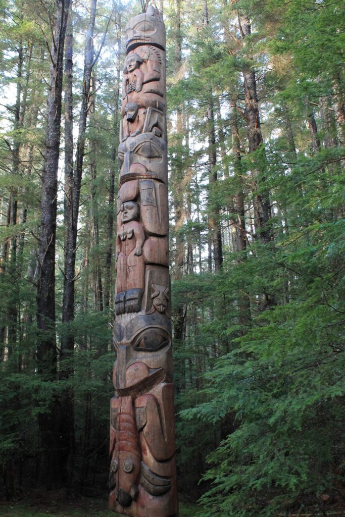
Sitka National Historical Park commemorates the early history of Alaska. It interpreters the Tlingit and Russian experiences in Alaska before it was purchased by the US. The site of the park is actually the site of a horrific battle between the native Tlingit people and the Russian fur traders.
Visitors can walk through a forest of Tlingit and Haida totem poles and check out the restored Russian Bishop’s House.
Sitka National Historical Park was established on March 23, 1910 as a National Monument. On October 18, 1972, it was redesignated as a Historical Park.
Things to do in Sitka National Historical Park: Fishing, hiking, totem pole viewing
How to get to Sitka National Historical Park: Sitka is located on Baranof Island on the Inside Passage. Visitors can arrive via boat or airplane. There are ferries and flights from Juneau, Anchorage, and Seattle. Many cruise ships stop here as well.
Where to Stay in Sitka National Historical Park: Lodging can be found in Sitka.
Sitka National Historical Park Entrance Fee: Free
Sitka National Historical Park Official Website: Click Here
Map of Sitka National Historical Park: Download
Wrangell-St. Elias National Park and Preserve
Wrangell-St. Elias National Park and Preserve is the nation’s largest national park. The park contains several mountain ranges such as the entire Wrangell range, the western portion of the Saint Elias Mountains, and the eastern portion of the Chugach Mountains. The park contains some of the highest mountains in North America.
Visitors to the park can check out the historic mining town of Kennecott and other small mines. In addition to the history, the park offers amazing hiking, backpacking, wildlife viewing, and mountaineering.
Wrangell-St. Elias National Park and Preserve was established on December 1, 1978 as a National Monument. As part of the 1980 Alaska National Interest Lands Conservation Act, it was redesignated and expanded as a National Park and Preserve. Wrangell-St. Elias is part of the Kluane / Wrangell–St. Elias / Glacier Bay / Tatshenshini-Alsek UNESCO World Heritage Site established in 1979 and is an International Biosphere. This is another park that is technically two NPS units.
Things to do in Wrangell-St. Elias National Park and Preserve: Backpacking, fishing, floating, hiking, hunting, mountaineering, wildlife viewing, winter activities
How to get to Wrangell-St. Elias National Park and Preserve: Wrangell-St. Elias can be reached via Alaska’s road system. The Nabesna and McCarthy roads provide minimal access to the park but much of the interior can only be reached via plane or boat.
Where to Stay in Wrangell-St. Elias National Park and Preserve: There are several lodges located on private land within the park both on the road system and fly in.
Wrangell-St. Elias National Park and Preserve Entrance Fee: Free
Wrangell-St. Elias National Park and Preserve Official Website: Click Here
Map of Wrangell-St. Elias National Park and Preserve: Download
Yukon-Charley Rivers National Preserve
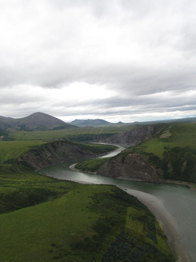
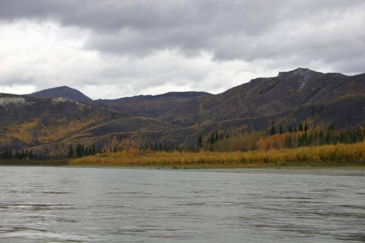
Yukon-Charley Rivers National Preserve protest 115 miles of the Yukon River and the entire Charley River basin. The preserve is home to wolves, black bears, moose, caribou, and Dall sheep. Most park visitors come to float the rivers or hike in the area. Every winter, the Yukon Quest sled dog race passes through the preserve.
Yukon-Charley Rivers National Preserve was established on December 1, 1978. It was elevated to a National Preserve in 1980 by the Alaska National Interest Lands Conservation Act (ANILCA).
Things to do in Yukon-Charley Rivers National Preserve: Camping, dog mushing, fishing, floating, hiking, hunting, winter activities
How to get to Yukon-Charley Rivers National Preserve: There are no roads to the Yukon-Charley Rivers National Preserve. The Preserve can be accessed by boat or small airplane. Boat access to the Yukon can be made from roadways such as the Dalton Highway or Top-of-the-World Highway. Air taxis leave from Eagle or Fairbanks. Here is a list of NPS approved air taxies.
Yukon-Charley Rivers National Preserve’s visitor center is located in Eagle, Alaska.
Where to Stay in Yukon-Charley Rivers National Preserve: There are a handful of public-use cabins in Yukon-Charley Rivers. Otherwise way to spend the night is to camp.
Yukon-Charley Rivers National Preserve Entrance Fee: Free
Yukon-Charley Rivers National Preserve Official Website: Click Here
Map of Yukon-Charley Rivers National Preserve: Download
Aleutian World War II National Historic Area
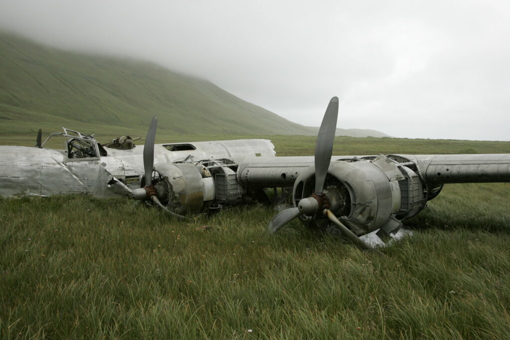
The Aleutian World War II National Historic Area preserves the history of World War II and the battle over the Aleutian islands. The Battle for Aleutians was one of the bloodies of the Pacific Theater and isn’t well known. These islands were some of the closest to Japanese territory. On June 7, 1942, the Japanese attacked the island of Attu and Kiska. The captured these islands and 42 Attuan villagers were taken as prisoners-of-war. A further nine Aleut villages were evacuated and burned down so that they couldn’t be used by the Japanese.
There are eight sites spread across 5 islands. The islands of Amaknak and Umnak have ferry and flight service. The other three are a bit of a planning nightmare and have limited access.
Things to do in Aleutian World War II National Historic Area: Sightseeing, driving tours
How to get to Aleutian World War II National Historic Area: The Aleutian World War II National Historic Area Visitor Center is located on the island of Amaknak and can be reached via airplane or boat. There are regular commercial flights and ferries to the island.
Where to Stay in Aleutian World War II National Historic Area: There are limited hotesl on Amaknak.
Aleutian World War II National Historic Area Entrance Fee: Free
Aleutian World War II National Historic Area Official Website: Click Here
Map of Aleutian World War II National Historic Area: Download
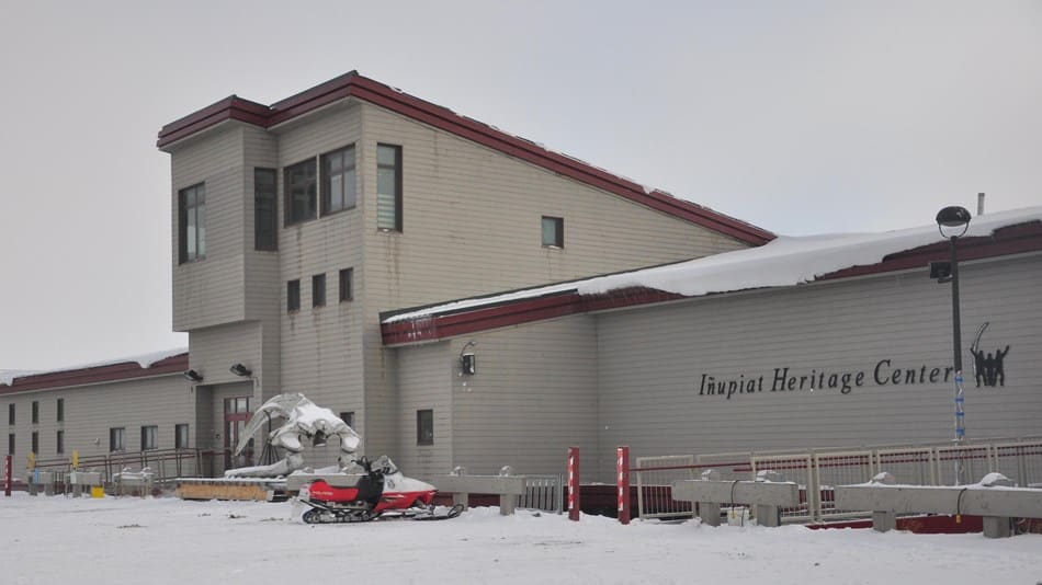
Inupiat Heritage Center
The Inupiat Heritage Center is a small museum in Utqiagvik (formerly known as Barrow). The museum focus on the the story of the Inupiat people. The Inupiat people have lived in northern Alaska for thousands of years. Their way of life changed in unimaginable ways when he 19th century rolled around and commercial New England whalers arrived.
Inupiat Heritage Center is an associated National Park Service site.
Things to do in Inupiat Heritage Center: sightseeing, learning
How to get to Inupiat Heritage Center: There are no roads to Utqiagvik (formerly known as Barrow). The only way to reach Utqiagvik is via airplane. Once in Utqiagvik, there are bus tours and taxies to get around.
Where to Stay in Inupiat Heritage Center: There are several hotels in Utqiagvik.
Inupiat Heritage Center Entrance Fee: Free
Inupiat Heritage Center Official Website: Click Here
Directions to Inupiat Heritage Center: Download
View all the National Park Service Sites in neighboring states (not connected):
Does Alaska Trip Planning Leave You Feeling Overwhelmed?
Jump right into booking your Alaska National Parks trip with our expertly designed, pre-made, downloadable National Park itineraries.
Pin to Share: National Parks of Alaska

Hi, I'm Jennifer!

Welcome to the wonderful world of National Parks. I'm here to help you plan your NEXT amazing adventure through the United States National Parks and beyond. I want the national parks to be accessible to all.
I live in Tennessee, and when I'm home, you can find me hiking in the Smokies and the Cumberland Plateau.
58/63 National Parks
250+/423 National Park Units
Want to know more? Start Here.
Snag one of my National Park Ebooks and Downloadable Itineraries

Talk with an Expert

Share your love of the parks with a shirt, ornaments, hoodies, frames, and more.

2 Comments
Sarah Madsen
Hello
Alaska is currently under a 14 day quarantine for anyone entering the state. Unfortunately this summer is not the year to visit the national parks in Alaska. Stay safe and visit parks closer to home.
Sincerely Sarah Madsen
Fairbanks, Alaska
Jennifer Melroy
Hey Sarah,
The Alaska 14 day quarantine is currently set to expire on June 2 (which may or may not be extended), but this guide isn’t about planning a trip for this summer. This guide was is to help people learn more about the National Parks of Alaska and get an idea of what trip planning to visit them is like.
Most people planning trips to Alaska National Parks plan months if not a year or more in advance. These aren’t last-minute or cheap trips. The only people I know who are still considering trips to Alaska this year are those like myself who have had their trip planned since January 2020 (or earlier). Most of us are still in holding patterns waiting on tourism operators and NPS to decide what they are going to do past July 1.