Just a stone’s throw from the bustling city of Miami, Biscayne National Park offers a stunning aquatic paradise unlike any other. Encompassing coral reefs, mangrove forests, and crystal-clear waters, this park is a haven for marine life and a dream destination for water enthusiasts. Whether you’re snorkeling through vibrant coral gardens, kayaking along scenic coastlines, or simply soaking in the serene beauty of the seascape, we’ll equip you with all the tips and insights to make the most of your visit to this captivating underwater wonderland.
If you are planning a trip to Biscayne National Park and need some help planning your trip, this is our starter guide for visiting Biscayne National Park. We often have detailed, in-depth guides to Biscayne National Park trip planning and will link to these where appropriate to make your trip planning as easy as possible.
The article will discuss all aspects of visiting Biscayne National Park, including:
- Maps of Biscayne National Park
- General Information about Biscayne
- How to Make the Most of Your Visit
- Best Things to do in Biscayne
- Nearby National Parks
Planning to explore the Southeast? Download your free Southeast National Park Checklist HERE.
Does Florida Trip Planning Leave You Feeling Overwhelmed?
Jump right into booking your Florida National Park trip with our expertly designed, pre-made, downloadable National Park itineraries.
Articles about Biscayne National Park
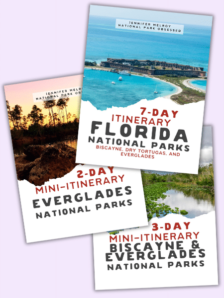
Itineraries for Biscayne National Park
Downloadable Itineraries for Biscayne National Park
- Mini 2-Day Biscayne & Everglades National Parks Itinerary
- Mini 3-Day Biscayne and Everglades National Parks Itinerary
- Mini 7-Day Florida National Park Itinerary
- All Access Pass, including all Current and Future Digital Downloads
Looking for an itinerary specially designed for you? Let National Park Obsessed’s founder design the perfect itineary just for you. Get a Custom National Park Itinerary Here. Or do you just want to chat 1-on-1 with a Natioanl Park planning expert? Book a National Park Travel Consultation.
Map of Biscayne National Park
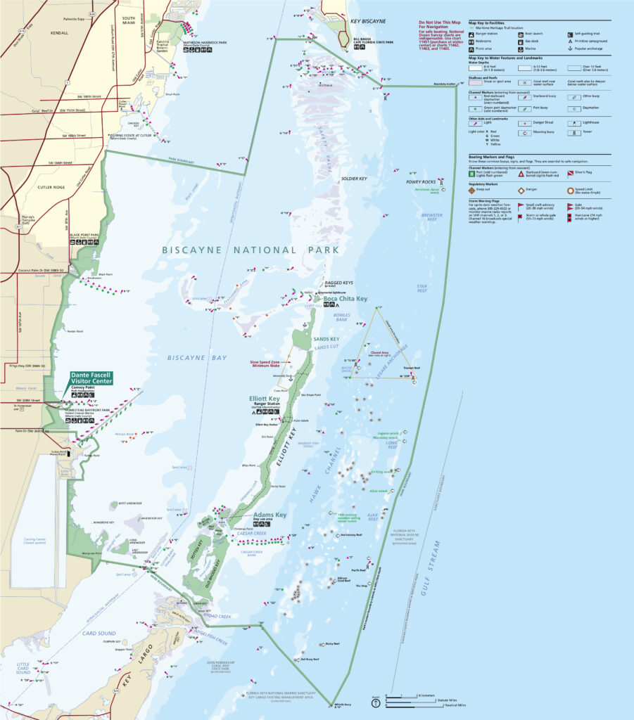
Click on the Biscayne Map above to download the official brochure map. If you’d like a PDF copy of this Biscayne Map click here.
Biscayne National Park Basics
- Region: Southeast
- State: Florida
- Park Size: 172,971 acres (270.27 sq miles) (699.99 sq km)
- Location: Miami-Dade County
- Closest Cities: Homestead, Florida
- Busy Season: pretty steady year-round
- Visitation: 571,242 (in 2023)
- Funniest 1-Star Review: This National Park was highly recommended to us, but didn’t have a whole lot. It would be nice if they expanded some of the land-based and cold-weather activities. There is a boardwalk where you can walk out through some mangroves, mostly where people go fishing. Some educational signs but few exhibits. Not even much scenery. We saw a couple kinds of fish, but mostly murky water.
- Official Website: NPS.gov
How much does Biscayne National Park Cost?
Biscayne National Park is free to enter.
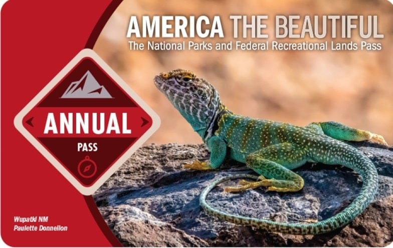
Get Free Entrance to the National Parks
Get free admission to all 116 fee-charging National Park Units with the America the Beautiful Pass.
When is Biscayne National Park Open?
Biscayne National Park is open year-round.
Are dogs allowed in Biscayne National Park?
Yes, pets are welcome in Biscayne National Park but are limited to developed areas such as roads, parking areas, picnic areas, and campgrounds. Pets are not allowed on the trails in the park. Please review the Biscayne Pet Policy before bringing your dog to Biscayne .
- Pets must be kept on a leash no longer than 6 feet and under your control at all times.
- Do not leave pets unattended while tied to picnic tables, trees, or other stationary objects.
- Do not leave pets inside your vehicle. Even if the window is cracked open, temperatures inside can rise quickly even on cooler days. Leaving pets inside a parked car is considered animal cruelty per Florida law.
- Pet excrement must be immediately collected and disposed of in the nearest trash can.
- Where Pets Are Allowed
- The grounds at Convoy Point
- Elliott Key
- Where Pets Are Not Allowed
- Boca Chita Key, including on boats docked in the harbor
- The Dante Fascell Visitor Center
Where are Biscayne National Park’s visitor centers?
- Dante Fascell Visitor Center – Open Year Around
Land Acknowledgment
The park, now known as Biscayne National Park, is on Seminole, Matecumbe, Taino, Tequesta land.
Thank you to the Native Land Digital for making the Indigenous territories accessible to all. They have mapped the known territories to the best of the current knowledge and is a work in progress. If you have additional information on the Indigenous nations boundaries, please let them know.
Native Land Digital is a registered Canadian not-for-profit organization with the goal to creates spaces where non-Indigenous people can be invited and challenged to learn more about the lands they inhabit, the history of those lands, and how to actively be part of a better future going forward together.
How Much Time Should I Spend Visiting Biscayne National Park?
If you have a couple of hours in Biscayne National Park, explore Covoy Point and the Dante Fascell Visitor Center.
If you have one day in Biscayne National Park, take a boat tour to Boca Chita Key.
If you have two days in Biscayne National Park, go stand up paddle boarding in Jones Lagoon.
If you have three or more days in Biscayne National Park, go camping on Elliot Key.
Does Florida Trip Planning Leave You Feeling Overwhelmed?
Jump right into booking your Florida National Park trip with our expertly designed, pre-made, downloadable National Park itineraries.
Things to do in Biscayne National Park
Tours in Biscayne National Park
- Jones Lagoon Paddle – 3.5 hours – $89 per person – Paddle around the clear water of Jones Lagoon and have a chance to see to baby shark, turtles, and Roseate Spoonbills.
- Mangroves & Seaglass Meadows Paddle – 1.5 hours – $39 per person – Enjoy a short paddle along one of the longest contiguous stretches of mangrove shoreline.
- Small Group Snorkel – 3.5 hours – $99 per person – The snorkeling trip will visit one of the area’s shipwreck and a open ocean coral patch.
- Heritage of Biscayne Cruise – 3.5 hours – $79 per person – Take a tour of narrated tour of Biscayne Bay with a stop at one of the park’s islands.
Best Things to Do in Biscayne National Park
- Paddle Tour
- Snorkeling
- Junior Ranger Badge
- Convoy Point Jetty Trail
- Maritime Heritage Trail
- Go Fishing
Best Things to See in Biscayne National Park
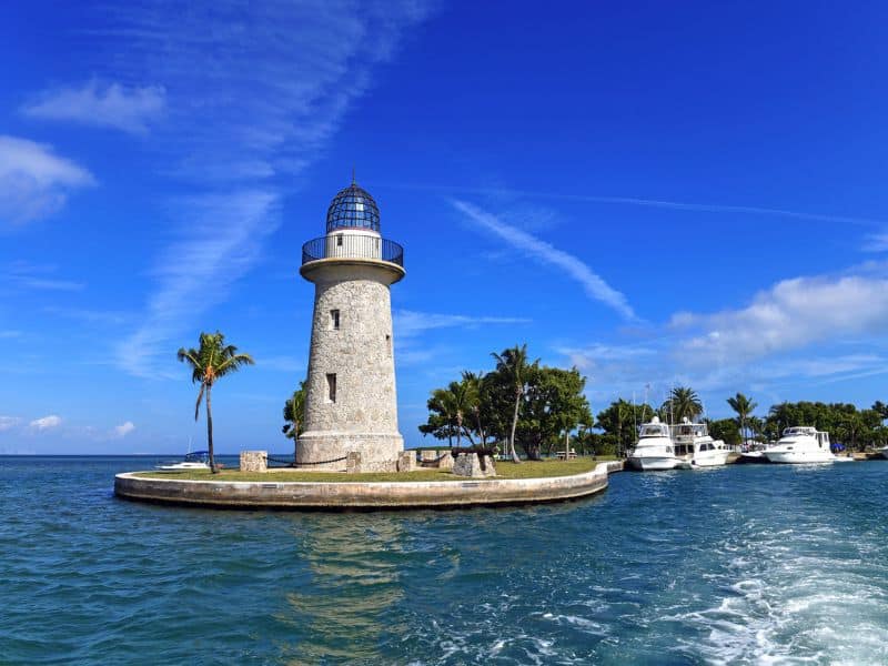
- Boca Chita Key Lighthouse
- Adams Key
- Elliot Key
- Adams Key
- Jones Langoon
- Fowey Rocks Lighthouse
Best Guided Tours of Biscayne National Park
Biscayne National Park Wildlife
- Florida Manatee
- Schaus’ Swallowtail
- Butterfly
- Green Sea Turtle
- Brown Pelican
- Great Barracuda
Where to stamp your National Parks Passport Book in Biscayne National Park?
The National Park Passport Book is the BEST and cheapest National Park souvenir. Every National Park Obsessed person should have one of these books.
If you are new to the National Parks, you can learn more about the National Parks Passport program here or jump right in by ordering:
- The ever-popular Classic National Parks Passport
- Get 15% Off Your Next Order at the America’s National Parks Online Store with Code: NATIONALPARKOBSESSED at Checkout
- Or get the National Park Obsessed’s National Park Passport & Journal
IMPORTANT: Do NOT stamp your government-issued passport.
There are Biscayne official stamps for Biscayne National Park. Here is the list of National Park Passport Stamps you can get in Biscayne National Park:
- Homestead, FL
- NPS Centennial
Bonus Stamps
- Bark Ranger
- Junior Ranger
Biscayne National Park Passport Stamp Locations
Here are all the locations to find the Biscayne National Park Passport Stamps. Not every stamp is available at every location.
- Boca Chita Lighthouse Entry
- Dante Fascell Visitor Center
National Parks Near Biscayne National Park
National Park Service units within a 4 hours drive
- Big Cypress National Preserve
- Dry Tortugas National Park
- Everglades National Park
National Park Service units within an 8 hours drive
- Canaveral National Seashore
- Castillo de San Marcos National Monument
- Cumberland Island National Seashore
- De Soto National Memorial
- Fort Caroline National Memorial
- Fort Frederica National Monument
- Fort Matanzas National Monument
- Fort Pulaski National Monument
- Timucuan Ecological and Historic Preserve
Final Thoughts on Biscayne National Park
Do you have any questions about Biscayne National Park, let us know in the comments below or need help planning your National Park trips. Let me know in the comments or join me in my National Park Trip Planning Community!
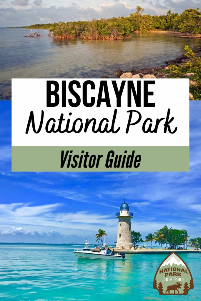
Pin for Later: The Complete Guide to Visiting Biscayne National Park in 2024

Hi, I'm Jennifer!

Welcome to the wonderful world of National Parks. I'm here to help you plan your NEXT amazing adventure through the United States National Parks and beyond. I want the national parks to be accessible to all.
I live in Tennessee, and when I'm home, you can find me hiking in the Smokies and the Cumberland Plateau.
58/63 National Parks
250+/423 National Park Units
Want to know more? Start Here.
Snag one of my National Park Ebooks and Downloadable Itineraries

Talk with an Expert

Share your love of the parks with a shirt, ornaments, hoodies, frames, and more.
