Visiting Kings Canyon National Park
- Jennifer Melroy
- Last Modified January 27, 2024
- First Published on October 31, 2020
Planning a trip to Kings Canyon National Park and need some help planning your trip?
Here is the National Park Obsessed guide for visiting Kings Canyon National Park, California.
The Quick Guide to Visiting Kings Canyon National Park
Kings Canyon National Park Basics
Region: Pacific-West / West Coast / Pacific
Park Size: 461,901 acres (721.72 sq miles) (1,869.25 sq km)
Location: Fresno Tulare Counties
Closest Cities: Fresno, California
Busy Season: May to September
Visitation: 1,246,053 (in 2019)
How much does Kings Canyon National Park Cost?
Sequoia & Kings Canyon National Park costs the following:
- 7-day Passenger Vehicle Pass – $35
- 7-day Motorcycle Pass – $30
- 7-day Individual Pass – $20
An annual Sequoia & Kings Canyon National Park Pass costs $70 but it is not recommended you buy this pass. For an extra $10 you can get an American the Beautiful Pass. This $80 pass offers free admission to all 116 fee-charging National Park Units.
When is Kings Canyon National Park Open?
Kings Canyon National Park is open year-round, but during winter some park roads close.
Are dogs allowed in Kings Canyon National Park?
Yes, pets are welcome in Kings Canyon National Park but are limited to developed areas such as roads, parking areas, picnic areas, and campgrounds. Pets are not allowed on the trails in the park. Please review the Kings Canyon Pet Policy before bringing your dog to Kings Canyon.
Where are Kings Canyon National Park’s visitor centers?
Foothills Visitor Center – Open Year Round
Giant Forest Museum – Open Year Round
Lodgepole Visitor Center – May to October
Kings Canyon Visitor Center – Open Year Round
Cedar Grove Visitor Center – Open Summer Season
Mineral King Ranger Station – May to September
Land Acknowledgments for Kings Canyon National Park
The National Park known as Kings Canyon National Park sits on Northern Paiute, Eastern Mono/Monache, and Western Mono/Monache.
Thank you to the Native Land Digital for making the Indigenous territories accessible to all. They have mapped the known territories to the best of the current knowledge and is a work in progress. If you have additional information on the Indigenous nations boundaries, please let them know.
Native Land Digital is a registered Canadian not-for-profit organization with the goal to creates spaces where non-Indigenous people can be invited and challenged to learn more about the lands they inhabit, the history of those lands, and how to actively be part of a better future going forward together.
Where to stamp your National Parks Passport Book in Kings Canyon National Park?
The National Park Passport Book is the BEST and cheapest National Park souvenir. Every National Park Obsessed person should have one of these books.
If you are new to the National Parks, you can learn more about the National Parks Passport program here or jump right in by ordering:
- The ever-popular Classic National Parks Passport
- Get 15% Off Your Next Order at the America’s National Parks Online Store with Code: NATIONALPARKOBSESSED at Checkout
- Or get the National Park Obsessed’s National Park Passport & Journal
IMPORTANT: Do NOT stamp your government-issued passport.
There are two official stamps for Kings Canyon National Park. Here is the list of National Park Passport Stamps you can get in Kings Canyon National Park:
- Cedar Grove Visitor Center
- Kings Canyon Visitor Center
Kings Canyon National Park Passport Stamp Locations
Here are all the locations to find the Kings Canyon National Park Passport Stamps. Not every stamp is available at every location.
- Cedar Grove Visitor Center
- Kings Canyon Visitor Center
- Roads End Wilderness Permit Station
Jennifer Melroy
Hi, I'm Jennifer!
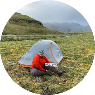
Welcome to the wonderful world of National Parks. I'm here to help you plan your NEXT amazing adventure through the United States National Parks and beyond. I want the national parks to be accessible to all.
I live in Tennessee, and when I'm home, you can find me hiking in the Smokies and the Cumberland Plateau.
58/63 National Parks
250+/423 National Park Units
Want to know more? Start Here.
ACKNOWLEDGEMENT OF LAND
On this site, we promote travel to the United States and beyond that are the traditional lands of Indigenous and First Nations peoples.
With respect, I make a formal land acknowledgment, extending my appreciation and respect to these lands’ past and present people.
To learn more about the people who call these lands home, I invite you to explore Native Land.
DISCLAIMER
National Park Obsessed assumes no responsibility or liability for any errors or omissions in the content of this site (NationalParkObsessed.com). The information contained in this site is provided with no guarantees of completeness, accuracy, usefulness or timeliness. You are encouraged to conduct your own due diligence before acting on the information provided on this site and should not rely on the opinions expressed here.
There is an inherent risk in all outdoor recreation activities, the reader assumes all responsibility for their own personal safety.
DISCLOSURE
We are a participant in the Amazon Services LLC Associates Program, an affiliate program designed to provide a means for us to earn fees by linking to Amazon.com and affiliated sites.
Privacy Policy • About Us • Contact
Select stock photography provided depositphotos
Copyright ©2023 National Park Obsessed, LLC
Privacy Overview
Last Updated on 27 Jan 2024 by Jennifer Melroy
