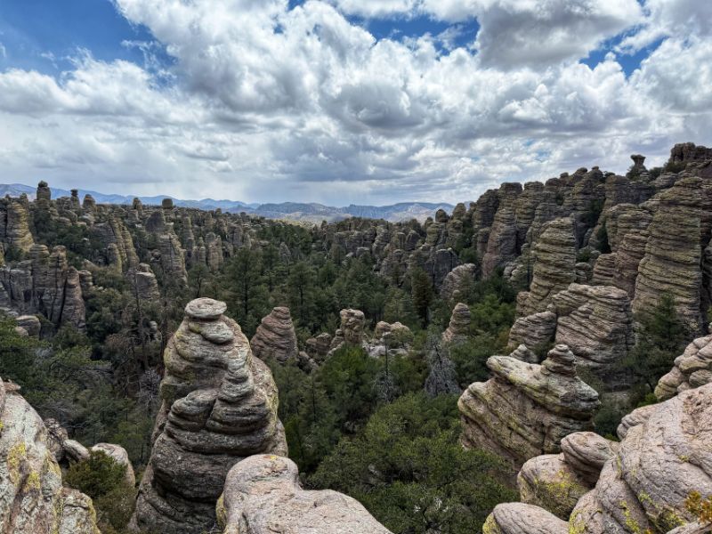
Planning on visiting Chiricahua National Park? From towering rock pinnacles and balancing boulders to scenic drives and incredible hiking trails, Arizona’s newest National Park is a destination that deserves a spot on your Southwest road trip itinerary.
Located in southeastern Arizona, Chiricahua National Park protects a landscape unlike anywhere else in the National Park System. Nicknamed the “Wonderland of Rocks,” the park is famous for its thousands of volcanic rock formations, narrow canyons, and unusual geology. But there is more to Chiricahua than its rocks. The park is part of the Madrean Sky Islands, where desert grasslands, oak woodlands, and pine forests come together to support an incredible diversity of plants and wildlife.
I’ve visited Chiricahua twice, once in 2023 and again in 2024, and have hiked almost every trail in the park. While the rock formations are what initially draw most visitors, the hiking, wildlife, and surprisingly varied landscapes are what make this park special.
On October 20, 2026, Chiricahua National Monument officially became Chiricahua National Park, making it the 64th National Park in the United States and Arizona’s fourth.
Whether you’re planning a quick stop on a Southern Arizona road trip or spending several days exploring the park’s trails, this guide covers everything you need to know about visiting Chiricahua National Park. You’ll find information on the best time to visit, how to get there, where to stay, the best hikes, and my recommendations for making the most of your trip.
This post may contain affiliate links, meaning if you book or buy something through one of these links, I may earn a small commission at no extra cost to you! Read the full disclosure policy here
How much time do you need to visit Chiricahua National Park?
I recommend spending at least one full day in Chiricahua National Park. This gives you enough time to drive Bonita Canyon Scenic Drive, explore Massai Point, and complete one of the park’s shorter or moderate hikes.
If you’re an avid hiker, plan on two days. This allows time for Echo Canyon Loop and a longer hike into the Heart of Rocks without rushing through the park.
You can see some of Chiricahua’s most impressive scenery in half a day, but you’ll miss much of what makes this park special.
Chiricahua National Park Map
Chiricahua National Park Basics
Where Is Chiricahua National Park?
Chiricahua National Park is located in the Chiricahua Mountains of southeastern Arizona, approximately 36 miles south of Willcox. The park is part of Cochise County, near the Arizona–New Mexico border, and sits within a region known as the Madrean Sky Islands.
Despite being in southern Arizona, Chiricahua looks very different from the cactus-covered landscapes many people associate with the state. As you drive into the mountains, the grasslands give way to oak and pine forests, with thousands of rock pinnacles rising above the canyons. Chiricahua is a relatively remote park. There are no major cities immediately outside its boundaries, and services are limited.
Approximate driving distances include:
| Starting Location | Distance | Driving Time |
|---|---|---|
| Willcox, Arizona | 36 miles | 45–60 minutes |
| Tucson, Arizona | 120 miles | 2 hours |
| Phoenix, Arizona | 230 miles | 3.5–4 hours |
| Las Cruces, New Mexico | 150 miles | 2.5–3 hours |
| El Paso, Texas | 190 miles | 3 hours |
Why Is Chiricahua a National Park?
Chiricahua was originally established as a National Monument on April 18, 1924, by President Calvin Coolidge. The monument was created to protect its unusual volcanic rock formations and scenic landscapes. For more than a century, Chiricahua was managed as a National Monument within the National Park System.
On October 20, 2026, President Donald Trump signed the Chiricahua National Park Act, officially redesignating the monument as Chiricahua National Park. This made Chiricahua the 64th National Park in the United States, joining Grand Canyon, Petrified Forest, and Saguaro as Arizona’s four National Parks.
The designation did not automatically change the park’s boundaries or create new visitor facilities. Visitors can continue exploring the same scenic drives, hiking trails, and historic sites that made Chiricahua special long before it became a National Park.
What Makes Chiricahua National Park Special?
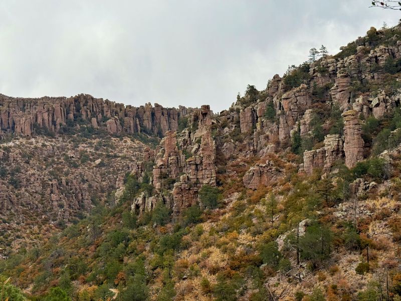
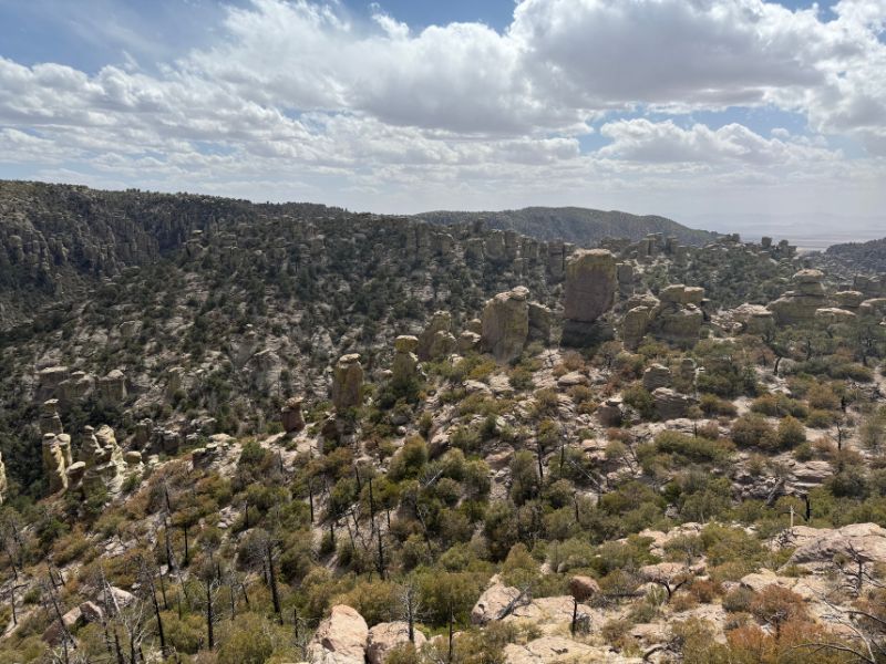
Chiricahua is best known for its remarkable rock formations, but the park’s geology and biodiversity are equally impressive. The landscape was created by an enormous volcanic eruption approximately 27 million years ago.
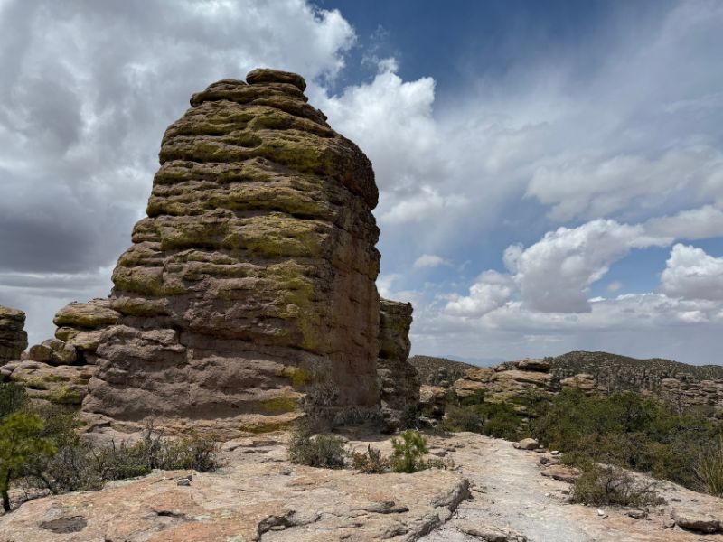
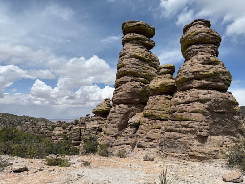
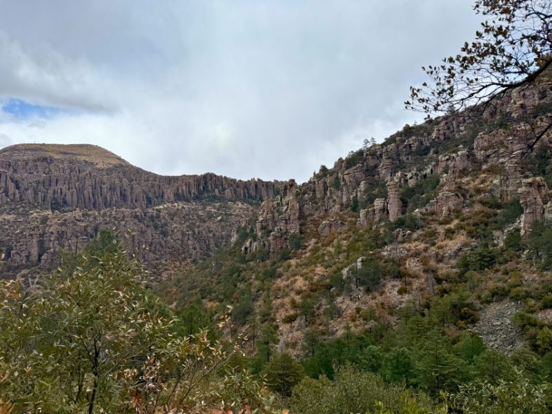
The Turkey Creek Caldera eruption deposited thick layers of volcanic ash across the region. Over time, this material hardened into rhyolite tuff. Millions of years of erosion, weathering, and fracturing gradually sculpted the rock into the pinnacles, columns, balancing boulders, and narrow passageways visitors see today. These formations are especially impressive along Echo Canyon, Heart of Rocks, and the trails surrounding Massai Point.
Chiricahua is also part of the Madrean Sky Islands, a collection of isolated mountain ranges surrounded by lower-elevation desert and grassland. Because the mountains rise thousands of feet above the surrounding valleys, the park contains several distinct ecological communities. You can walk through dry grasslands, oak woodlands, and pine forests during a single visit.
This unusual combination of habitats supports an impressive diversity of birds, mammals, reptiles, and plants.
Chiricahua National Park History
Long before Chiricahua became a National Park, the surrounding mountains were home to Indigenous peoples, including the Chiricahua Apache. The rugged landscape provided important resources, shelter, and places of cultural significance.
During the nineteenth century, the Chiricahua Mountains became closely associated with Apache leaders such as Cochise and Geronimo and the conflicts that followed increasing American settlement and military expansion.
Later, settlers and ranching families established homesteads in the region. Among them were Swedish immigrants Neil and Emma Erickson, who settled in Bonita Canyon in the late nineteenth century. Their homestead eventually became Faraway Ranch, one of the park’s most important historic sites.
After the establishment of Chiricahua National Monument in 1924, the Civilian Conservation Corps played a major role in developing the park’s visitor infrastructure. CCC workers constructed trails, roads, retaining walls, and other improvements, many of which remain important to the visitor experience today.
Land Acknowledgment and Indigenous History
The National Park known as Chiricahua National Park sits on Chiricahua Apache land. When visiting Chiricahua, I encourage travelers to learn about the Apache history of the region and recognize that the landscape has long been connected to living Indigenous communities.
Nearby Fort Bowie National Historic Site provides additional historical context about the Apache Wars, the U.S. military presence in southeastern Arizona, and the experiences of the Chiricahua Apache.
Thank you to the Native Land Digital for making the Indigenous territories accessible to all. They have mapped the known territories to the best of the current knowledge and is a work in progress. If you have additional information on the Indigenous nations boundaries, please let them know.
Native Land Digital is a registered Canadian not-for-profit organization with the goal to creates spaces where non-Indigenous people can be invited and challenged to learn more about the lands they inhabit, the history of those lands, and how to actively be part of a better future going forward together.
Chiricahua National Park Facts and Statistics
When to Visit Chiricahua National Park
The best time to visit Chiricahua National Park is March through April and October through November, when temperatures are generally comfortable for hiking and exploring the Wonderland of Rocks.
Spring is the most popular time to visit, with March consistently attracting the highest number of visitors. Fall offers similar hiking conditions with fewer crowds, making October and November particularly good months to explore the park.
While Chiricahua National Park is open year-round, its mountainous location means temperatures and weather conditions can vary significantly throughout the year. Summer brings hot temperatures and monsoon thunderstorms, while winter can bring freezing temperatures, snow, and icy hiking trails.
If I were planning a hiking-focused trip, I would prioritize March, April, October, or November.
Best Time to Visit Chiricahua National Park
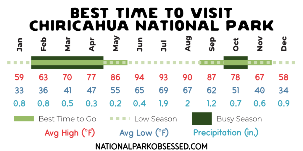
The best time to visit depends on what you want to experience:
- Best overall weather: March, April, October, and November.
- Best time for hiking: March through April and October through November.
- Best time to avoid crowds: January, February, September, and November, with some weather trade-offs.
- Busiest month: March.
- Hottest months: June and July.
- Wettest months: July and August.
- Best balance of weather and crowds: October and November.
Although March and April have some of the best hiking conditions, they are also among the park’s busiest months. If you have flexibility in your travel dates, I would consider visiting in late October or November.
Chiricahua National Park Month-by-Month Visiting Guide
| Month | Typical Conditions | Hiking Outlook |
|---|---|---|
| January | Cold mornings, possible snow and ice | Good with precautions |
| February | Cool temperatures, occasional winter storms | Generally good |
| March | Mild days, chilly mornings, busy season | Excellent |
| April | Pleasant, dry, and sometimes windy | Excellent |
| May | Warmer, generally dry | Very good |
| June | Hot and dry before the monsoon | Start early |
| July | Hot with monsoon thunderstorms | Weather-dependent |
| August | Monsoon storms and wetter conditions | Weather-dependent |
| September | Warm with lingering monsoon activity | Improving |
| October | Mild days and cooler nights | Excellent |
| November | Cool, generally pleasant conditions | Excellent |
| December | Cold mornings, possible snow and ice in high elevations | Good with precautions |
Chiricahua National Park Weather by Month
Chiricahua experiences significant seasonal temperature changes. Average daily highs range from the upper 50s in winter to the mid-90s in early summer.
Even during the warmer months, nighttime temperatures can be considerably cooler, particularly at higher elevations.
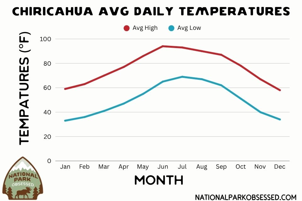
The hottest month is June, with an average high of 94°F and an average low of 65°F. July is nearly as hot, with an average high of 93°F, but it also marks the beginning of the wettest part of the summer monsoon season.
January and December are the coolest months, with average highs around 58–59°F and lows in the low 30s.
Spring and fall provide the most comfortable hiking temperatures, particularly March, April, October, and November.
| Month | Avg High | Avg Low | Avg Precipitation |
|---|---|---|---|
| January | 59°F | 33°F | 0.8 in |
| February | 63°F | 36°F | 0.8 in |
| March | 70°F | 41°F | 0.5 in |
| April | 77°F | 77°F | 0.3 in |
| May | 86°F | 55°F | 0.2 in |
| June | 94°F | 65°F | 0.4 in |
| July | 93°F | 69°F | 1.9 in |
| August | 90°F | 67°F | 2.0 in |
| September | 87°F | 62°F | 1.2 in |
| October | 78°F | 51°F | 0.7 in |
| November | 67°F | 40°F | 0.6 in |
| December | 58°F | 34°F | 0.9 in |
Weather averages are representative conditions and may differ from actual conditions at individual elevations within the park.
Rainfall and Monsoon Season in Chiricahua National Park
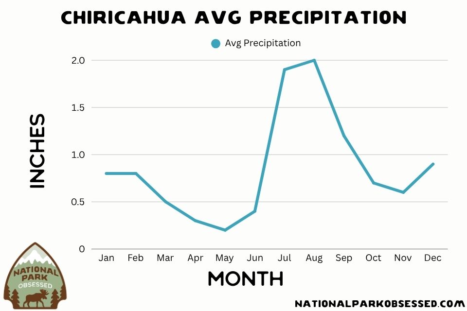
Chiricahua has two relatively distinct precipitation patterns: a drier spring and early summer, followed by a wetter summer monsoon season.
May is typically the driest month, averaging just 0.2 inches of precipitation. Rainfall increases dramatically in July and August, with average precipitation reaching approximately 1.9 and 2.0 inches, respectively.
Summer thunderstorms can develop quickly in the Chiricahua Mountains. Lightning, heavy rain, and slippery trails are important considerations, particularly when hiking in exposed areas or narrow canyons.
If you’re visiting during the monsoon season, plan longer hikes for early in the morning and monitor the forecast throughout the day.
Chiricahua National Park Visitation by Month
Chiricahua has historically been one of the less-visited destinations in the National Park System, receiving approximately 45,000 to 72,000 visitors annually between 2016 and 2025.
However, visitation is not evenly distributed throughout the year.
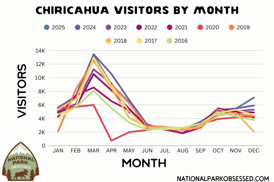
March is consistently the busiest month, with several years recording more than 10,000 visitors during the month.
April is generally the second-busiest spring month, although visitation varies from year to year.
Visitation drops considerably during June, July, and August, when summer heat and monsoon thunderstorms make outdoor activities less appealing.
October and November experience a smaller increase in visitation as temperatures become more comfortable.
For visitors hoping to avoid crowds without sacrificing good hiking weather, October and November offer an excellent alternative to spring.
Annual Visitation at Chiricahua National Park
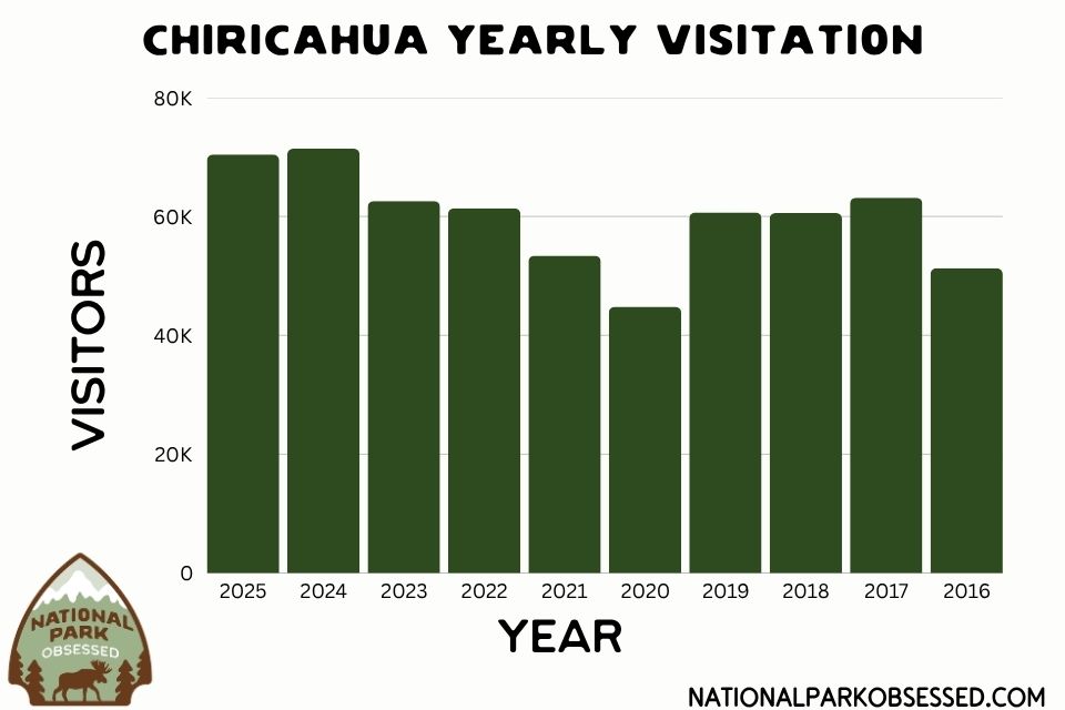
Between 2016 and 2025, annual visitation fluctuated considerably, with the park generally receiving fewer than 75,000 visitors per year. Visitation dropped sharply in 2020, followed by a recovery in subsequent years.
In 2024 and 2025, Chiricahua recorded approximately 71,000 and 70,000 visitors, respectively.
These figures reflect visitation before Chiricahua became a National Park in October 2026. The new designation may increase public awareness and visitation, but it is too early to know how significantly visitation patterns will change.
| Year | Visitors per Year |
|---|---|
| 2025 | 70,406 |
| 2024 | 71,390 |
| 2023 | 62,582 |
| 2022 | 61,377 |
| 2021 | 53,413 |
| 2020 | 44,794 |
| 2019 | 60,655 |
| 2018 | 60,577 |
| 2017 | 63,132 |
| 2016 | 51,277 |
When Is Chiricahua National Park Most Crowded?
March is historically the busiest month at Chiricahua National Park, followed by April.
Spring’s comfortable hiking temperatures make it an attractive time to explore the park, particularly for travelers visiting southeastern Arizona.
The biggest crowd-related concern is not necessarily congestion throughout the park, but limited parking at popular trailheads such as Echo Canyon. If you’re visiting during March or April, I recommend arriving early, particularly if you plan to hike Echo Canyon Loop or Heart of Rocks.
For fewer crowds, consider October or November, when temperatures are generally comfortable and visitation is lower than the spring peak.
How to Get to Chiricahua National Park
Chiricahua National Park is located in a relatively remote part of southeastern Arizona. For most visitors, driving is the only practical way to reach the park.
There is no regular public transportation connecting Chiricahua with nearby cities, and rideshare services should not be considered a reliable option.
Closest Airports to Chiricahua National Park
Tucson International Airport (TUS)
Tucson is the closest major commercial airport and the most convenient option for many visitors. From Tucson, expect approximately two hours of driving to reach Chiricahua.
Tucson is also a good starting point for a Southern Arizona road trip that includes Saguaro National Park, Coronado National Memorial, and other nearby destinations.
Tucson International Airport (TUS)
Tucson is the closest major commercial airport and the most convenient option for many visitors.
From Tucson, expect approximately two hours of driving to reach Chiricahua.
Tucson is also a good starting point for a Southern Arizona road trip that includes Saguaro National Park, Coronado National Memorial, and other nearby destinations.
Phoenix Sky Harbor International Airport (PHX)
Phoenix generally offers a larger selection of flights and rental cars. However, the drive to Chiricahua is considerably longer. Expect approximately 3.5 to 4 hours, depending on traffic and your route.
El Paso International Airport (ELP)
El Paso can be another option, particularly if you’re combining Chiricahua with destinations in southern New Mexico or western Texas. The drive takes approximately three hours.
Driving to Chiricahua National Park
Most visitors approach Chiricahua from Interstate 10 and the town of Willcox. From Willcox, follow Arizona Highway 186 south toward the Chiricahua Mountains, then continue toward the park entrance. The road is paved, but portions are winding and hilly. Once inside the park, Bonita Canyon Scenic Drive continues through the main developed area and climbs toward Massai Point.
Important: Do not blindly follow GPS directions that route you onto remote dirt roads through the surrounding mountains. Some mapping applications may suggest unpaved routes that are unsuitable for passenger vehicles.
Getting Around Chiricahua National Park
A personal vehicle is the best way to explore Chiricahua. Bonita Canyon Scenic Drive connects the park’s main attractions, including the visitor center, campground, hiking trailheads, and Massai Point.
However, the road has restrictions for large vehicles. Vehicles longer than 24 feet are not permitted beyond Bonita Canyon Campground. Larger RVs and trailers have additional parking and access restrictions.
If you’re traveling with an RV or trailer, review the current NPS regulations before arriving.
Can You Visit Chiricahua National Park Without a Car?
Visiting Chiricahua without a vehicle is extremely difficult. There is no regular public transportation to the park, and taxis or rideshare services are not dependable in the surrounding area.
The park has a limited hikers’ shuttle to support certain one-way hikes, but this is not transportation from nearby towns and should not be confused with a sightseeing shuttle.
For most visitors flying into Arizona, renting a car is the most practical option.
How Many Days Do You Need in Chiricahua National Park?
I recommend spending one to two days in Chiricahua National Park You can see many of the main overlooks and rock formations in a single day, but the park’s best experiences involve hiking.
| Time Available | What You Can Reasonably Do |
|---|---|
| Half Day | Bonita Canyon Scenic Drive, Massai Point, short walks |
| One Day | Scenic drive, Echo Canyon Loop, visitor center, overlooks |
| Two Days | Echo Canyon Loop, Heart of Rocks, scenic drive, historic sites |
| Three or More Days | Big Loop, additional hikes, wildlife watching, photography, nearby NPS sites |
Half a Day in Chiricahua National Park
If you only have a few hours, focus on Bonita Canyon Scenic Drive and the viewpoints near Massai Point. Drive to the end of the scenic road, stop at the overlooks, and explore the Massai Point Nature Trail.
If time allows, consider the short walk to the Echo Canyon Grottoes. This is a good introduction to the Wonderland of Rocks without committing to a long hike.
One Day in Chiricahua National Park
One full day is enough to experience many of Chiricahua’s highlights. I would prioritize Echo Canyon Loop, one of the park’s best moderate hikes. The 3.3-mile loop passes through impressive rock formations, narrow passages, and forested areas.
After your hike, spend time exploring Massai Point and the scenic drive. If you have additional time, visit Faraway Ranch Historic District or one of the shorter trails in Bonita Canyon.
Two Days in Chiricahua National Park – My Recommendation for Hikers
Spend your first day exploring Echo Canyon Loop, the scenic drive, and the park’s overlooks.
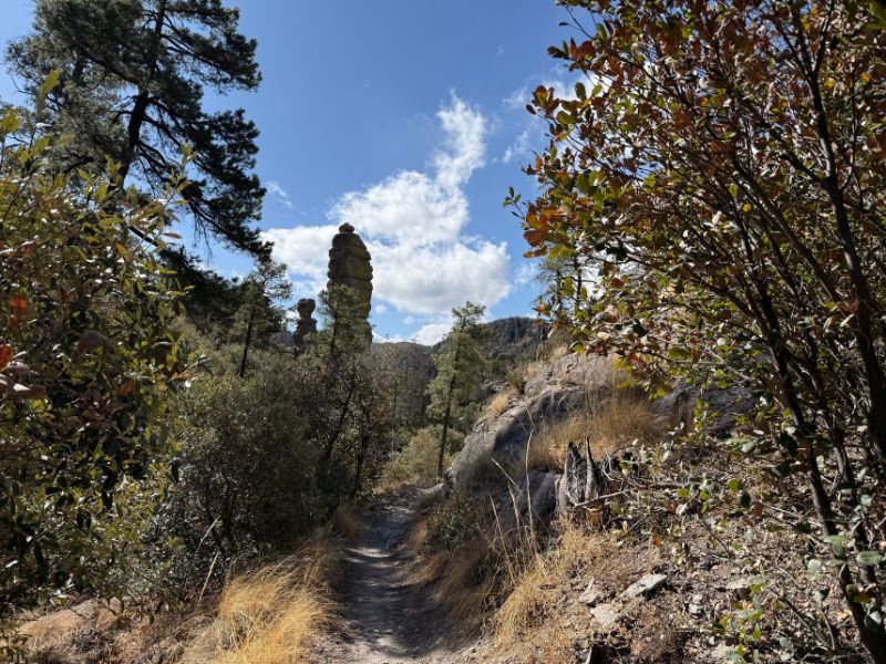
On your second day, tackle Heart of Rocks.This strenuous hike takes you deep into the Wonderland of Rocks, where you’ll encounter some of Chiricahua’s most unusual formations.
Three or More Days in Chiricahua National Park
With three or more days, you can explore most of Chiricahua’s major hiking trails.
Consider hiking the Big Loop, visiting less-traveled trails such as Natural Bridge, and spending time photographing the rock formations.
You can also use the extra time to visit nearby Fort Bowie National Historic Site or explore the surrounding Chiricahua Mountains.
For visitors interested in hiking, wildlife, geology, and photography, Chiricahua offers plenty to fill several days.
Best Things to Do in Chiricahua National Park
From hiking among towering rock pinnacles to exploring historic ranch buildings, Chiricahua National Park offers plenty to do. Here are some of the highlights to include in your visit.
Hike to the Heart of Rocks
Heart of Rocks is home to some of Chiricahua’s most recognizable formations, including Punch and Judy, Duck on a Rock, and Kissing Rocks. Reaching this area requires a strenuous hike, but the chance to walk among these unusual formations makes it one of the park’s most rewarding experiences.
Explore Echo Canyon
Echo Canyon is one of the best places to experience Chiricahua’s Wonderland of Rocks. The 3.3-mile Echo Canyon Loop winds through towering pinnacles, narrow rock passages, and forested areas, including the Grottoes. It’s an excellent choice for first-time visitors.
Take in the Views from Massai Point
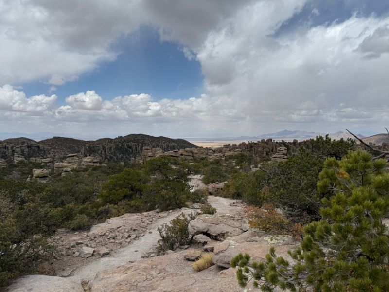
Located at the end of Bonita Canyon Scenic Drive, Massai Point offers panoramic views of the Wonderland of Rocks and surrounding mountains. The 0.5-mile nature trail provides additional viewpoints and is ideal for visitors with limited time.
Drive Bonita Canyon Scenic Drive
Bonita Canyon Scenic Drive winds through the park, climbing from the lower canyon to Massai Point. Along the way, you’ll pass the visitor center, campground, scenic overlooks, and several hiking trailheads. It’s the best way to experience Chiricahua without committing to a long hike.
Visit Faraway Ranch Historic District
Faraway Ranch preserves the history of the Erickson family, who settled in Bonita Canyon in the late 1800s and later operated a guest ranch. Explore the historic district to learn about the area’s ranching and early tourism history. Check with the visitor center for tour availability.
Watch for Wildlife and Birds
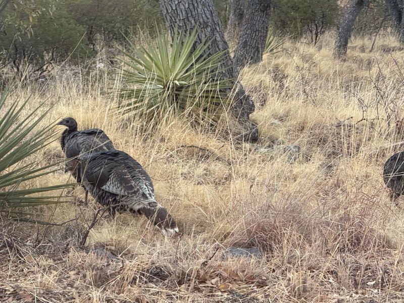
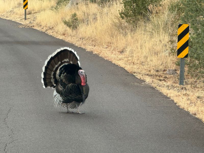
Chiricahua’s Sky Island ecosystem supports an incredible diversity of wildlife, including white-nosed coatimundis, deer, javelinas, black bears, and hundreds of bird species. The lower canyon and wooded areas are particularly good places for birdwatching.
Go Stargazing in Chiricahua
Chiricahua’s remote location and limited light pollution make it a great place for stargazing. On clear, moonless nights, the Milky Way can be spectacular. If you’re camping at Bonita Canyon, be sure to spend some time enjoying the night sky.
Complete the Junior Ranger Program
Stop by the visitor center to pick up a Junior Ranger activity booklet and learn about Chiricahua’s geology, wildlife, and history. The program is a fun way for kids and adults to explore the park and earn a Junior Ranger badge.
Best Hikes in Chiricahua National Park
Hiking is one of the best ways to explore Chiricahua’s Wonderland of Rocks. I’ve hiked almost every trail in the park, and there’s something for everyone, from short walks to challenging all-day hikes.
| Trail | Distance | Difficulty | Highlights |
|---|---|---|---|
| Massai Point Nature Trail | 0.5-mile loop | Easy | Panoramic views and geology |
| Echo Canyon Grottoes | ~1 mile round trip | Easy–Moderate | Rock passages and pinnacles |
| Bonita Creek Trail | 0.5 mile one way | Easy | Wildlife and birdwatching |
| Echo Canyon Loop | 3.3-mile loop | Moderate | Grottoes, Wallstreet, and Echo Park |
| Sugarloaf Mountain | 1.8 miles round trip | Moderate | Historic fire lookout and mountain views |
| Natural Bridge | 4.8 miles round trip | Moderate–Strenuous | Natural bridge overlook |
| Heart of Rocks | ~7.5 miles round trip | Strenuous | Named rock formations |
| Big Loop | ~9.5 miles | Strenuous | Echo Canyon, Heart of Rocks, and Inspiration Point |
For first-time visitors, I recommend Echo Canyon Loop. It offers some of the park’s best scenery without requiring an all-day hike. If you’re looking for a longer adventure, Heart of Rocks and the Big Loop are excellent options.
Where to Stay Near Chiricahua National Park
Chiricahua National Park doesn’t really have a gateway town, and your lodging options are limited to staying in Wilcox, camping in nearby BLM land, or staying in the park.
Camping in Chiricahua National Park
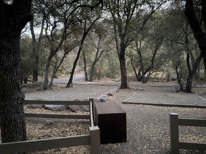
Bonita Canyon Campground is the park’s only campground. Located along Bonita Canyon Scenic Drive, it provides a convenient base for exploring Chiricahua’s hiking trails and scenic overlooks.
The campground is relatively small and is best suited for tents and smaller camping vehicles. There are no RV hookups, and large vehicles face restrictions on the park road.
Don’t Miss Your National Park Camping Reservation! Campgrounds in popular National Parks can fill up months in advance. My National Park Reservation Master List helps you stay on top of booking windows for campgrounds, lodging, tours, and other activities across the National Parks, so you know when and where to make your reservations.
Hotels Near Chiricahua National Park
Willcox is the most practical town for most visitors looking for a hotel. Located approximately 36 miles from the park, Willcox offers lodging, restaurants, fuel, groceries, and other basic services. Staying in Willcox allows you to reach Chiricahua in roughly 45 minutes to an hour.
The town also works well as a base for exploring nearby attractions, including Fort Bowie National Historic Site and other destinations in southeastern Arizona.
Smaller communities such as Portal may also have lodging options, although reaching the main park entrance can require a considerably longer drive than the distance on a map suggests.
Staying in Tucson vs. Willcox
If Chiricahua is your main destination, I recommend staying in Willcox rather than Tucson. Tucson is approximately two hours from the park, making a day trip possible but less convenient.
A round trip from Tucson can involve four hours of driving before accounting for time spent hiking or sightseeing. However, Tucson makes sense if Chiricahua is one stop on a longer Southern Arizona itinerary.
If you’re visiting Saguaro National Park, Coronado National Memorial, and Chiricahua, you may prefer to split your lodging between Tucson and Willcox.
Things to Know Before Visiting Chiricahua National Park
Chiricahua is a relatively remote National Park with limited services, so a little advance planning can make your visit much easier. Here are a few important things to know before you go.
Cell Service and Offline Maps
Cell service is unreliable throughout much of Chiricahua National Park. Download the official park map, hiking maps, and offline driving directions before arriving, especially since GPS apps sometimes suggest unpaved routes through the surrounding mountains.
Food, Water, and Fuel
There are no restaurants or gas stations inside Chiricahua National Park, so bring food and plenty of water, especially if you’re planning a longer hike. Fill up your gas tank and purchase supplies in Willcox or another nearby community before heading into the park.
Hiking Safety and Elevation
Chiricahua’s trails can be more challenging than their mileage suggests, with rocky terrain, steep grades, stairs, and significant elevation changes. Wear sturdy footwear, carry plenty of water, and allow extra time for longer hikes, particularly if you’re not accustomed to hiking at higher elevations.
Summer Monsoon and Weather Safety
Summer thunderstorms can develop quickly in the Chiricahua Mountains, bringing lightning, heavy rain, and slippery trails. Avoid exposed ridges during storms and be cautious around washes and narrow canyons where flash flooding can occur. Check the forecast and plan longer hikes for early in the day.
RV and Trailer Restrictions
Bonita Canyon Scenic Drive has restrictions for large vehicles, including a 24-foot vehicle length limit beyond Bonita Canyon Campground. If you’re traveling with a larger RV or trailer, check the current park regulations and plan to explore with a smaller vehicle if necessary.
Pets in Chiricahua National Park
Chiricahua is not particularly dog-friendly for hikers. Leashed pets are allowed in developed areas and on certain lower-elevation trails, but they are prohibited on most of the park’s popular hiking trails, including Echo Canyon, Heart of Rocks, and Sugarloaf Mountain. If you’re traveling with a dog, plan your activities around these restrictions.
Reservations, Entrance Fees, and Park Hours
Chiricahua National Park currently has no entrance fee or timed-entry reservation requirement. However, reservations are required for Bonita Canyon Campground. The park is generally accessible year-round, although winter weather and temporary closures can affect access. Check the official NPS website for current conditions before visiting.
Other National Parks and Attractions Near Chiricahua National Park
Chiricahua is a great addition to a Southern Arizona road trip, with several National Park Service sites and other attractions within a few hours’ drive. If you have extra time, these are some of the places worth adding to your itinerary.
Fort Bowie National Historic Site
Fort Bowie National Historic Site preserves an important chapter in the history of the Chiricahua Apache, the Apache Wars, and the U.S. military presence in southeastern Arizona. Reaching the historic fort generally requires a 1.5-mile hike each way along a trail that passes several historic landmarks, making it a worthwhile stop for anyone interested in the region’s history.
Coronado National Memorial
Located along the U.S.–Mexico border, Coronado National Memorial interprets the history of the Coronado expedition and the cultural heritage of the borderlands. The memorial also offers scenic mountain views, hiking trails, and a chance to explore another part of Arizona’s Sky Island landscape.
Saguaro National Park
Saguaro National Park protects the iconic giant saguaro cacti and Sonoran Desert landscapes surrounding Tucson. Visiting Saguaro and Chiricahua on the same trip is a great way to experience two completely different Arizona ecosystems, from cactus-covered desert hills to pine forests and volcanic rock formations.
Tumacácori National Historical Park
Tumacácori National Historical Park preserves the ruins of three Spanish colonial missions in southern Arizona. The park offers a fascinating look at the region’s Indigenous and Spanish colonial history and makes an easy addition to a road trip through the Tucson area and southern Arizona.
Kartchner Caverns State Park
Kartchner Caverns State Park is my favorite cave in the United States, including all the caves managed by the National Park Service. Located near Benson, the park protects a spectacular living limestone cave filled with delicate formations, including impressive stalactites, stalagmites, and flowstone. The cave’s formations are exceptionally well preserved, and guided tours provide access to different sections of the cave. Reservations are highly recommended, and photography is not permitted inside the cave.
Frequently Asked Questions About Visiting Chiricahua National Park
Is Chiricahua National Park Worth Visiting?
Absolutely! Chiricahua is worth visiting for its incredible rock formations, scenic drives, and hiking trails. The Wonderland of Rocks is unlike anywhere else in Arizona, and the park offers excellent opportunities to explore without the crowds typically associated with larger National Parks.
Can You See Chiricahua National Park in One Day?
Yes, one full day is enough to drive Bonita Canyon Scenic Drive, visit Massai Point, and hike Echo Canyon Loop. However, I recommend two days if you want to explore Heart of Rocks or complete several of the park’s longer trails.
Do You Need Reservations to Visit Chiricahua National Park?
No, Chiricahua National Park does not currently require timed-entry reservations for sightseeing or day hiking. However, reservations are required for Bonita Canyon Campground, which has a limited number of campsites.
How Much Does It Cost to Enter Chiricahua National Park?
Chiricahua National Park currently has no entrance fee.
Can You Drive Through Chiricahua National Park?
Yes, Bonita Canyon Scenic Drive travels through the park to Massai Point, providing access to overlooks, hiking trails, and the visitor center. However, it is not a through-road, so you’ll need to return along the same route to exit the park.
Are Dogs Allowed in Chiricahua National Park?
Dogs are allowed in developed areas and on certain lower-elevation trails but are prohibited on most of the park’s popular hiking trails, including Echo Canyon and Heart of Rocks. Pets must remain on a leash no longer than six feet.
Is Chiricahua National Park Open Year-Round?
Yes, Chiricahua National Park is generally open year-round, although snow and ice can temporarily affect roads and trails during winter. Spring and fall offer the most comfortable conditions for hiking, while summer brings hot temperatures and monsoon thunderstorms.
Does Chiricahua National Park Have a Shuttle?
Chiricahua has historically offered a limited hikers’ shuttle for visitors completing certain one-way hiking routes. This is not a general sightseeing shuttle, and availability depends on staffing and seasonal operations. Check with the visitor center for current schedules.
Can You Visit Chiricahua National Park Without Hiking?
Yes! Bonita Canyon Scenic Drive and Massai Point provide excellent opportunities to enjoy Chiricahua’s scenery without completing a long hike. However, many of the park’s most impressive rock formations are only accessible on foot.
Is Chiricahua National Park Good for Kids?
Chiricahua is a great destination for families, particularly those with children who enjoy exploring unusual landscapes. Short walks, scenic overlooks, wildlife watching, and the Junior Ranger program offer plenty to do, although families should prepare for uneven trails, elevation changes, and limited services.
Final Tips for Visiting Chiricahua National Park
Chiricahua may be America’s newest National Park, but its incredible landscapes have been worth exploring for a long time. The park’s towering rock formations, quiet hiking trails, and diverse wildlife make it one of the most distinctive destinations in the Southwest.
Having visited Chiricahua twice and hiked almost every trail, I think the best way to experience the park is to get out of your vehicle and explore the Wonderland of Rocks on foot. If you only have one day, prioritize Echo Canyon Loop and Massai Point. If you have two days, add Heart of Rocks.
And if you’re planning a larger Southwest road trip, don’t overlook the other National Park Service sites scattered across southeastern Arizona.
Need help planning your Chiricahua National Park adventure? Join my National Park Trip Planning Facebook Group to ask questions, share your itinerary, and get advice from fellow National Park travelers.
Whether Chiricahua is your first National Park or your 64th, it’s a destination worth making time to explore.
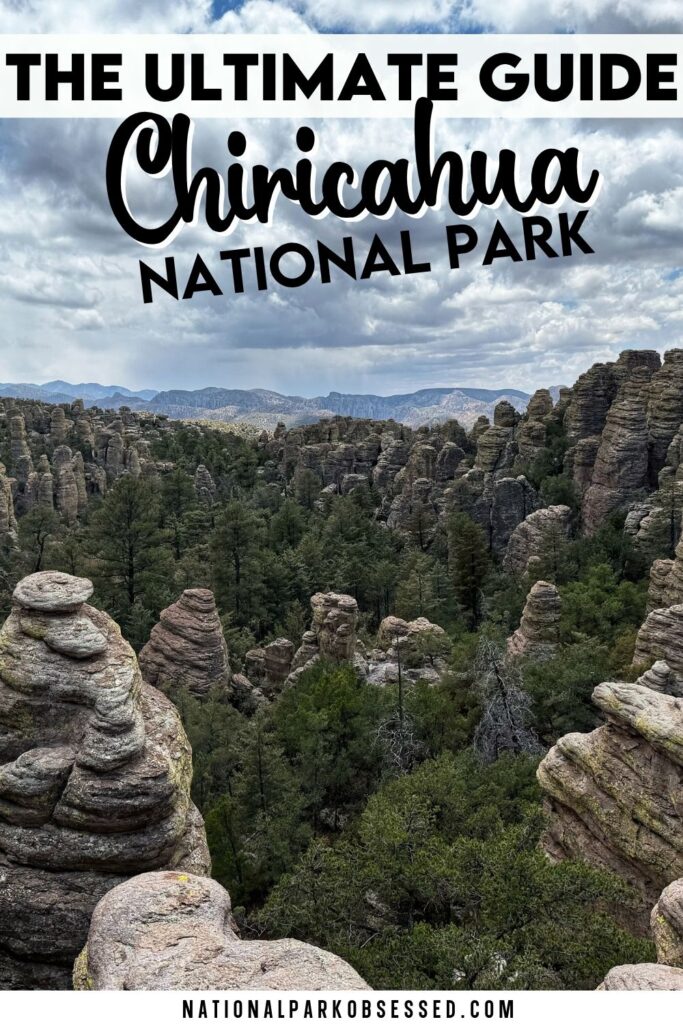
Pin for Later: The Complete Guide to Visiting Chiricahua National Park

Hi, I'm Jennifer!

Welcome to the wonderful world of National Parks. I'm here to help you plan your NEXT amazing adventure through the United States National Parks and beyond. I want the national parks to be accessible to all.
I live in Tennessee, and when I'm home, you can find me hiking in the Smokies and the Cumberland Plateau.
58/63 National Parks
250+/423 National Park Units
Want to know more? Start Here.
Snag one of my National Park Ebooks and Downloadable Itineraries
Talk with an Expert
Share your love of the parks with a shirt, ornaments, hoodies, frames, and more.