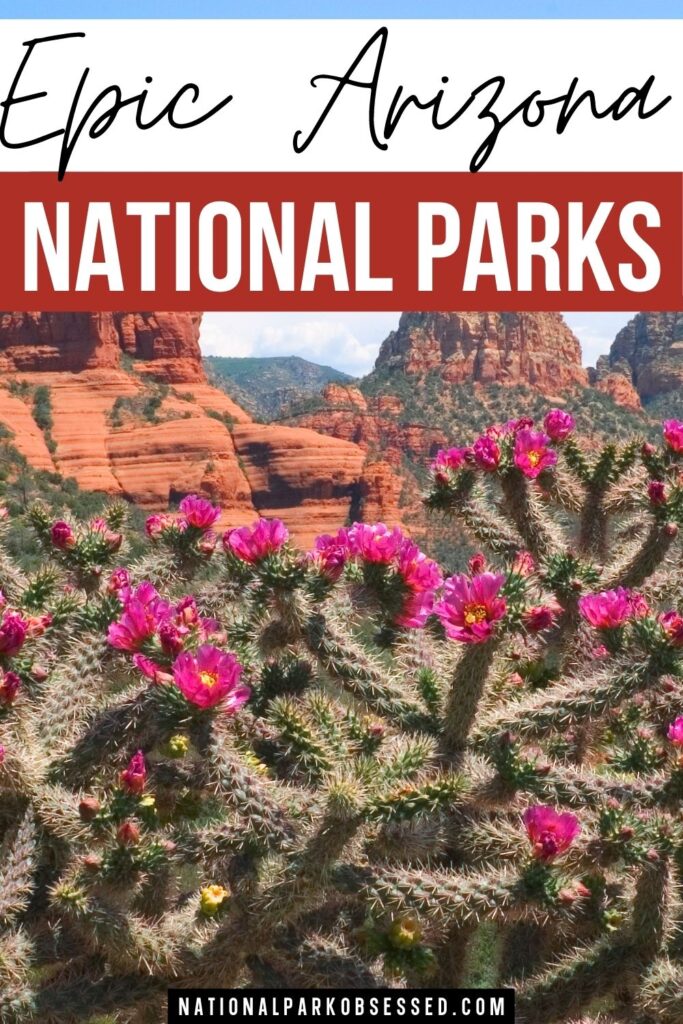
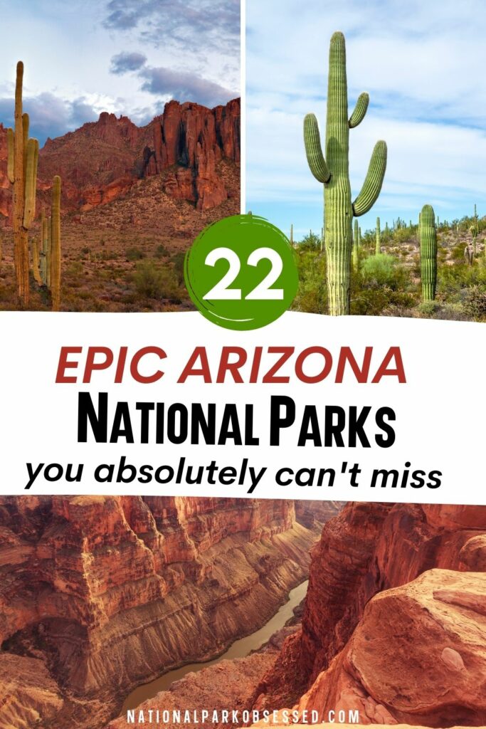
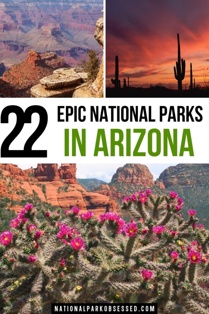
Post Summary: National Parks of Arizona
Arizona, the home of deserts and canyons, is the picture-perfect depiction of what you would imagine the Southwest would look like. From dry red land, the multitude of cacti, hundreds of pueblos, and massive, outstanding canyons, Arizona has it all. Home of one of the “Seven Wonders of the World”, the Grand Canyon welcomes millions of visitors each year. Travelers frequent the region to learn more about the ancient native settlers of this land and bask in the amazing natural architecture of the canyons.
If you’re not yet satisfied with that, Arizona also offers 22 other national parks for visitors to come and discover their next adventure. From abandoned Ancient Pueblos that withstood the test of centuries, to swimming in the different lakes, to appreciating the endemic species here like the famous giant saguaro cactus, and other pertinent historical and cultural sites, you can do it all here. Venture deep into the canyons and deserts of America, it offers something unique and exciting for your next adventure!
This post may contain affiliate links, meaning if you book or buy something through one of these links, I may earn a small commission at no extra cost to you! Read the full disclosure policy here
Map of National Parks of Arizona
Arizona National Parks
Arizona is part of the Southwest, West Coast and Intermountain regions.
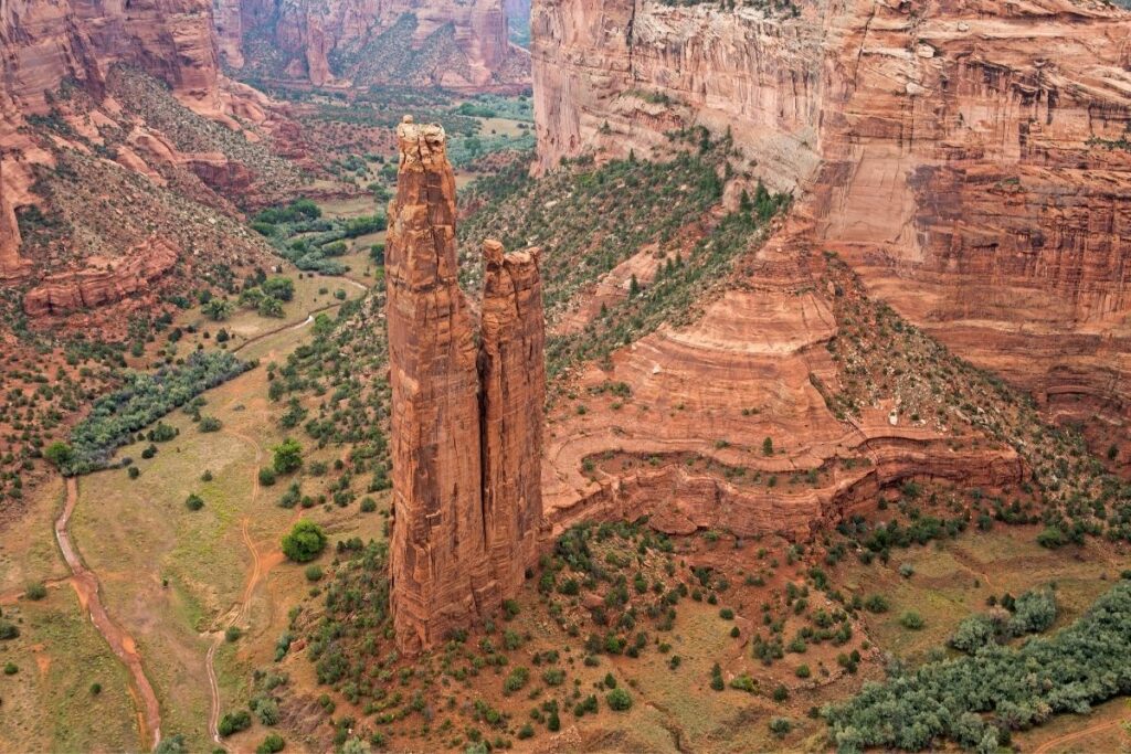
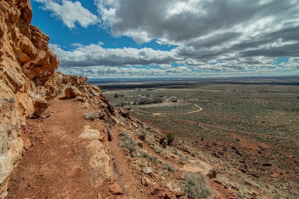
Canyon De Chelly National Monument
The Canyon De Chelly National Monument covers about 83,000 acres of the ancestral land of Native American tribes like the ancient Puebloan people up to today’s Navajo people.
The Tseyi area is entirely owned by the Navajo Tribal Trust with about forty families living within the park. The only area that is accessible by visitors is the White House Ruin Trail. The rest of the canyon can be accessed by visitors if accompanied by a park ranger or an authorized Navajo guide. What can be accessed though is truly breathtaking. The canyon walls and the original natural landscapes have been preserved throughout the five thousand years of different tribes living in this area. Descendants of the original Puebloan people are now the predominant settlers here and continue to care for it as their ancestors have.
Canyon De Chelly National Monument was established under the National Park Service in April of 1931.
Things to do: Scenic Drives, Hiking
How to get there: By car, drivers take highway 191 to the Welcome Center. By plane, the nearest airports available are in Phoenix or Albuquerque.
Where to Stay: There is the Thunderbird Lodge and Canyon de Chelly Inn available for visitors. Other options are available in nearby towns the Apache County.
Entrance Fee: Free
Official Website: Click Here
Map: Download
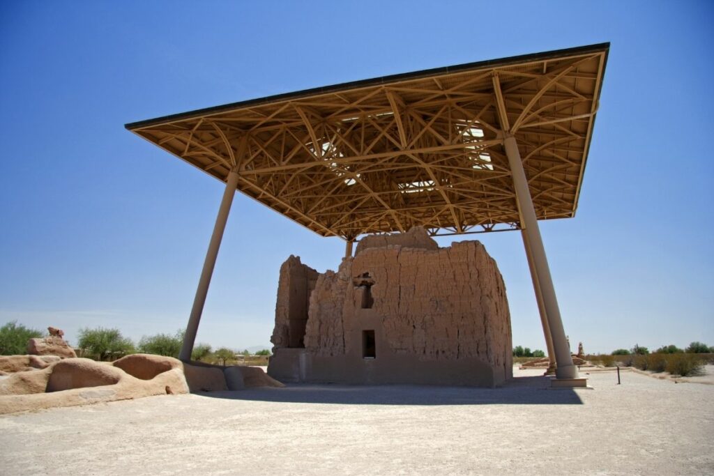
Casa Grande Ruins National Monument
Casa Grande Ruins National Monument preserves the ancient Hohokam ruins in Coolidge, Arizona. The Hohokam people are believed to have lived from 300 to 1500 AD in the harsh desert environment of Sonora.
The name Casa Grande or directly translated to the “Big House” alludes to one of the biggest structures in the area. Made using traditional adobe processes, the structure is believed to have been three to four stories high. Whether it was used as living or gathering quarters for the ancient Sonoran Desert people or just a large structure created as a marker is still unknown. It does, however, serve as evidence of the amazing feats these desert people were able to accomplish. Aside from the Casa Grande, the Sonoran Desert people left ruins of extensive canals, irrigation systems, and even trading connections for generations to discover. Visitors can now come to learn more about these ancient people and how they were able to thrive despite these difficult conditions.
This area was named a national monument by President Woodrow Wilson on August 3, 1918.
Things to do: Guided Tours, Picnicking
How to get there: Private vehicles are used for transportation. The park is located in Coolidge, Arizona, and is roughly an hour’s drive from both Phoenix and Tucson. Take the Coolidge exits on Interstate 10 and follow the instructions to the park gate.
Where to Stay: Casa Grande has no accommodation available within the park. The nearest city is in Coolidge, which offers hotels, inns, and motels.
Entrance Fee: Free
Official Website: Click Here
Map: Download
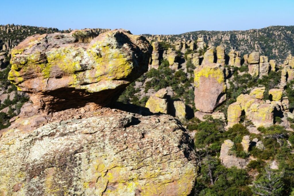
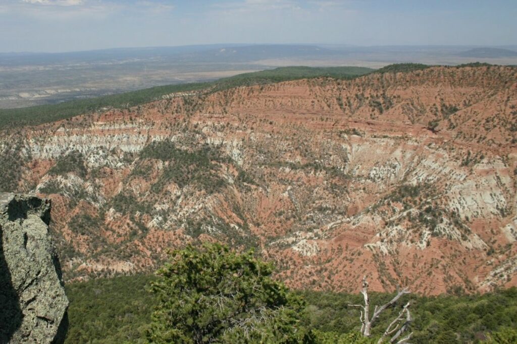
Chiricahua National Monument
Coined as “The Wonderland of Rocks”, the Chiricahua National Monument has over twelve thousand acres of hoodoos, balancing rocks, and the famous rhyolite rock pinnacles, along with other astounding formations. This monument preserves the beautiful sky island in North America. Sky Islands are isolated mountain ranges that rise up out of a sea of the surrounding desert.
This national monument has so many rock formations due to the immense volcanic eruption that happened about 27 million years ago. That event created hoodoos and even rock groups that tower over the area today.
Visitors frequent this monument to hike the different trails available through beautiful meadows, interesting rock formations, and explore the forests and mountains in the park. You can spot as many as two hundred species of birds in the area like the Gould’s Turkey, which was reintroduced to the park. Others spot black bears or even rattlesnakes during their hike.
Aside from the natural attractions, the monument also preserves Faraway Ranch Historic District, which is the site of some of the last battles of European settlers against the original Apache people. Travelers can enjoy a recreational hike while learning about the rich cultural and historic relevance of this area when visiting.
The Chiricahua National Monument was established under the National Park Service on April 18, 1924.
Things to do: Hiking, Camping, Scenic Driving, Horseback Riding
How to get there: By plane, the closest major airports are in Tucson and Phoenix. By car, Chiricahua National Monument is 120 miles southeast of Tucson. From Tucson, use I-10 east to the Willcox exit. The park is not accessible by public transit.
Where to Stay: Chiricahua does not offer lodges but they offer campgrounds. The nearest city is 34 miles away in Willcox, which has various hotels, inns, and motels.
Entrance Fee: Free
Official Website: Click Here
Map: Download
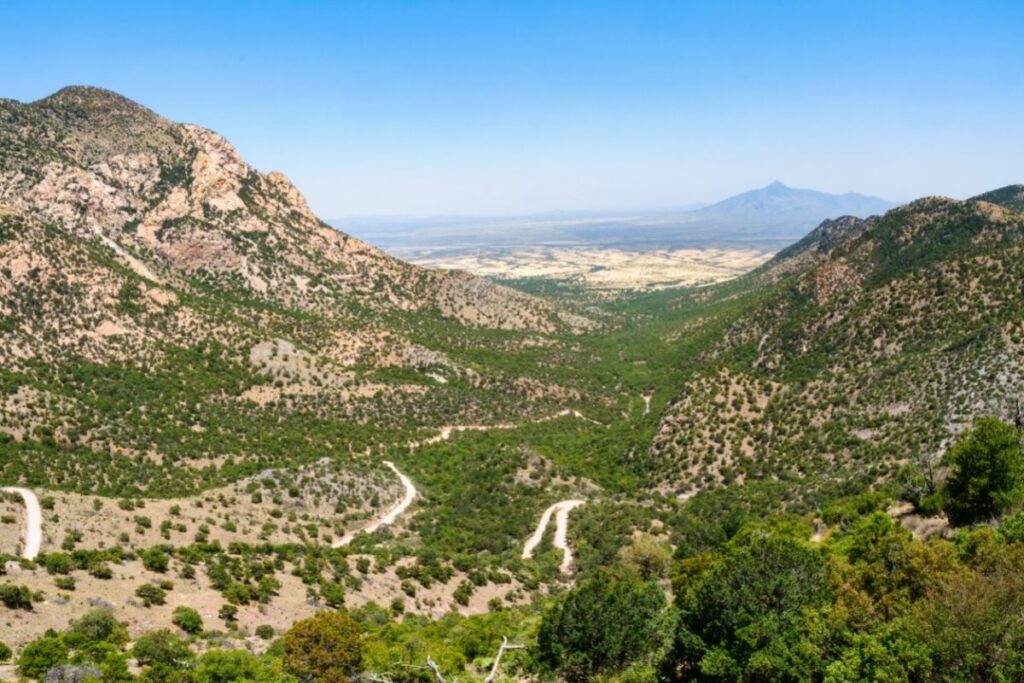
Coronado National Memorial
The Coronado National Memorial sits along the Mexico-United States border in Arizona and remembers events that have happened as early as the year, 1540. It commemorates the first expedition done by conquistador, Francisco Vásquez de Coronado. Celebrated as one of the first people to have seen the Grand Canyon and Colorado River, Coronado was a famed explorer that led the expedition to discover what is present-day Mexico and Kansas.
Here in Coronado National Memorial, we remember the cultural collapse caused by the expedition. Coronado and his army took control of what was once the ancestral cities of Cibola. What the European settlers did truly change the lives of indigenous people forever. Today, there is no physical evidence of the ancient settlements but travelers can still visit the memorial and enjoy the beautiful view of the San Pedro River. This river is believed to be the very corridor that Coronado used to siege ancient Cibola. Other than that, visitors also explore the rugged trails and even the Coronado Cave.
This memorial was established under the National Park Service in 1952.
Things to do: Scenic Drives, Hiking, Climbing
How to get there: By car, take I-10 east from Phoenix or Tucson and exit to Sierra Vista or Fort Huachuca. Tucson International Airport is the closest airport serving southeast Arizona. Coronado National Memorial is not accessible by public transit.
Where to Stay: There is no lodging available in Coronado National Memorial. The nearest town that offers accommodation is Sierra Vista.
Entrance Fee: Free
Official Website: Click Here
Map: Download
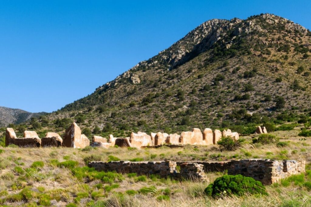
Fort Bowie National Historic Site
Fort Bowie National Historic Site commemorates our own 19th-century American army. What was once a U.S. Army outpost that was created to be used during the different engagements between American armies and the Chiricahua people is now a tourist attraction for travelers to enjoy and learn about the wealth of history and culture of the area.
The site was originally created by California Volunteers in 1862 after a series of violent engagements that occurred between the Apaches and American soldiers. Throughout the violent battles, the fort was improved and fortified to include a hospital, more protection, and other features. The fort was eventually abandoned when Geronimo of the Apache people finally surrendered and the indigenous groups were relocated to Florida and Alabama. This famed area is even the inspiration of a Western film called Fort Bowie starring Ben Johnson.
What is left of this military hub is now carefully preserved under the care of the National Park Service since 1960.
Things to do: Wildlife Viewing, Hiking
How to get there: To get to the site by car, take I-10 to the town of Bowie. By plane, the closest major airports are in Tucson and Phoenix.
Where to Stay: There are no accessible lodges on the site the closest city that accommodates stay-in guests is in Bowie, Arizona, which is 13 miles away.
Entrance Fee: Free
Official Website: Click Here
Map: Download
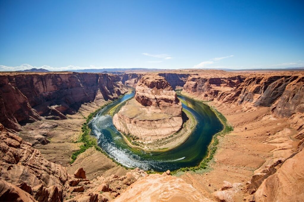
Glen Canyon National Recreation Area
The Glen Canyon National Recreation Area includes the land around Lake Powell and some of the Cataract Canyon in Utah and Arizona. This recreation area is named after the Glen Canyon which was completely flooded by the Glen Canyon Dam and is now fully submerged under Lake Powell.
Today it is used mainly for enjoyment for travelers from all over the world wanting to bask in the beautiful and distinct rock formations of these canyons. The 1.2 million-acre area has so much to offer for its visitors. No wonder over four million people decide to go here each year! Between the rugged but beautiful terrain of the canyons and the clear, dark blue lake, this recreation area is a natural wonder. One of the famous sites to see is the Reflection Canyon and the Navajo Sandstone. From water activities like boating, fishing, and kayaking to backcountry experiences, there is something for everyone. Visitors can even spot wildlife indigenous to this state like bobcats, bighorn sheep, kangaroo rats, and coyotes.
The Glen Canyon National Recreation Area was established in 1972.
Things to do: Boating, Fishing, Kayaking, Swimming
How to get there: The south entrance of the Wahweap sector of Glen Canyon National Recreation Area is three miles north of Page, Arizona, on Highway 89. A commercial airline serves the city of Page by plane.
Where to Stay: Within the park, there is an available lodging area. Lake Powell Resort in Wahweap and Defiance House Lodge in Bullfrog both have hotel rooms near the lake. Glen Canyon also has camping options for visitors.
Entrance Fee: $30 per vehicle or free with an America the Beautiful Pass.
Official Website: Click Here
Map: Download
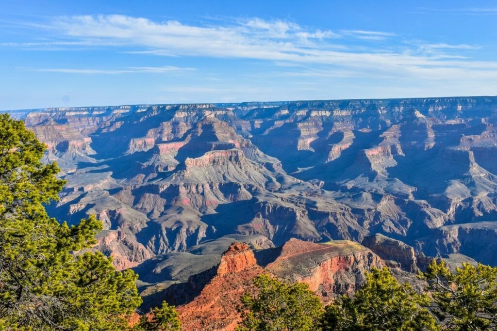
Grand Canyon National Park
The Grand Canyon National Park is the fifteenth site to be established under the National Park Service. This park is over a million acres of colorful sandstone. The most visited feature of the park is the famed wonder of the world, the Grand Canyon. Today, it is one of the most visited national parks with over two million travelers venturing out to see the canyon themselves.
This area was first popularized in the 1880s when the first railroads were completed. One of the most famous enthusiasts is President Theodore Roosevelt himself, who visited the site in 1903. It aims to preserve the impressive system of canyons in the Arizona area.
Travelers can come to enjoy a challenging hike, backcountry camping, and different tours in the area to not only enjoy the amazing views but also experience nature at its best. Visitors can expect to be surrounded by layers and layers of colorful rocks and sandstones that were formed in the course of millions of years. This geological treasure is definitely a must-see on your next adventure!
The Grand Canyon was named a UNESCO World Heritage Site in 1979.
Things to do: Photography, Cycling, Hiking, Backpacking, Sightseeing, Stargazing, Guided Tours, Whitewater rafting
How to get there: The Grand Canyon is located in the northwest part of Arizona, near the Utah and Nevada borders. Commercial airlines fly to Las Vegas, Nevada, Phoenix, Arizona, and Flagstaff, Arizona.
Where to Stay: A lodging area is available and reservations should be made well ahead of time, as park lodging is usually fully booked for most of the year.
Entrance Fee: $35 per vehicle or free with an America the Beautiful Pass.
Official Website: Click Here
Map: Download
Hohokam Pima National Monument
The Hohokam people is a society of ancient desert dwellers that lived and thrived between 300 and 1500 AD in old Arizona and the Sonoran Desert. The Hohokam Pima National Monument aims to preserve what is left of this society, an ancient village called Snaketown.
This archaeological site is owned by the Gila River Indian Community and offers a glimpse of the lives of the early people that resided in ancient Arizona. Many archaeologists believe that over 2,000 inhabitants resided in the vanished Snaketown at its peak. Believed to have massive influence from Mexico, Snaketown seems to have many urban-style features in their neighborhood. Some of the findings cited are a central plaza, modern irrigation systems, and other urban innovations. The site has now been backfilled for future excavations and protection of the site.
Hohokam Pima National Monument is located within the Gila River Indian Community. The site is NOT open to the public and there is no access that doesn’t involve trespassing. Please respect the Gila River Indian Community and do not attempt to access the site via the directions that can be found on the internet. Most park visitors consider a visit to the Huhugam Heritage Center as a visit to the National Monument.
You can also find artifacts from the Hohokam people are displayed in nearby museums and an impressive Hohokam structure still stands as the Casa Grande Ruins National Monument.
Things to do: Museum
How to get there: The site is located in the Gila River Indian Community and is NOT accessible to the public. Please visit the Huhugam Heritage Center instead.
Where to Stay: There are no accessible lodges on the Monument the closest city that accommodates stay-in guests is in Everhart.
Entrance Fee: $6
Official Website: Click Here
Map: Download
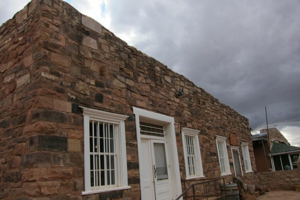
Hubbell Trading Post National Historic Site
The Hubbell Trading Post National Historic Site preserves the trading engagements between the Navajo people and the early European settlers in Arizona.
This trading post became an important highlight in the history and recovery of the Navajo people coming from the devastating effects of the 1864 exile of the Navajo people to New Mexico. Now named the “Long Walk of the Navajo”, this was a somber memory in American history, which aimed to culturally cleanse the area. After 10 years, the Navajo were finally allowed to come back. Original residents aimed to recover from this through trade. This became one of the most important symbols of hope for the Navajo people at that time.
This trading post was a joint effort of John Lorenzo Hubbell, an influential trader promoting Navajo art and goods, and by many of the Navajo people reclaiming their lives. Made with local sandstone and other available materials, the building stands strong, reflecting the resilience of Navajos.
Through this, Navajos were able to gain access to different trader’s goods. They traded wool, sheep, and, later, rugs, jewelry, baskets, and pottery for them. Today, visitors can come to see and buy authentic Navajo arts and goods. You can also explore the grounds, the Hubbell Home and learn more about the Navajo culture.
In 1960, The Hubbell Trading Post National Historic Site was declared as a National Historic Landmark.
Things to do: historical tour, guided tour
How to get there: Hubbell Trading Post National Historic Site is located at milepost 446.3 on Arizona State Route 264 and is accessible by car. Visitors driving on I-40 can go north on US Highway 191 to Ganado and then west on US Highway 264. By plane, Amtrak, buses, and a small airport service Gallup, New Mexico, 60 miles east of the park. A large airport is located 200 miles east in Albuquerque, New Mexico.
Where to Stay: There are no accessible lodges on the site; instead, Ganado, Arizona, is the closest city that can accommodate stay-in guests.
Entrance Fee: Free
Official Website: Click Here
Map: Download
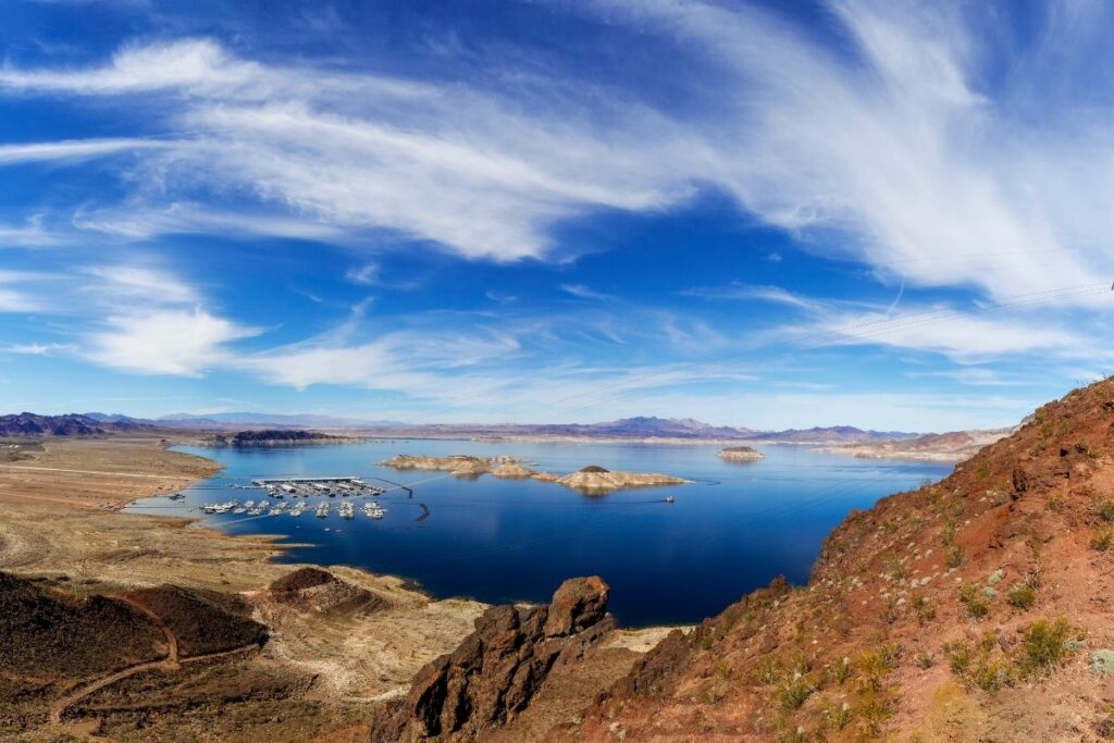
Lake Mead National Recreation Area
The Lake Mead National Recreation Area covers about 1.4 million acres of different bodies of water perfect for outdoor activities and a great weekend out. This recreation area includes Lake Mead, Lake Mohave, and other smaller reservoirs near the Colorado River and Arizona. Aside from water sports and activities, this recreation area features a lot more for travelers to explore like the nine wilderness areas, Hoover Dam, views of the surrounding desert landscapes of the Mojave Desert, the Great Basin Desert, and the Sonoran Desert, and even the once sunk ghost town of St. Thomas, Nevada.
America’s first and largest national recreation area has almost anything for visitors to learn, explore, see, and do. This area has about 8 million visitors each year and it’s no surprise why. People come to enjoy and hike the vast desert views or explore and spot the hundreds of endemic species in the area. Water sports enthusiasts can truly enjoy the lakes here with experiences like scuba diving, sports fishing, and kayaking available for visitors.
This area has been protected as the Lake Mead NRA by the National Park Service since 1947.
Things to do: Boating, Hiking, Kayaking, Fishing, Scuba Diving
How to get there: Drivers can access Lake Mead NRA, which is just minutes from most of Las Vegas, and Lake Mojave, which is just minutes from Laughlin, Nevada, and Bullhead City, Arizona. By plane, the nearest major airport is McCarran International Airport in Las Vegas.
Where to Stay: Lake Mead has several lodging areas like Cottonwood Cove Motel and Temple Bar Marina Resort. Campgrounds are also available in Boulder Beach and Lake Mead.
Entrance Fee: $25 per vehicle or free with an America the Beautiful Pass.
Official Website: Click Here
Map: Download
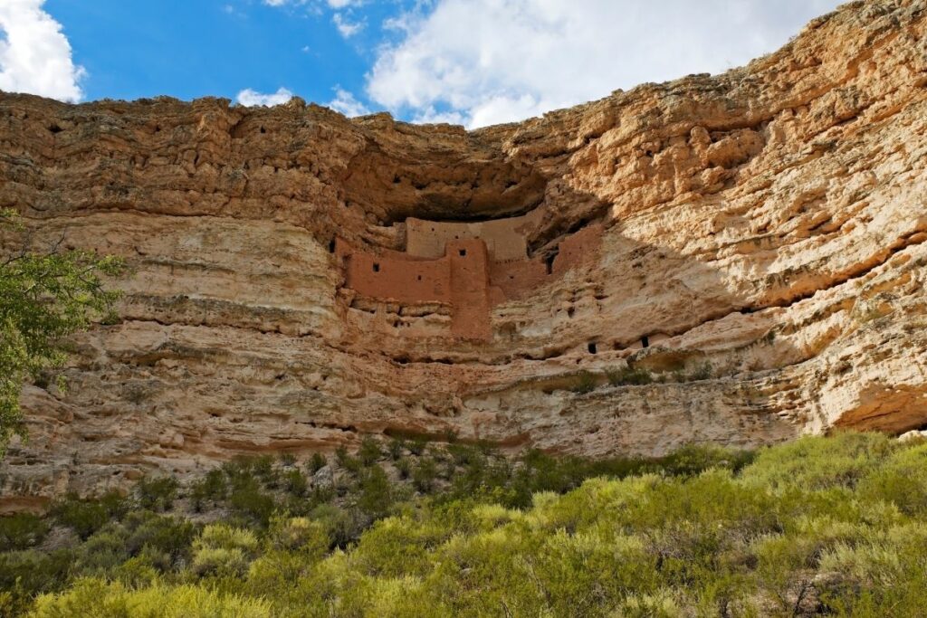
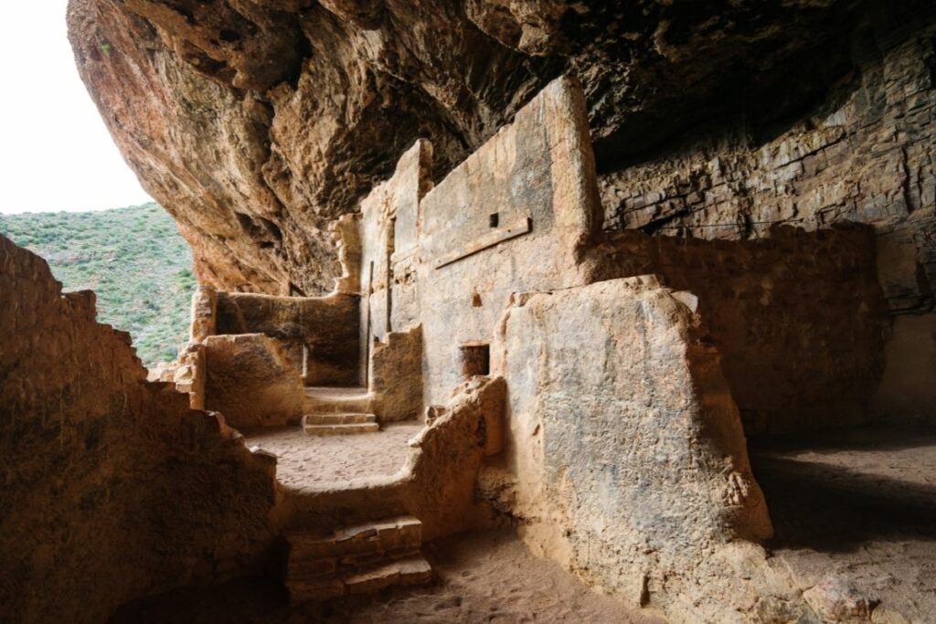
Montezuma Castle National Monument
Montezuma Castle National Monument preserves an impressive 20-room high-rise dwelling built on the side of a massive limestone cliff. These dwellings were used by the ancient Sinagua people. This prehistoric apartment complex shows the ingenious survival skills of this indigenous group to thrive in the harsh desert environment.
Despite its name, it is not connected to Montezuma, an ancient Aztec god, nor is it a castle. It was first related to Montezuma as it was believed that gods aided in the construction of impressive buildings at the time but it was not built in the Aztec era or related to them. Instead of a castle, it is more of a system of different cliff dwellings that are built throughout time.
This ancient cliff dwelling faces Beaver creek and stands about 90 feet up the limestone cliff. This impressive feat alludes to the skill and innovation already present at that time by these pre-Columbian people. This area is one of the best-preserved prehistoric sites that can be due to the ideal location. Nestled within the high areas of the cliff, the height and the limestone that protects it from natural elements and disasters. Come check out the original dwellings created in prehistoric times!
This area was declared a National Monument on December 8, 1906.
Things to do: Hiking, Sightseeing
How to get there: Travelers can follow I-17 to exit 289 or 293 and reach the Well’s entrance.
Where to Stay: There is no available lodging area in the monument, but the neighboring city offers accommodation in Camp Verde.
Entrance Fee: $10 per person or free with an America the Beautiful Pass.
Official Website: Click Here
Map: Download
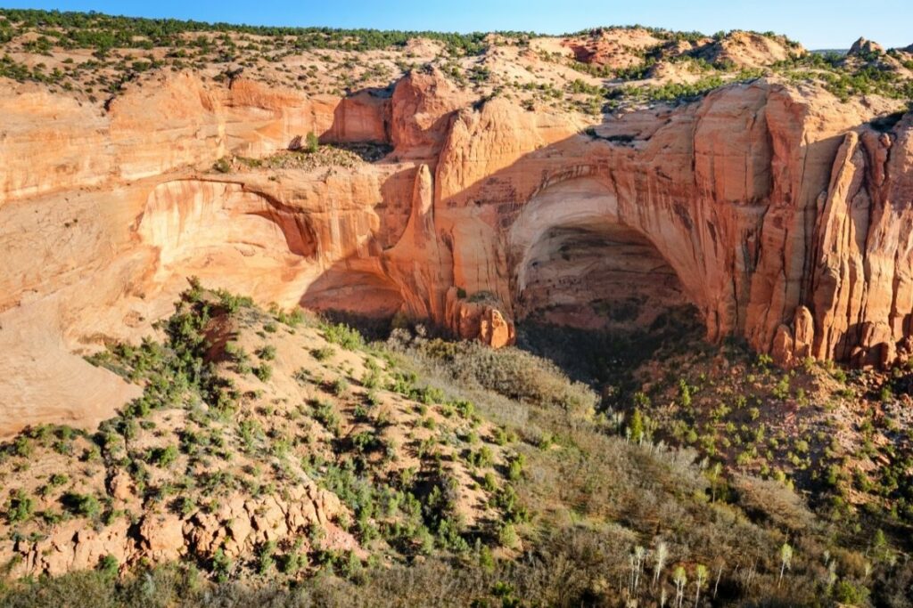
Navajo National Monument
Despite its name, the Navajo National Monument preserves the home of many ancient tribes like the Hopi, Paiute, Zuni, and Navajo. This canyon became the chosen residence of these tribes for centuries. Now located within the Navajo territory, the monument preserves three cliff-dwellings of ancient Puebloan people: Keet Seel, Betatakin, and Inscription House.
These three cliff-dwellings are nestled inside different areas within the system of canyons. Get a glimpse of desert life as an indigenous group by seeing the impressive structures they’ve built and communities that thrived as early as 1250. These structures were mostly made from sandstone blocks and still feature a lot of structures consistent with the ancient Puebloan people that resided in more exposed areas. Kivas can still be found and as well as pit-houses for the communities. These sites were completely abandoned in the thirteenth century when the ancient Puebloan people decided to migrate to less harsh environments and find more stable sources of survival.
This was named a National Monument on October 15, 1966.
Things to do: Guided Tours, Camping
How to get there: Visitors are welcome to visit the Navajo National Monument is located off of US Highway 160 at the end of State Highway 564.
Where to Stay: There is no available lodging area in the monument, but they offer a free campground for visitors.
Entrance Fee: Free
Official Website: Click Here
Map: Download
Organ Pipe Cactus National Monument
The Organ Pipe Cactus National Monument is protected under the National Park Service as well as a UNESCO biosphere reserve. This monument aims to protect and preserve the wealth of natural wonders in this 330,000-acre area. Coined as “The Green Desert”, the Organ Pipe Cactus National Monument conserves the unique collection of cacti in the extreme south of Arizona.
This national monument depicts the true desert life Arizona is famous for. Despite the arid environment, many people, plants, and wildlife have adapted and thrived in it creating communities here. Located on the southern border of Arizona and Sonora, Mexico, this area is completely covered by different types of cacti. Aside from the cacti, a wealth of flora and fauna can be spotted on your trip. There are reported sightings of mountain lions, Sonoran Pronghorns, White-tailed Deer, and much more. Other plants that do well in the area are pomegranates, desert caper, and cottonwood trees.
This is a perfect, unique spot to explore what else nature has to offer than what we stereotypically believe deserts are.
Things to do: Scenic Driving, Camping, Biking
How to get there: Phoenix and Tucson are the closest airports by plane. By vehicle, drivers can travel through Ajo and Why on Arizona Highway 85 that is four miles from the monument’s entrance.
Where to Stay: There are no accessible lodges on the Monument the closest city that accommodates stay-in guests is in Ajo.
Entrance Fee: $25 per vehicle or free with an America the Beautiful Pass.
Official Website: Click Here
Map: Download
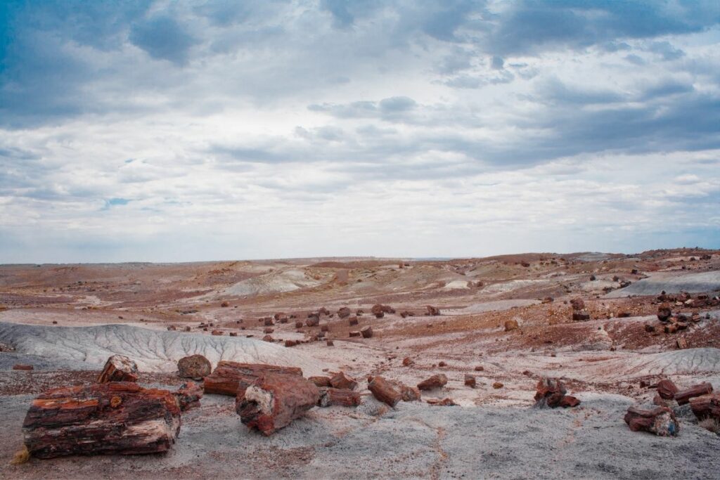
Petrified Forest National Park
The Petrified Forest National Park is located within the Navajo and Apache counties of Arizona. It aims to preserve the plethora of petrified wood in the area.
Petrified wood is fossilized remains of vegetation from prehistoric eras. It becomes petrified when the wood is buried under water-saturated volcanic ash. This phenomenon occurred on a grand scale in Arizona. Many of these petrified wood deposits are found in this area from over 225 million years ago. Aside from the wood that has been preserved, the park also has many other fossils of wildlife that lived during the Triassic age like ancient reptiles.
One of the key features in the area is the collection of colorful badlands, which is the reason for its nickname: The Painted Desert. Some of the famous sites within the Chinle Formation are the Tepees, which are gray and dark red geological formations. Today, visitors can come to enjoy the geological wonders that nature created through the test of time!
Things to do: Hiking, Backpacking, Bicycling, Guided Tours
How to get there: By Airplane, Phoenix, Arizona, and Albuquerque, New Mexico are the closest major airports. By private vehicle, drivers can travel Interstates 17 North and 40 East from the north and west sides of greater Phoenix, going through Flagstaff.
Where to Stay: Camping is available in Petrified Forest but they don’t offer hotels, inns, and motels.
Entrance Fee: $25 per vehicle or free with an America the Beautiful Pass.
Official Website: Click Here
Map: Download
Pipe Spring National Monument
The Pipe Spring National Monument commemorates a rich historic past of Arizona with the Native Indian people and even the Mormon religion. Located in Fredonia, Arizona, the Pipe Spring became an oasis for the harsh arid environment of the desert.
Pipe Spring made it possible for plants and wildlife to survive in the area despite the dry climate. Native wildlife like bighorn sheep and nighthawks frequent the spring. This spring provided water and survival to many groups throughout history. Welcoming inhabitants from all walks of life, the Pipe Spring is a water source amidst the dry and unforgiving climate of the Arizona desert. Take a trip to the past and learn about the Kaibab Paiute tribe that resided in the area. Spanish missionaries, Mexican traders, explorers, and even Mormons were able to seek refuge here.
The name of the monument originated from Jacob Hamblin, one of the church leaders of the Mormon religion. Through a missionary expedition, the Church of Latter-Day Saints made this area one of their more prominent stations throughout history. Despite them residing here, the Kaibab Paiute tribe continued to live in the area. Thus, the Kaibab Paiute Indian Reservation was established around the spring.
Things to do: Guided Tours
How to get there: Pipe Spring is approximately 3.5 hours west of McCarran Airport in Las Vegas, Nevada. Travelers can take Interstate 15 to the St. George, Utah entrance.
Where to Stay: There are no accessible lodges on the Monument, but Fredonia, Arizona, is the closest city that can accommodate stay-in tourists.
Entrance Fee: $10 per person or free with an America the Beautiful Pass.
Official Website: Click Here
Map: Download
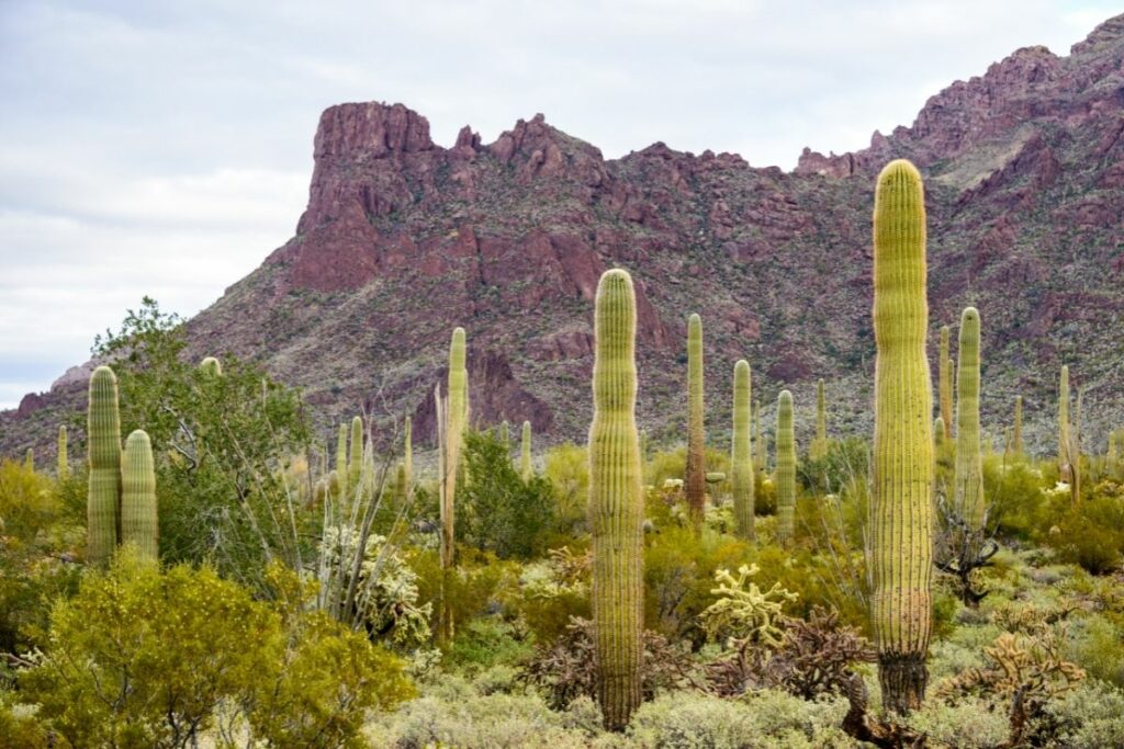
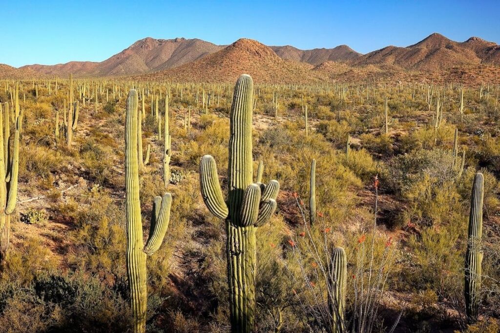
Saguaro National Park
The Saguaro National Park preserves America’s largest cacti, the giant saguaro cactus, and the beautiful surrounding area of the Sonoran Desert. These outstanding and majestic plants can only be found near the area of urban Tucson, within the picturesque landscapes of the Sonoran Desert. The Saguaro cactus is a tree-like cactus that can grow up to twelve feet tall. This type of cactus is a quintessential symbol of Arizona and the state wildflower.
Travelers get to also experience the unique brown, green, and orange-painted sights of this amazing dessert. This National Park consists of two features, the Tucson Mountain District and the Rincon Mountain District.
The Tucson Mountain District is famous for its historic relevance to the ancient Hohokam people among other inhabitants. While the Rincon Mountain District got its name from the Spanish word for a corner. This alludes to the shape of the mountain range. Some common animals seen in either district are bobcats, different bats, mountain lions. Visitors can also expect different birds soaring in the skies above them like doves, owls, and sparrows.
This area is definitely one of the key features anyone should visit in Arizona.
Things to do: Hiking, Camping, Scenic Driving, Horseback Riding
How to get there: Drivers can take the route Rincon Mountain District to 3693 S. Old Spanish Trail, Tucson, Arizona 85730 or Tucson Mountain District to 2700 N. Kinney Road, Tucson, Arizona 85743
Where to Stay: There are no accommodation options inside the park itself. A wide array of lodging options is available in downtown Mesa
Entrance Fee: $25 per vehicle or free with an America the Beautiful Pass.
Official Website: Click Here
Map: Download
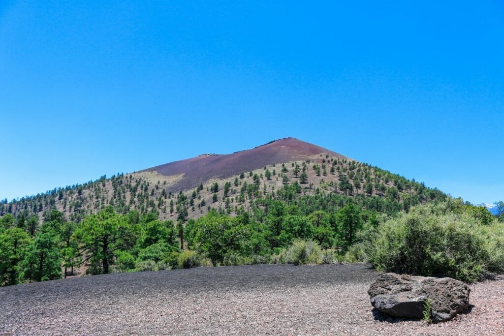
Sunset Crater Volcano National Monument
The Sunset Crater Volcano National Monument preserves the crater left after a series of massive volcanic eruptions. Imagine a dark volcanic cone-shaped crater sitting behind barren arid land with bright blue skies atop. This crater is known as one of the youngest of the San Francisco volcanic field.
The series of eruptions that happened began as early as 1064 AD. Throughout the centuries, different settlements, wildlife, and flora tried to thrive in and around the volcano. Unfortunately, other succeeding eruptions obliterated most endemic flora and drove out ancient tribes like the Sinagua people. The most recent eruption scare was on June 5, 2015, wherein images of steam coming from the site were released. However, it was later found that the “steam” actually came from a forest fire and geologists deemed this crater as extinct.
Due to the many years of extinction, life can restore itself in and around the crater cultivating wildlife and different endemic plants in the area. This volcanic crater is even named after a species of wildflower that is endemic in Arizona, the Sunset Crater Beardtongue.
Things to do: hiking, wildlife viewing
How to get there: Drivers can take US 89 to reach the Sunset Crater.
Where to Stay: There are no accessible lodges on the monument the closest city that accommodates stay-in guests is in Flagstaff, AZ.
Entrance Fee: $25 per vehicle or free with an America the Beautiful Pass.
Official Website: Click Here
Map: Download
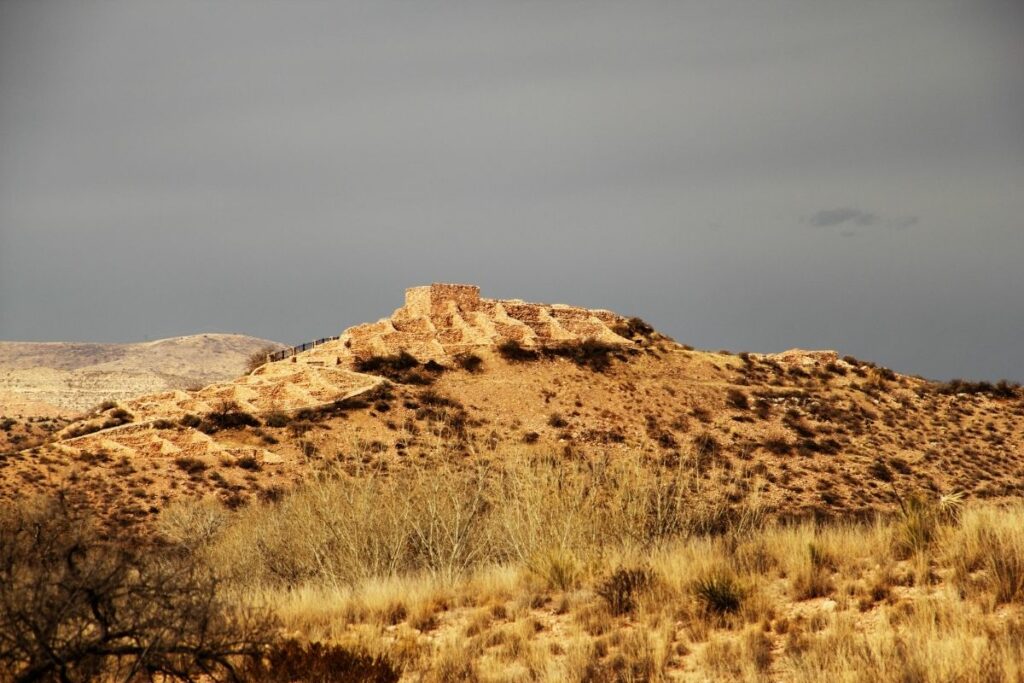
Tonto National Monument
The Tonto National Monument preserves two sites of cliff dwellings of the ancient Salado Indians. Believed to have inhabited the area as early as 1300 AD, travelers can come to see the structures that they have left behind. This was the exact site in which the Salado Phenomenon happened.
The Salado Phenomenon is the joining of several native tribes to create a bustling, vibrant, society. While this happened over 700 years ago, their remains are still available for travelers to get a glimpse of the life and struggle of this community in the 13th to 15th centuries. You can still see room details and original walls. One of the key features of these dwellings is the crafts that were still preserved. Visitors can still see pottery, cloth, and other artifacts that share the story of the Salado culture and people.
Aside from the cultural relevance, these amazing structures sitting within the limestone cliffs are also surrounded by amazing and rich natural history. The park is surrounded by Tonto National Forest where you get to see yucca, agave, Arizona Sycamore, and hackberry trees in the area among so much more.
Things to do: Guided Tours, Stargazing, Hiking
How to get there: Recommended Routes to Tonto National Monument are 87 north toward Payson, 60 east toward Globe, or 77 north toward Globe
Where to Stay: Tonto National Monument does not have any campgrounds, although the Tonto National Forest that surrounds it does. Hundreds of tent and RV camping sites are available throughout Roosevelt Lake, many of which are within a 15-minute drive of the monument.
Entrance Fee: $10 per person or free with an America the Beautiful Pass.
Official Website: Click Here
Map: Download
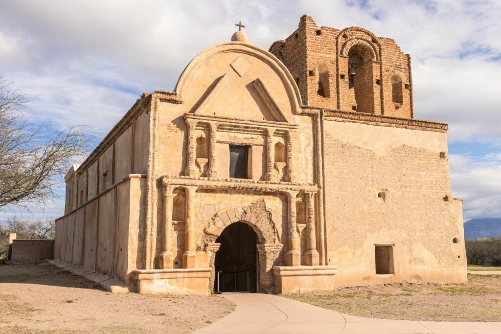
Tumacacori National Historical Park
Tumacacori National Historical Park is located near the Santa Cruz Valley and it protects the remains and ruins of three Spanish mission communities. This area became an amalgamation of cultures in the 1700s. During that time, native Indian tribes were greeted with the first Spanish settlers, the Jesuit and Franciscan missionaries. Together, they created buildings, churches, and communities in this area.
One of the key features of this park is the Franciscan church of the Mission San José de Tumacácori, which was built in the 1750s, along with the two other churches in the complex. There are also Medieval-style buildings present in the community for visitors to travel back in time and get a glimpse of the lives of the native Americans and European settlers co-existing in the area.
The three tribes were prominent groups of their time. The O’odham people were the oldest to have lived in the area, predating the Spaniards, and have been thriving in ancient Arizona. When the Spanish settlers came, the Yaqui people co-existed with them and helped build the communities around the three famed churches. There is even historical evidence that the Apache tribe also briefly lived in these communities.
This park was designated under the National Park Service in 1990.
Things to do: Hiking, Guided Tours, Cultural Demonstrators.
How to get there: Travelers can follow the address; Tumacácori National Historical Park is located 45 miles (80 kilometers) south of Tucson, Arizona, and 18 miles (26 kilometers) north of Nogales, Arizona, off Interstate 19.
Where to Stay: Travelers can choose five lodging areas available in Tumacacori Park and five camping grounds
Entrance Fee: $10 per person or free with an America the Beautiful Pass.
Official Website: Click Here
Map: Download
Tuzigoot National Monument
The Tuzigoot National Monument preserves the ruins of an outstanding village that was linked to the Ancient Pueblos living in early Arizona. This monument is a 2 to 3-story pueblo on a hill above the Verde Valley. Built between 1125 and 1400 CE, the Sinagua people featured an amazing display of early stone masonry, and the expertise they had that these buildings stood the test of time.
This archaeological site was first discovered and excavated by Louis Caywood and Edward Spicer of the University of Arizona in the early 1930s. Aside from these impressive ruins, they found ancient artifacts of the people that lived in Ancient Arizona. These artifacts can still be viewed in the museum on site. The name “Tuzigoot” comes from the Apache word for “crooked waters”, alluding to the nearby bodies of water like Pecks Lake.
These ruins were named a national monument on July 25, 1939, by President Franklin D. Roosevelt.
Things to do: Hiking, Sightseeing
How to get there: Tuzigoot National Monument is 52 miles south of Flagstaff, Arizona via U.S. Highway 89A, or 90 miles north of Phoenix. Travelers can take exit 287 for Highway 260 West to Cottonwood.
Where to Stay: Overnight accommodation is not available in the monument but close communities offer many options. There are many hotels, hostels, and other accommodations available in Cottonwood for visitors
Entrance Fee: $10 per person or free with an America the Beautiful Pass.
Official Website: Click Here
Map: Download
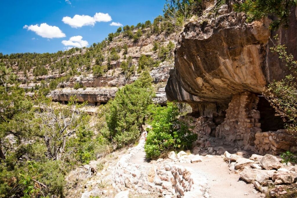
Walnut Canyon National Monument
The Walnut Canyon lies along the Colorado Plateau and truly lives up to its name. This monument has walnut-colored ridges, cliffs, and beautiful geological wonders. Aside from the amazing work of nature in this dry region, the early Sinagua people settled in this area and made it their home.
They built over 80 cave dwellings deep within the canyon. “Sinagua” or loosely translated from Spanish, “without water”, has been able to survive and thrive in very dry regions like Ancient Arizona. They were experts in water collecting and thriving despite the lack of this essential resource. In the early 1200s, they chose to settle here to take advantage of the flowing water of the limestone cliffs – a rarity in the desert region. So, they built their homes under these limestone ledges. But with news of droughts of nearby villages, the Sinagua people decided to abandon their dwellings and set off to a more sustainable area. In the meantime, their homes were able to withstand erosion and time through their excellent masonry skills and strategic location protecting this archaeological site from natural elements.
Today, visitors can come and explore the natural rock formations as well as the ancient pueblos that were built by early survivors in the area.
Things to do: Hiking, Sightseeing,
How to get there: Flagstaff Pulliam Airport is the closest commercial airport. There is no public transit to Walnut Canyon.
Where to Stay: Walnut Canyon National Monument has no lodges or campgrounds. In and around Flagstaff, there are a variety of hotels and campgrounds.
Entrance Fee: $15 per person or free with an America the Beautiful Pass.
Official Website: Click Here
Map: Download
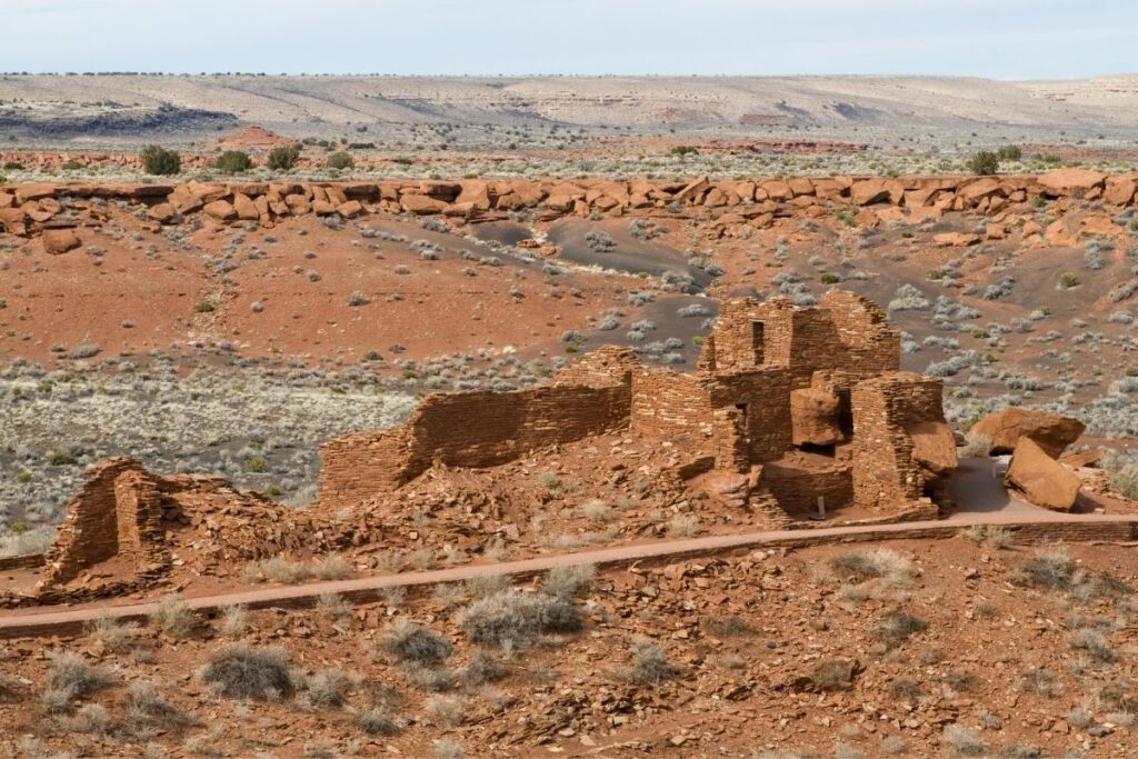
Wupatki National Monument
Within the Painted Desert of Arizona lies the Wupatki National Monument, which features not only the wealth of natural geological wonders of the area but also many archaeological sites of ancient Puebloan people. Many tribes were believed to have inhabited the area as early as 500 AD. Some of these tribes were the Cohonina, Kayenta Anasazi, and Sinagua. Visitors can come and experience the lives of the people that came before through the ruins and artifacts they left behind.
The Wupatki or loosely translated to “Tall House” from the Hopi language, is an outstanding massive building made by these ancient people. The monument features over 100 dwellings within the structure, a large open space believed to be a ballcourt, and a community room for people to gather. There are many other smaller sites to discover in the surrounding areas to get a glimpse of the lives of these resilient and innovative people.
The monument was designated on October 15, 1966.
Things to do: Hiking, Museum Tour
How to get there: Drivers can travel 12 miles north on US-89 (19 km). It takes 45–60 minutes to drive from Flagstaff to the Wupatki Visitor Center.
Where to Stay: The closest hotels are located in Cameron or Flagstaff. The park itself has four campgrounds.
Entrance Fee: $25 per vehicle or free with an America the Beautiful Pass.
Official Website: Click Here
Map: Download
Associated Sites of Arizona
Grand Canyon – Parashant National Monument
Parashant National Monument is included inside the greater area of the Grand Canyon. This million-acre area aims to conserve and protect the remote and less disturbed areas of the Grand Canyon. Visitors can still come to travel through the monument and experience nature in all of its raw glory.
With no paved roads, the monument encourages you to take a solitary journey through the depths of the Grand Canyon and discover what untouched areas have to offer. With eight different hiking trails, travelers can come and enjoy spotting endemic species of wilderness in the area and explore the natural wonders here. You can feel the ancient water from Pakoon Springs or even just bask in the beauty of Mount Trumbull, among other adventures.
Travelers can also opt to go backcountry camping and really become one with nature in this monument. It also has a great opportunity for astrology. Known for its remote area, dark, clear skies, and virtually no people, it is the perfect area for night-sky viewing and discovering stars and the rest of the cosmos.
The Parashant National Monument is managed by the National Park Service since January 11, 2000.
Things to do: Astronomy, Hiking, Off-roading, Backpacking
How to get there: Physical address of Parashant National Monument is 345 East Riverside Drive, St. George, UT 84790.
Where to Stay: There are no accommodation options inside the park itself. A wide array of lodging options is available in downtown Las Vegas, Nevada.
Entrance Fee: Free
Official Website: Click Here
Map: Download
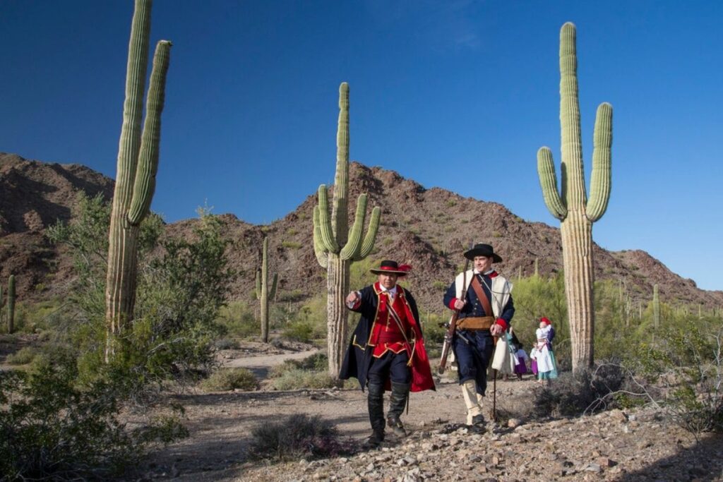
Juan Bautista de Anza National Historic Trail
Juan Bautista de Anza National Historic Trail preserves and commemorates one of the first segments of the Spanish colonization plan in the 1700s. The trail is named after Juan Bautista de Anza, the captain that led 300 colonists to venture through America and establish it as the New Spain.
That he did. Along with his army of conquistadors, de Anza was able to establish a 1,200-mile trail from Mexico to Upper California and protect their territory from the English and Russian groups looking into exploring and conquering this area of the Americas. Throughout their expedition, they left many remnants of Spanish culture all throughout the trail forts, missions, and pueblos still accessible today.
Travelers are now invited to explore the trail and the monuments or historical places along it to get a taste of Spain. Along the way, enjoy the beautiful desert landscapes of Arizona, the coastal roads of other states, and more! The trail begins from Nogales, Arizona to San Francisco, California.
Things to do: Driving, Hiking, History, Museums
How to get there: The Juan Bautista de Anza National Historic Trail, which spans 20 counties in Arizona and California. In Arizona, sites of interest are in the counties of Santa Cruz, Pima, Pinal, and Yuma.
Where to Stay: Travelers can visit Santa Cruz, Pima, Pinal, and Yuma counties that have countless lodging, hotels, and inns available.
Entrance Fee: Free but sites along the trail may charge a separate fee.
Official Website: Click Here
Map: Download
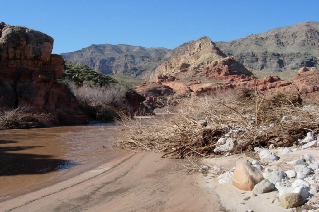
Old Spanish National Historic Trail
In the 1700s the popularity of trading between European settlers in the Americas and Mexico peaked. A popular trading hub is from the borders in Los Angeles and New Mexico. With the need to better transport goods to and from these Mexican provinces, the Old Spanish Trail was born. The Old Spanish National Historic Trail preserves the exact 2800-mile route of rocky terrain. European settlers would not only trade horses, mules, and goods here but also contraband items and even Native American slaves. The trail goes through New Mexico, Colorado, Utah, California, Nevada, and of course, Arizona.
This trail is no longer one continuous pathway for visitors to enjoy. Instead, some segments are privately owned but a substantial amount of the original trail can still be explored by travelers throughout these six states. In Arizona, visitors can go to the different national parks and monuments along and nearby the trail like the Navajo National Monument, Glen Canyon National Recreation Area, among many others. Here you can discover breathtaking desert views, various massive lakes, and other remnants of history.
This trail was designated under the care of the National Park Service in 2002.
Things to do: Along the trail’s length, public lands and state, county, and city parks protect trail resources and provide recreational opportunities.
How to get there: The national historic trail can be reached by flying into several airports, the nearest is in Flagstaff, Arizona. Trail-related destinations are well-connected in this area.
Where to Stay: Travelers can visit Flagstaff and other cities in Arizona for accommodation.
Entrance Fee: Entrance Fee: Free but sites along the trail may charge a separate fee.
Official Website: Click Here
Map: Download
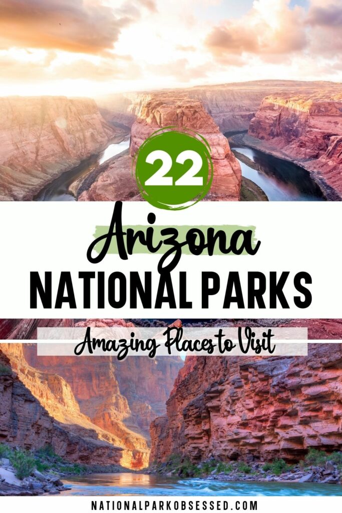
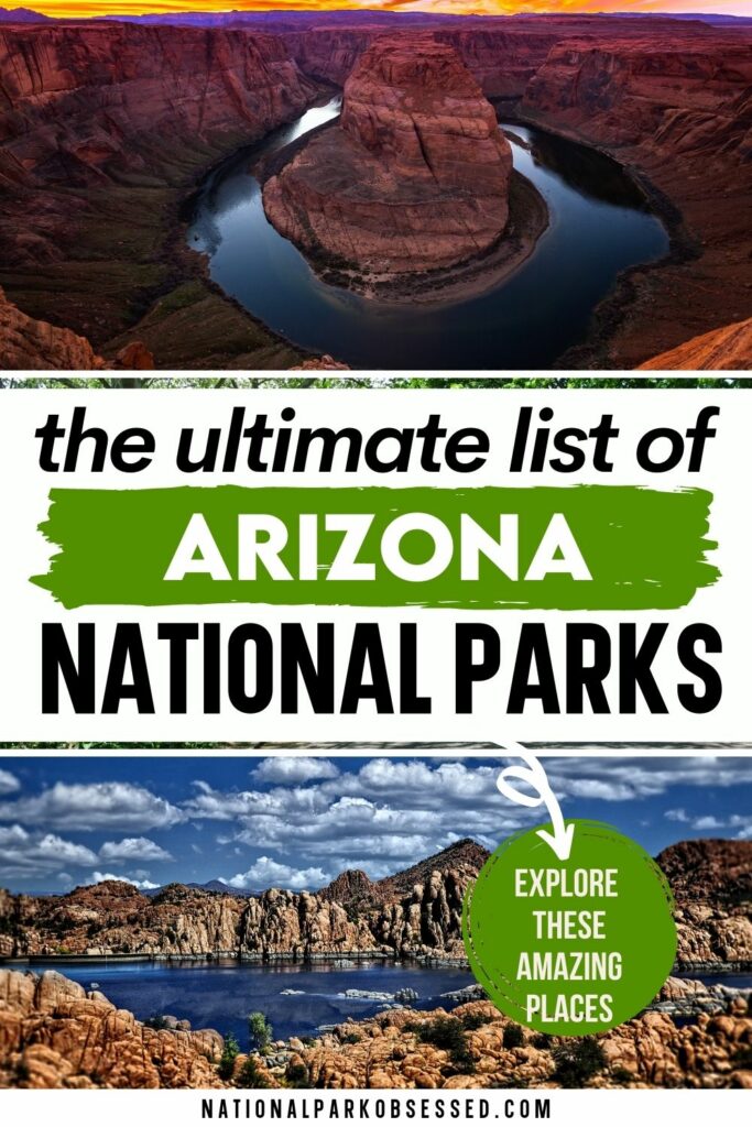
List of National Parks in Arizona
There are 22 National Parks in Arizona that received 7.6 million visitors in 2020 and generated over $1 billion in tourism economic benefits. The majority of visitors visited Grand Canyon National Park and Lake Mead National Recreation Area.
- Canyon De Chelly National Monument
- Casa Grande Ruins National Monument
- Chiricahua National Monument
- Coronado National Memorial
- Fort Bowie National Historic Site
- Glen Canyon National Recreation Area (AZ, UT)
- Grand Canyon National Park
- Hohokam Pima National Monument
- Hubbell Trading Post National Historic Site
- Lake Mead National Recreation Area (AZ, NV)
- Montezuma Castle National Monument
- Navajo National Monument
- Organ Pipe Cactus National Monument
- Petrified Forest National Park
- Pipe Spring National Monument
- Saguaro National Park
- Sunset Crater Volcano National Monument
- Tonto National Monument
- Tumacacori National Historical Park
- Tuzigoot National Monument
- Walnut Canyon National Monument
- Wupatki National Monument
Affiliated Areas
- Grand Canyon – Parashant National Monument
- Juan Bautista de Anza National Historic Trail (AZ, CA)
- Old Spanish National Historic Trail (AZ, CA, CO, NV, NM, UT)
Arizona National Parks also provides support and management to 2 National Heritage Areas as well as 1,481 National Register of Historic Places Listings.
There are 46 National Historic Landmarks, 10 National Natural Landmarks, 621 Places recorded by the Heritage Documentation Program, and over 13 million objects in the Arizona National Parks Museum Collections. There are 13,186Archaeological Sites in the Ohio National Parks.
Arizona is home to 31 State Parks.
Arizona UNESCO World Heritage Sites
- Grand Canyon National Park
- The 20th-Century Architecture of Frank Lloyd Wright (Taliesin and Taliesin West) (AZ, CA, IL, NY, PA, WI)
Arizona’s Neighboring States
Planning to visit a few of the National Parks in Arizona and wandering about what national parks are in neighboring states. Here are the list of National Parks in surrounding states.
- California National Parks – Califonria is home to 9 National Parks (Channel Islands, Death Valley, Kings Canyon, Lassen Volcanic, Pinnacles, Redwoods, Sequoia, Yosemite) and 19 other units
- Colorado National Parks – Colorado is home to Black Canyon of the Gunnison, Great Sand Dunes, Mesa Verde and Rocky Mountain National Parks and 9 other units.
- Nevada National Parks – Nevada is home to Great Basin National Park and a tiny peice of Death Valley plus 3 other units.
- New Mexico National Parks – New Mexico is home to Carlsbad Caverns and White Sands National Park along with 13 other units.
- Utah National Parks – Utah is home to the Mighty Five National Parks (Arches, Bryce Canyon, Canyonlands, Capitol Reef, Zion) and 8 NPS units.
Final Thoughts of the National Parks in Arizona
I hope this guide to the National Parks in Arizona is helpful as you plan to explore these amazing National Parks.
Pin for Later: National Parks of Arizona: Explore the 22 Arizona National Parks (2021 Update)

Hi, I'm Jennifer!

Welcome to the wonderful world of National Parks. I'm here to help you plan your NEXT amazing adventure through the United States National Parks and beyond. I want the national parks to be accessible to all.
I live in Tennessee, and when I'm home, you can find me hiking in the Smokies and the Cumberland Plateau.
58/63 National Parks
250+/423 National Park Units
Want to know more? Start Here.
Snag one of my National Park Ebooks and Downloadable Itineraries

Talk with an Expert

Share your love of the parks with a shirt, ornaments, hoodies, frames, and more.
