National Parks of Pennsylvania
There is currently nineteen National Park Service Site in Pennsylvania and 10 associated sites.
Official National Parks of Pennsylvania
- Allegheny Portage Railroad National Historic Site
- Appalachian National Scenic Trail
- Delaware Water Gap National Recreation Area
- Edgar Allan Poe National Historic Site
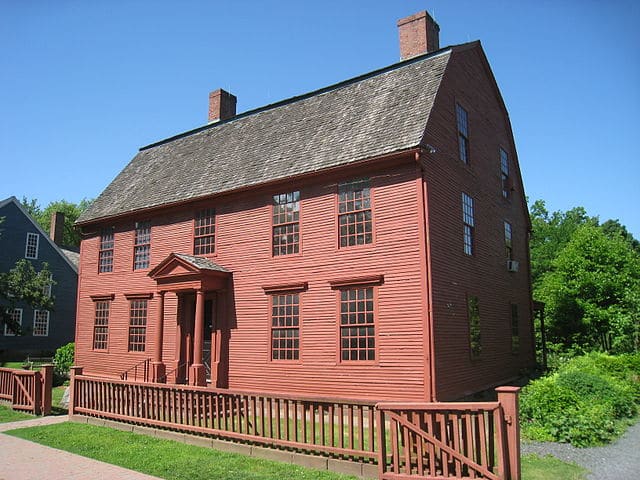
- Eisenhower National Historic Site
- First State National Historical Park
- Flight 93 National Memorial
- Fort Necessity National Battlefield
- Friendship Hill National Historic Site
- Gettysburg National Military Park
- Hopewell Furnace National Historic Site
- Independence National Historical Park
- Johnstown Flood National Memorial
- Middle Delaware National Scenic River
- Potomac Heritage National Scenic Trail
- Steamtown National Historic Site
- Thaddeus Kosciuszko National Memorial
- Upper Delaware Scenic and Recreational River
- Valley Forge National Historical Park
Associated sites of Pennsylvania
- Captain John Smith Chesapeake National Historic Trail
- Chesapeake Bay
- Delaware and Lehigh National Heritage Corridor
- Gloria Dei Church National Historic Site
- Lower Delaware National Wild and Scenic River
- North Country National Scenic Trail
- Oild Region National Heritage Area
- Rivers of Steel National Heritage Area
- Schuylkill River Valley National Heritage Area
- Washington-Rochambeau National Historic Trail
[show-map id=”43″]
Pennsylvania National Parks
Allegheny Portage Railroad National Historic Site
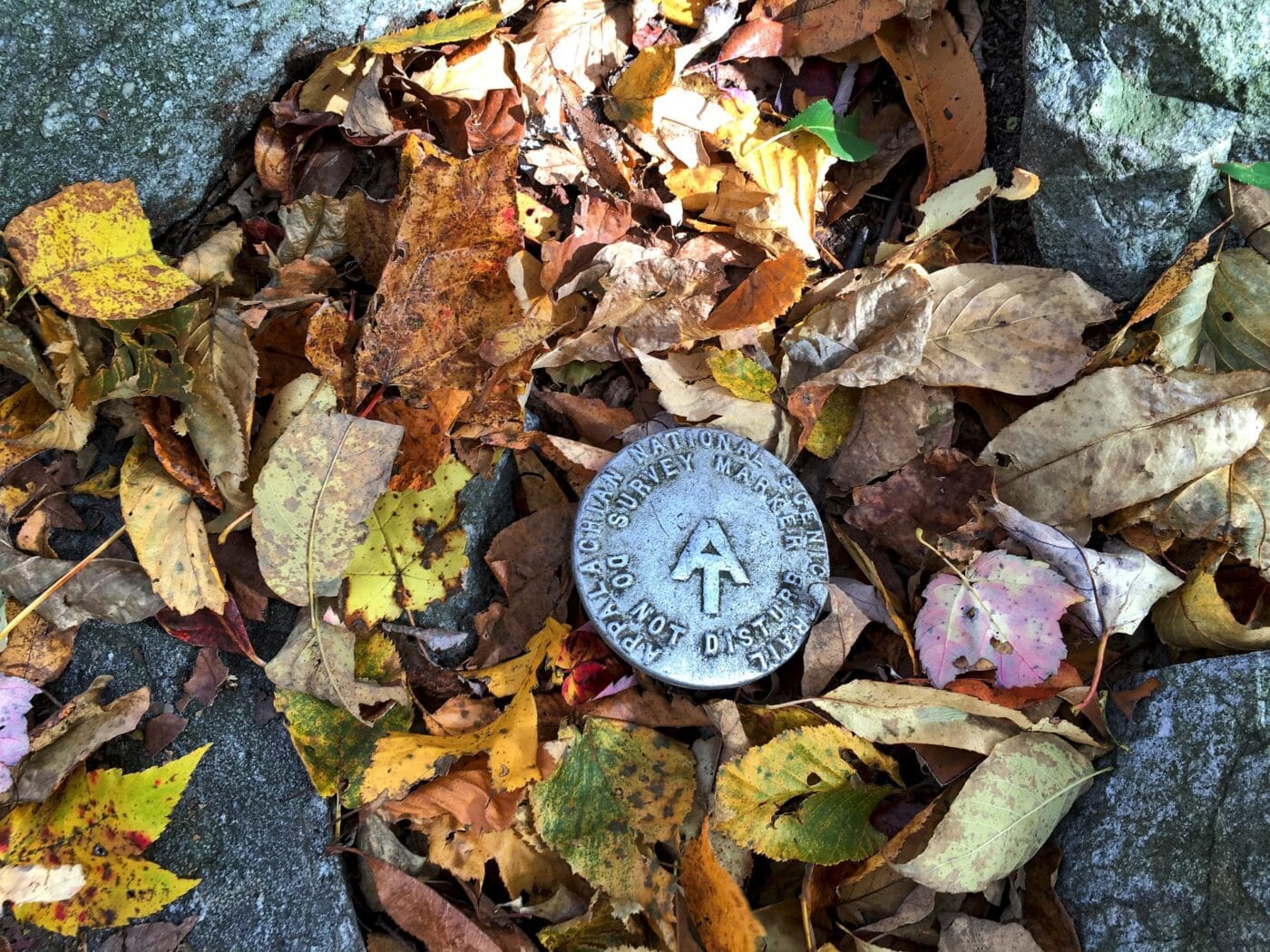
Appalachian National Scenic Trail
Depending on where you are from, the Appalachian National Scenic Trail either starts in Mount Katahdin, Maine and ends in Springer Mountain, Georgia, or starts in Springer Mountain, Georgia, and ends in Katahdin, Maine. The Appalachian Trail is 2,181 miles long and passes through 14 states (Georgia, North Carolina, Tennessee, Virginia, West Virginia, Maryland, Pennsylvania, New Jersey, New York, Connecticut, Massachusetts, Vermont, New Hampshire, and Maine).
There is 229.6 miles of trail in the state of Pennsylvania. The Susquehanna River is the dividing point between the northern section of the AT and the southern section of the AT. At Pine Grove Furnace State Park, thru-hikers are halfway done with their hike. At the Pine Grove Furnace General Store, thru-hikes must stop in and complete the half-gallon challenge. The half-gallon challenge is where they eat a half-gallon of ice cream to celebrate being halfway done.
Every year several thousand people attempt to thru-hike the trail. Tens of thousands of people will hike sections of the trail each year. The trail was officially completed in 1937 but the improvement has been ongoing since then. The trail is maintained by 31 different trail clubs and other partnerships.
Things to do in Appalachian National Scenic Trail: Hiking, Wildlife Viewing, Scenic Views
How to get to Appalachian National Scenic Trail: There are multiple access points along the trail. Many of which are driveable.
Where to Stay in Appalachian National Scenic Trail: Along the trail, there are numerous shelters and backcountry campgrounds. Hotels are available in towns along the trail.
Appalachian National Scenic Trail Entrance Fee: There is no entrance fee for the Appalachian Trail but the trail passes through numerous state and national parks, forests and public lands which may charge an entrance fee or have overnight permit fees.
Appalachian National Scenic Trail Official Website: Click Here
Map of Appalachian National Scenic Trail: Download
Delaware Water Gap National Recreation Area
Edgar Allan Poe National Historic Site
Eisenhower National Historic Site
First State National Historical Park
First State National Historical Park protects the history of early colonial Delaware and the events leading up to Deleware being the first state to ratify the United States Constitution. The park spans sites mostly in Delaware with a few sites in Chadds Ford, Pennsylvania. This region was settled by Dutch, Swedes, Finns, and English. The park protects the cultural landscape of the Brandywine River Valley and examines the early settlers relationship with the Native Americans in the region.
The park is made of seven sites. They are Beaver Valley, Fort Christina National Historic Landmark, Old Swedes Church, New Castle Court House Museum, The Green, John Dickinson Plantation, Ryves Holt House.
The First State was created in 2013 by President Obama as a National Monument. In 2014, Congress elevated the monument to a Historical Park.

Flight 93 National Memorial
Fort Necessity National Battlefield
Friendship Hill National Historic Site
Gettysburg National Military Park
Hopewell Furnace National Historic Site
Independence National Historical Park
Johnstown Flood National Memorial
Middle Delaware National Scenic River
Potomac Heritage National Scenic Trail
Steamtown National Historic Site
Thaddeus Kosciuszko National Memorial
Upper Delaware Scenic and Recreational River
Valley Forge National Historical Park
Captain John Smith Chesapeake National Historic Trail
Captain John Smith Chesapeake National Historic Trail is about 3,000 miles of water routes along the Chesapeake Bay watershed. The rivers are located in the following states – Washington D.C, Deleware, Maryland, New York, Pennsylvania, and Virginia. The water routes follow the voyages of Captain John Smith between 160 -1609. Smith produced the first maps of the region.
The much of the Historic trail is included in the Chesapeake Bay Gateways Network. The trail passes thru many state and local sites where you can rent canoes and kayaks. Boat tours are offered in the bay.
Captain John Smith Chesapeake National Historic Trail was established on December 19, 2006.
Chesapeake Bay Gateways Network
The Chesapeake Bay Gateways Network is a collection of over 150 parks, refuges, museums, historic communities, and water trails along the Chesapeake Bay watershed. This network included sites in Washington D.C, Deleware, Maryland, New York, Pennsylvania, Virginia, and West Virginia.
The Chesapeake Bary watershed drains into the large estuary called the Chesapeake Bay. The Chesapeake Bary is a 200-mile long bay that connects the Susquehanna River and the Atlantic Ocean. Over 15o rivers and streams drain into the bay. The bay ranges from 2.8 miles wide to 30 miles. There is an estimated 11,684 miles of shoreline.
Visitors to the Chesapeake Bay Gateways Network can explore a range of sites and learn about the history, culture and natural importance of the area.

Delaware and Lehigh National Heritage Corridor
Gloria Dei Church National Historic Site
Lewis and Clark National Historic Trail
The Lewis and Clark National Historic Trail follows the route Meriwether Lewis and William Clark took across the United States’ newly purchased territory. The trail starts at Camp Dubois, Illinois and passes thru Missouri, Kansas, Iowa, Nebraska, South Dakota, North Dakota, Montana, Idaho, Oregon, and ends in Washington. The trail is a combination of auto, land and water routes.
The Lewis and Clark expedition started in May 1804 with the goal to find a practical route across the western region of North America. They were to lay claim to these lands to limit European expansion. The expedition was a success. Lewis and Clark crossed the Louisiana purchase and made it to the Pacific Ocean. They recorded the plants, animals, and landscapes as they traveled. They laid the foundations for future relationships with the American Indian tribes of the relationships.
The trail was established on November 10, 1978. There are over 100 stops along the trail.
Things to do in Lewis and Clark National Historic Trail: Hiking, Auto Tours, Museums,
How to get to Lewis and Clark National Historic Trail: The sites are located in the 16 states the trail runs through.
Where to Stay in Lewis and Clark National Historic Trail: There are various places to stay along the trail.
Lewis and Clark National Historic Trail Entrance Fee: There may be nominal fees at trail-related federal, state, or locally owned historic sites and interpretive facilities.
Lewis and Clark National Historic Trail Official Website: Click Here
Map of Lewis and Clark National Historic Trail: Download
Lower Delaware National Wild and Scenic River
North Country National Scenic Trail
Oild Region National Heritage Area
Rivers of Steel National Heritage Area
Schuylkill River Valley National Heritage Area
Washington-Rochambeau National Historic Trail
Washington-Rochambeau National Historic Trail is a 680-mile long Historical Trail. The trail is sometimes known as the Washington–Rochambeau Revolutionary Route. The route follows the road used by George Washington’s Continental Army and Jean-Baptiste de Rochambeau’s Expédition Particulière took on their way from Newport, Rode Island to Yorktown, Virginia. Yorktown was the final battle of the American Revolutionary War.
Washington-Rochambeau National Historic Trail is primary an auto trail. While the route forces on the march to Yorktown, the trail passes thru or near many other important revolutionary war sites. Rhode Island sites include the Joy Homestead.
Washington-Rochambeau National Historic Trail passes through Connecticut, Rhode Island, Massachusetts, New York, New Jersey, Pennsylvania, Maryland, Delaware, Washington D.C, and Virginia.
Things to do in Washington-Rochambeau National Historic Trail: Auto touring, bicycling, walking, historical tours, guided tours, museums
How to get to Washington-Rochambeau National Historic Trail: There are major airports all along the route.
Where to Stay in Washington-Rochambeau National Historic Trail: The trail follows major highways and lodging is located along the route.
Washington-Rochambeau National Historic Trail Entrance Fee: Free, but some of the federal, state, and privately managed buildings along the trail may have an entrance fee.
Washington-Rochambeau National Historic Trail Official Website: Click Here
Map of Washington-Rochambeau National Historic Trail: Download