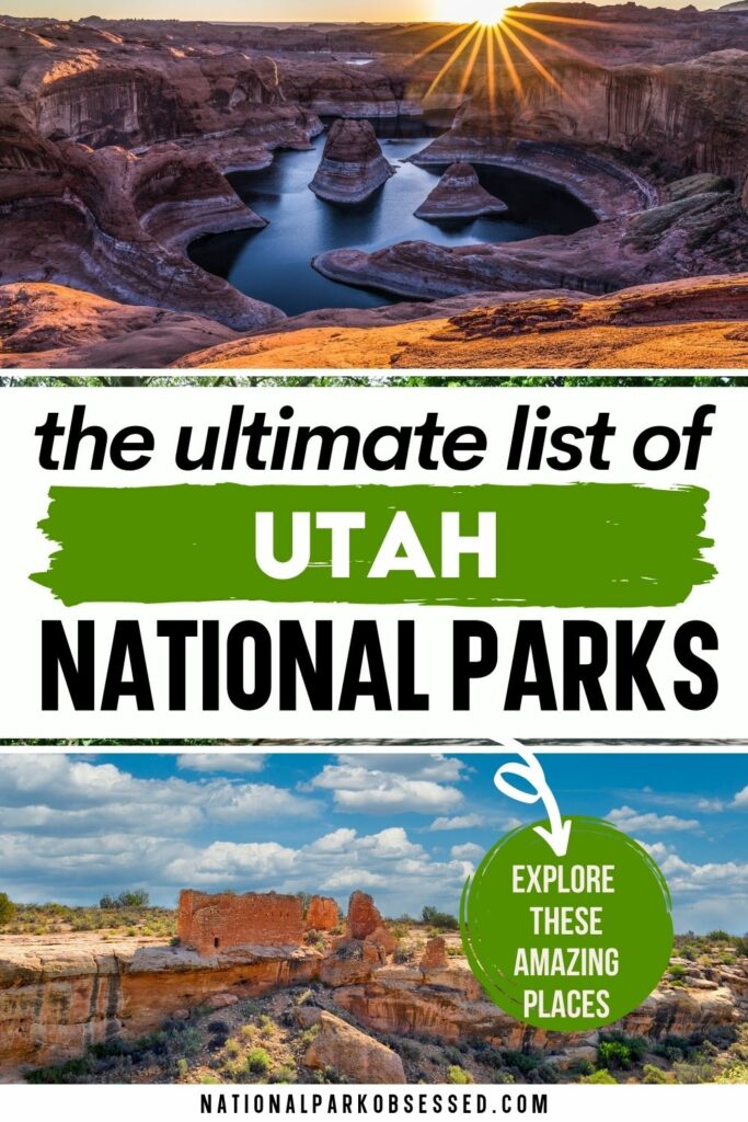
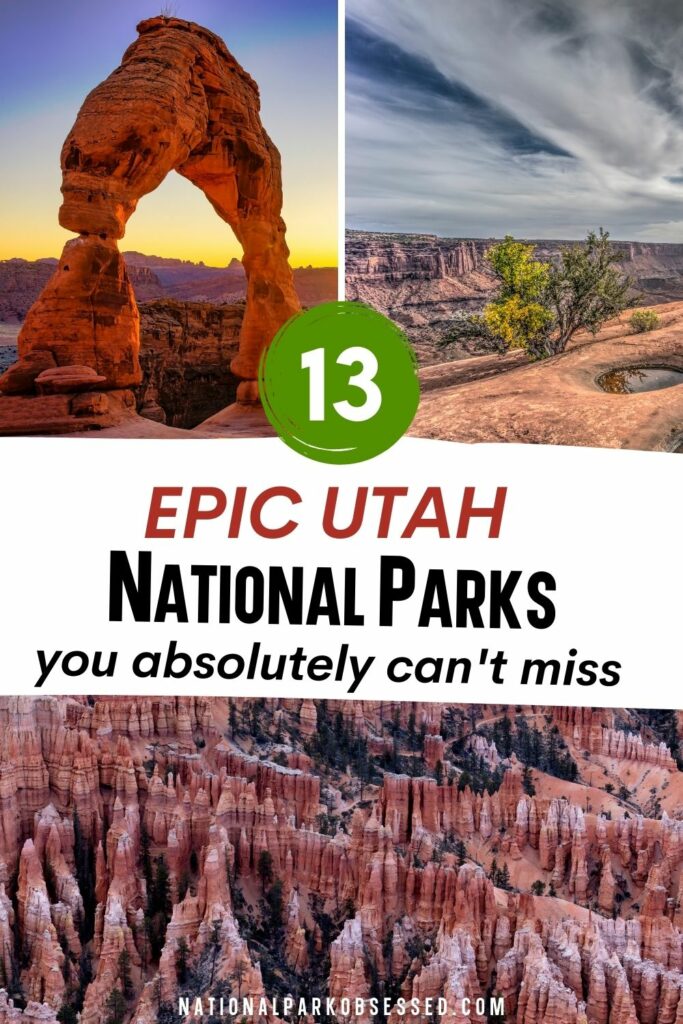
Post Summary: National Parks in Utah
Utah is famous for a winter wonderland and the Sundance festival, also boasts many a range of natural wonders, historical sites with cultural and historical relevance of Native Americans and Mormons, and legacy of other events in American history. Visitors have a multitude of destinations to fit in their itinerary when planning a visit to the Beehive State.
Utah preserves its beautiful red-rock landscapes in the different national monuments and parks available throughout the state where you can bask in awe with the different natural bridges, arches, and even limestone formations in caves. Integral to prehistoric research, Utah is also home to many sites of dinosaur remains. Further, many hikers frequent the area to explore new ridges and trails with varied wildlife, flora, and history. Other outdoor activities, guided tours, and destinations are also available to learn more about the wealth of culture and history in the area.
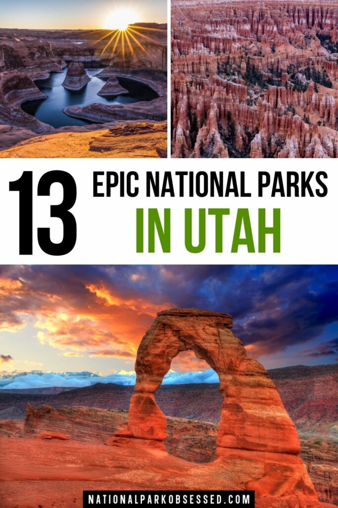
Let’s explore the 13 National Parks in Utah.
This post may contain affiliate links, meaning if you book or buy something through one of these links, I may earn a small commission at no extra cost to you! Read the full disclosure policy here
Map of National Parks in Utah
Utah National Parks
Utah is part of the Southwest and West Coast Region.
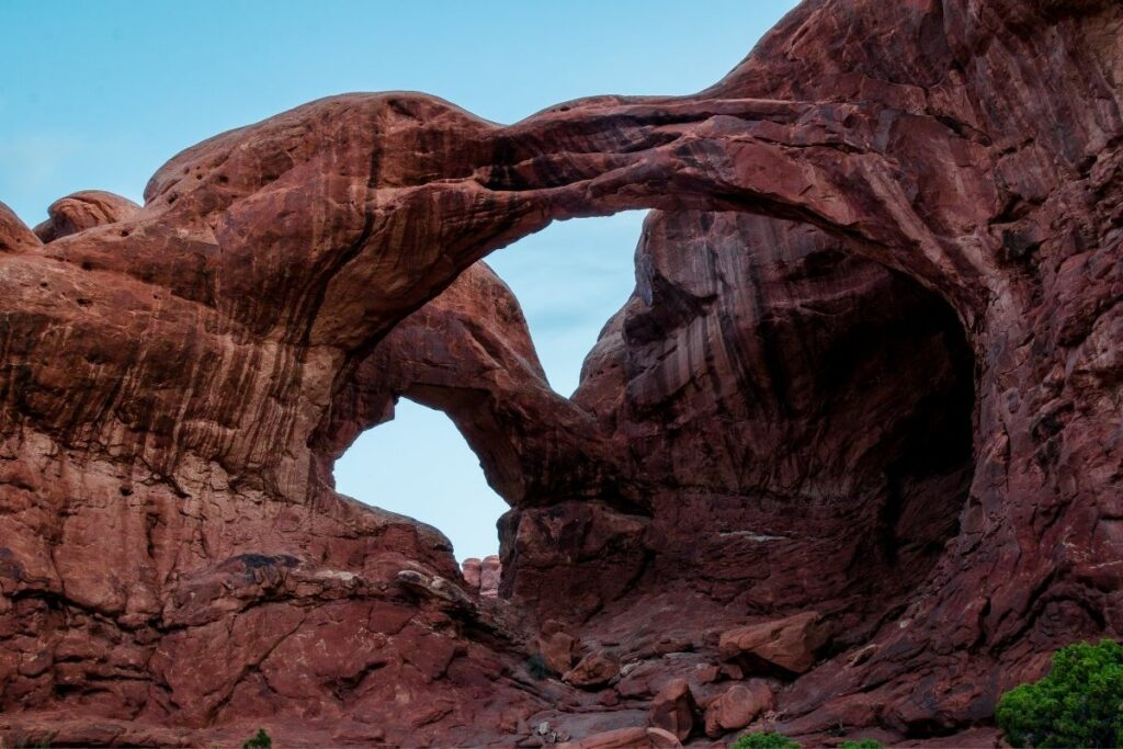
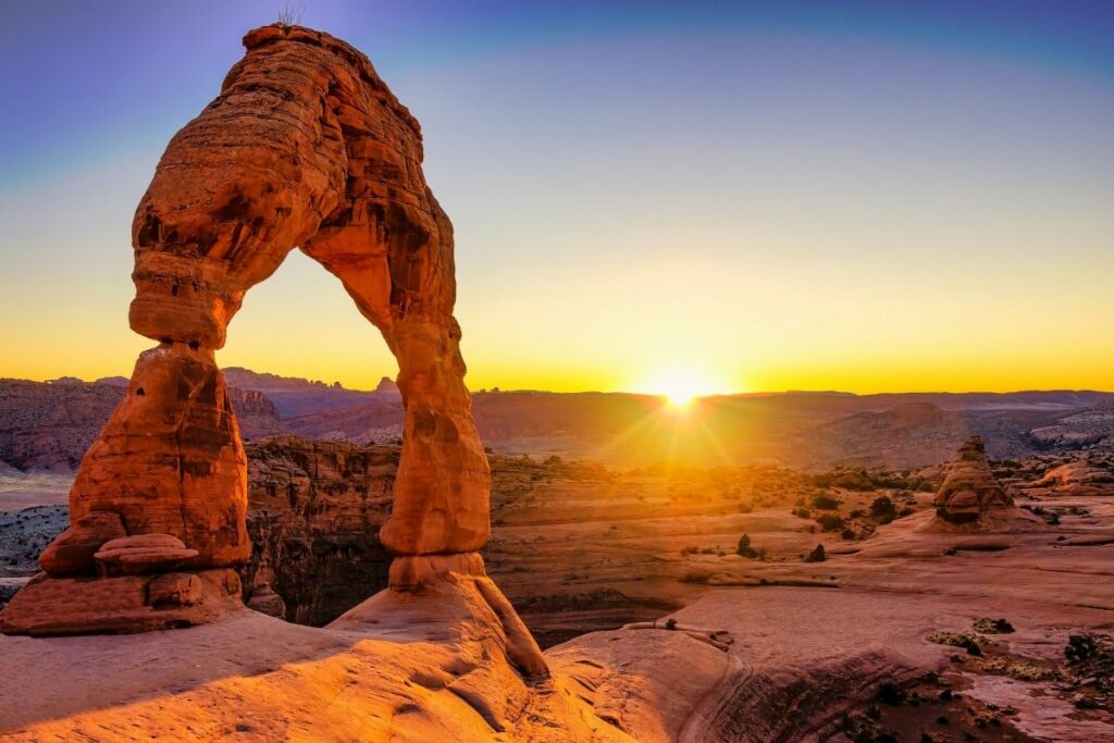
Arches National Park
Arches National Park is a red-rock wonderland! Acres and acres of interesting rock formations, thousands of natural arches, and rugged terrain greet you as you enter this park.
Through many centuries of erosion, geological changes, and other forces shaped this land into what we know it today. This destination is a must-visit for hikers to enjoy scenic views of the different rock formations you can see from horizon to horizon. More than two thousand natural arches can be found in the area. Hence, the name of the park. One of the most famous sites is the Delicate Arch which is a 52-foot tall natural arch that serves as a famous landmark of Utah. You can even spot this arch on most Utah license plates.
On November 12, 1971, the area was designated under the care of the National Park Service.
Things to do: Auto Tours, Hiking, Camping, Canyoneering, Backpacking, Rock Climbing
How to get there: The entrance to Arches National Park is in Moab, Utah. Drivers take the Interstate 70 to reach the town. By plane, the nearest airports visitors can use are Canyonlands Field, Grand Junction Regional Airport, Salt Lake City International Airport. By train, visitors can use Amtrak’s California Zephyr and get off on Green River, Utah.
Where to Stay: There is no accommodation available inside the park except for one campground. A wide array of options are available in Moab, Utah, which is about five miles away from the park. >> Check prices of nearby hotels on Booking.com or Hotels.com
Entrance Fee: $30 per vehicle or free with an American the Beautiful Pass.
Official Website: Click Here
Map: Download
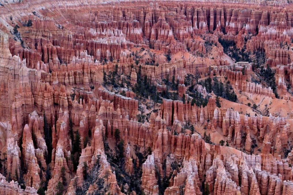
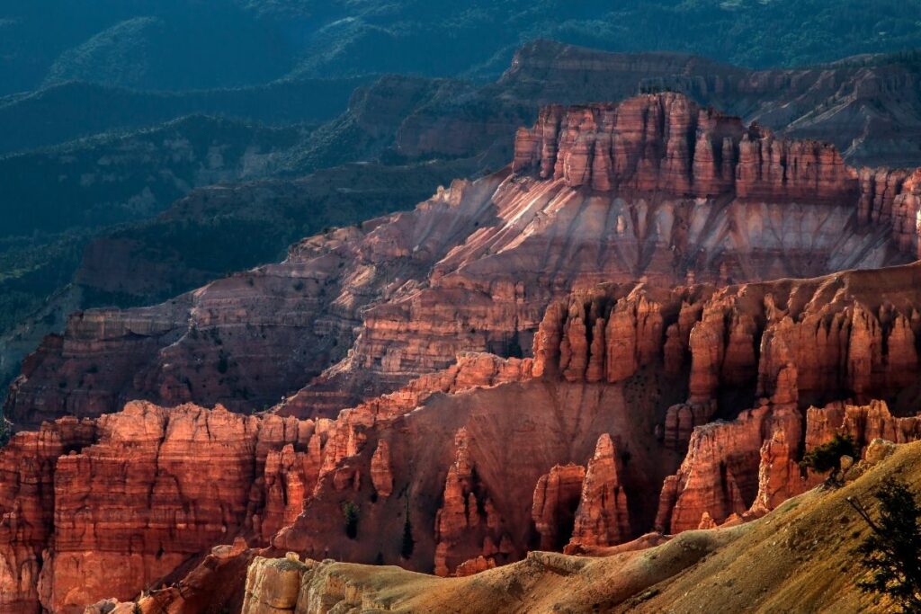
Bryce Canyon National Park
Located in southwestern Utah is an impressive collection of natural amphitheaters, hoodoos, and other geological formations. This area is called the Bryce Canyon National Park. Despite its name, this park is actually not a canyon. What it’s famous for is the large hoodoos that populate the 35,000-acre park.
Hoodoos are tall, thin spires of rock that protrudes from very dry land. They are usually formed by frost weathering and erosion through time. Full of red, orange, and white rock formations, hikers frequent the area to enjoy the picturesque landscape. The land was named after Ebenezer Bryce, a Mormon pioneer that settled in the canyon in the 1850s.
Bryce Canyon National Park was designated under the National Park Service in 1928.
Things to do: Sunrise viewing, sunset viewing, hiking, backpacking, scenic drives
How to get there: The closest airport to Bryce Canyon National Park is in Las Vegas (LAS), Nevada and Salt Lake City (SLC), Utah; each approximately 270 miles from the park. Also, there are smaller airports in Cedar City (CDC), Utah (80 miles), and St. George (SGU), Utah (125 miles). There is no available public transportation near the park.
Where to Stay: There is a Lodge at Bryce Canyon, and camping is available within the park. Other lodging options can be found at Bryce or Mt. Carmel Junction. >> Check prices of nearby hotels on Booking.com or Hotels.com
Entrance Fee: $35 per vehicle or free with an American the Beautiful Pass.
Official Website: Click Here
Map: Download
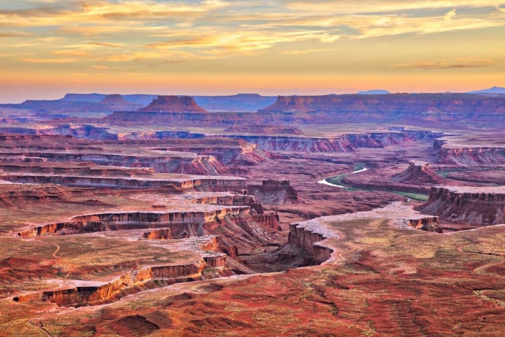
Canyonlands National Park
Very near to the town of Moab, Utah is a beautiful red-rock canyon terrain. These formations can be found in the Canyonlands National Park. This national park aims to preserve acres of canyons and land formations created from years and years of erosion and changes brought by the Colorado River and the Green River.
This national park has four segments: the Island in the Sky, the Needles, the Maze, and the rivers mentioned, which carved two large canyons into the Colorado Plateau. Despite all these segments being located in the same desert, each has its own unique and distinct qualities that visitors like to explore.
Hikers can enjoy the terrain or other outdoor activities like rock climbing or even boating. Each of these four segments is6 roads can quite far from each other and can require a two to six-hour drive so it’s recommended to allot more than one day to fully explore what the park has to offer.
Things to do: Camping, Hiking, Boating, Horseback Riding, Scenic Drives, 4×4
How to get there: Travelers can go by plane from Canyonlands Field (CNY) (16 miles from Moab). Drivers can take the directions; from US 191 north of Moab, UT 313 leads to Island in the Sky, and from US 191 south of Moab, UT 211 leads to The Needles. There is no available public transportation in the area.
Where to Stay: There are no lodging or dining facilities in the park. There are several campgrounds within Canyonlands. Visitors can choose nearby lodging areas in Moab, Monticello, Green River, and Hanksville. >> Check prices of nearby hotels on Booking.com or Hotels.com
Entrance Fee: $30 per vehicle or free with an American the Beautiful Pass.
Official Website: Click Here
Map: Download
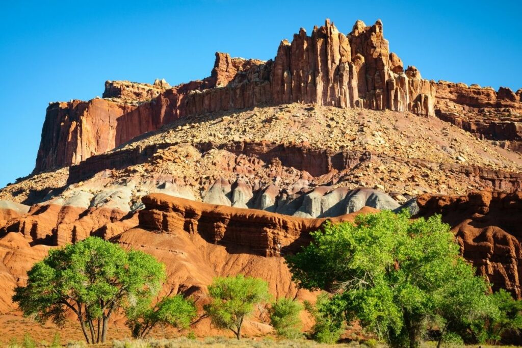
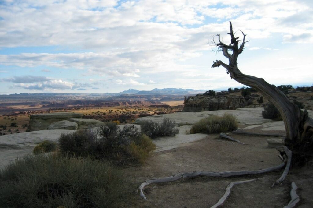
Capitol Reef National Park
This vast land of over 241,000 acres of canyons and rock formations is formed and preserved throughout the many centuries of natural erosion of the area. This picturesque desert landscape is especially rugged. One of the most famous features is a nearly 100-mile long formation called the Waterpocket Fold. Known as a geological wrinkle of the Earth, this formation extends from Lake Mountain to Lake Powell.
A section in Wayne County was originally named Wayne Wonderland but it was eventually renamed the Capitol Reef National Park. The name comes from the whitish Navajo Sandstone cliffs with dome formations similar to the roofs of capitol buildings. The “reef” of the name is used to describe any rocky barrier, may it be on land or in the ocean.
The Capitol Reef National Park was officially designated under the management and care of the National Park Service in 1971.
Things to do: Road Tour, Hiking, Camping
How to get there: Individuals can reach Capitol Reef National Park by traveling westbound on Interstate 70; from there take Utah State Route 24 (SR-24) west toward Hanksville, after that turn right to continue on SR-24 west, and the Capitol Reef Visitor Center will be on the left. Drivers can also take the roads in eastbound on Interstate 70, northbound on Interstate 15, and southbound on Interstate 15.
Where to Stay: Capitol Reef National Park has no restaurant or lodge. There are various options like motels, campgrounds, and cabins close to the park in Torrey. >> Check prices of nearby hotels on Booking.com or Hotels.com
Entrance Fee: $20 per vehicle or free with an American the Beautiful Pass.
Official Website: Click Here
Map: Download
Cedar Breaks National Monument
Cedar Breaks National Monument is an outstanding natural amphitheater that has an elevation of over 10,000 feet above sea level. This height allows visitors to tower over a beautiful rugged terrain of red and orange rock formations below the amphitheater. Despite the canyon landscape, there is still much wildlife that thrives in the area. Explorers can spot many bird species, insects, and as well as some mammals like the tiny alpine dwelling pika and the mountain lion.
Aside from the majestic horizon full of red-rock and white breaks, the national monument also offers other cultural and historic relevance. The Southern Paiute people have called this home for many years and when European settlers arrived, the area was renamed Cedar Breaks when nearby juniper trees were mistakenly identified as cedar. Civilian Conservation Corps in 1933 spent much of their time here as well.
Cedar Breaks National Monument was officially established in 1933.
Things to do: Camping, Hiking, Ski, Snowmobile
How to get there: There are 6 roads that can lead to Cedar Breaks National Monument. By car, travelers can use the nearest routes south on 1-15, north on I-15, U.S. Highway 89, and U.S. Highway 89
Where to Stay: There is no accessible lodging area in Cedar Breaks National Monument. But there are various hotels, suites, inns, and condos available in Cedar City, which is 20 miles away from the monument. >> Check prices of nearby hotels on Booking.com or Hotels.com
Entrance Fee: $10 per person or free with an American the Beautiful Pass.
Official Website: Click Here
Map: Download
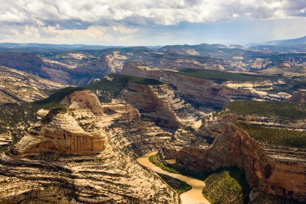
Dinosaur National Monument
The Dinosaur National Monument is located at the border of Colorado and Utah, just southeast of the Uinta Mountains. This wealth of beautiful natural rock formations include something distinct compared to other national monuments in the state. This national monument is famous for its Dinosaur Quarry. Many traces and fossils of dinosaurs including Allosaurus, Deinonychus, Abydosaurus, and various sauropods have been found in the area making this an important destination for tourists and researchers as well.
The first discovery was made by paleontologist Earl Douglass of the Carnegie Museum. He discovered eight vertebrae of an Apatosaurus on August 17, 1909. After that, researchers have frequented the monument to excavate and discover more remains of that era.
Travelers also go to this monument for the rich wildlife and seeing petroglyphs or fossils embedded in the rocks and a wide variety of outdoor activities to try like river rafting, horseback riding, and more.
Things to do: River Rafting, Picnicking, Camping, Hiking
How to get there: Dinosaur National Monument is located in both Colorado and Utah. Each state provides a chance to visit very distinctive areas of the monument. Drivers can take the route one-half mile from the Quarry, From U.S. Highway 40 in Jensen, Utah, take Utah Highway 149 north to the monument.
Where to Stay: There is no lodging or hotels within Dinosaur National Monument. There are the nearby communities of Vernal, Utah, Dinosaur, Colorado, Craig, Colorado, and Rangely, Colorado, that have accessible lodging. >> Check prices of nearby hotels on Booking.com or Hotels.com
Entrance Fee: $25 per vehicle or free with an American the Beautiful Pass.
Official Website: Click Here
Map: Download
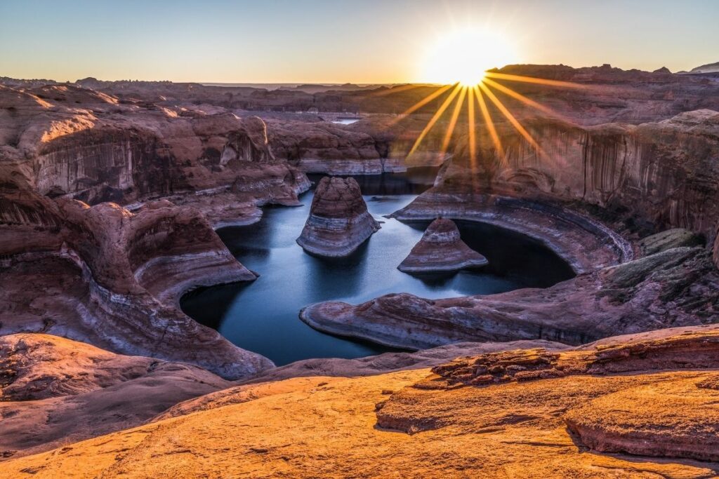
Glen Canyon National Recreation Area
The Glen Canyon National Recreation Area covers more than one million acres of land around Lake Powell and Cataract Canyon in Utah and Arizona. The beautiful landscapes of this desert are full of Navajo Sandstone, Kayenta Formation, and Wingate Sandstone. Hikers will be able to enjoy beautiful views of red and orange in different shapes and forms across the horizon as they visit the park.
The National Recreation Area is named after the Glen Canyon which was flooded by the Glen Canyon Dam. Now, the Glen Canyon is completely submerged under Lake Powell and sits under those waters. Travelers can enjoy many outdoor activities in this canyon like boating, kayaking, biking, scenic drives, and a lot more. Fishing enthusiasts can even expect to catch bass, walleye, bluegill, and catfish in the Lake.
The Glen Canyon National Recreation Area was officially designated for public use in 1972.
Things to do: Kayaking, Boating, Fishing, Camping, Hiking, Scenic Drives, Off-road vehicle driving.
How to get there: Glen Canyon National Recreation Area is a big place, with land in two states and many entry points. By plane, the City of Page is served by a commercial airline. The airport’s code letters are PGA. By car, visitors can take Wahweap, Antelope Point, Lone Rock Beach, and Hite. There is available public transportation in the Antelope Point areas
Where to Stay: Glen Canyon National Recreation Area offers lodging, camping, and houseboat rentals. For lodging, visitors can choose from Lake Powell Resort in Wahweap and Defiance House Lodge in Bullfrog, for camping the available options are to pitch a tent on the beach and pull into a full hook-up RV spot and rent a Houseboat in Antelope Point Marina or Lake Powell. Lodging can also be found in Page, AZ >> Check prices of nearby hotels on Booking.com or Hotels.com
Entrance Fee: $30 per vehicle or free with an American the Beautiful Pass.
Official Website: Click Here
Map: Download
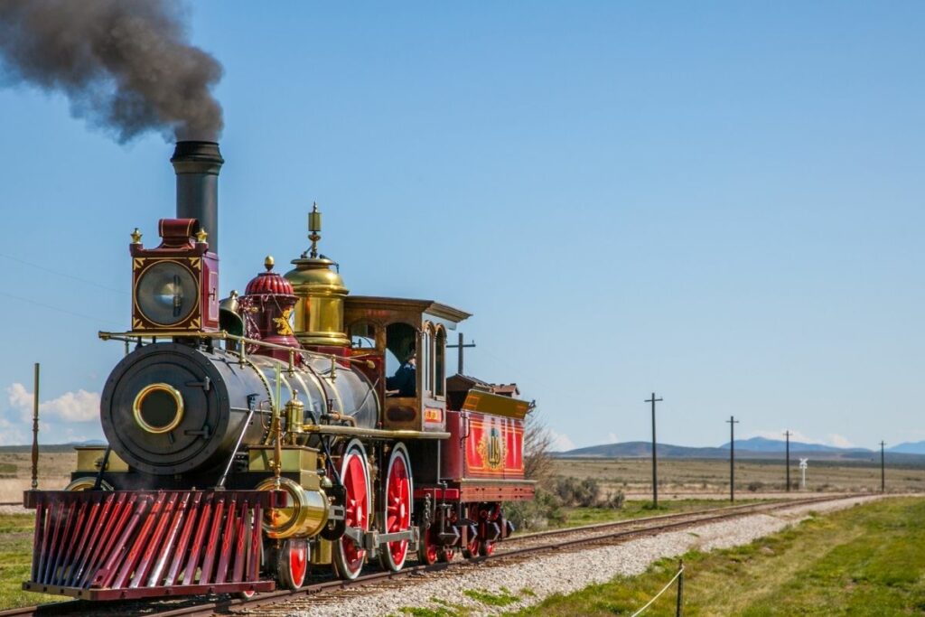
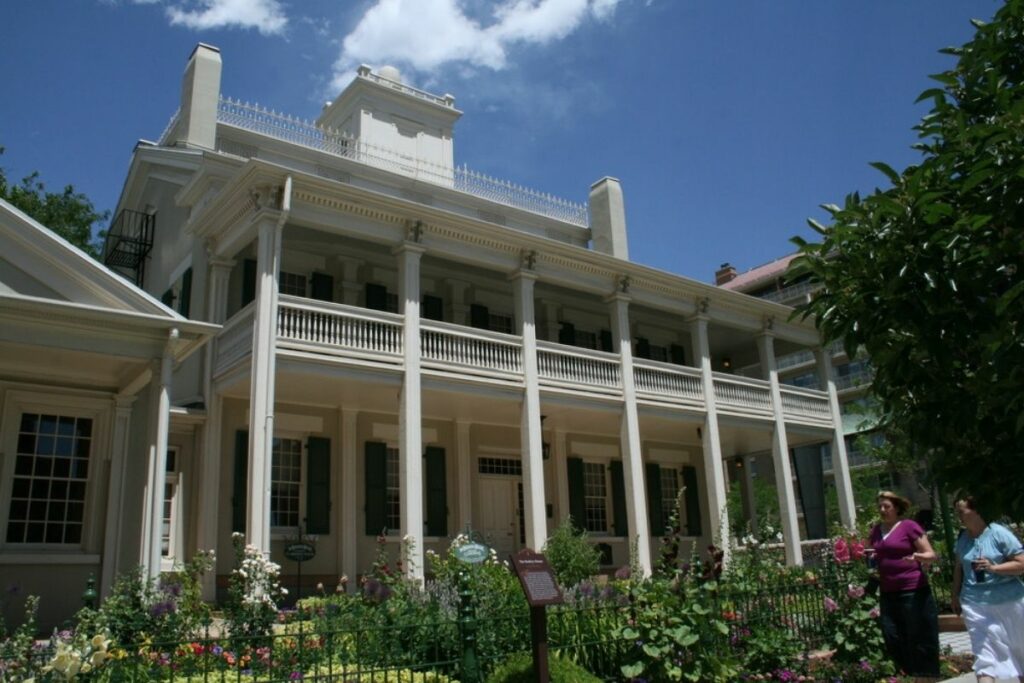
Golden Spike National Historical Park
Golden Spike National Historical Park is the completion site of the first transcontinental railroad connecting the whole nation. This was where the last spike was placed to complete the railroad and the Wedding of the Rails Ceremony commenced.
In the Wedding of the Rails Ceremony, four spikes were gifted by different territories, officially uniting the country from coast to coast. The Golden Spike National Historical Park commemorates this historic event and keeps the legacy of this railroad and the lives and stories that come with it. Auto tours and other guided tours are available to learn more about the history of this construction and the ceremony.
The Golden Spike National Historical Park was officially designated under the care of the National Park Service on March 12, 2019.
Things to do: Golden Spike features two driving tours that allow visitors to drive on the 1869 railroad grade, a 1.5-mile hiking trail showcasing 19th-century building techniques, locomotive ranger programs in the summer, and engine house programs in the winter.
How to get there: Golden Spike National Historical Park is 32 miles west of Brigham City, Utah, via Utah Hwy. 83. Drivers can take other the route in Northbound on I-15, Southbound on I-15, Eastbound on I-84, and Westbound from Logan. Travelers should be cautious once they turn off State Highway 83. Several different GPS systems have misdirected visitors headed to other sites.
Where to Stay: There is no available lodging in Golden Spike. There are available hotels, inns, and motels in a nearby town located in Tremonton that is approximately 20 miles away. >> Check prices of nearby hotels on Booking.com or Hotels.com
Entrance Fee: $20 per vehicle or free with an American the Beautiful Pass.
Official Website: Click Here
Map: Download
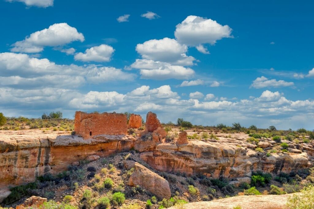
Hovenweep National Monument
Hovenweep National Monument preserves the amazing masonry done by early settlers of ancient groups in this area. This monument is known for the six groups of Ancestral Puebloan villages that have created a home in this area in the 12th century.
Visitors can come to explore the original stones of different buildings created by the different settlers of this area from early hunter-gatherers to the Puebloan people. These magnificent ancient buildings have stood the test of time and travelers can view very old doorways, houses, and more. The different buildings in this monument are divided into six different groups: the Cajon Group, Cutthroat Castle group, The Holly group, Hackberry group, Horseshoe group, and the Square Tower group.
Hovenweep became a National Monument in 1923 and is now under the care of the National Park Service.
Things to do: Stargazing, Bird Watching, Hiking
How to get there: The nearest plane is commercial airlines serving Cortez, Durango, Grand Junction, Colorado; Salt Lake City and Moab, Utah; and Albuquerque. By car, visitors can take the route US 491 to County Road CC for 5 miles. There are no public transportation.
Where to Stay: There are no restaurants or lodges in Hovenweep National Monument. The nearest restaurants and hotels are in Monticello, Blanding, and Bluff, Utah, and Cortez, Colorado. These towns are about 40-45 miles (one hour’s drive) from Hovenweep. >> Check prices of nearby hotels on Booking.com or Hotels.com
Entrance Fee: $20 per vehicle or free with an American the Beautiful Pass.
Official Website: Click Here
Map: Download
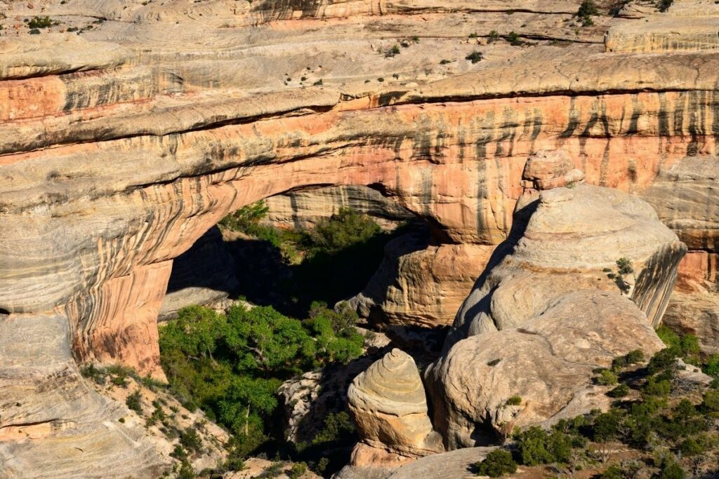
Natural Bridges National Monument
The Natural Bridges National Monument became the first national monument of Utah in 1908 officially established by President Theodore Roosevelt. Aptly named, this national monument boasts three natural bridges made of white Permian sandstone and carved by water. These beautiful and majestic natural wonders display the true power water has to create them through the years.
The bridges were given many names throughout the years from “President,” “Senator” and “Congressman” by Cass Hite to “Augusta,” “Caroline” and “Edwin”. Later on, the park expanded the monument to cover the surrounding ancient Puebloan structures that led them to rename the three natural bridges to “Sipapu,” “Kachina” and “Owachomo” in 1990. These are all Hopi names which is a native tribe to honor the people that have first settled here.
Aside from the great cultural and geological relevance of the park, travelers can also enjoy spotting some of the nocturnal animals that thrive in the area like kangaroo rats, skunks, foxes, bobcats, mountain lions, and bats. Other wildlife that can be seen include mule deer, coyotes, porcupines, desert cottontails, and many more.
Things to do: Stargazing, Bird Watching, Hiking
How to get there: By plane, Commercial airlines serve Cortez and Grand Junction, Colorado; Moab and Salt Lake City, Utah; and other cities in the southwest. Drivers can take south of town on US 191 to UT 95. Bus and service shuttle is available in the nearby city.
Where to Stay: There are no restaurants or lodges in Natural Bridges National Monument. The nearest restaurants and hotels are in Blanding, Utah, about 36 miles (45 minutes drive) from Natural Bridges. >> Check prices of nearby hotels on Booking.com or Hotels.com
Entrance Fee: $20 per vehicle or free with an American the Beautiful Pass.
Official Website: Click Here
Map: Download
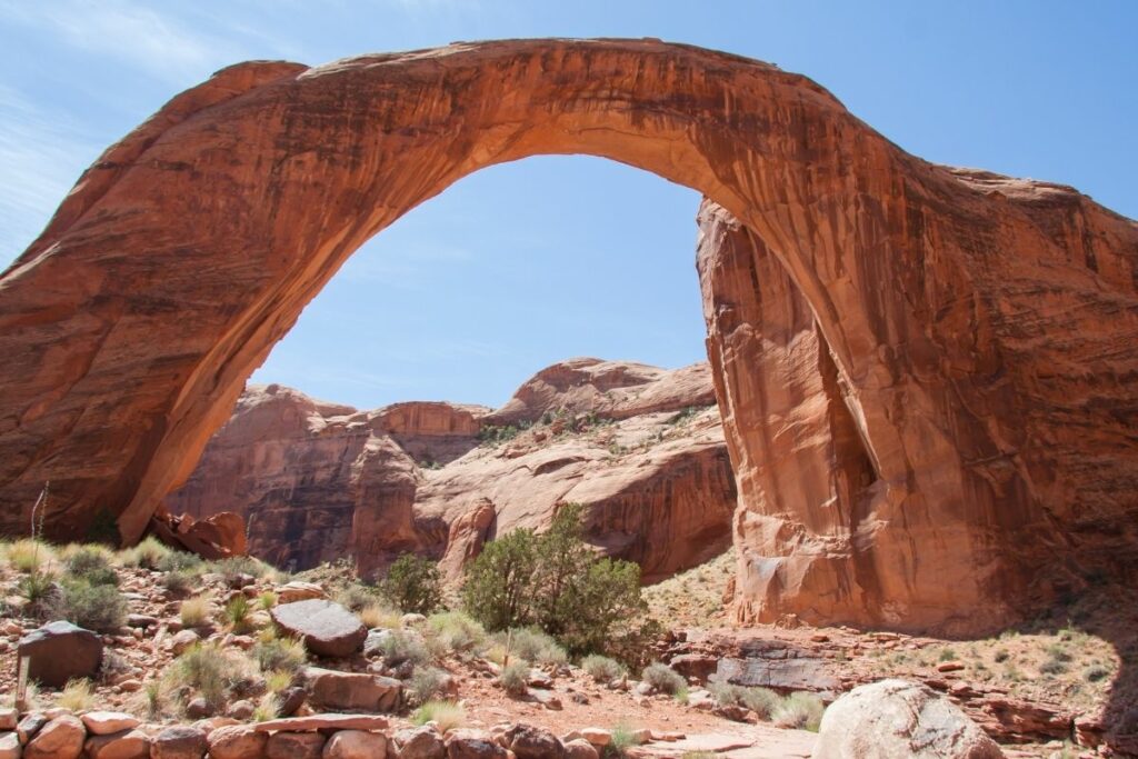
Rainbow Bridge National Monument
The Rainbow Bridge National Monument is actually included in the Glen Canyon National Recreation Area of Utah but it deserves a special mention as it is one of the highest natural bridges ever discovered in the world. Its size has often been subjected to dispute because of the Kolob Arch and Landscape Arch are larger than the Rainbow Bridge. However, the two aforementioned rock formations are technically described as arches and not a bridge, which in turn maintains the Rainbow Bridge’s claim.
It is one of the easiest access bridges as well with just a two-hour boat ride across Lake Powell followed by a mile-long hike, travelers can bask in the grandeur of the natural bridge. The Rainbow Bridge is made of sandstone that was originally deposited in the area through the wind during the Jurassic era. After many centuries, the sandstone compressed and created the formations as we know them today.
This bridge has also been of great importance to the Native Americans as it is believed to be sacred. The Ancient Pueblo people and now the Navajo people deemed the monument as a rainbow turned into stone.
President William Taft designated this site under the National Park Service in 1910.
Things to do: Hiking, Sight-seeing
How to get there: Rainbow Bridge is only accessible by boat on Lake Powell or by land over a 14+ mile trail from the Navajo Nation. By boat across Lake Powell in Glen Canyon National Recreation Area using private, rental, or tour boats.
Where to Stay: There is no lodging in or near the national monument. the nearest town is Page, Arizona. >> Check prices of nearby hotels on Booking.com or Hotels.com
Entrance Fee: Free
Official Website: Click Here
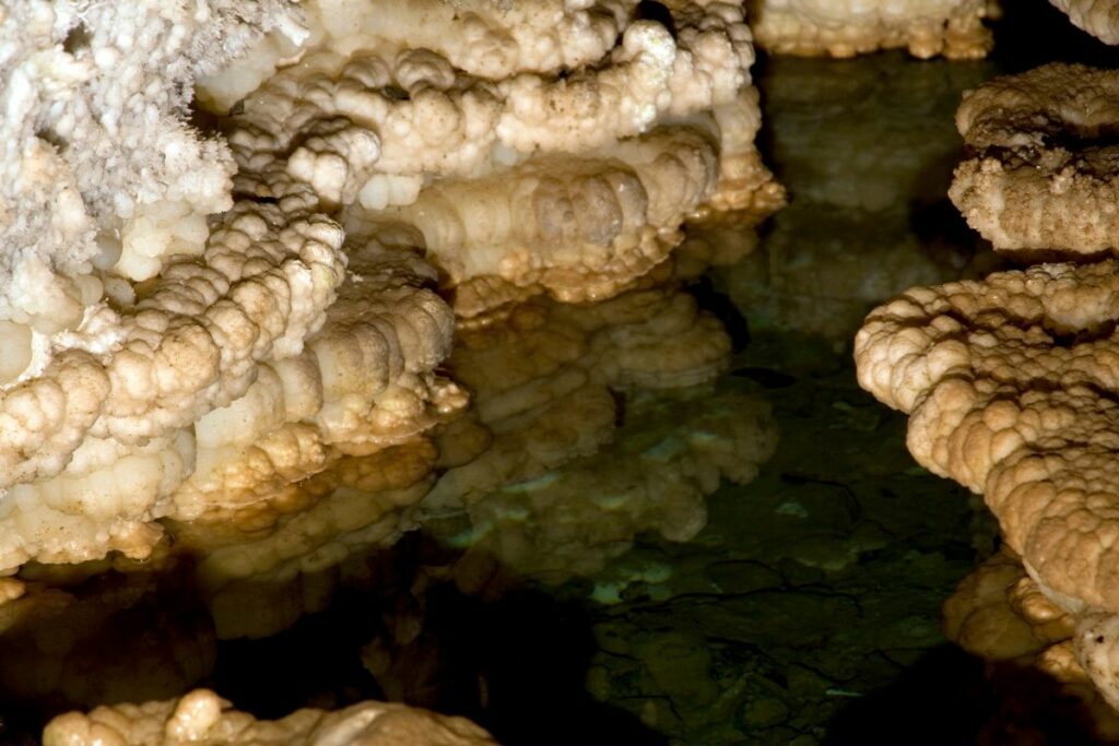
Timpanogos Cave National Monument
Timpanogos Cave National Monument preserves and protects the majestic canyon caves of Mount Timpanogos. This cave system is comprised of three different caves for your underground adventure: Hansen Cave, Middle Cave, and Timpanogos Cave. These caves are actually connected through manmade tunnels created in the 1930s.
The first cave was discovered by Martin Hansen and named after him while on a hunt around the area. Family members of Hansen then proceeded to discover the other two caves on different trips. The monument is also famous for the legend of the Timpanogos which have at least twelve different recorded versions of the tale. Legend has it that there lived an Indian warrior and an Indian princess. The two fell in love and the princess rejected many of her suitors. Unfortunately, jealousy ended their happiness and while heartbroken, the tale ends with many jealous warriors charging the hero forcing him to fall to his death. He is now believed to be immortalized as the Emerald Lake. His lover, the princess, is devastated. She lies down on the mountain top and dies in misery, which is believed to be the reason for the mountain’s outline of a woman today.
There are many other versions of the story that exists and visitors can learn more about them, the history, and the geologic mysteries waiting underground.
Things to do: Guided Tours, Hiking
How to get there: Timpanogos Cave is located in the Wasatch Mountains in Northern Utah, approximately 40 miles south of Salt Lake City. By plane, The closest major airport is Salt Lake City International Airport. There is no public transportation to or in the monument.
Where to Stay: There is no lodging in or near Timpanogos Cave. The nearest city is in American Fork, which has a few lodging and dining options, >> Check prices of nearby hotels on Booking.com or Hotels.com
Entrance Fee: Free
Official Website: Click Here
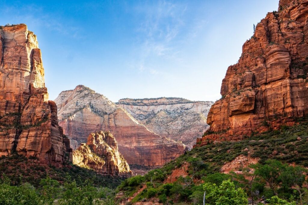
Zion National Park
Zion National Park is located near the town of Springdale, Utah. Known as the first national park of Utah, this preserves the pathways of ancient native people and pioneers. One of the greatest features of the park is the Zion Canyon that stretches 229 miles long. The pathway is complete with reddish canyon walls on either side made of Navajo sandstone and has been eroded by the Virgin River throughout the years.
Adventurers visit this destination to experience many of the outdoor activities available like canyoneering, rock climbing, and more. Others hike around the area to appreciate the beautiful scenic views of rock formations and the ancient Navajo sandstone. Wildlife viewing is also a great experience in this park with much wild fish, insects, birds, and mammals that can be spotted in the area. It would be common to see mule deer, coyotes, grey foxes, or even a mountain lion on your trip. You can also come to learn more about its cultural relevance and the Native American’s that resided within the area.
Things to do: Hiking, Canyoneering, Climbing, Camping, Backpacking, Scenic Drives
How to get there:
By plane, there are International Airports: Las Vegas, Nevada (170 miles), Salt Lake City, Utah (300 miles). traveler can visit Zion Park on State Route 9 in Springdale, Utah.
Where to Stay: There is a lodge in the main canyon and lodging can be found in surrounding towns such as Springdale. Zion has three campgrounds. >> Check prices of nearby hotels on Booking.com or Hotels.com
Entrance Fee: $35 per vehicle or free with an American the Beautiful Pass.
Official Website: Click Here
Map: Download
Associated Sites of Utah
California National Historic Trail
Deemed as the largest migration in American history, the California National Historic Trail preserves the legacy of this historic event wherein over 250,000 emigrants traveled from different states to California seeking a better life. They journeyed through 10 states using this five thousand-mile-long trail.
In the early 1800s, California was virtually ignored by most Americans since it was still a province of Mexico. Getting there was only limited to traveling by sea. After the first group from Missouri, headed west, many followed suit. This journey was not easy, to say the least. The five thousand miles long journey rendered many of the travelers hungry, sick, and almost naked. After the gold rush and the promise of gold in California, even more, people took this treacherous trail in hopes of better fortune in the West.
Today, travelers can follow the footsteps of many emigrants that took the same trail to California and experience the historic grit and struggle of many that stood before. Unfortunately, most of the segments of this trail are now privately owned or restricted so only some areas are open for hiking, cycling, and recreation for visitors.
Things to do: auto-touring, visiting interpretive sites, hiking, biking or horseback riding trail segments, and visiting museums
How to get there: Nearly 2,000 miles of historic trail were once the primary “road” used by farmers, enterprising business managers, gold-seekers, and fortune hunters who chose to make a new life on the California frontier and those portions of the California National Historic Trail authorized by Congress include them. From Missouri to California, the path passes across ten states.
Where to Stay: There are various lodging areas on or along California National Historic Trail. Travelers can choose from 10 different states to visit and enjoy.
Entrance Fee: Free but various attractions along the trail may charge an entrance fee.
Official Website: Click Here
Map: Download
Mormon Pioneer National Historic Trail
Mormon Pioneer National Historic Trail commemorates the story of how the Mormon doctrine commenced and their struggles in starting the new religion. This religion started with Joseph Smith, who is believed to be the prophet and translator of the Book of Mormon organized a legal entity that is now known as The Church of Jesus Christ of Latter-day Saints. His followers are called Mormons.
He first established this organized religion in Missouri but because of the stark differences of his teachings and other Christian doctrines, they were driven out by the people. The Mormons settled along the Mississippi River in Illinois, wherein thousands of converts joined the doctrine. They named this community the Nauvoo. After neighboring towns in Illinois, found out of the stark differences like polygamy and secret plural marriages, the people of Illinois arrested Smith. After a mob that broke out inside the jail, Smith and his brother were murdered. Due to this distress, Smith’s successor decided to organize his followers to retreat away from Illinois and away from the vigilantes.
In 1846, they embarked on a three-month-long escape from their previous settlement. Now, this pathway is known as the Mormon Pioneer National Historic Trail.
Things to do: auto-touring, visiting interpretive sites, hiking, camping, biking or horseback riding along with trail segments, and visiting museums and interpretive centers.
How to get there: Drivers can trail across five states to see the 1,300-mile route traveled by Mormons who fled Nauvoo, Illinois, to the Great Salt Lake Valley in 1846-1847.
Where to Stay: Accommodation is available around the area. In five states you can find many hotels, lodging, and inns.
Entrance Fee: Free but various attractions along the trail may charge an entrance fee.
Official Website: Click Here
Map: Download
Old Spanish National Historic Trail
One of the prominent businesses back in the 1700s is trading mules and goods from borders in Los Angeles and New Mexico. The Old Spanish National Historic Trail preserves the exact route people would take to transport horses and mules across these areas. Aside from these, people would also transfer contraband goods and Indian slaves using the same route. Today, the trail stretches across New Mexico, Colorado, Utah, Arizona, Nevada, and of course, California.
The name recognizes the use of this route by the Spanish since the early 16th century. It was first coined in a publication written by John C. Frémont of his 1844 journey for the U.S. Topographical Corps. His report detailed the route and first gave it its name.
The Spanish created settlements in Utah after an unsuccessful journey to California before they returned to Sante Fe in 1776. After some time, Mormon settlers also created homesteads along the trail affecting trade and also tolerance of slaves.
This trail was included in the National Trail Systems in 2002.
Things to do: Public lands and state, county, and city parks along the trail route preserve trail resources and provide for recreation activities.
How to get there: Flying into a variety of airports, including Santa Fe, New Mexico; Alamosa and Durango, Colorado; Las Vegas, Nevada; St. George, Utah; Flagstaff, Arizona; and Los Angeles, California, will get you to the national historic trail. These cities are well-connected to trail-related destinations.
Where to Stay: Travelers can visit Arizona, California, Colorado, Nevada, New Mexico, and Utah, with countless lodging, hotels, and inns available in those states.
Entrance Fee: Free but various attractions along the trail may charge an entrance fee.
Official Website: Click Here
Map: Download
Pony Express National Historic Trail
Pony Express National Historic Trail preserves the route wherein young men would ride horseback from Missouri to California and deliver mail within ten days to the recipient. The Pony Express could deliver letters faster than ever before as they cross the 1800-mile-long trail to deliver their speedy service.
Before the electronic age, the Old West was able to communicate and connect the East to the West through this service that was only operational for eighteen months. Through the efforts of the owners of Pony Express, it was made clear to Congress that speedy delivery of letters was absolutely essential in that age. After some time, Congress authorized to subsidize a transcontinental pathway for these parcels. Although operational for only a short amount of time, it revolutionized mail delivery systems.
Today, travelers can check out museums to learn more about the Old West, try their hands at horseback riding like the men that delivered letters all those years ago, or hike the trail and enjoy the views.
Things to do: Auto Tours, Hiking, Bicycling, Horseback Riding, Visiting Museums
How to get there:
Where to Stay: One of the trail segments ends in Ibapah, Utah. The closest airport to this area is the Goshute Airport. Other segments are located near towns like Henefer, Echo, Salt Lake City, Fairfield, and Faust. It is best to travel the trail via car and explore the different towns on the way.
Entrance Fee: Free but various attractions along the trail may charge an entrance fee.
Official Website: Click Here
Map: Download
List of National Parks of Utah
There are 13 National Parks in Ohio that received 11 million visitors in 2020 and generated over $1.3 billion in tourism economic benefits. The most popular national parks in Utah include Zion National Park, Glen Canyon National Recreation Area, Bryce Canyon National Park and Arches National Park.
- Arches National Park
- Bryce Canyon National Park
- Canyonlands National Park
- Capitol Reef National Park
- Cedar Breaks National Monument
- Dinosaur National Monument (CO, UT)
- Glen Canyon National Recreation Area (AZ, UT)
- Golden Spike National Historical Park
- Hovenweep National Monument (CO, UT)
- Natural Bridges National Monument
- Rainbow Bridge National Monument
- Timpanogos Cave National Monument
- Zion National Park
Affiliated Areas
- California National Historic Trail CA, CO, ID, KS, MO, NE, NV, OR, UT, WY)
- Mormon Pioneer National Historic Trail (IL, IA, NE, UT, WY)
- Old Spanish National Historic Trail (AZ, CA, CO, NV, NM, UT)
- Pony Express National Historic Trail (CA, CO, KS, MO, NE, NV, UT, WY)
Utah National Parks also provides support and management to 2 National Heritage Areas, 1 Wild and Scenic River as well as 1,872 National Register of Historic Places Listings.
There are 14 National Historic Landmarks, 4 National Natural Landmarks, 680 Places recorded by the Heritage Documentation Program, and over 2.8 million objects in the Utah National Parks Museum Collections. There are 6,880 Archaeological Sites in the Utah National Parks.
Utah is home to 43 State Parks.
Utah International Dark Sky Parks
Utah is home to several International Dark Sky Parks. These are areas that are
- Natural Bridges National Monument
- Hovenweep National Monument
- Dead Horse Point State Park
- Steinaker State Park
Utah’s Neighboring States
Planning to visit a few of the National Parks in Arizona and wandering about what national parks are in neighboring states. Here is the list of National Parks in surrounding states.
- Arizona National Parks – Arizona is home to Grand Canyon, Petrified Forest and Saguaro National Parks and 19 NPS units.
- Colorado National Parks – Colorado is home to Black Canyon of the Gunnison, Great Sand Dunes, Mesa Verde and Rocky Mountain National Parks and 9 other units.
- Idaho National Parks – Idaho shares Yellowstone National Park with Montana and Wyoming and has 6 other units.
- Nevada National Parks – Nevada is home to Great Basin National Park and a tiny peice of Death Valley plus 3 other units.
- New Mexico National Parks – New Mexico is home to Carlsbad Caverns and White Sands National Park along with 13 other units.
- Wyoming National Parks – Wyoming has 2 National Parks: Grand Teton National Park and shares Yellowstone National Park with Montana and Idaho plus 5 NPS units.
Final Thoughts of the National Parks of Utah
I hope this guide to the National Parks of Utah is helpful as you plan to explore these amazing National Parks.
Pin for Later: National Parks in Utah: Explore the 13 Utah National Parks (2021 Update)

Hi, I'm Jennifer!

Welcome to the wonderful world of National Parks. I'm here to help you plan your NEXT amazing adventure through the United States National Parks and beyond. I want the national parks to be accessible to all.
I live in Tennessee, and when I'm home, you can find me hiking in the Smokies and the Cumberland Plateau.
58/63 National Parks
250+/423 National Park Units
Want to know more? Start Here.
Snag one of my National Park Ebooks and Downloadable Itineraries

Talk with an Expert

Share your love of the parks with a shirt, ornaments, hoodies, frames, and more.
