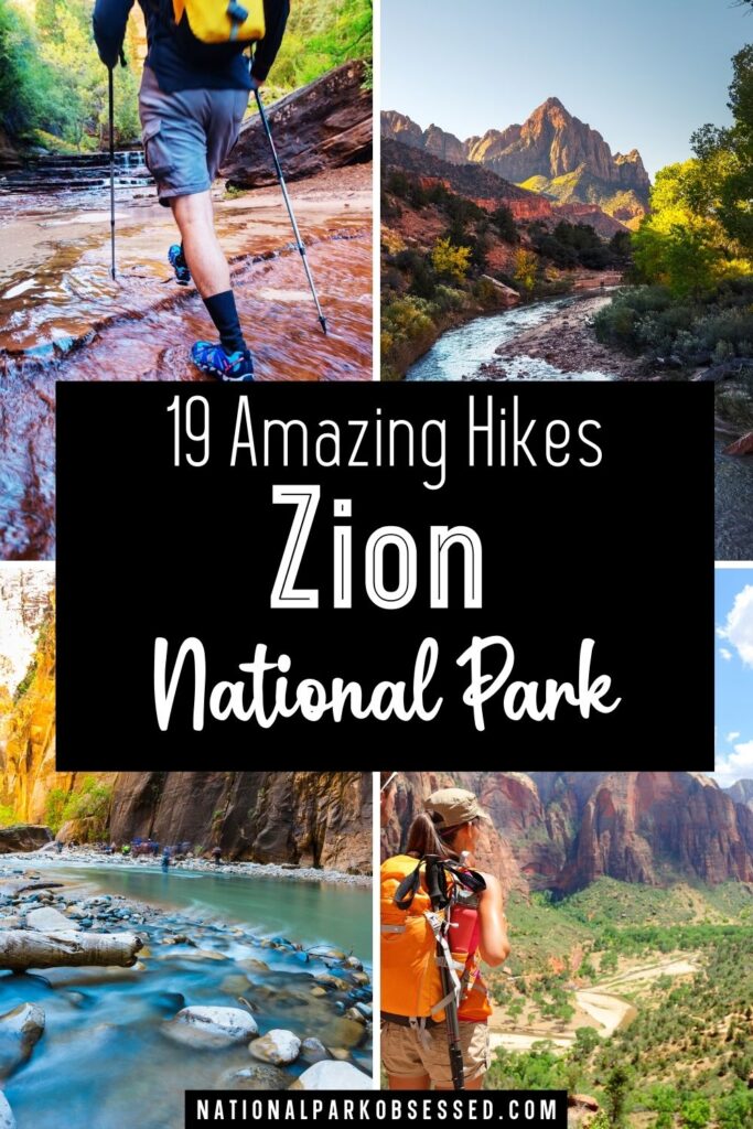
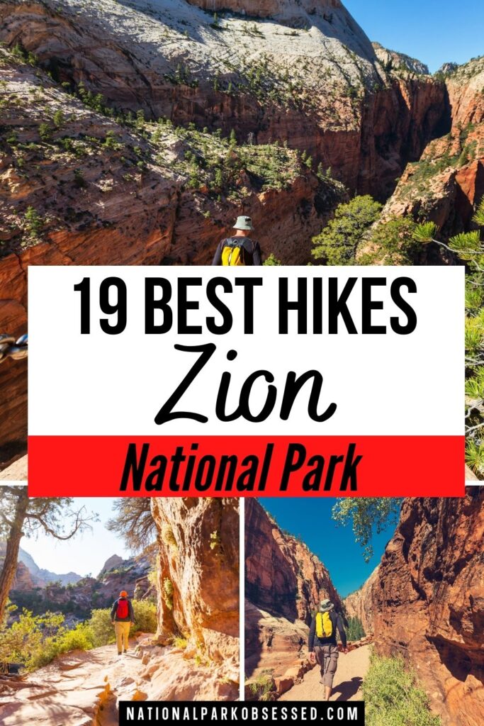
Post Summary: Best Hikes in Zion National Park
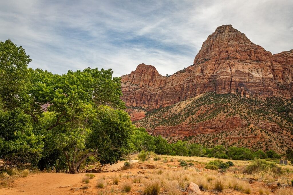
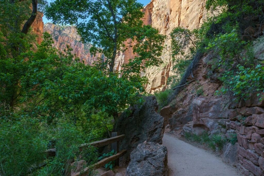
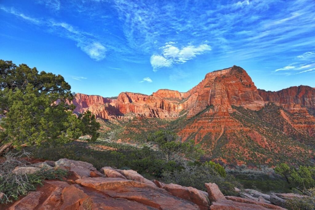
Zion National Park is located in southwest Utah and is famous for its steep red cliffs and canyons. It is one of the most iconic national parks in the United States and is a must-visit for even the most casual hiker. Zion was the first Utah National Park and covers a total area of 229 sq. mile (590 km2). Its most impressive feature is Zion Canyon itself which is 15 miles (24km) long and over 2,600 feet (792m) deep. The National Park offers so much to not only hikers but the general public too. With stunning scenery, unique rock formations, and plenty of trail choices, the park has something for everyone.
This article is going to show you the 20 best hikes in Zion National Park, and everything you need to know about the trails. Whether you are an advanced hiker, or only just starting out on your journey, this National Park offers a bit of everything. The list will be split into strenuous, moderate, and easy hikes so you know exactly which part of the article you need. Some of the easier trails are flat and paved, whilst some of the more strenuous hikes may involve more technical aspects including bouldering, canyoneering, and swimming. Depending on the amount of time you have, your hiking abilities, and your fitness level, you can go through the hikes in this article and pick out the desired ones for your trip!
Quick Guide to Best Zion Hikes
| Trail Name | Region | Difficulty | Distance | Elevation |
| Angels Landing | Grotto | Strenuous | 5.2 miles | 1,604 ft |
| Emerald Pools Trail | Zion Lodge | Moderate | 2.9 miles | 620 ft |
| Grotto Trail | Scenic Canyon Drive | Easy | 2.4 miles | 561 ft |
| Hidden Canyon Trail | Weeping Rock | Moderate | 3.1 miles | 971 ft |
| Lower Emerald Pools Trail | Zion Lodge | Easy | 1.4 miles | 127 ft |
| Lower Pine Creek Trail | Canyon Junction | Moderate | 0.6 miles | 55 ft |
| Middle Fork Taylor Creek Trail | Kolob Canyon | Moderate | 4.9 miles | 590 ft |
| Narrows – Bottom Up to Big Springs | Temple of Sinawava | Strenuous | 8.8 miles | 695 ft |
| Narrows – Top Down | Chamberlain’s Ranch | Strenuous | 15.5 miles | 1,017 ft |
| Observation Point via East Mesa Trail | East Canyon | Strenuous | 7 miles | 702 ft |
| Observation Point via East Rim Trail | Weeping Rock | Strenuous | 6.7 miles | 2,644 ft |
| Overlook Trail | Mount Carmel Tunnel | Moderate | 0.9 mile | 187 ft |
| Pa’rus Trail | Zion Visitor Center | Easy | 3.4 miles | 157 ft |
| Riverside Walk | Temple of Sinawava | Easy | 1.9 miles | 193 ft |
| Subway Canyon | West Zion | Strenuous | 4.5 miles | 1,305 ft |
| Timber Creek Overlook Trail | Kolob Canyons | Easy | 1.1 miles | 255 ft |
| Watchman Trail | Zion Canyon Visitor Center | Moderate | 3.1 miles | 636 ft |
| Weeping Rock | Weeping Rock | Easy | 0.3 miles | 36 ft |
| West Rim Trail | Lava Point Campground | Strenuous | 15 miles | 1,748 ft |
Things to Know about Hiking in Zion National Park
- Many of the hiking trails in Zion are made up of uneven, rocky surfaces so make sure to pack good quality trail runners. Some of the trails even require you to wade or swim, so make sure you are adequately prepared.
- Temperatures can reach up to 100° F (38° C) in Zion National Park in the summer months, and many of the trails offer little to no shade. Make sure you bring a hat, wear lots of sunscreen and take it easy when hiking in this kind of heat.
- Cell phone reception in the National Park is incredibly rare. Make sure you discuss the trail you are doing with someone, and roughly when they should expect to hear from you. That means if there are any problems, that individual can get in touch with the park rangers if you aren’t back by the time you are supposed to be.
- For some of the more strenuous hikes, it’s best to bring a trekking pole with you. Aside from stability, they will also reduce the impact on your hip, knee, and ankle joints.
- Toxic levels of Cyanobacteria have been found in the Virgin River, and as of January 2022 these toxin levels have increased and a ‘Danger Advsiory’ has been issued. Cyanobacteria produce toxins that affect the nervous system which can be fatal. Children and dogs are most susceptible so make sure you monitor this situation before deciding which hike to go on.
- Between the months of March and November, and the winter holiday season the Zion Shuttle is in operation. It is important to note that during this time, private vehicles are not allowed to drive on the Zion Canyon Scenic Drive.
Best Hikes in Zion National Park
Strenuous Zion Hikes
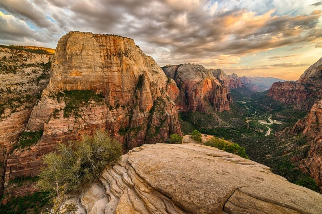
Angels Landing
- Distance: 2.6 miles / 3.55 km one way (5.2 miles / 7.1 km round trip)
- Elevation Gain: 1604 feet (489m)
- Estimated Time: 4-5 hours
- Type of Trail: Out and back
- Trailhead Location: The Grotto Trailhead
- Map: All Trails
Angels Landing will be requiring a permit to hike from April 2022 until February 2023. Learn more about the Angels Landing permit lottery here.
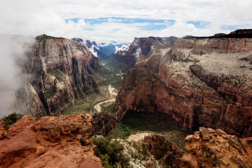
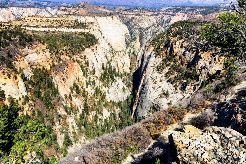
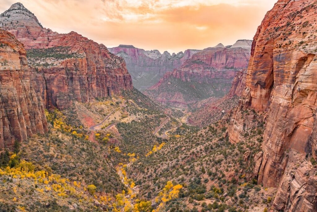
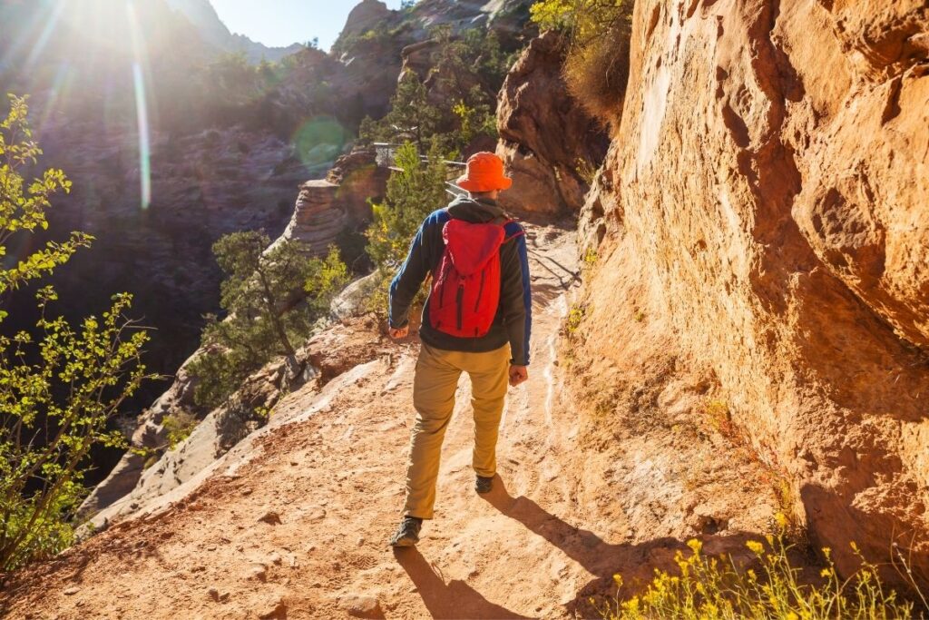
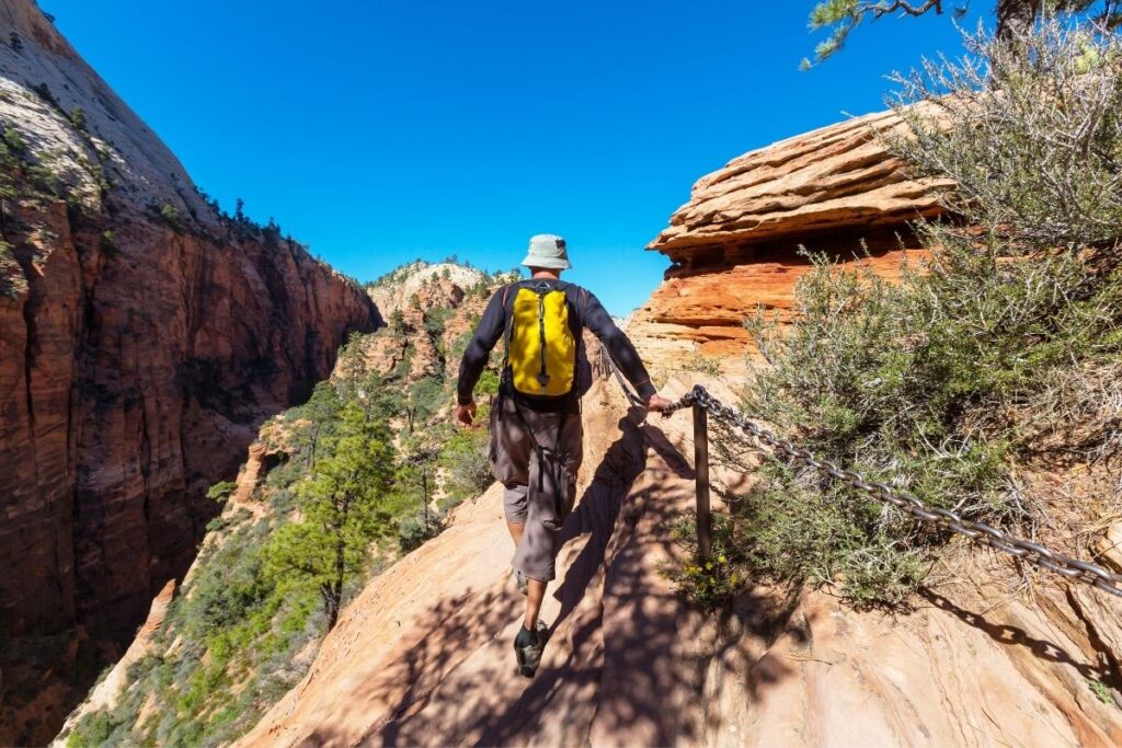
Angels Landing is considered to be one of the most strenuous hikes in Zion National Park, if not the hardest. The trail follows the West Rim Trail, and then a number of switchbacks take you up to Refridgerator Canyon. After the canyon, you will then have to climb up Walter’s Wiggles which are a series of 21 switchbacks to get to the top of the ridge, to Scout Lookout. From there you hike along a narrow ridge to get to Angels Landing, which is where you get to see the best views in all of Zion National Park. However, this hike is not recommended for people with a fear of heights. That is due to the steep drop-offs, very narrow trail, and the anchored support chains that have been attached to some sections of the cliff. For this reason, it’s also important not to attempt this trail during stormy weather or when the trail is wet. However, if you are feeling adventurous and want to take this hike on, you will be thoroughly rewarded with scenic views.
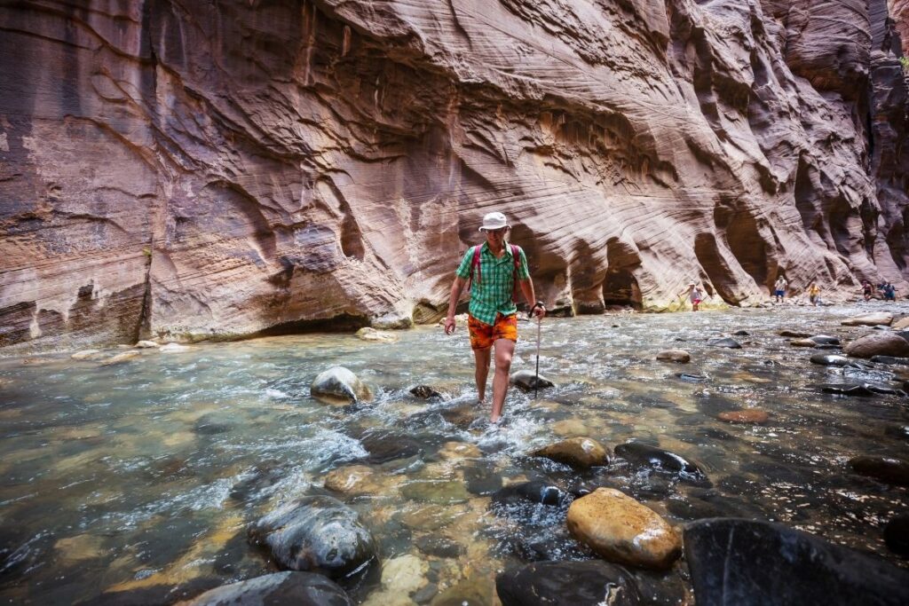
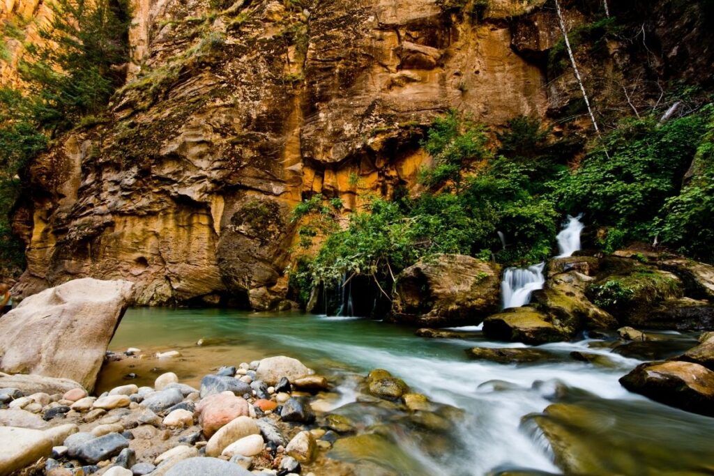
Narrows
The Narrows is one of the most popular day hikes in Zion National Park. It’s named for being the narrowest part of the canyon and there are multiple ways to reach the Narrows. That means the length of the hike can be adapted depending on your time in the National Park and your fitness level.
Bottom up to Big Springs
- Distance: 4.4 miles / 7.15 km one way (8.8 miles / 14.3 km round trip)
- Elevation Gain: 695 feet (212m)
- Estimated Time: 4-5 hours
- Type of Trail: Out and Back
- Trailhead Location: Temple of Sinawava
- Map: All Trails
This trail is classed as a river trail, as you head along the bottom of the canyon. Water levels vary on this trail from ankle deep to chest high so caution must be used whilst hiking. It’s important to check the weather forecast before attempting this hike in case the water level has fluctuated dramatically. Generally, throughout the summer, the trail is accessible to kids 4 feet and taller, but that all depends on the current water levels. As the trail is an out and back trail you can turn back at any time if you feel the height of the water is getting uncomfortable. Once you reach Big Springs, you must turn back anyway as continuing after this requires a permit. The views along this trail are stunning as you hike through the clear blue water in the gorge, and look up to the light gleaming through the canyon.
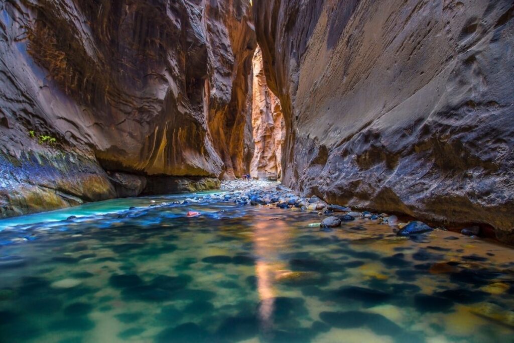
Top Down
- Distance: 15.5 miles / 24.9 km one way
- Elevation Gain: 1,017 feet (310m)
- Estimated Time: 12-14 hours
- Type of Trail: Point to point
- Trailhead Location: Champerlain’s Ranch
- Map: All Trails
When it comes to hiking the Narrows, taking the Top-down trail as a one-day hike option is the most strenuous. As the hike takes around 12-14 hours this trail is recommended for experienced hikers and people with very high fitness levels. The trail starts out very easy, but as you head further along you will have to cross the stream several times. At about 8 miles into the hike, the water volume more than doubles so you will have to wade your way through. However, this part of the Narrows has the deepest water and the tallest canyon walls which create very scenic views. The most important thing to remember about this trail is that it requires a backcountry permit. It’s also possible to do this trail as an overnight hike which will give you more time to enjoy the views, rather than have to rush. There are 12 designated sites for you to camp overnight here.
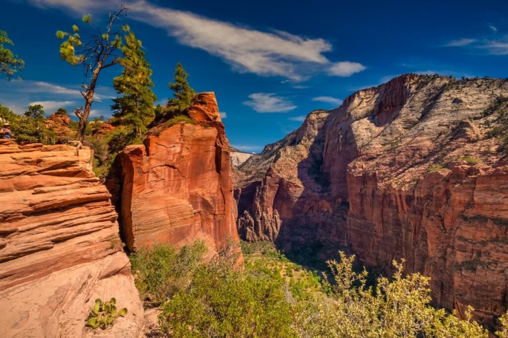
Observation Point
Observation Point Via East Mesa Trail
- Distance: 3.5 miles / 5.65 km one way (7 miles / 11.3 km round trip)
- Elevation Gain: 702 feet (214m)
- Estimated Time: 3-4 hours
- Type of Trail: Out and Back
- Trailhead Location: Behind the Zion Ponderosa Resort
- Map: All Trails
Due to the Weeping Rock Trailhead being closed, currently, this is the only trail where you can reach Observation Point. A large portion of the trail winds through a ponderosa pine forest, but as you head further along the trail, the beautiful scenery starts to show through. Once you reach Observation Point you will get a stunning view of the canyon and you will get to see the famous Angels Landing Trail from above. The trailhead of this hike is quite difficult to find and is only accessible via dirt roads found behind the Zion Ponderosa Resort. Signs have been put up at major intersections to help you find this secluded starting point. This route is a lot less strenuous than the East Rim Trail, which until the rockslide was the most popular choice.
Observation Point Via East Rim Trail
- Distance: 3.3 miles / 5.45 km one way (6.7 miles / 10.9 km round trip)
- Elevation Gain: 2644 feet (806m)
- Estimated Time: 12-14 hours
- Type of Trail: Out and back
- Trailhead Location: 100 ft west of East Entrance fee booths
- Map: All Trails
Weeping Rock Trailhead is closed due to a rock slide in 2019. This is a long-term closure. (Aka NPS has no money to clear the area and do a stability study on the rockface). Observation Point can be reached via East Mesa Trail.
This route to Observation Point is the most popular one, but it is no easy feat. As soon as you start the hike you will find yourself climbing switchbacks until the trail levels out near Echo Canyon. As soon as you leave Echo Canyon, you will again immediately come across switchbacks, and these are steeper this time around. However, once you get to Observation Point it will all have been worth it. Looking out into the scenery of the canyon from this point is a once-in-a-lifetime experience. The trailhead for this route is found on the Zion-Mount Carmel Highway and is located about 100 ft west of the East Entrance fee booths. The trail can also be accessed from the Stave Spring Trail. Unfortunately, this trail is now closed, and the only way to reach Observation Point is via the East Mesa Trail.
Subway Canyon
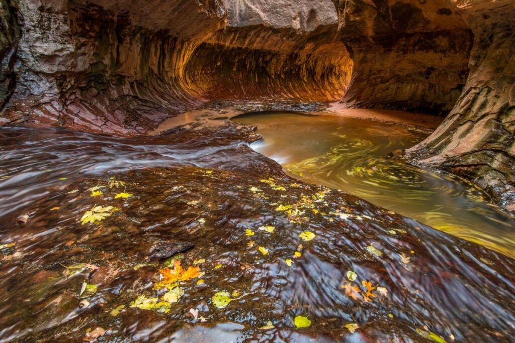
- Distance: 4.5 miles / 7.3 km one way (9 miles /14.6 km round trip)
- Elevation Gain: 1305 feet (398m)
- Estimated Time: 7-9 hours
- Type of Trail: Out and back
- Trailhead Location: Left Fork Trailhead
- Map: All Trails
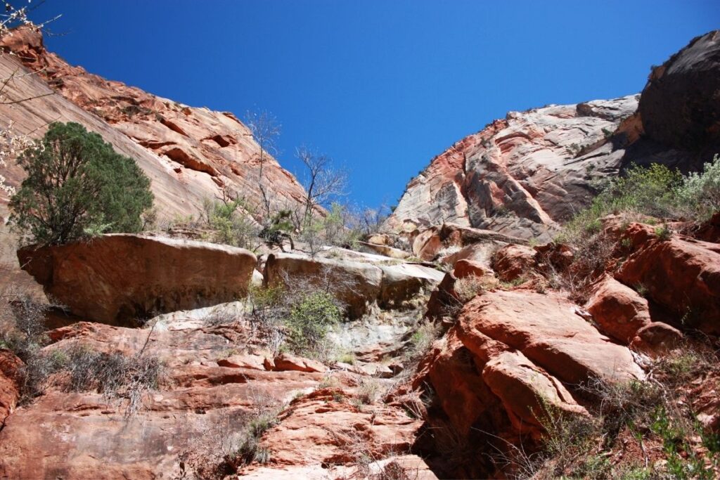
The Subway Canyon is one of the most technical trails in Zion National Park. It requires a permit, and anyone who attempts this trail must be aware of the conditions ahead. The trail isn’t well maintained and the hike itself requires individuals to climb down waterfalls, scramble over boulders, and canyoneer from the top of the cliff down to the bottom. You can also choose to climb up the canyon from the bottom, but this way is a lot more difficult. The majority of the hike takes place in the stream, and where the water runs deep enough you will have to swim. Due to the technicality of the hike and the endurance needed, it’s only recommended to attempt this hike if you are with an experienced canyoneer. As the trail includes canyoneering, a rappeling system is needed to complete the hike.
West Rim Trail
- Distance: 15 miles / 24.1 km one way
- Elevation Gain: 1748 feet (533m)
- Estimated Time: 10-12 hours
- Type of Trail: Point to Point
- Trailhead Location: Lava Point Campground
- Map: All Trails
The West Rim Trail can be hiked either as a day trip or as an overnight trip depending on your fitness levels and the time you have in the National Park. The trail is located at quite a high elevation, so people can find this trail even more difficult if they are not accustomed to hiking in these high-altitude alpine conditions. The hike starts with beautiful views of the Wildcat Canyon area before it splits into Telephone Canyon Trail and the West Rim Trail. For this hike take the West Rim Trail route to Cabin Spring where you will be able to see out over the canyon for miles. The views are spectacular and continue even as you start your descent down into the canyon. It’s important to mention that during parts of the trail there isn’t much shade or coverage which can be a problem on a hot day. Make sure to wear a hat, apply sunscreen and bring plenty of water.
Moderate Hikes in Zion
Emerald Pools Trail
- Distance: 2.9 miles / 4.8 km round trip
- Elevation Gain: 620 feet (189m)
- Estimated Time: 2-4 hours
- Type of Trail: Loop
- Trailhead Location: Zion Lodge
- Map: All Trails
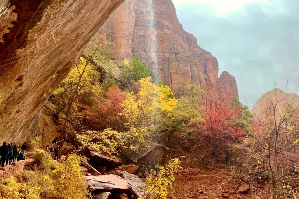
The trail starts out as a paved path that leads to the lower emerald pool and waterfalls. These pools are beautiful and are the perfect spot to relax and take in the sun. The views here are stunning but depending on the recent weather, the water level in these pools can sometimes be very low. As you continue along, the trail becomes rocky and climbs up to the middle part of the trail where you will be rewarded with a series of viewpoints. After hiking further along the trail, you will reach the upper emerald pool. This pool is a lot larger than the others, and there is a high waterfall that runs it to it from a nearby cliff. Although parts of the trail are steep, there are a few shady sections and the hike isn’t too long making it family-friendly.
Hidden Canyon Trail
- Distance: 1.5 miles / 2.5 km one way (3.1 miles / 5 km round trip)
- Elevation Gain: 971 feet (296m)
- Estimated Time: 2-3 hours
- Type of Trail: Out and back
- Trailhead Location: Weeping Rock Trailhead
- Map: All Trails
Weeping Rock Trailhead is closed due to a rock slide in 2019. This is a long-term closure. (Aka NPS has no money to clear the area and do a stability study on the rockface).
The Hidden Canyon Trail consists of a number of steep switchbacks and then runs along a cliff face. This hike is incredibly scenic and offers stunning views of the surrounding canyon. However, the trail is not for the faint-hearted. Aside from steep drop-offs at the side of the route, there are chain-assisted cliffs to tackle if you want to continue along your hike. Once you get to the entrance of Hidden Canyon you can choose to head back. If you are experienced with bouldering, there is a route that continues another half a mile up the canyon but it can get pretty technical. This trail is not recommended for people with a fear of heights or children because of its sheer cliffs, dangerous drop-offs, and chain-assisted cliffs that you have to traverse. Due to the trailhead being located at Weeping Rock, this trail is currently closed due to rockfall.
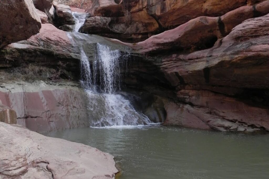
Lower Pine Creek Waterfall
- Distance: 0.6 mile / 1.1 km round trip
- Elevation Gain: 55 feet (17m)
- Estimated Time: 30 minutes
- Type of Trail: Out and back
- Trailhead Location: The first switchback after Canyon Junction on Route 9
- Map: All Trails
Although the Lower Pine Creek Waterfall Trail is only short, it’s rugged with boulder obstacles and includes a lot of water. Once you reach the trailhead the route will be obvious. The trail is an unmarked one and isn’t listed on any park maps but you will be able to see the route – until you come to the river that is! After that, it’s a case of wading through the water and climbing over boulders to make your way through. Before the end of the hike, it can be a bit of a scramble to get to the waterfall so make sure you have sturdy footwear. Once you reach the waterfall you will find that a pool sits below, and looks incredibly inviting. Luckily for you, this is one of the few places to swim in Zion National Park.
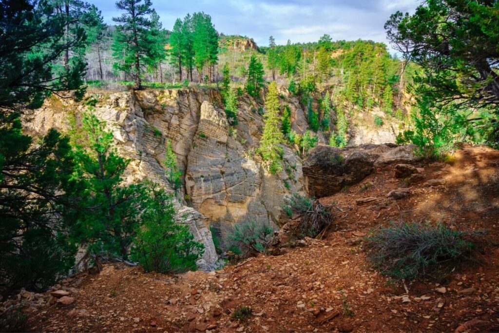
Middle Fork Taylor Creek Trail
- Distance: 2.4 miles / 3.9km one way (4.9 miles / 7.9 km round trip)
- Elevation Gain: 590 feet (180m)
- Estimated Time: 3-5 hours
- Type of Trail: Out and back
- Trailhead Location: Car park just past the Kolob Canyon Visitor’s Center
- Map: All Trails
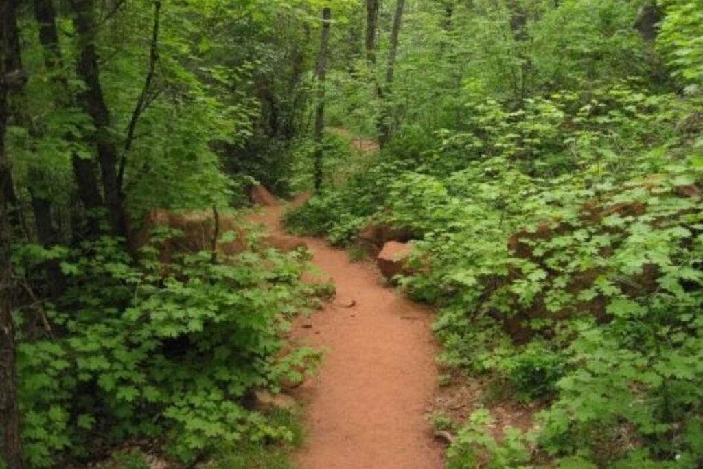
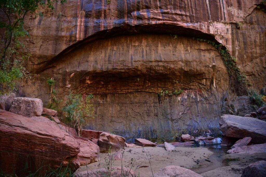
This trail is one of the best-known hikes in Zion National Park and is famous for its red stone and beautiful greenery. The trail starts from the parking lot and then makes its way down to Taylor Creek. The trail stays close to the streambed, and often you will have to cross over the water. However, water levels are often very low at this point unless there has been serious rainfall. At the end of the trail, you will come to the Double Arch Alcove which is the most beautiful part of the hike. With the beautiful red color and lush green scenery, the views here are spectacular. It is possible to hike past this point, but the trail gets increasingly more difficult with overgrown vegetation and the canyon becomes a lot narrower.
Overlook Trail
- Distance: 0.45 mile / 0.8 km one way (0.9 mile / 1.6 km round trip)
- Elevation Gain: 187 feet (57m)
- Estimated Time: 1 hour
- Type of Trail: Out and back
- Trailhead Location: The car park just after the Mount Carmel Tunnel
- Map: All Trails
The Overlook Trail is one of the shortest hikes in Zion National Park but is popular with photographers, hikers, and tourists. The trail is short and not very steep, so makes for a great family hike. The trail starts off with a collection of stone steps that ascend the ridge until the trail becomes relatively flat. As you continue along the trail you will get scenic views into the Pine Creek Narrows and the surrounding canyon. Once you reach the Overlook, you will be able to see the true expanse of Zion National Park. You will get a view of the Beehives, the Streaked Wall, the West Temple, Towers of the Virgins, and the East temple all from this one spot. If you only have a limited amount of time whilst visiting Zion, then make sure this hike is at the top of your list.
Watchman Trail
- Distance: 1.5 miles / 2.5 km one way (3.1 miles / 5 km round trip)
- Elevation Gain: 636 feet (194m)
- Estimated Time: 2-3 hours
- Type of Trail: Out and back
- Trailhead Location: Near Zion Canyon Visitor Center, just across from the shuttle stop.
- Map: All Trails
Although often overlooked, the Watchman Trail is a great hike that is perfect for beginners. The first part of the trail is incredibly easy and takes you along the Virgin River. From there the trail takes a steady incline up a number of switchbacks, which will eventually lead to the overlook. Aside from the stunning view of the valley below, you will also get to see Bridge Mountain and Watchman Tower from here. Once you reach the top of this hike, there is also a scenic 0.3-mile loop trail that you can choose to do. The loop offers great views over the National Park and of Springdale.
Easy Zion Hikes
Grotto Trail
- Distance: 1.2 miles / 2km one way (2.4 miles / 4 km round trip)
- Elevation Gain: 561 feet (171m)
- Estimated Time: 1 hour
- Type of Trail: Out and back
- Trailhead Location: Grotto Picnic area
- Map: All Trails
The Grotto Trail is an easy hike that is used to connect the Grotto picnic area to Zion Lodge. The trail starts out at the Grotto picnic area which is the only picnic area in the main section of Zion National Park. From there the trail is relatively flat throughout as it follows along the canyon floor, and through a wooded meadow. If you want to lengthen your hike you can choose to hike from the finish point at Zion Lodge, and then onto the Emerald Pools before following the Kayenta Trail back to the picnic area. This creates a full loop if you aren’t quite satisfied with the shorter option.
Lower Emerald Pools
- Distance: 0.7 miles / 1.1km one way (1.4 miles / 2.3 km round trip)
- Elevation Gain: 127 feet (39m)
- Estimated Time: 1 hour
- Type of Trail: Out and back
- Trailhead Location: Zion Lodge
- Map: All Trails
The Lower Emerald Pools hike is one of the easiest hikes in Zion National Park. It is a paved trail that is relatively flat making it accessible to wheelchair users. The pools are the perfect spot to relax and cool down after walking in Utah’s heat. This trail is popular with families who have small children, as well as the elderly as it is an easy walk that still boats beautiful views. If you want to lengthen the trail, you can then head up the middle trail. For those who decide to continue from the middle trail, you can reach the upper pool although the trail is more difficult.
Pa’rus Trail
- Distance: 1.7 miles / 2.75 km one way (3.4 miles / 5.5 km round trip)
- Elevation Gain: 157 feet (48m)
- Estimated Time: 1-2 hours
- Type of Trail: Out and back
- Trailhead Location: Watchman campground
- Map: All Trails
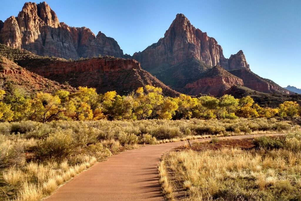
The word Pa’rus translates from a Paiute word meaning “bubbling, tumbling water”. It’s an easy paved trail that follows the Virgin River through Lower Zion Canyon. Although one of the newer hikes, the Pa’rus Trail has become popular due to how accessible the trail is and the beautiful scenery that comes with it. Throughout the trail, you cross over several bridges as it heads through the canyon before ending at canyon junction. As the trail is paved and relatively flat this walk is also accessible to wheelchair users. You will get to see the stunning wildflowers that line this trail and if you’re lucky, you might even come across a mule deer. Pa’rus Trail is the only dog-friendly trail in Zion National Park, so is perfect if you want a day trip with your pooch. It is also the only trail that allows bicycles.
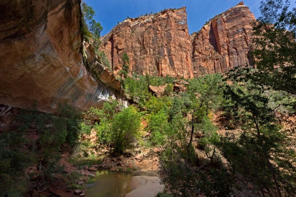
Riverside Walk
- Distance: 0.95 mile / 1.55 km one way (1.9 miles / 3.1 km round trip
- Elevation Gain: 193 feet (59m)
- Estimated Time: 1-2 hours
- Type of Trail: Out and back
- Trailhead Location: Temple of Sinawava
- Map: All Trails
The Riverside Walk is also known as “the gateway to the Narrows”. The trail is a relatively flat and paved path that starts at the Temple of Sinawava and ends at the entrance to the Narrows. Along the way, you’ll be walking in between towering canyons, and will get incredible views of the canyon, the hanging gardens, and the Virgin River. Once you get to the end of the trail, many people choose to spend time exploring the entrance of the Narrows and wade into the mouth of it. Although this trail is only short and won’t take a lot of time, it’s important to allow yourself some extra time to explore the end part of the trail. If you want to lengthen your walk and hike further into the Narrows, you will need to wade up the stream and the hike is much more difficult from this point.
Timber Creek Overlook
- Distance: 0.5 mile / 0.9 km one way (1.1 miles / 1.8 km round trip)
- Elevation Gain: 255 feet (78m)
- Estimated Time: 30 minutes
- Type of Trail: Out and back
- Trailhead Location: Kolob Canyons Viewpoint parking lot
- Map: All Trails
The Timber Creek Overlook Trail follows along a small ridge that offers incredible views of the Kolob Canyons, the Kolob terrace, and the Pine Valley Mountains. Aside from the stunning canyon views, if you hike this trail during spring or summer you will get to see the beautiful desert wildflowers that line this trail. If you do this hike on a clear day, you might even get to see Mt. Trumbull from the overlook. The mountain is located just under 100 miles away in Arizona, so that is pretty impressive. If you only have a short amount of time in Zion National Park then this is a trail not to be missed. The trail is short and there is plenty of parking located at the trailhead, along with picnic tables and bathroom facilities. This makes it the perfect family hike if you are looking for something scenic but relaxing.
Weeping Rock
- Distance: 0.3 mile / 0.5 km round trip
- Elevation Gain: 36 feet (11m)
- Estimated Time: 30 minutes
- Type of Trail: Out and back
- Trailhead Location: The 7th stop on the Zion Canyon Shuttle
- Map: All Trails
Weeping Rock Trailhead is closed due to a rock slide in 2019. This is a long-term closure. (Aka NPS has no money to clear the area and do a stability study on the rockface).
The Weeping Rock trail is short but pretty steep, and narrow. Unfortunately, that means it isn’t recommended for wheelchair users or baby strollers. Weeping Rock is one of the most famous attractions in Zion National Park, and it isn’t hard to see why. The Weeping Rock is an alcove that has been eroded over time by rainfall. Once the water reaches the impermeable rock after the sandstone, it is then forced out the side – hence why it is known as “the Weeping Rock”. The weeping walls are now home to lush green hanging gardens, with a stream running underneath, making for a beautiful sight. Unfortunately, this trail is now closed due to rockfall and is inaccessible.
Frequently Asked Questions about Zion Trails
What is the best hike in Zion National Park?
When it comes to choosing the best hike in Zion National Park, it’s a difficult decision. Some of the best and most popular hikes in Zion include Angels Landing, Observation Point, the Narrows, the Canyon Overlook Trail, and the Emerald Pools Trail. All of these hikes offer something unique but are of various difficulty levels.
Angels Landing is the most iconic hike in Zion National Park but it is probably the most difficult, so isn’t one for beginners. It offers arguably the best view in all of the National Park although the hike to the top is treacherous at best. The trail takes you to an outstanding viewpoint that looks out over the canyon, giving you the opportunity to see for miles. Although the view from the top is magnificent, getting up there is no easy feat.
What is the hardest hike in Zion National Park?
Due to Zion’s sheer drops and steep cliff faces, there are many difficult hikes throughout the National park. Some of the hardest hikes in the National Park include Observation Point and the Narrows, but it is often Angels Landing that takes the top spot. Angels Landing is not only considered to be one of the most dangerous trails in the park but it’s also considered to be one of the most dangerous tails in any National Park across the United States.
At the end of Angels Landing, you will come across the best view of Zion National Park. The viewpoint is surrounded by sheer drop-offs on each side, and if you were to slip you could fall over 1,000 feet before hitting the bottom or cliffside. However, even more, dangerous than the viewpoint at the end of the trail is the hike on the way there. The trail is very narrow, with steep drop off’s and a land bridge that you have to cross. When it comes to crossing the land bridge, there is only a metal chain to hold onto and walkers have just over a foot of trail to walk along before they reach the 1,000 foot drop off on each side.
As you can imagine this hike is not recommended for people with a fear of heights. It’s also important not to attempt this trail during stormy weather or when the trail is wet which may increase your chances of falling.
How difficult are hikes in Zion?
There are a variety of hikes in Zion National Park that suit a range of fitness levels. We have split this article up into easy, moderate, and strenuous hikes so you know exactly where to look for your fitness level and abilities.
Some of the more strenuous hikes in Zion are incredibly difficult and often include bouldering, swimming, canyoneering, or hiking along narrow trails with sheer drops on either side. Unless you are feeling confident and have experience hiking, it’s best not to attempt these hikes first.
However, there are also plenty of trails that are paved, flat, and wheelchair accessible. If you don’t feel confident in your hiking abilities just yet, then it’s best to start out on one of the easier trails. The Pa’rus Trail and the Lower Emerald Pools trail are both easier options within the National Park and are a good place to test your abilities. If you are wanting to try out something a bit more difficult then why not have a go at the Overlook Trail or the Watchman Trail.
Final Thoughts on Day Hiking in the Zion
We hope this article has encouraged you to visit Zion National Park and the many trails that are available. With stunning red sandstone, unique rock formations, and lush greenery, this part of the United States offers dramatic views. If you are trying to decide which National Parks to visit, then make sure this one makes the list. What is your favorite hike in Zion National Park? If yours isn’t on this list, then please leave it in the comments below! If you love all things hiking and outdoors, or simply have a goal to visit as many National Parks as possible, then why not join us in our National Park Trip Planning Community.
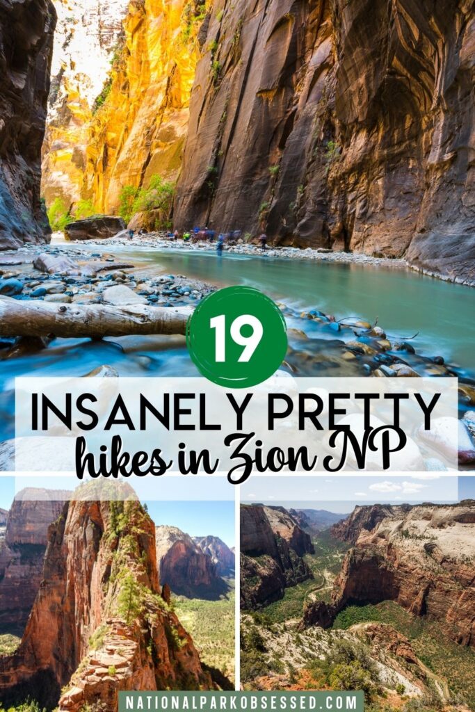
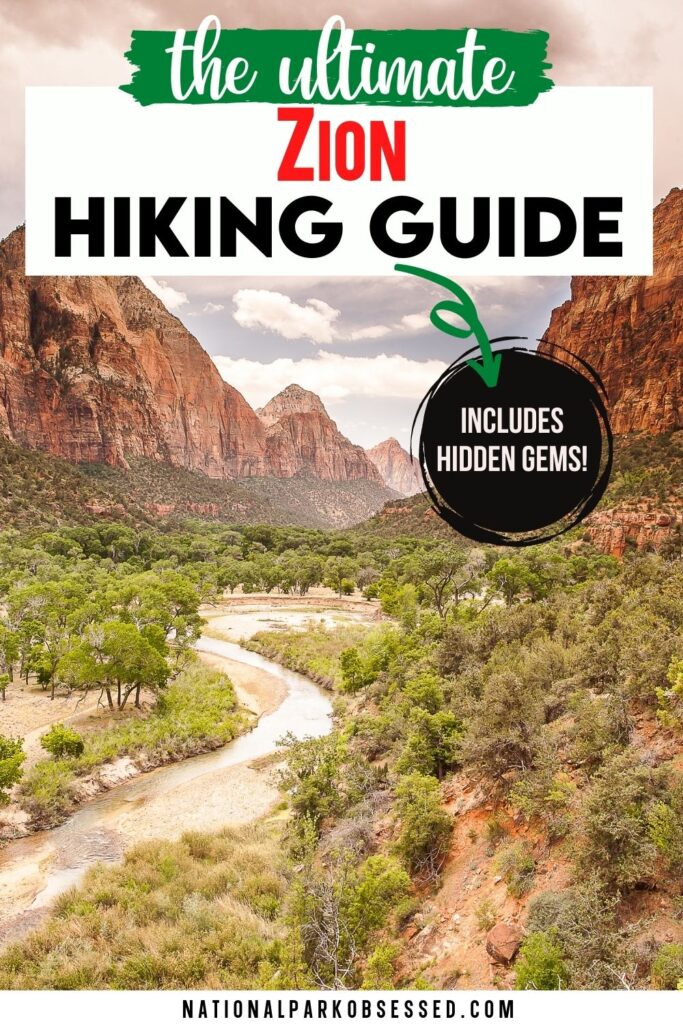
Pin for Later: The 19 ABSOLUTE Best Hikes in Zion National Park for 2022

Hi, I'm Jennifer!

Welcome to the wonderful world of National Parks. I'm here to help you plan your NEXT amazing adventure through the United States National Parks and beyond. I want the national parks to be accessible to all.
I live in Tennessee, and when I'm home, you can find me hiking in the Smokies and the Cumberland Plateau.
58/63 National Parks
250+/423 National Park Units
Want to know more? Start Here.
Snag one of my National Park Ebooks and Downloadable Itineraries

Talk with an Expert

Share your love of the parks with a shirt, ornaments, hoodies, frames, and more.
