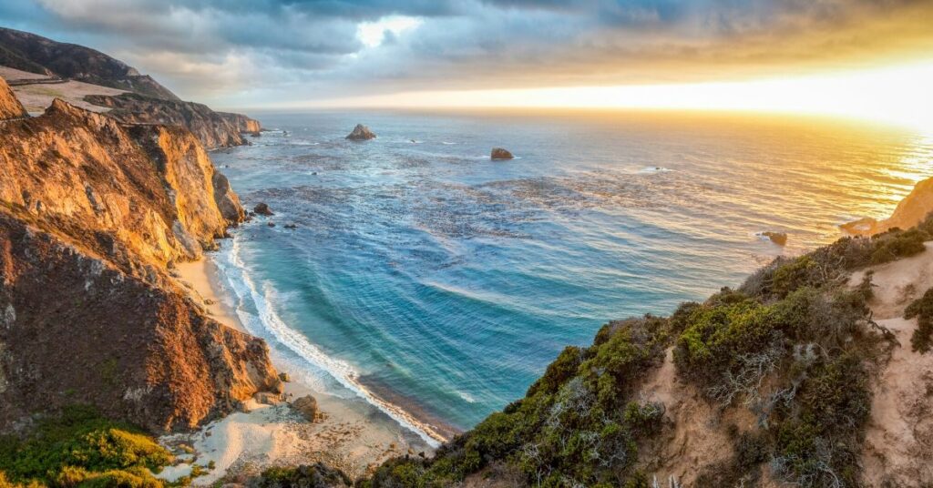
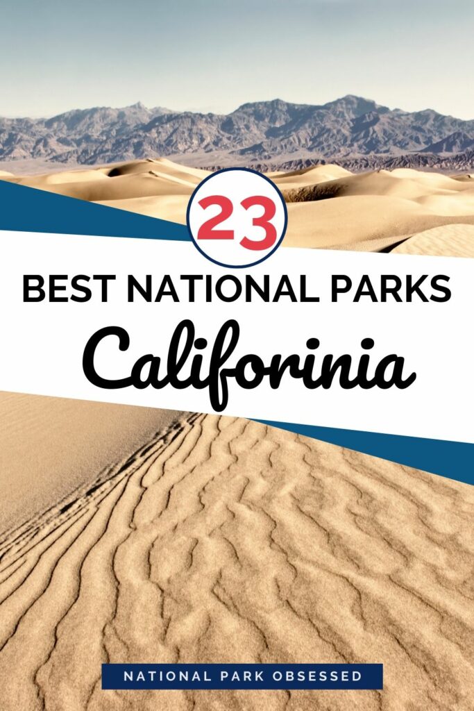
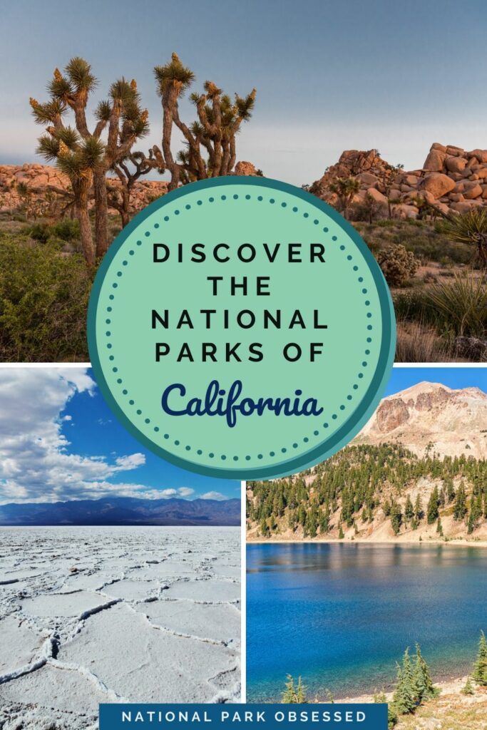
California is a very diverse landscape of coastal communities, deserts, mountain peaks, and vast forests. Known as the “Golden State”, California’s rich economy has created an influx of residents and visitors seeking to leave their mark. There are twenty-eight National Park Service units, nine of them as National Parks. From the creation of the Yosemite Grant Act in 1864 that would lead to the creation of the first National Park, Yellowstone in 1872, to the vast desert phenomenon of Death Valley National Park. California is also home to the most visited National Park Service Unit, the Golden Gate National Recreation Area which takes multiple days to fully visit. Through elements of culture, history, cinema, and recreation, there is something for everyone to enjoy in the National Parks of California.
Help support this site by purchasing one of our National Park Shirts, Poster, and other gear. Every purchase includes a donation to the national parks and helps keep National Park Obsessed’s website free to use and producing more national park guides.
Looking for more help planning your next adventure? Join the National Park Obsessed Facebook Group here to connect other national park lovers, trade advice, or see inspiring photos of the National Parks?
Official National Parks of California
- Cabrillo National Monument
- Castle Mountains National Monument
- César E. Chávez National Monument
- Channel Islands National Park
- Death Valley National Park
- Devils Postpile National Monument
- Eugene O’Neill National Historic Site
- Fort Point National Historic Site
- Golden Gate National Recreation Area
- Alcatraz Island
- John Muir National Historic Site
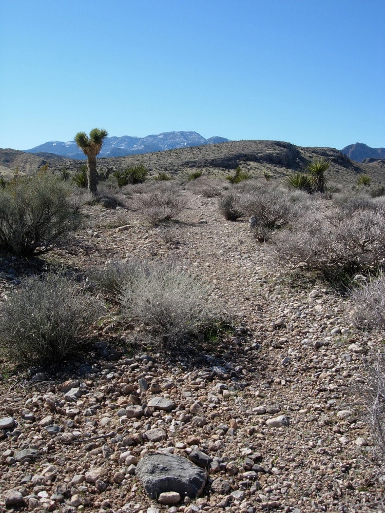
- Joshua Tree National Park
- Kings Canyon National Park
- Lassen Volcanic National Park
- Lava Beds National Monument
- Manzanar National Historic Site
- Mojave National Preserve
- Muir Woods National Monument
- Pinnacles National Park
- Point Reyes National Seashore
- Port Chicago Naval Magazine National Memorial
- Redwood National Park and State Parks
- Rosie the Riveter/World War II Home Front National Historical Park
- San Francisco Maritime National Historical Park
- Santa Monica Mountains National Recreation Area
- Sequoia National Park
- Tule Lake National Monument
- Whiskeytown-Shasta-Trinity National Recreation Area
- Yosemite National Park
Associated sites of California
- California National Historic Trail
- Juan Bautista de Anza National Historic Trail
- Old Spanish National Historic Trail
- Pony Express National Historic Trail
This post may contain affiliate links, meaning if you book or buy something through one of these links, I may earn a small commission at no extra cost to you! Read the full disclosure policy here
National Parks of California Map
[show-map id=”8″]
California National Parks
California is part of the Southwest and West Coast Region.
Cabrillo National Monument
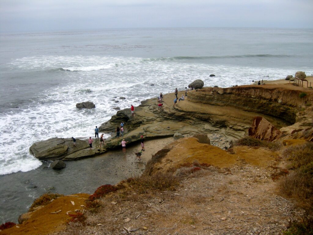
Cabrillo National Monument commemorates the landing of Juan Rodriguez Cabrillo in San Diego Bay on September 28, 1542. This historical landing further commemorates the first time that a European expedition set foot on what would eventually become the West Coast of the country. The world’s first public whale watching lookout point was established here in 1950, which attracted over 10,000 visitors in its first year.
The park contains two popular areas among visitors. The cliffs located adjacent to the Visitor Center provide panoramic views of the San Diego Harbor, Naval Station North Island and Tijuana, along with expansive views of the Pacific Ocean. The tidepools are located along the 1-mile, round-trip Coastal Trail hike. Upon entering the park, a sign marks the turn-off for the parking lot. Attracting more than 215,000 people annually due to its impressive rocky intertidal formations, the area along the cliffs are steep and the trail can range from easy to strenuous from its layout.
Cabrillo National Monument was established on October 14, 1913 but did not become a part of the National Park Service until 1933.
Things to do in Cabrillo National Monument: Hiking, whale watching (during Winter), tidepools, panoramic harbor and ocean views, wildlife views, bird watching.
How to get to Cabrillo National Monument: The monument is located at the southern tip of Point Loma, minutes from downtown San Diego and San Diego International Airport. The monument can be reached by personal car and public transportation, but Rideshare services such as Uber and Lyft are not recommended due to limited cell phone reception in the area.
The San Diego Metropolitan Transit System (MTS) offers bus service including hourly stops daily, (Monday-Friday), at Cabrillo National Monument via Route 84.
Where to Stay in Cabrillo National Monument: There is no lodging available at the monument, however there are plenty of hotel lodging options available in San Diego. The closest RV and tent campground, Campland on the Bay is located seven-miles away in Mission Bay.
Cabrillo National Monument Entrance Fee: $20 per vehicle valid for 7-days
Cabrillo National Monument Official Website: Click Here
Map of Cabrillo National Monument: Download
Castle Mountains National Monument
Castle Mountains National Monument is located next to the Mojave National Preserve along the California/Nevada border. A relatively new unit, the 20,000 acre park is known for its desert forests and rising spires known as the Castle Peaks.
Castle Mountains National Monument was established on February 12, 2016 .
Things to do in Castle Mountains National Monument: Off-road driving, photography, hiking
How to get to Castle Mountains National Monument: The monument is accessible only by a dirt road. It can be reached from several dirt roads off Lanfair Road inside the Mojave National Preserve. Four-wheel drive vehicles with a high clearance are recommended. Do not reply on GPS navigation to get to the park.
Where to Stay in Castle Mountains National Monument: There is no lodging available at the monument, but there are campgrounds at Mid Hills and Hole-in-the-Wall Campgrounds are available on a first-come, first serve basis at the nearby Mojave National Preserve.
Castle Mountains National Monument Entrance Fee: Free
Castle Mountains National Monument Official Website: Click Here
Map of Castle Mountains National Monument: None available
César E. Chávez National Monument
As one of the newest units within the National Park System, the Cesar E. Chavez National Monument is located on the former headquarters of the United Farm Workers of America (UFW) and home to Cesar E. Chavez from the 1970’s until his death in 1993.
Chavez’s leadership led to the establishment of the first U.S. law recognizing farm workers bargaining rights, the California’s Agricultural Labor Relations Act of 1975. A visitor center and the memorial garden where Chavez is buried are open to the public, but many areas are closed to the public.
The National Monument was established on October 8, 2012 by proclamation under the Antiquities Act.
Things to do in Cesar E. Chavez National Monument: Visitor Center, memorial garden where Cesar E. Chavez is buried.
How to get to Cesar E. Chavez National Monument: Located 30-miles East of Bakersfield in the community of Keene off of CA-58.
Where to Stay in Cesar E. Chavez National Monument: The closest lodging options are 8-miles East in the city of Tecachapi or 35-miles West in Bakersfield.
Cesar E. Chavez National Monument Entrance Fee: Free
Cesar E. Chavez National Monument Official Website: Click Here
Map of Cesar E. Chavez National Monument: Download
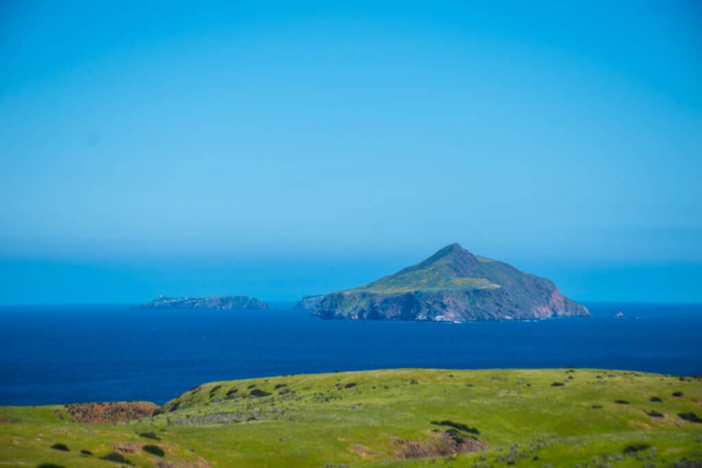
Channel Islands National Park
Located off the coast of California, the Channel Islands National Park consists of five of the eight Channel Islands – Anacapa, Santa Barbara, Santa Cruz, Santa Rosa and San Miguel island.
Each island provides a unique experience for its visitors – Anacapa provides impressive views of the other islands from Inspiration Point, while Santa Cruz offers unique kayaking and beach experiences from Scorpion Beach.
There are no services available, so you must pack-out what you packed-in with you.
Channel Islands National Park was established on March 5, 1980. Anacapa and Santa Barbara islands were originally a designated a national monument on April 26, 1938.
Things to do at Channel Islands National Park: Hiking, kayaking, overnight camping, bird watching, diving, whale watching, tidepooling, visitor center
How to get to Channel Islands National Park: Transportation to the islands is accessible by boat and can range from 1-hour to 3-hours in length depending on the island destination. Island Packers provides daily roundtrip transportation to Anacapa Island and Santa Cruz Island from their locations in Oxnard harbor and Ventura harbor.
Where to Stay in Channel Islands National Park: Camping is available year-round on all of the islands. Campers must pack-in and pack-out all of their gear, trash included. Advanced reservations are required along with a $15.00 per-night-per site fee. Due to limited space on the concession boats, campers must secure transportation reservations prior to camping reservations.
Channel Islands National Park Entrance Fee: Free
Channel Islands National Park Official Website: Click Here
Map of Channel Islands National Park: Download
Get help planning your trip to Channel Islands National Park:
- National Parks of California
- The Ultimate Guide to Camping in Channel Islands National Park
- 14 Things Not to Miss on Your First Visit to Channel Islands National Park
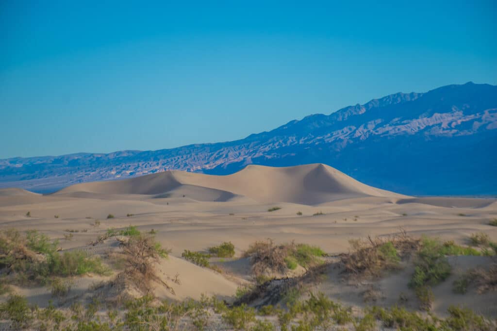
Death Valley National Park
Death Valley is the largest National Park in the contiguous United States. Made-up of an area that is 91% wilderness, national park provides visitors with many unique activities along its boundaries. Badwater Basin, the lowest point in North America lies near the southwestern area of the park, a short drive from the city of Baker, California.
Nearby are the popular hiking trails through Golden Canyon, Mosaic Canyon and Natural Bridges Canyon. Scotty’s Castle, Racetrack Playa and the Ubehebe Crater are located in the northern most are of the park.
The fictional planet of “Tatooine” in the Star Wars universe, the park attracts fans desiring to visit the locations seen in the movie.
Due to the extreme heat experienced during the summer months, the park has the highest number of visitors between the winter and fall seasons. In March, the park can experience a super bloom of wildflowers, dependent on the volume of rain received the previous year.
Death Valley National Park was originally established as National Monument on February 11, 1933 before becoming a National Park on October 31, 1994.
Things to do at Death Valley National Park: Hiking, sand dune sledding, photography, astronomy, backpacking, biking, scenic driving, canyon exploring, military jet watching
How to get to Death Valley National Park: Traveling to Death Valley National Park is accessible from Entrance Stations in the West, East and South boundaries. Visitors arriving from the Los Angeles area can access the Southern entrance near the city of Baker after exiting the I-15. If you’re arriving from the West, CA-178 heads East into the park, the nearest major city is Ridgecrest, CA. To the East is the entrance near historic Ryholite Ghost Town and the community of Beatty, NV.
The nearest major airport, McCarran International Airport (LAS) is located 2-hours 15-minutes to the East in Las Vegas
Where to Stay in Death Valley National Park: There are several lodging options available year-round within the park near the Furnace Creek Visitor Center.
Stovepipe Wells, the original resort in the park offers lodging and fully capable RV hookups available. A gift shop, National Park Service ranger station and a fully operational store are located onsite.
The Ranch at Death Valley, formerly the Furnace Creek Ranch provides private motel lodging. A large gift shop is located near the entrance along with dining options at the 1849 Buffet and The Last Kind Words Saloon.
The crown-jewel of lodging is the Inn at Death Valley. The AAA-rated four-diamond resort ushers in the elegance of Old Hollywood atmosphere complemented by its stunning outdoor pool and fine dining at The Inn at Death Valley.
Lodging options are also available outside of the park. 45-minutes East of Furnace Creak in Beatty, NV at the Stagecoach Hotel and Casino. Due to its close proximity to the park, reservations in advance are recommended.
Death Valley National Park Entrance Fee: $30 per vehicle valid for 7-days
Death Valley National Park Official Website: Click Here
Map of Death Valley National Park: Download
Get help planning your Death Valley National Park Trip
- National Parks of California
- National Parks of Nevada
- Death Valley Jeep Rental – Farabee’s Jeep Review
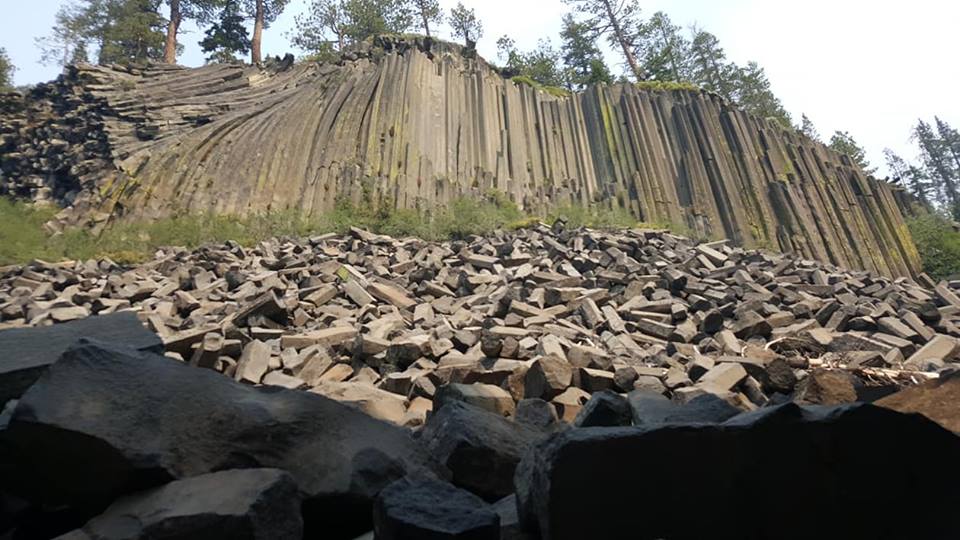
Devils Postpile National Monument
Located in the Sierra Nevada near the resort of Mammoth Mountain, Devils Postpile National Monument is an unusual formation of basalt columns. Created by lava flow nearly 100,000 years ago, the columns appear as stacked posts up-to 60-feet tall and 2-feet wide. A moderate uphill trail near the base of the allows visitors to experience the monument from the top of its columns.
Continuing down the trail for two-miles, Rainbow Falls plunges 100-feet into the water below.
Devils Postpile National Monument was created on July 6, 1911 through persuading efforts by several of California’s most prominent including John Muir to prevent a hydroelectric dam being constructed in the area..
Things to do at Devils Postpile National Monument: Hiking, camping, photography, fishing, wildlife viewing, waterfall viewing
How to get to Devils Postpile National Monument: The Reds Meadow/Devils Postpile Shuttle departs from the front of the Mammoth Mountain Adventure Center on a 16-mile, one-way trip down the mountain to the parking lot. The monument is a 1/4 mile walk from the ranger station.
Where to Stay in Devils Postpile National Monument: A small campsite is located within the monument that is a first-come-first serve campground. RV and campers are permitted as long as they don’t exceed 25-feet. Should camping not suit you, multiple resorts and lodges are located within the Mammoth Mountain Village area where the shuttle departs for the monument.
Devils Postpile National Monument Entrance Fee:
Day Passes are available at the Mammoth Mountain Adventure Center for $8.00 per Adult, $4.00 per Child (3-15), Children 2 and under are free. Day Passes include roundtrip transportation on the Reds Meadow/Devils Postpile Shuttle.
Devils Postpile National Monument Official Website: Click Here
Map of Devils Postpile National Monument: Download
Eugene O’Neill National Historic Site
The Eugene O’Neill National Historic Site preserves the Tao House, home to America’s only Nobel Prize winning playwright. Using the prize money, Eugene O’Neill and his wife personally designed the house from their interest in Asian art and decor.
Through fundraising efforts, the house and the 13-acres it lies on was saved from demolition in the early 1970’s.
The Eugene O’Neill National Historic Site was established on October 12, 1976.
Things to do at Eugene O’Neill National Historical Site: Ranger guided tours, walking trails along the property
How to get to Eugene O’Neill National Historical Site: Tours aboard a National Park Service vehicle begin from the Museum of the San Ramon Valley in Danville. There is no public transportation or private vehicles allowed on the property.
Where to Stay in Eugene O’Neill National Historical Site: While there is no lodging available on property, there are multiple lodging choices nearby in Danville.
Eugene O’Neill National Historical Site Entrance Fee: Free. Guided tours of the house must be reserved at least two weeks in advance. Tours are offered on Wednesdays, Thursdays, Fridays and Sundays at either 10:00 AM or 2:00 PM. Tours include roundtrip transportation.
Self-Guided Tours are offered on Saturdays at 10:15 AM, 12:15 PM and 2:15 PM on a first-come, first-served basis.
Eugene O’Neill National Historical Site Official Website: Click Here
Map of Eugene O’Neill National Historical Site: Download

Fort Point National Historic Site
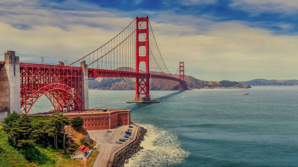
Located beneath the Golden Gate Bridge, Fort Point National Historic Site is a historic fort predating the Civil War created to defend San Francisco against hostile warships. It was constructed between 1853 and 1861 by the U.S. Army Engineers.
The park has a rich history in entertainment from previous decades. A scene from Alfred Hitchcock’s masterpiece, ‘Vertigo’ was filmed at the site along with The Amazing Race Season 16 and Dawn of the Planet of the Apes.
Fort Point National Historic Site was established October 16, 1970.
Things to do at Fort Point National Historic Site: Guided tours, museum, bookstore, exhibits, panoramic city views
How to get to Fort Point National Historic Site: Getting to the site can be trick and GPS navigation can provide assistance. Arriving from San Francisco, exit the US-101 North right before the Golden Gate Bridge Toll Plaza and follow the signs down the hill to the site. It is located at the end of Marine Drive.
Where to Stay in Fort Point National Historic Site: There is no lodging at the site, however there are plenty of options only minutes away in San Francisco.
Fort Point National Historic Site Entrance Fee: Free
The site is open Friday through Sunday from 10:00 AM – 5:00 PM.
Fort Point National Historic Site Official Website: Click Here
Map of Fort Point National Historic Site: None Available
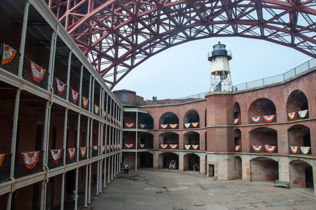
Golden Gate National Recreation Area
Golden Gate National Recreation Area is an expansive collection of areas located within San Francisco, San Mateo County and Marin County.
Over 30-years, the National Park Service acquired land and historic sites beginning with Alcatraz Island and Fort Mason, incorporating them into the Golden Gate National Recreation Area.
Established on October 27, 1972, it is the most visited National Park Service site with over 15-million annual visitors.
Things to do at Golden Gate National Recreation Area: Alcatraz Island, Muir Woods National Monument, Marin Headlands, the Presidio of San Francisco, Lands End, Crissy Field
Alcatraz Island
Alcatraz Cruises departs from Pier 33 Alcatraz Island in San Francisco, providing roundtrip ferry transportation to the island and “Doing Time: Alcatraz Island Cellhouse Audio Tour.” Due to its popularity, tickets should reserved be in advance for both the daytime and evening tours. Learn about the storied history of the island while visiting the famous cellblock that once housed Al Capone and “Machine Gun” Kelly. While on “the rock”, visitors can experience the locations made famous in 1979’s ‘Escape from Alcatraz’ staring Clint Eastwood.
The Presidio of San Francisco
The Presidio of San Francisco is a former U.S. military reservation and park consisting of 2,347 square miles and was fortified on September 17, 1776 along the northern tip of San Francisco. The San Francisco National Cemetery, Walt Disney Family Museum, and Lucasfilm’s headquarters are located here.
How to get to Golden Gate National Recreation Area: The Recreation Area is located within the counties of San Francisco, Marin and San Mateo. They can be reached by Highways 1, 80, 101 and 280. The closest airports are Oakland International Airport (OAK) and San Francisco International Airport (SFO).
Public Transportation is available from the Cable Car System, Muni Trains and Bus Lines.
Where to Stay in Golden Gate National Recreation Area: There are numerous options within the San Francisco Bay area.
Golden Gate National Recreation Area Entrance Fee: Alcatraz Island, Muir Woods National Monument, Kirby Cove and the Presidio all assess their own fees for transportation and entrance. Please see the official website below for pricing.
Golden Gate National Recreation Area Official Website: Click Here
Map of Golden Gate National Recreation Area: Download
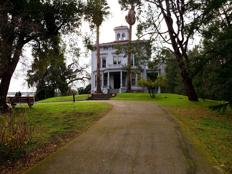
John Muir National Historic Site
The John Muir National Historic Site illustrates the life of America’s favorite naturalist and conservationist whose work led to the creation Yosemite, Sequoia, Grand Canyon and Mt. Rainer as National Parks. The house built by Muir’s father-in-law, Dr. John Strentzel in 1862 is a 17-room wooden Victorian mansion.
Upon entry into the “big house”, visitors are greeted by a park ranger who provides a brief historical overview of the house. From the impressive dining room on the first floor, to Muir’s study on the second floor and up to the stairway accessible attic, there is plenty for everyone to enjoy.
The John Muir National Historic Site was August 31, 1964.
Things to do at John Muir National Historic Site: Guided ranger tours, cell phone tour of the grounds, Martinez Adobe, hiking, picnicking
How to get to John Muir National Historic Site:
From San Francisco: I-80 E (Oakland-San Francisco Bay Bridge) to CA-4 E, exit at Alhambra Avenue. Visitor Center is on the left side of the street.
Public Transportation: BART’s Concord Station is the closest stop. From there, transfer to The County Connection #16 bus that stops at the park.
Where to Stay in John Muir National Historic Site: There is lodging within walking distance of the site in Martinez. It is also within short driving distance of San Francisco, Oakland and Berkeley.
John Muir National Historic Site Entrance Fee: Free
John Muir National Historic Site Official Website: Click Here
Map of John Muir National Historic Site: Download
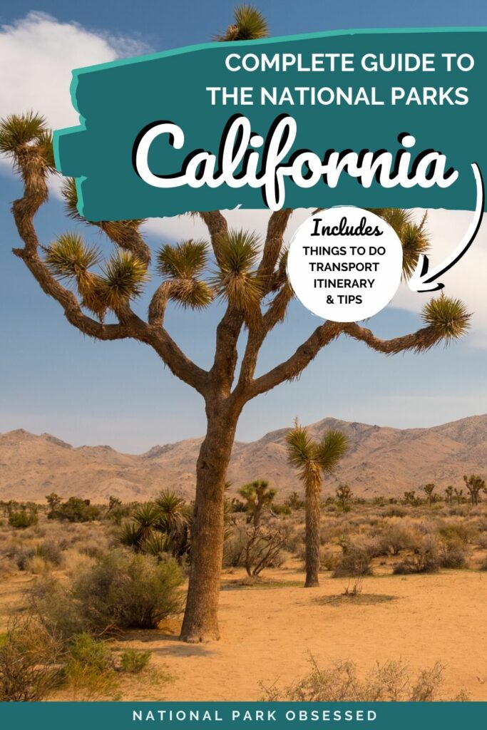
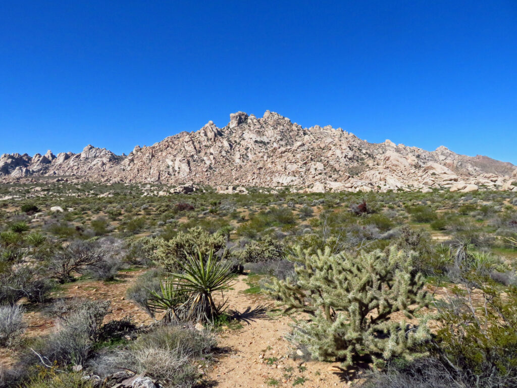
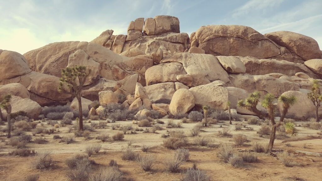
Joshua Tree National Park
Joshua Tree National Park is made-up of the Mojave Desert and Colorado Desert and is a popular weekend getaway for those living in Los Angeles and San Diego counties with three visitor centers open year-round. Slightly larger than the state of Rhode Island, the park is home to Joshua Tree forests and large rock formations that are popular among rock climbers.
Park visitors fill-up the campgrounds and popular hiking trails such as Skull Rock during the cooler Spring months. Keys View. on the eastern boundaries of the park is an observation point notable for sunset viewing opportunities of the Coachella Valley and Mt. San Jacinto, home to the Palm Springs Aerial Tramway. The park is also famous for astronomy and stargazing for views of the Milky Way on clear evenings.
Joshua Tree National Park was originally declared a national monument in 1936, it was redesignated as a national park on October 31, 1994.
Things to do at Joshua Tree National Park: Hiking, rock climbing and rappelling, camping, horseback riding, stargazing, night photography, wildlife and wildflower viewing, sunset viewing
How to get to Joshua Tree National Park: Joshua Tree National Park is located near the towns of Palm Springs, Indio and Twentynine Palms. The closest airport is Palm Springs Airport. Accessing any of the three park entrances from the I-10 or CA-62.
Where to Stay in Joshua Tree National Park: There are nine campgrounds located within the park. Reservations are required for the majority of the 500 campgrounds in the park between September-May. Reservations can be booked up to 6-months in advance.
Additionally, there are four first-come, first-serve campgrounds: Belle, Hidden Valley, Ryan and White Tank are available from September-May for $15.00 per night by cash or check.
Joshua Tree National Park Entrance Fee: $30.00 per vehicle valid for 7-days
Joshua Tree National Park Official Website: Click Here
Map of Joshua Tree National Park: Download
Get help planning your trip to Joshua Tree National Park
- National Parks of California
- All about Joshua Tree National Park
- One Day in Joshua Tree National Park
- 10 Things to Miss on Your First Visit to Joshua Tree National Park
- The Ultimate Guide to Camping in Joshua Tree National Park
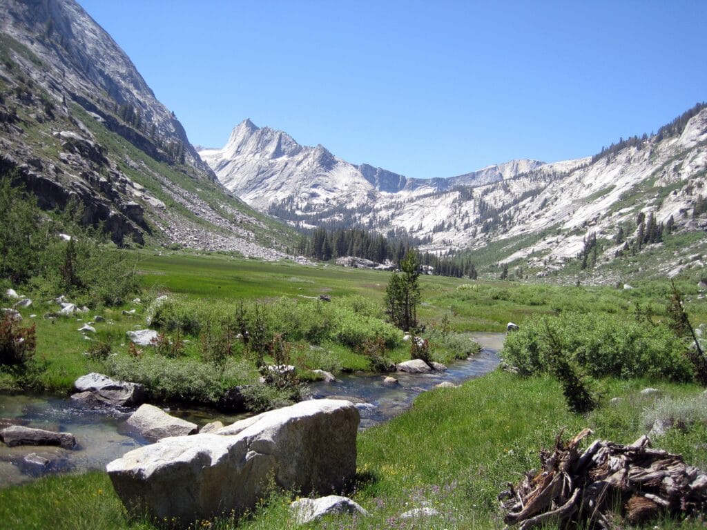
Kings Canyon National Park
Kings Canyon National Park was the 4th National Park established in the US.
Located above Sequoia National Park, it is the least accessible of the parks but rich in hiking trails, most notably the combined Pacific Crest and John Muir Trail which traverses the entire park. The park contains two tourist locations: Grant Grove, home to the General Grant Tree, the second largest tree in the world by volume and Cedar Grove. Two visitor centers are located at Grant Grove and Cedar Grove. The only vehicle entrance to the park is also located at Grant Grove.
Kings Canyon National Park was originally created as General Grant National Park on October 1, 1890, predating the establishment of the National Park Service.
On March 4, 1940, President Franklin D. Roosevelt established Kings Canyon National Park, adding the original General Grant National Park to its boundaries.
Things to do at Kings Canyon National Park: Grant Grove, Cedar Grove, hiking, backpacking, climbing, fishing
How to get to Kings Canyon National Park: The nearest major city is Fresno, located to the West of the Big Stump Entrance Station. CA-180 E from Fresno is the easiest route and less steeper and wider.
Where to Stay in Kings Canyon National Park: The John Muir Lodge and Grant Grove Cabins are open year-round, while the Cedar Grove Lodge is open from spring through fall.
Kings Canyon National Park Entrance Fee: $35.00 per vehicle valid for 7-days to Kings Canyon and Sequoia National Park
Kings Canyon National Park Official Website: Click Here
Map of Kings Canyon National Park: Download
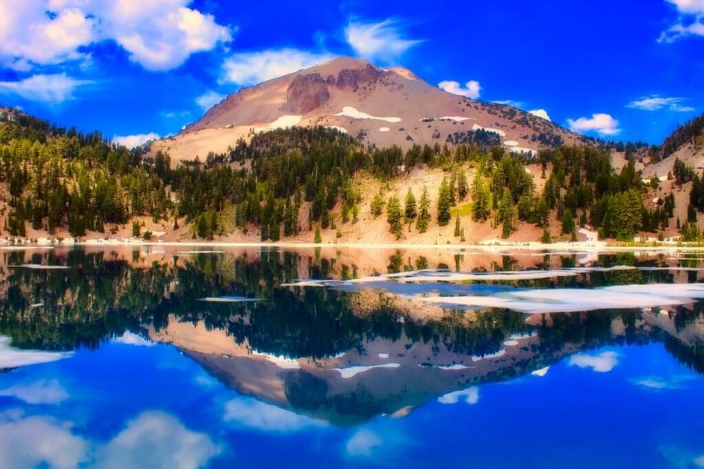
Lassen Volcanic National Park
Lassen is open everyday and it experiences all four seasons throughout the year. Spring and Summer see the higher amount of park visitors, while park access and roads are limited from December – March. Only one gas station is located within the park near the Manzanita Lake Campground, open from mid-May through mid-October.
Hydrothermal areas are located throughout the park for visitors to enjoy. A three-mile roundtrip hike takes you through Bumpass Hell, a 16-acre bowl of mudpots, boiling pools and roaring steam vents. The popular location is accessible by a boardwalk.
Lassen Volcanic National Park originally began in 1907, designated as two monuments, Cinder Cone National Monument and Lassen Peak National Monument before becoming a National Park in August 1916.
Things to do at Lassen Volcanic National Park: Day hiking, backpacking, stargazing, parkcaching, fishing, boating, hydrothermal areas
How to get to Lassen Volcanic National Park: Located in Northern California, the park is 3-hours Northeast of Sacramento. CA-44 E from the North and CA-36 E from the South access the park from the I-5 freeway.
Where to Stay in Lassen Volcanic National Park: Drakesbad Guest Ranch is the only lodging available within the park. Reservations are available early-June through early-October.
There are 8 campgrounds located within the park. Juniper Lake and Southwest Walk-In are first-come, first-serve only, while the remaining 6 campgrounds offer reservations and first-come, first-serve sites.
Lassen Volcanic National Park Entrance Fee: $30.00 per vehicle valid for 7-days
Lassen Volcanic National Park Official Website: Click Here
Map of Lassen Volcanic National Park: Download
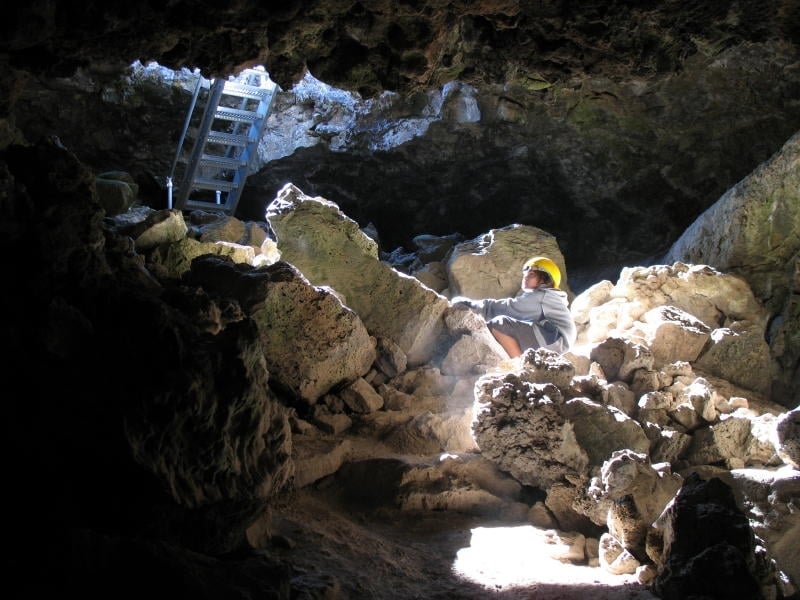
Lava Beds National Monument
Lava Beds National Monument is a rugged landscape created from volcanic eruptions for over a half-million years. Located in a very remote area of Northeastern California near the border with Oregon.
The park provides 13 hiking trails, 28,000 acres of wilderness, over 800 caves and the historical battlefield from the Modoc War for visitors to enjoy.
Lava Beds National Monument was established on November 21, 1925.
Things to do at Lava Beds National Monument: Hiking, cave tours (reservations required), ranger programs
How to get to Lava Beds National Monument: The nearest major town is Klamath Falls, Oregon, 50-minutes to the North via Highway 39. The closest major airport is located in Reno, NV, four-hours to the Southeast. Locating a gas station can be a challenge, the nearest one is located over 1-hour from the park.
Where to Stay in Lava Beds National Monument: Indian Well Campground contains 43 camping sites on a first-come, first-serve basis. They are available for $10.00 per night.
Lava Beds National Monument Entrance Fee: $25.00 per vehicle good for 7-days
Lava Beds National Monument Official Website: Click Here
Map of Lava Beds National Monument: Download
Manzanar National Historic Site
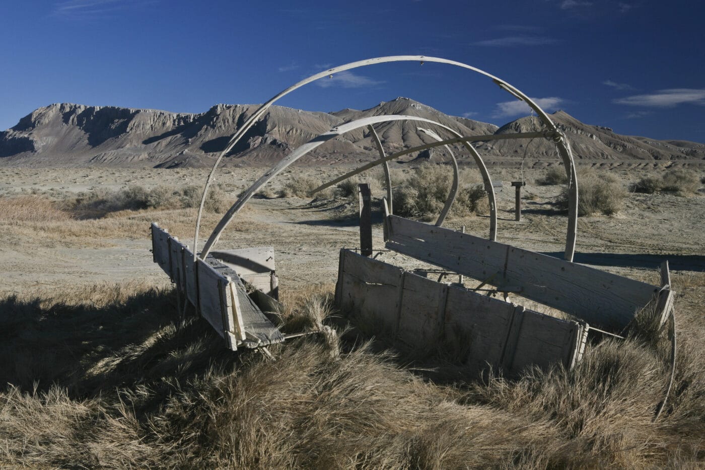
Manzanar National Historic Site is the best preserved and well known of the ten WWII internment camps. Located near Lone Pine, California at the base of Mt. Whitney, more than 120,000 Japanese Americans were incarcerated here from December 1942 – 1945.
Long before its associated history with WWII, the community of Manzanar was was a ranchers paradise, resulting in successful farming until it was abandoned in 1929 from lack of available resources required for sustainability.
The Visitor Center, housed in the restored Manzanar High School Auditorium provides park visitors a through introduction of Manzanar through extensive exhibits, bookstore and a 22-minute film, “Remembering Manzanar.” Visitors can also walk or drive the 3.2 self-guided tour which includes Block 14 (a reconstructed residential block), Merritt Park and the cemetery monument. To this day, several burials remain at the monument.
Manzanar National Historic Site was established on March 3, 1992.
Things to do at Manzanar National Historic Site: Visitor center, Block-14, cemetery, self-guided auto tour
How to get to Manzanar National Historic Site: Manzanar National Historic Site is located off I-395, two-hours south of Mammoth Mountain.
Where to Stay in Manzanar National Historic Site: While there is no lodging available at the site, the city of Lone Pine is 11-miles South.
Manzanar National Historic Site Entrance Fee: Free
Manzanar National Historic Site Official Website: Click Here
Map of Manzanar National Historic Site: Download
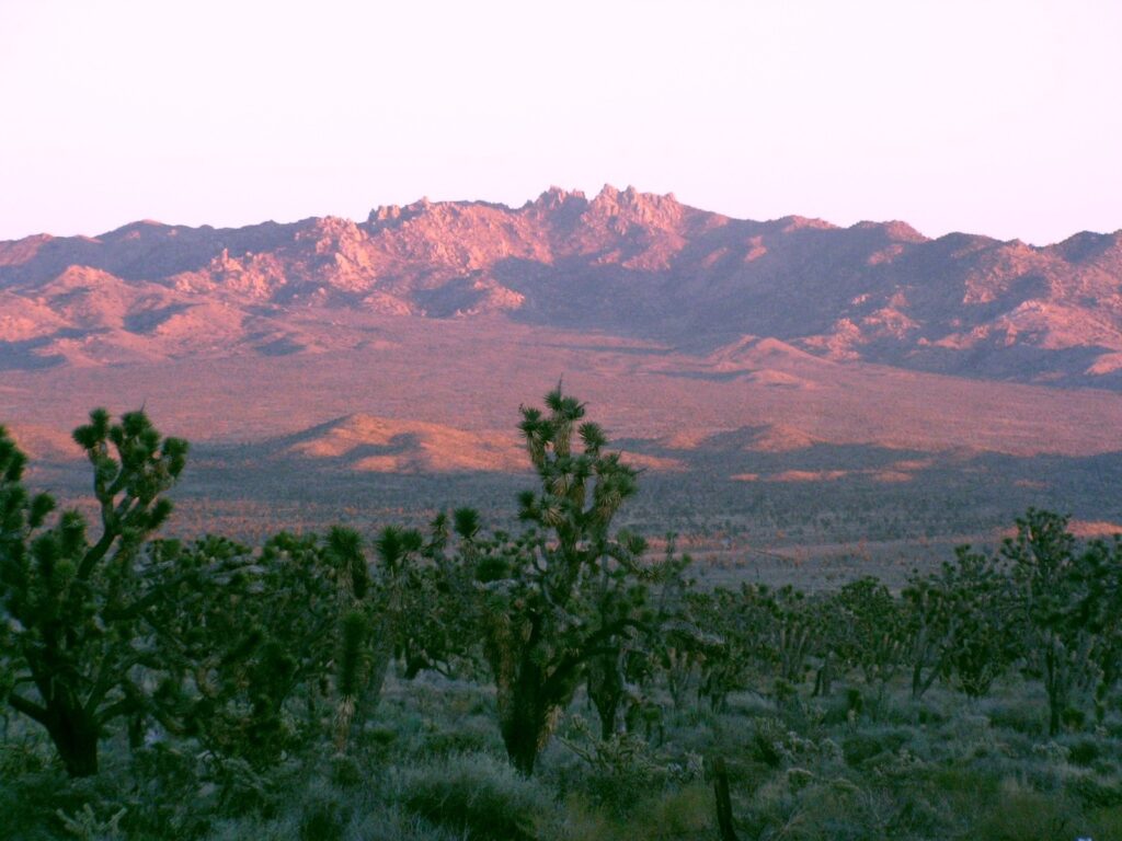
Mojave National Preserve
Mojave National Preserve is the 3rd largest National Park Service unit in the contiguous US at 1,542,776 acres located east of Baker, CA.
The Kelso Dunes dominate the skyline for miles, standing 650 feet tall at their highest point that can be seen in the distance from the I-15. The ghost town and defunct railroad depot of Kelso is located within the park boundaries at its height in the 1940s during the nearby gold, silver, borax, and iron mining. The railroad depot houses the official Visitor Center a few minutes from the Kelso Dunes.
For anyone looking for adventure, the eastern portion of the park contains volcanic formations, most notably the Cima volcanic fields containing 40 cinder cones and the 1.3 mile Rings Loop Trail.
The Mojave National Preserve was established on October 31, 1994.
Things to do at Mojave National Preserve: Backpacking, camping, sand dunes, hiking, horseback riding, wilderness
How to get to Mojave National Preserve: The preserve is located east of Barstow and is accessible by exiting the I-40 or I-15 highway off Kelbaker Road.
Where to Stay in Mojave National Preserve: There are two developed, family style campgrounds within the preserve that are available year-round. Mid Hills and Hole in the Wall campgrounds are first-come, first-served for $12.00 per night.
Mojave National Preserve Entrance Fee: Free
Mojave National Preserve Official Website: Click Here
Map of Mojave National Preserve: Download
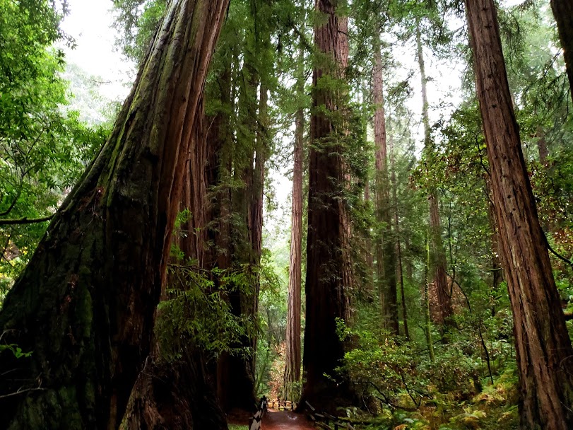
Muir Woods National Monument
Muir Woods National Monument is named for John Muir, a naturalist whose environmental campaigns helped to establish the National Park Service is located 12-miles north of San Francisco.
The first monument created from the donation of private land in 1908, it protects 540 acres, the majority being coastal redwood
Visiting Muir Woods National Monument requires visitors to purchase a parking or shuttle pass in advance of their arrival. These fees are separate from the entrance fee into the monument and are scheduled in 30-minute increments.
Please also keep in mind that there is no cell phone service or WIFI available at the monument, therefore, it is suggested download your parking reservation or shuttle pass in advance.
Muir Woods National Monument was established on January 9, 1908.
Things to do at Muir Woods National Monument: Hiking, photography, Junior Ranger program
How to get to Muir Woods National Monument:
Muir Woods is located 12-miles North of San Francisco. Coming from San Francisco, cross the Golden Gate Bridge (US-101 N) to the Mill Valley/Highway 1 exit and follow the signs to Muir Woods.
Parking at Muir Woods: $8.50 for standard vehicles, $30.00 for medium vehicle and $45.00 for large vehicles.
Shuttle Reservations: $3.25 per adult round trip transportation (16 years and older). Children 15 years and younger are free. The Muir Woods Shuttle serves three off-site locations in Sausalito and Mill Valley. Additional information can be located here.
Where to Stay in Muir Woods National Monument: There is no lodging available at the monument, but there are plenty of options nearby in San Francisco and Oakland.
Muir Woods National Monument Entrance Fee:
$15.00 – Adults (16 years and older)
Children 15 year and under are free
Muir Woods National Monument Official Website: Click Here
Map of Muir Woods National Monument: None Available
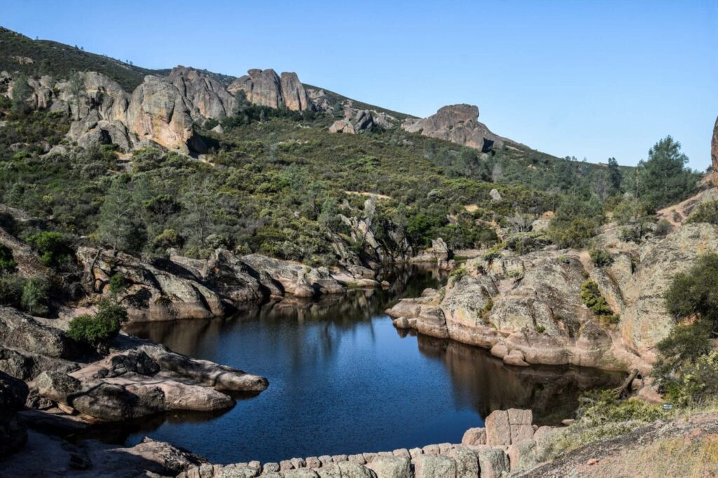
Pinnacles National Park
Pinnacles National Park is the smallest national park in California.
The Pinnacles are part of the Neenach Volcano that were split away during an eruption along the San Andreas Fault 23-million years ago near the city of Lancaster, 200-miles to the south.
30-miles hiking trails are located within the park boundaries ranging from moderate to strenuous. Pinnacles offers a variety of challenging climbing activities for experienced climbers. Visitors looking to explore the seasonal Bear Gulch Cave and Balconies Cave should check the official park website prior to their visit.
Originally a monument established by President Theodore Roosevelt in 1908, it was redesignated as a national park on January 10, 2013.
Things to do at Pinnacles National Park: Hiking, Bear Gulch Reservoir, Talus Cave, Bear Gulch Cave, Condor Gulch Overlook
How to get to Pinnacles National Park: The park is accessible through the west and east entrance stations. There are no connecting roads in the park.
West Entrance (Contact Station): Take the US-101 into the town of Soledad, CA and then merge CA-146 for 14-miles East until reaching the Contact Station. Please be aware that the highway merges into a one-lane road and can be tricky to navigate.
East Entrance (Visitor Center): Take the US-101 South if coming from the San Francisco Bay area to the CA-25 South to the CA-146. If approaching from the South, take the US-101 North to the CA-198 E, CA-25 North to CA-146.
Please remember that there are no connecting roads in the national park. There is also no public transportation in the park.
Where to Stay in Pinnacles National Park: Pinnacles Campground is located on the east side of the park. The campground offers tent and RV sites with coin-operated showers, dumping station and water. The Campground Store is open daily from 9:30 AM – 5:00 PM. Sites can be reserved up-to six months in advance.
Pinnacles National Park Entrance Fee: $30.00 per vehicle valid for 7-days
Pinnacles National Park Official Website: Click Here
Map of Pinnacles National Park: Download
Get help planning your trip to Pinnacles National Park
Point Reyes National Seashore
Point Reyes National Seashore combines panoramic cliff views, sandy beaches and hiking trails for everyone to enjoy. Attracting over 2.5 million visitors annually, Point Reyes National Seashore was established after a 1962 bill to protect the coastline from development.
Located along the westernmost part of the Point Reyes Headlands, the Point Reyes Lighthouse attracts whale watchers from mid-January through late March. Due to its location, parking can be limited and fill-up early in the day. The visitor center and observation deck are located near the parking lot, while the lighthouse is located 900-feet beyond it at the end of a steep staircase.
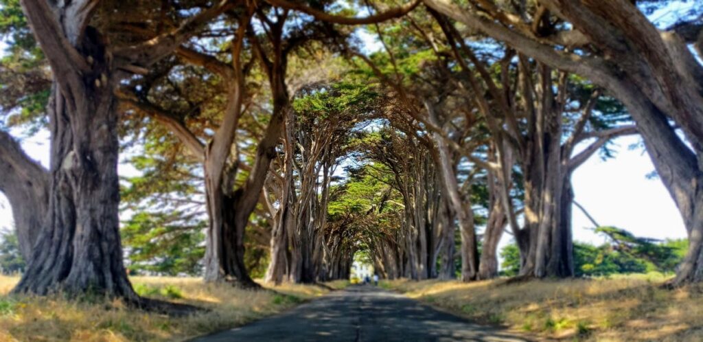
The Cypress Tree Tunnel and KPH Maritime Radio Receiving Station. are also located within the park. The tunnel is a popular location among photographers during sunrise and sunset. The receiving station is a historic structure constructed in the early 1900’s that has been restored and functional.
Point Reyes National Seashore was established on September 13, 1962.
Things to do at Point Reyes National Seashore: Alamere Falls, Chimney Rock, Cypress Tree Tunnel, Point Reyes Lighthouse, Tomales Point, Hiking, Wildlife Viewing
How to get to Point Reyes National Seashore: Located 1-hour North of San Francisco, the park can be accessed by taking US-101 N across the Golden Gate Bridge to Sir Francis Drake Blvd to US-1, and then proceed on Bear Valley Road.
Where to Stay in Point Reyes National Seashore: Hostelling International USA-Point Reyes is the only lodging available in the park. It is dormitory style accommodations open year-round.
Backcountry hike-in campgrounds, Glen Campground, Coast Campground, Sky Campground and Wild Campground are located in the valley and atop bluffs. Each campground site can hold up-to six people.
Point Reyes National Seashore Entrance Fee: Free
Point Reyes National Seashore Official Website: Click Here
Map of Point Reyes National Seashore: Download
Port Chicago Naval Magazine National Memorial
Located inside the Concord Naval Weapons Station, the Port Chicago Naval Magazine National Memorial recognizes the 320 sailors and civilians killed on during the Port Chicago munitions disaster on July 17, 1944. Known as the largest domestic loss of life during WWII, its aftermath led to the largest mutiny in US Navy history.
Port Chicago Naval Magazine National Memorial was established on October 28, 1992.
Things to do at Port Chicago Naval Magazine National Memorial: Guided tour of the memorial
How to get to Port Chicago Naval Magazine National Memorial: All visitors are shuttled from John Muir National Historic Site and must be there by 12:30 PM on the day of their visit.
John Muir National Historic Site
4202 Alhambra Ave
Martinez, CA 94553
Where to Stay in Port Chicago Naval Magazine National Memorial: The cities of Martinez and Concord are closest to the John Muir House.
Port Chicago Naval Magazine National Memorial Entrance Fee:
Reservations are required to visit the memorial on Thursdays, Fridays and Saturdays. They must be reserved at least two weeks in advance through the park’s official email or telephone number. Visitors must submit their full legal name, phone number, date of birth and government issued identification number.
Port Chicago Naval Magazine National Memorial Official Website: Click Here
Map of Port Chicago Naval Magazine National Memorial: Not available
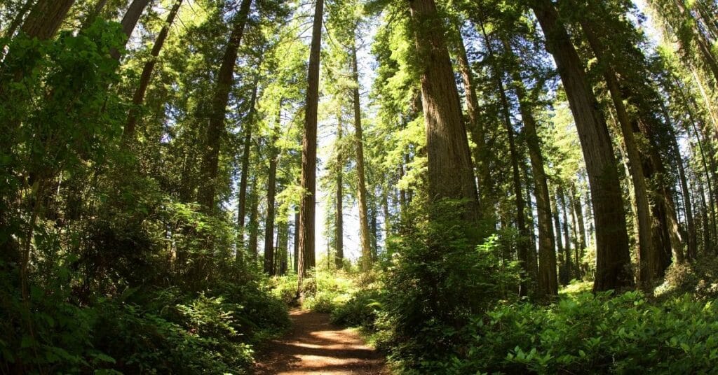
Redwood National Park and State Parks
Redwood National Park and State Parks is located along the Northern California coastline. With over 40-miles of rugged coastline, giant Redwood trees, rivers and vast prairies, the National Park was established in 1968 to preserve the area after multiple decades of unrestricted logging following the prospectors turned loggers at the end of Gold Rush.
Due to its expansive boundaries, there are multiple visitor centers available to learn about the recovery and preservation efforts. The ecosystem of the park protects multiple endangered species such as the Chinook salmon, Northern spotted owl and Steller’s sea lion. With over 200-miles of trails, wildlife viewing opportunities and picturesque scenery, there is something for everyone to enjoy throughout their visit.
Cinematic history was made inside of the park through the years. It served as the forest moon planet of Endor in Star Wars Episode VI: Return of the Jedi and was also featured in E.T. and Jurassic Park: The Lost World.
Redwood National Park was first established on October 2, 1968 and then combined with the three Redwood State Parks in 1994.
Things to do at Redwood National Park and State Parks: Hiking, camping, biking, wildlife viewing, tidepooling, kayaking, scenic drives
How to get to Redwood National Park and State Parks: The parks are located 6-hours North of San Francisco.
They are accessible along the North-South corridor the US-101 freeway. This stretches between Crescent City and Orick, CA.
Public Transportation is available. Redwood Coast Transit (RCT) offers service between Orick and Crescent City, with several stops along the way.
Where to Stay in Redwood National Park and State Parks: Camping is the only option available for staying in the parks. There are no lodging facilities available.
There are however plenty of lodging options available outside of the parks.
There are four developed campgrounds managed by the California Department of Parks and Recreation. Reservations are essential during the summer months and must be made through the California State Parks.
Redwood National Park and State Parks Entrance Fee:
Redwood National Park entrance is free to visit and there are no entrance stations
The California State Parks collect day-use fees at the developed campground entrance stations. America the Beautiful passes will be honored and discounted pricing will be available to pass holders.
Redwood National Park and State Parks Official Website: Click Here
Map of Redwood National Park and State Parks: Download
Get help planning your Redwoods National Park Trip
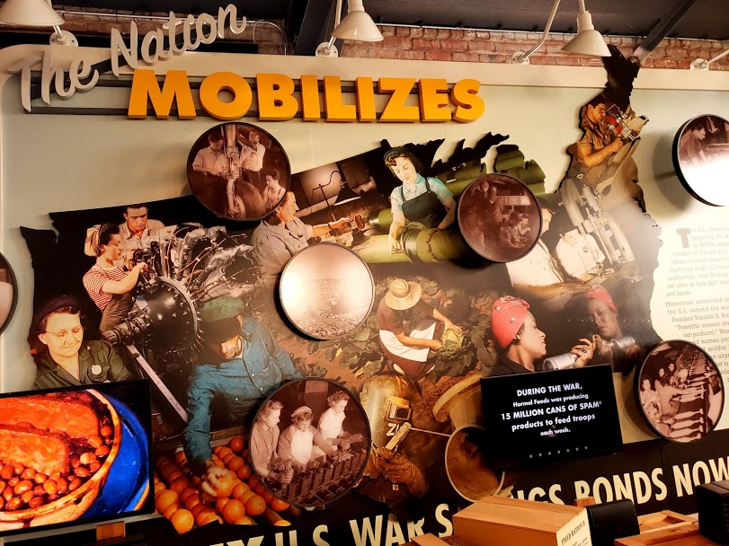
Rosie the Riveter/World War II Home Front National Historical Park
Rosie the Riveter/World War II Home Front National Historic Park interprets and preserves the National Home Front legacy of WWII. Located in the Kaiser Richmond Shipyards, it is a combination of “partnership parks” administered by the National Park Service.
The Visitor Education Center is located within the Ford Richmond Plant, the largest assembly plant built on the West Coast is free of charge and showcases multiple educational films and exhibits and Rosie Friday’s, an opportunity to meet a real life WWII Home Front worker. The Rosie Memorial is the first National tribute to home front American women and is located nearby in Marina Park on the site of the former Kaiser Richmond Shipyard # 2.
The SS Red Oak Victory is also located nearby in Richmond. Now preserved as a museum, it saw active duty during WWII, Vietnam and Korean Wars. It is open on Tuesday, Thursday, Saturday and Sunday.
Rosie the Riveter/World War II Home Front National Historic Park was established on October 25, 2000.
Things to do at Rosie the Riveter/World War II Home Front National Historical Park: Educational Center, Exhibits, Films, Rosie Memorial, SS Red Oak Victory
How to get to Rosie the Riveter/World War II Home Front National Historical Park:
Please note: The Visitor Educational Center is located within a commercial area making it your eye out for a large brick warehouse and park as the park unit is adjacent to them.
From San Francisco: 35-minutes Northeast via I-80 E across the San Francisco-Oakland Bay Bridge to the 580 North to the Visitor Center in Richmond, CA.
Where to Stay in Rosie the Riveter/World War II Home Front National Historical Park: The closest lodging is available in the City of Richmond. There are also plenty of options in nearby Oakland and Berkeley.
Rosie the Riveter/World War II Home Front National Historical Park Entrance Fee: The Visitor Center and Memorial are free to visit. The Red Oak Victory Ship assess its own admission fee.
Rosie the Riveter/World War II Home Front National Historical Park Official Website: Click Here
Map of Rosie the Riveter/World War II Home Front National Historical Park: Download
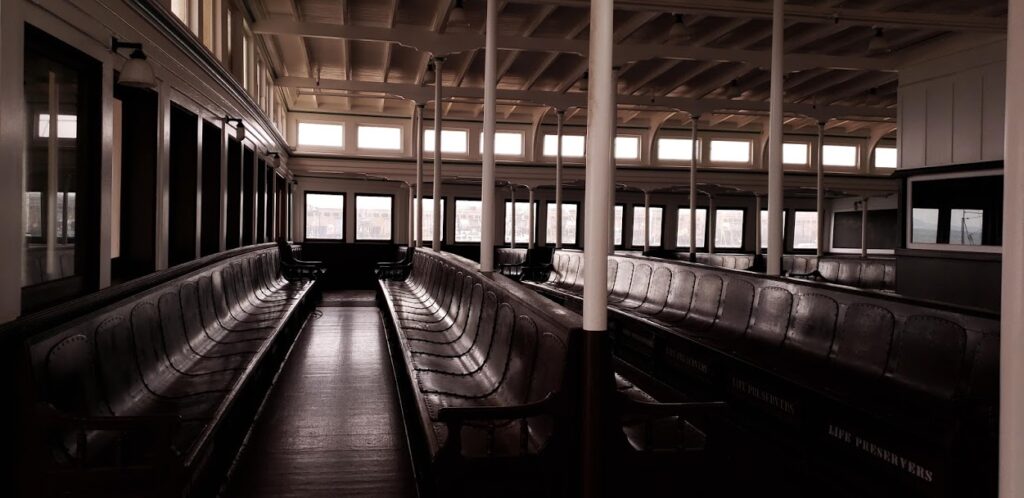
San Francisco Maritime National Historical Park
San Francisco Maritime National Historical Park is located at Hyde Street and Jefferson Street in the Fisherman’s Wharf area. The Visitor Center is housed inside a 1908 brick cannery warehouse and tells the story of San Francisco’s colorful and diverse maritime history through interactive exhibits.
Located at the end of Hyde Street Pier, the collection of historical ships, including the Eureka and Balcultha dominate the skyline.
The Eureka, a paddle steamboat and largest existing wooden ship in the world was a main source of transportation for people across the bay to Sausalito prior to the construction of the Golden Gate Bridge.
San Francisco Maritime National Historical Park was established on June 27, 1988.
Things to do at San Francisco Maritime National Historical Park: Visitor Center, Hyde Street Pier, Maritime Museum, Aquatic Park
How to get to San Francisco Maritime National Historical Park: The park is located at the end of Hyde Street near Fisherman’s Wharf, Ghiradheli Square and Fort Mason. The Visitor Center address is: 499 Jefferson Street (at Hyde), San Francisco, CA 94109
Where to Stay in San Francisco Maritime National Historical Park: There are numerous lodging options available throughout the city of San Francisco. The closet lodging around the park is along the Fisherman’s Wharf area.
San Francisco Maritime National Historical Park Entrance Fee: $15.00
San Francisco Maritime National Historical Park Official Website: Click Here
Map of San Francisco Maritime National Historical Park: Download
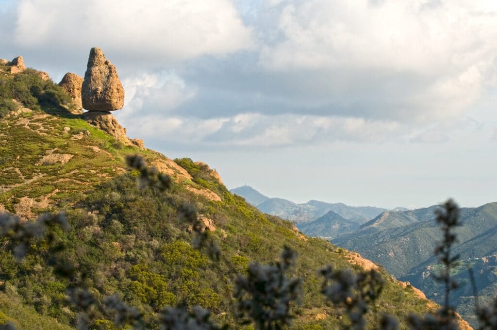
Santa Monica Mountains National Recreation Area
Santa Monica Mountains National Recreation Area preserves one of the best examples of the Mediterranean ecosystems. It contains over 156,000 acres of land stretching along the Pacific Ocean inland to the Hollywood Hills. Known for its diverse terrain, picturesque ocean views and miles of hiking trails, visitors are provided a sanctuary away from the nearby tourist areas.
The first “net zero” visitor center in the National Park Service, to promote sustainability goals is open daily in the city of Calabasas. The Juan Bautista de Anza National Historic Trail passes through the park boundaries and a cancellation stamp is available at the visitor center.
The area has played a significant role in Hollywood cinematic history, HBO’s “Westworld” and the X-Files were filmed at the Paramount Movie Ranch before it suffered extensive damage during the 2018 Woolsey Fire.
The Santa Monica Mountains National Recreation Area was established on November 10, 1978.
Things to do at Santa Monica Mountains National Recreation Area: Hiking, climbing, camping, horseback riding, wildflower viewing
How to get to Santa Monica Mountains National Recreation Area: The recreation area is surrounded by the US-101 and US-1 highways beteen the towns of Calabasas and Malibu. The Las Virgenes Road exit from the US-101 is minutes away from the Visitor Center.
Where to Stay in Santa Monica Mountains National Recreation Area: Circle X Campground is the only National Park Service campground in the recreation area. Located in the canyons of Malibu, it is designated for groups of 10 or more.
Santa Monica Mountains National Recreation Area Entrance Fee: Free
Santa Monica Mountains National Recreation Area Official Website: Click Here
Map of Santa Monica Mountains National Recreation Area: Download
Sequoia National Park
Sequoia National Park is located just below Kings Canyon National Park.
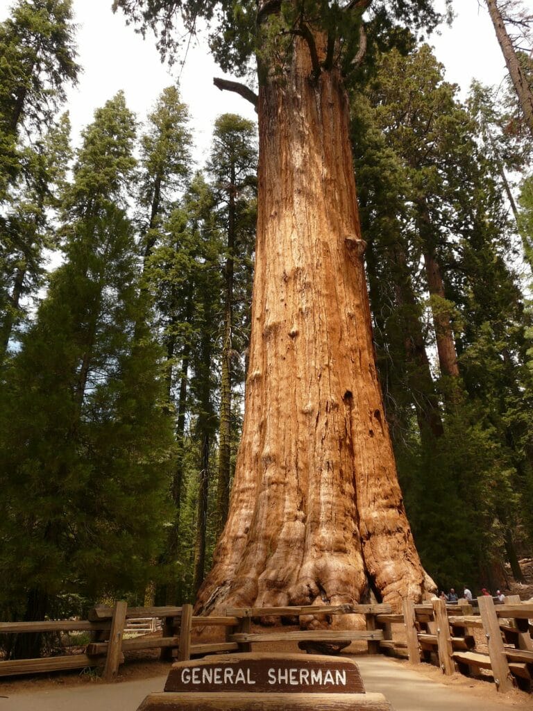
It is home to the largest tree on earth, the General Sherman is located in the Giant Forest section of the park that is home to five of the ten largest trees in the world. Mt. Whitney, the highest point in the contiguous United States at 14, 505 feet above sea level is located within the park. Visitors return to the park each Spring as the heavy snowpack has melted away to experience driving through Tunnel Log and enjoy the views of the Great Western Divide from the 6,725 foot granite dome, Moro Rock.
Sequoia National Park was established on September 25, 1890.
Things to do at Sequoia National Park: General Sherman tree, Tunnel Log, Moro Rock, Tokopah Falls, Crystal Cave, Crescent Meadow, Hiking trails
How to get to Sequoia National Park: The park can be accessed from CA-198 from the Ash Meadows Entrance. Visalia is the nearest major city to the park, located 45-minutes to the West. There are also no gas stations within the park. The nearest gas station is several miles West in Three Rivers.
Where to Stay in Sequoia National Park: The Wuksachi Lodge is open year-round in the Giant Forest area, providing a full-service restaurant, lounge and gift shop.
Three campgrounds are located in the foothills area: Potwisha, Buckeye Flat and South Fork. The campgrounds are open year-round and provide tent, RV and trailer camping.
The largest campground, Lodgepole is located 21-miles from the park entrance. It is open from late May through late September. Reservations are recommended during the summer months beginning six months in advance.
Sequoia National Park Entrance Fee: $35.00 per vehicle valid for 7-days to Kings Canyon and Sequoia National Park
Sequoia National Park Official Website: Click Here
Map of Sequoia National Park: Download
Tule Lake National Monument
Tule Lake National Memorial preserves one of the ten concentration camps constructed on the West Coast in 1942 to incarcerate Japanese Americans during World War II. Formerly known as the Tule Lake War Relocation Camp, it housed 29,840 people during the four years that it was open.
During its operation, it was a major focal point regarding civil rights issues and later after its closure, a holding area for Japanese Americans awaiting deportation who had renounced their citizenship.
Tule Lake National Monument was originally designated in December 2008 as one of nine sites and the only in the contiguous US to be part of the World War II Valor in the Pacific National Monument. On March 12, 2019, Tule Lake National Monument was created from the John D. Dingell Jr. Conservation, Management, and Recreation Act.
Things to do at Tule Lake National Monument: Ranger guided tours of Tule Lake Segregation Center and Camp Tulelake. To reserve a spot on either tour please call 530-260-0537.
How to get to Tule Lake National Monument: The address for the visitor center is: Butte Valley Fairgrounds at 800 Main St, Tulelake, CA. The park is located several miles north of Lava Beds National Monument.
Where to Stay in Tule Lake National Monument: There is no lodging or camping available at the monument. The closest lodging is available locally in Tulelake, CA or 30-miles North in Kalamath Falls, OR.
Tule Lake National Monument Entrance Fee: Free
Tule Lake National Monument Official Website: Click Here
Map of Tule Lake National Monument: Download
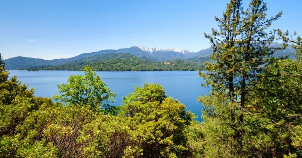
Whiskeytown-Shasta-Trinity National Recreation Area
Whiskeytown-Shasta-Trinity National Recreation Area is located within the historic California Gold Rush area of Northern California, 8-miles West of the city of Redding. The visitor center is open daily, with the exception of Thanksgiving, Christmas Day and New Years. It provides a historical introduction to the development of Whiskeytown and information related to panning for gold.
Multiple hikes to see any of the four falls, Whiskeytown, Boulder Creek, Brandy Creek and Crystal Creek Falls are located within the park.
Camping options along the lake are available and are operated by multiple companies, each with their own reservation system in place. Plenty of outdoor activities are available that include fishing, hiking, kayaking, boating and swimming during the summer months.
Whiskeytown-Shasta-Trinity National Recreation Area was on November 8, 1965.
Things to do at Whiskeytown-Shasta-Trinity National Recreation Area: Fishing, hiking, waterfalls, boating, kayaking, fishing
How to get to Whiskeytown-Shasta-Trinity National Recreation Area: The National Recreation Area is located 8-miles west of Redding. Take the US-5 to CA-44 W exit towards downtown Redding. Then continue on CA-299 for 8-miles until reaching the Visitor Center.
Where to Stay in Whiskeytown-Shasta-Trinity National Recreation Area: Oak Bottom Campground provides tent and RV camping. There are 94 tent sites and 22 RV sites (no hookup sites), with showers available. Camping rates vary during the year. $35.00 per night between mid-April through mid-October and $20.00 per night for the rest of the year. Discounts are provided for those with a Senior Pass or Access Pass. Reservations can be made in advance.
Brandy Creek RV is $20.00 per night on a first-come, first-served basis. Water and dump station may be periodically turned off to prevent freezing during winter months. No reservations or payment can be made at the campground or visitor center. Senior or Access Pass holders can receive a 50% discount.
Whiskeytown-Shasta-Trinity National Recreation Area Entrance Fee: $25.00 per vehicle valid for 7-days
Whiskeytown-Shasta-Trinity National Recreation Area Official Website: Click Here
Map of Whiskeytown-Shasta-Trinity National Recreation Area: Download
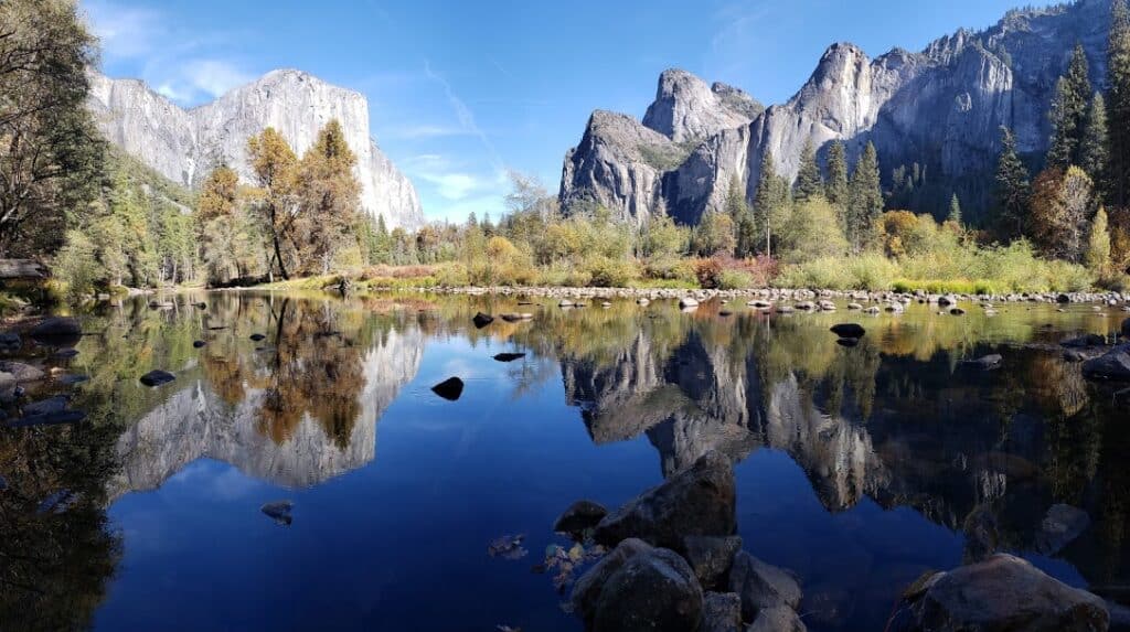
Yosemite National Park
Yosemite National Park is located in the western Sierra Nevada near the city of Oakhurst, CA and Bass Lake.
The park is a favorite among climbers for its challenging routes ascending up park icons El Capitan and Half Dome. The Yosemite Valley Shuttle provides free transportation to 21 stops along the Yosemite Village at popular hiking trails, the visitor center, Ahwahnee Hotel and Yosemite Falls.
The Yosemite Valley Shuttle provides a free transportation system within the park for visitors to enjoy. The shuttle makes 21-stops along the route at the Ahwahnee Hotel, Yosemite Falls, Yosemite Lodge and near the trailhead for Vernal and Nevada Falls.
Originally created by President Abraham Lincoln on June 30, 1864, the Yosemite Grant marked the first example of parkland being set aside for preservation and public use. It eventually set a precedent for the creation of the first national park in 1872, Yellowstone National Park.
Things to do at Yosemite National Park: Yosemite Valley Shuttle, Yosemite Valley Floor Tour, Ahwahnee Hotel, Ansel Adams Gallery, Tunnel View, hiking, waterfall viewing, rock climbing, picnics, photography, wildlife viewing
How to get to Yosemite National Park: Yosemite National Park has five different park entrances From the east, there is Tioga Pass which can be reached via US-395. From the West, the other four entrances can be reached via CA-41, CA-140, and CA-120.
Where to Stay in Yosemite National Park: The Ahwahnee Hotel is a luxury and historic hotel offering fine dining and centrally located in the valley. The hotel lobby was the inspiration for Stanley Kubrick’s “The Shining.”
The Yosemite Valley Lodge is located near the base of Yosemite Falls. It is where the Yosemite Valley Floor Tour begins and ends at. Open year-round, there are multiple dining options located within it.
The Wawona Hotel is located near the South Entrance. This historic Victorian lodge is open seasonally and provides a unique experience for guests as it does not contain any TV’s on property.
Historic Camp Curry was the site of the Yosemite Fire Fall that originated atop Glacier Point. Traditional cabins offer a rustic style camping experience, opening seasonally.
Yosemite National Park Entrance Fee: $35.00 per vehicle valid for 7-days
Yosemite National Park Official Website: Click Here
Map of Yosemite National Park: Download
Get help planning your trip to Yosemite National Park
- National Parks of California
- 10 Books to Read Before Visiting Yosemite National Park
- One Day in Yosemite Valley
- How to make the most of a weekend in Yosemite
California National Historic Trail
The California National Historic Trail is a massive 5,000 mile trail and runs thru 10 different states. This trail retraces the overland routes over 250,000 emigrants took to reach the fertile farmlands and famed gold fields of California in the 1840’s and 1850’s.
Unlike some of the other trails of the National Trails System, the California Trail isn’t a single hiking trail. It is a disconnected series of hiking trails, roads, and sites. Many of the US highways follow the wagon trail the settlers created as they rushed to California. Emigrants had a choice of routes across the United States. These trails start in Missouri and Nebraska. The then run thru Kansas, Colorado, and Wyoming before splitting into Idaho and Utah. They go thru Nevada and into California and Oregon.
Things to do in California National Historic Trail: Auto Tours, Hiking, Horseback Riding, Museums, Camping
How to get to California National Historic Trail: The route runs from Missouri and Nebraska to California and Oregon. The various trail routes are approximately followed by various Highways and Interstates.
Where to Stay in California National Historic Trail:
California National Historic Trail Entrance Fee: There may be nominal fees at trail-related federal, state, or locally owned historic sites and interpretive facilities.
California National Historic Trail Official Website: Click Here
Map of California National Historic Trail: Download
Juan Bautista de Anza National Historic Trail
Juan Bautista de Anza National Historic Trail is a 1,210-mile trail that runs from Nogales, Arizona to San Francisco, California. The route was used in 1775-1776 by Spanish commander Juan Bautista de Anza to establish a land route to help with Spanish colonization. He led two expeditions to help establish a mission and presidio near San Franciso Bay. His worked helped settle California and established the Californian horse and cattle industry.
The Juan Bautista de Anza National Historic Trail is mostly an auto trail running through Arizona and California. Juan Bautista de Anza’s route actually continues down into Mexico but that part is not part of the Juan Bautista de Anza National Historic Trail. There are many historical stops along the trail. These included both federal and state protected areas. Hiking is available near the trail.
Juan Bautista de Anza National Historic Trail was created in 1990.
Old Spanish National Historic Trail
Old Spanish National Historic Trail is a historic trade route that connected Santa Fe, New Mexico with Los Angeles, California. The trail built upon the known trails established of the Indian Tribes of the region and the Spanish explorers and trappers. There are several common routes along the Old Spanish Trail depending on who the trade partners were and what they were trading. The Armijo Route provides the most direct route and was often a yearly trip for traders along the route. The trial saw the most use from 1830s until 1860s. Large mule pack trains could be seen walking back and forth from Santa Fe to Los Angeles.
The Old Spanish National Historic Trail is mostly an auto trail. The trail runs thru Arizona, California, Colorado, Nevada, New Mexico, and Utah. Stops can include many other National Parks Service sites in the region.
Pony Express National Historic Trail
The Pony Express National Historic Trail follows the 1860 and 1861 mail route used by the Pony Express to transport mail between Missouri to California. The Pony Express used a relay of horse-mounted riders. The system was set-up so that riders would ride between 186 Pony Express stations. The stations were between 5-25 miles apart. At each station, the rider would switch to a fresh horse and continue on their journey. The Pony Express reduced the time to for a letter to travel across the US from six months to 10 days. After 18 months of speedy mail delivery, the Pony Express was replaced with the telegraph.
Pony Express National Historic Trail was declared a National Historic Trail on August 3, 1992. Today it is mostly an auto-touring route starting in Missouri and traveling through Kansas, Nebraska, Colorado, Wyoming, Utah, and Nevada on the way to California. There are sections of the trail where visitors can hike or ride along the trail. The trail is still being developed for tourism but there are several stations and museums along the route so visitors can learn more about the Pony Express.
In California, visitors can explore the B.F. Hasting Building in Old Sacramento, California. This building was the western terminus for the Pony Express.
View all the National Park Service Sites in neighboring states:
- Arizona National Parks – Arizona is home to Grand Canyon, Petrified Forest and Saguaro National Parks and 19 NPS units.
- National Parks of Nevada
- National Parks of Oregon

Hi, I'm Jennifer!

Welcome to the wonderful world of National Parks. I'm here to help you plan your NEXT amazing adventure through the United States National Parks and beyond. I want the national parks to be accessible to all.
I live in Tennessee, and when I'm home, you can find me hiking in the Smokies and the Cumberland Plateau.
58/63 National Parks
250+/423 National Park Units
Want to know more? Start Here.
Snag one of my National Park Ebooks and Downloadable Itineraries

Talk with an Expert

Share your love of the parks with a shirt, ornaments, hoodies, frames, and more.
