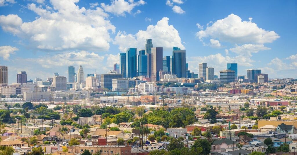
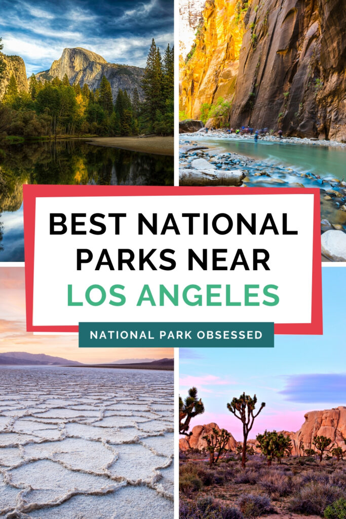
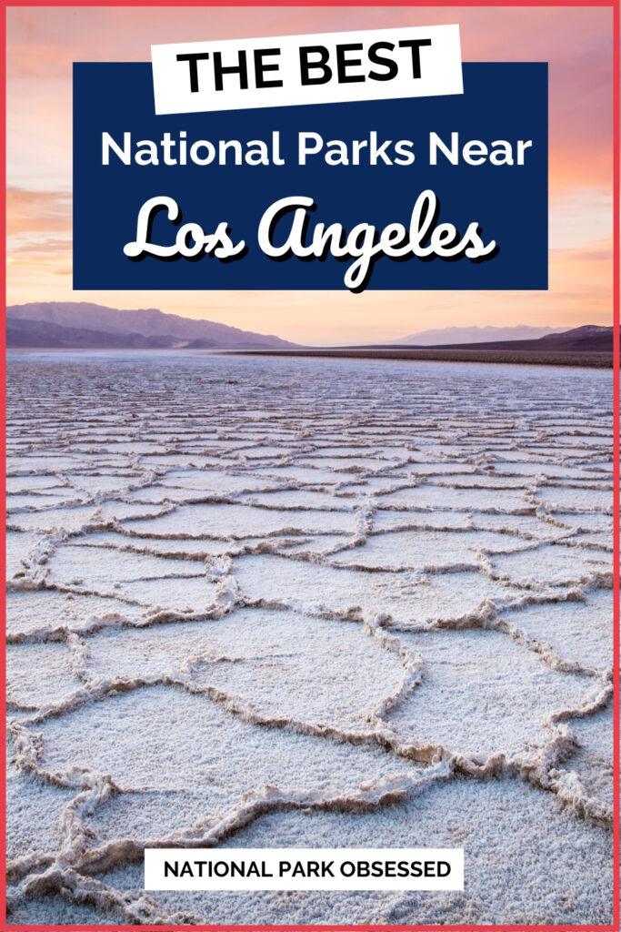
Los Angeles, California serves a gateway of many unique experiences for everyone to enjoy. Known as the “Entertainment Capitol of the World,” Los Angeles is a global hot spot visited annually by millions of tourists eager to retrace Hollywood’s most famous and soak up the sun along the picturesque beaches. There are multiple National Park Service units near Los Angeles, California within 8-hours for everyone to enjoy. Here is our list of National Parks Near Los Angeles, California.
Help support this site by purchasing one of our National Park Shirts, Poster, and other gear. Every purchase includes a donation to the national parks and helps keep National Park Obsessed’s website free to use and producing more national park guides.
Looking for more help planning your next adventure? Join the National Park Obsessed Facebook Group here to connect other national park lovers, trade advice, or see inspiring photos of the National Parks?
This post may contain affiliate links, meaning if you book or buy something through one of these links, I may earn a small commission at no extra cost to you! Read the full disclosure policy here
National Parks Near to Los Angeles, California
Map of National Parks near Los Angeles
National Parks Within 1 Hour of Los Angeles
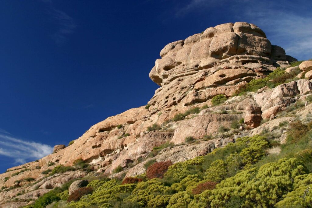
Santa Monica Mountains National Recreation Area
Drive time: 1-hour North via the 101 freeway North to the visitor center in Calabasas.
The Santa Monica Mountains National Recreation Area preserves one of the best examples of the Mediterranean ecosystems. Established on November 10, 1978, it contains over 156,000 acres of land stretching along the Pacific Ocean inland to the Hollywood Hills. Known for its diverse terrain, picturesque ocean views and miles of hiking trails, visitors are provided a sanctuary away from the nearby tourist areas.
The first “net zero” visitor center in the National Park Service, to promote sustainability goals is open daily in the city of Calabasas. The Juan Bautista de Anza National Historic Trail passes through the park boundaries and a cancellation stamp is available at the visitor center. The area has played a significant role in Hollywood cinematic history, HBO’s “Westworld” and the X-Files were filmed at the Paramount Movie Ranch before it suffered extensive damage during the 2018 Woolsey Fire.
National Parks Within 2 Hour of Los Angeles
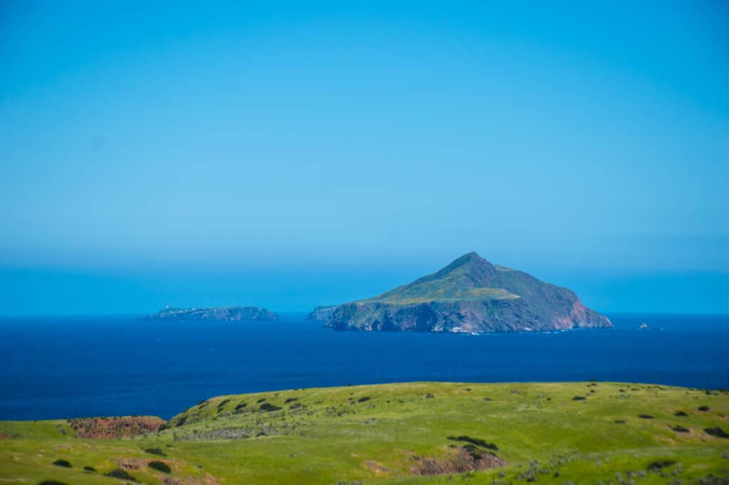
Channel Islands National Park
Drive time: 1-hour via the 101 freeway North to the Visitor Center in Ventura harbor
Channel Islands National Park consists of five of the eight Channel Islands – Anacapa, Santa Barbara, Santa Cruz, Santa Rosa and San Miguel island, located off the coast of California. Transportation to the islands are accessible by boat and can range from 1-hour to 3-hours in length depending on the island destination.
Anacapa and Santa Cruz islands are open year-round and can be reached via Islands Packers ferry service from their locations in Oxnard harbor and Ventura harbor. Camping is available on the islands but campgrounds must be reserved before your arrival. There are no services available, so you must pack-out what you packed-in with you. Each island provides a unique experience for its visitors – Anacapa provides impressive views of the other islands from Inspiration Point, while Santa Cruz offers unique kayaking and beach experiences from Scorpion Beach.
Get help planning your trip to Channel Islands National Park:
- National Parks of California
- The Ultimate Guide to Camping in Channel Islands National Park
- 14 Things Not to Miss on Your First Visit to Channel Islands National Park
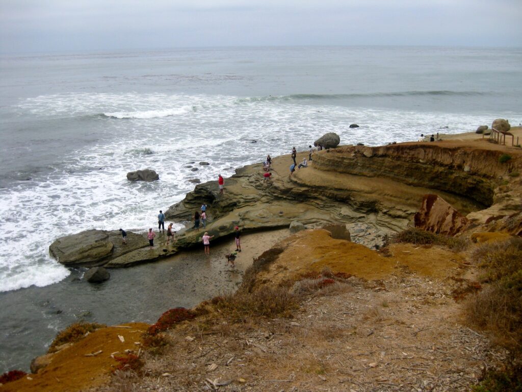
Cabrillo National Monument
Drive time: 1-hour 45-minutes via the I-5 freeway South to Point Loma.
Cabrillo National Monument is located at the southern tip of Point Loma several minutes from downtown San Diego and San Diego International Airport. The landing site of Juan Ramirez Cabrillo on September 28, 1542 is commemorated. The monument is open daily from 9:00 AM until 5:00 PM.
A short drive through former military installations and a national cemetery, the monument is a hidden gem of the area that provides spectacular panoramic views of the San Diego Bay and Pacific Ocean.
Park visitors can enjoy many unique outdoor opportunities around the monument grounds. The statue of Cabrillo is located near the visitor center that provides visitors the opportunity to take in panoramic views of San Diego and Mexico in the distance. Self-guided tours of the old Point Loma Lighthouse are available, but access to the tower is closed. The tidepools are also open year-round but please caution along the cliffs as they can be slippery.
Cesar E Chavez National Monument
Drive time: 2-hours Northeast via Highway-14 to Keene, California
The Cesar E. Chavez National Monument is located near the city of Bakersfield, California. As one of the newest units within the National Park System, it is located on the former headquarters of the United Farm Workers of America (UFW) and home to Cesar E. Chavez from the 1970’s until his death in 1993.
Chavez’s leadership led to the establishment of the first U.S. law recognizing farm workers bargaining rights, the California’s Agricultural Labor Relations Act of 1975. A visitor center and the memorial garden where Chavez is buried are open to the public, but many areas are closed to the public.
The monument is open daily from 10:00 AM until 4:00 PM but closed on Nationally observed holiday’s.
National Parks Within 4 Hour of Los Angeles
Mojave National Preserve & Castle Mountains National Monument
Drive time: 3-hours Northeast via the I-15 freeway
The Mojave National Preserve is located in the Mojave Desert near the city of Baker, CA. Established on October 31, 1994, the preserve is the 3rd largest unit in the National Park Service at 1,542,776 acres. The Kelso Dunes dominate the skyline for miles, standing 650 feet tall at their highest point. The ghost town and defunct railroad depot of Kelso is located within the park boundaries at its height in the 1940s during the nearby gold, silver, borax, and iron mining. The railroad depot houses the official Visitor Center a few minutes from the Kelso Dunes. For anyone looking for adventure, the eastern portion of the park contains volcanic formations, most notably the Cima volcanic fields containing 40 cinder cones and the 1.3 mile Rings Loop Trail.
Castle Mountains National Monument is located next to the Mojave National Preserve along the Nevada border. Accessible only by dirt roads, the 20,000 acre park was designed on February 12, 2016 by President Barack Obama. Relatively undeveloped, there is no Visitor Center or camping available and the use of GPS navigation is not recommended due to its remote location.
Death Valley National Park
Drive time: 4-hours 15-minutes East via Highway-14 and Highway-178
Death Valley National Park is located along the California/Nevada border. Made-up of an area that is 91% wilderness, the national park is originally began as Death Valley National Monument in 1933 until it was upgraded to a national park on October 31, 1994. In 2013, it was designed a “dark sky park” by the International Dark-Sky Association. The fictional planet of “Tatooine” in the Star Wars universe, Death Valley National Park is home to many unique natural elements created through its rich geographic history.
The national park provides visitors with many unique activities along its boundaries. Badwater Basin, the lowest point in North America lies near the southwestern area of the park, a short drive from the city of Baker, California. Nearby are popular hiking trails through Golden Canyon, Mosaic Canyon and Natural Bridges Canyon. Scotty’s Castle, Racetrack Playa and the Ubehebe Crater are located in the northern most are of the park.

Get help planning your Death Valley National Park Trip
- National Parks of California
- National Parks of Nevada
- 15 Things You Can’t Miss on Your First Visit to Death Valley National Park
- Death Valley Jeep Rental – Farabee’s Jeep Review
- Death Valley Airbnbs: 16 Amazing Airbnbs near Death Valley National Park
- StovePipe Wells Hotel Review
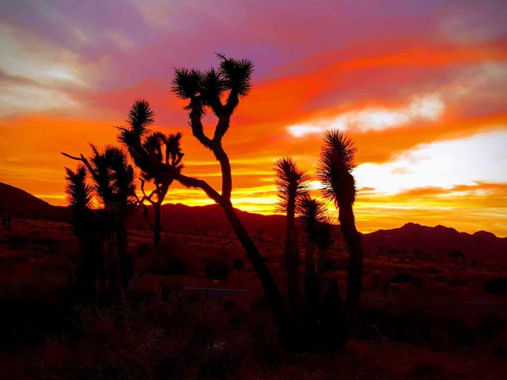
Joshua Tree National Park
Drive time: 2-hours 32-minutes East on the I-10 freeway
Joshua Tree National Park is located within the Coachella valley near the city of Palm Springs and Twentynine Palms. Originally declared a national monument in 1936, it was redesignated as a national park on October 31, 1994.
The park is made-up of the Mojave Desert and Colorado Desert and is a popular weekend getaway for those living in Los Angeles and San Diego counties with three visitor centers open year-round. Slightly larger than the state of Rhode Island, the park is home to Joshua Tree forests and large rock formations that are popular among rock climbers.
Park visitors fill-up the campgrounds and popular hiking trails such as Skull Rock during the cooler Spring months. Keys View. on the eastern boundaries of the park is an observation point notable for sunset viewing opportunities of the Coachella Valley and Mt. San Jacinto, home to the Palm Springs Aerial Tramway. The park is also famous for astronomy and stargazing for views of the Milky Way on clear evenings.
Get help planning your trip to Joshua Tree National Park
- National Parks of California
- All about Joshua Tree National Park
- One Day in Joshua Tree National Park
- 10 Things to Miss on Your First Visit to Joshua Tree National Park
- The Ultimate Guide to Camping in Joshua Tree National Park
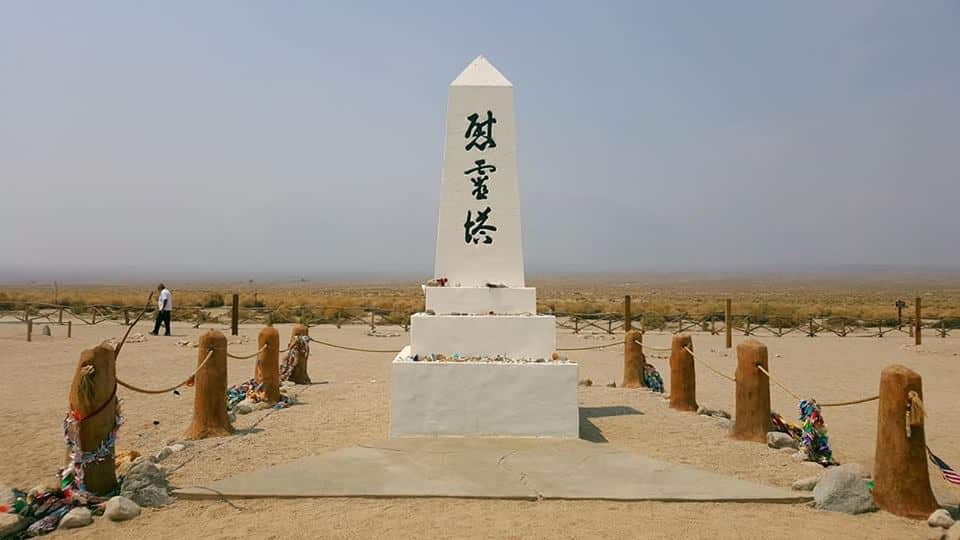
Manzanar National Historic Site
Drive time: 3.5 hours Northeast via Highway-14 and Highway-395 N
Manzanar National Historic Site is the best preserved and well known of the ten WWII internment camps. Located near Lone Pine, California at the base of Mt. Whitney, more than 120,000 Japanese Americans were incarcerated here from December 1942 – 1945.
Long before its associated history with WWII, the community of Manzanar was was a ranchers paradise, resulting in successful farming until it was abandoned in 1929 from lack of available resources required for sustainability.
The Visitor Center, housed in the restored Manzanar High School Auditorium provides park visitors a through introduction of Manzanar through extensive exhibits, bookstore and a 22-minute film, “Remembering Manzanar.” Visitors can also walk or drive the 3.2 self-guided tour which includes Block 14 (a reconstructed residential block), Merritt Park and the cemetery monument. To this day, several burials remain at the monument.
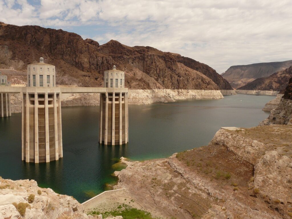
Lake Mead National Recreation Area
Drive time: 4-hours Northeast along the I-15 North
Lake Mead National Recreation Area is located in southeastern Nevada and northwestern Arizona, 25-miles from the Las Vegas strip. The nation’s first and largest national recreation area was designated in 1964 and is 1.5 million acres in size. A popular destination each summer, the two lakes that make-up the park, Lake Mead and Lake Mohave are visited by millions of visitors enjoying a weekend getaway at the lake for water recreation, boating and fishing.
National Park Passes are required to enter the park and separate fees are charged for camping and vessel uses. The visitor center is open daily from 9:00 AM until 4:30 PM and closed on Thanksgiving, Christmas and New Years Day. It provides a great introduction for visitors regarding the animals found in the lake and challenges it faces in the future.
Located along Highway 93, visitors can continue east from the visitor center along the road for several minutes until they reach the Hoover Dam. At the southwestern edge of Lake Mead between the border of Arizona and Nevada, the Hoover Dam provides visitors with an opportunity to see the impact on the ecosystem following its construction.
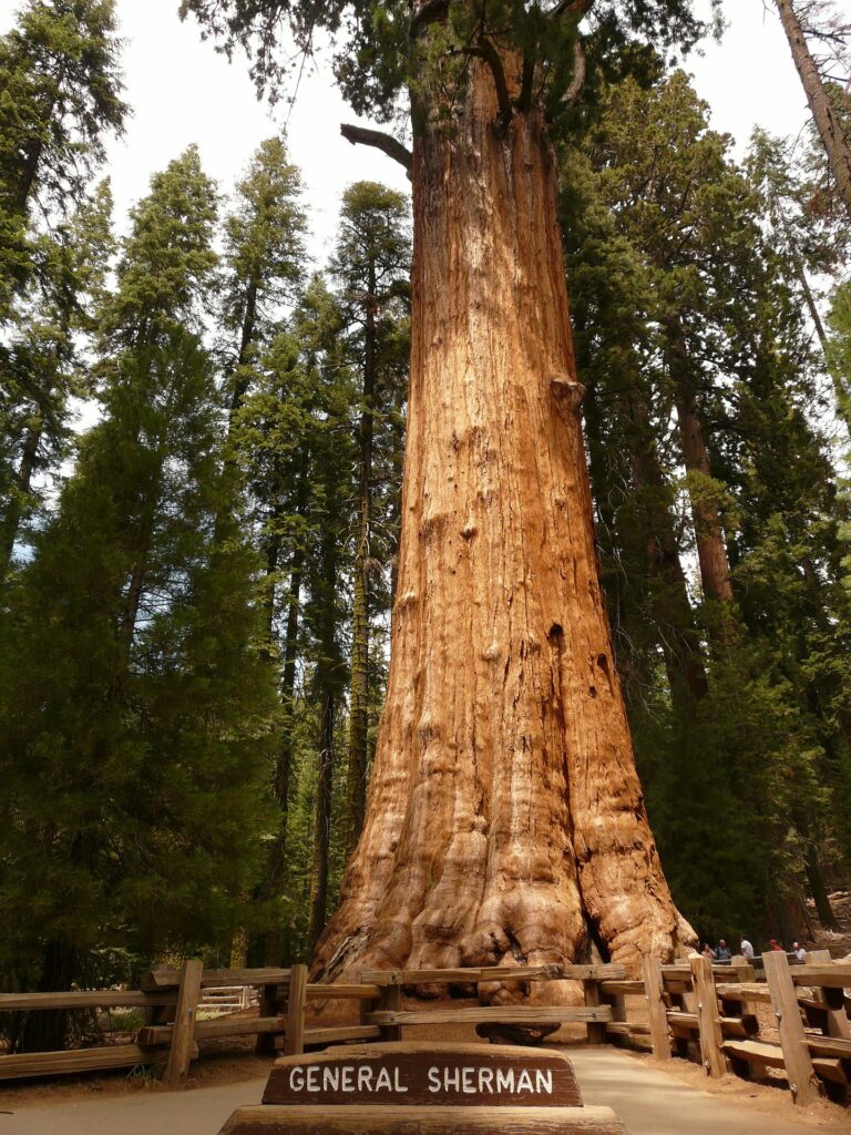
Kings Canyon & Sequoia National Parks
Drive time: 4-hours Northeast via the I-5 North and CA-65 N
Kings Canyon & Sequoia National Parks are located in Northern California near the city of Fresno, in the southern Sierra Nevada. Jointly administered since 1943, and connected by the Generals’ Highway, each national park were found separately. America the Beautiful National Park Passes are accepted, as are 7-day passes permitting entrance into both parks. There are no gas stations within the park boundaries. The nearest stations are in Three Rivers near Sequoia’s Ash Mountain Entrance and in Dulap, 19-miles from the Kings Canyon Visitor Center.
Sequoia National Park was established on September 25, 1890 to protect over 404,000 acres of forest. The largest tree on earth, the General Sherman is located in the Giant Forest section of the park that is home to five of the ten largest trees in the world. Mt. Whitney, the highest point in the contiguous United States at 14, 505 feet above sea level is located within the park. Visitors return to the park each Spring as the heavy snowpack has melted away to experience driving through Tunnel Log and enjoy the views of the Great Western Divide from the 6,725 foot granite dome, Moro Rock.
Kings Canyon National Park was originally in 1890 as General Grant National Monument, before it was expanded and renamed on March 4, 1940. Located above Sequoia National Park, it is the least accessible of the parks but rich in hiking trails, most notably the combined Pacific Crest and John Muir Trail which traverses the entire park. The park contains two tourist locations: Grant Grove, home to the General Grant Tree, the second largest tree in the world by volume and Cedar Grove. Two visitor centers are located at Grant Grove and Cedar Grove. The only vehicle entrance to the park is also located at Grant Grove.
National Parks Within 8 Hours of Los Angeles
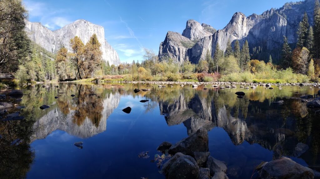
Yosemite National Park
Drive time: 5.5 hours Northeast via the I-5 North, CA-99 N and CA-41.
Yosemite National Park is located in the western Sierra Nevada near the city of Oakhurst, CA and Bass Lake. Originally created by President Abraham Lincoln on June 30, 1864, the Yosemite Grant marked the first example of parkland being set aside for preservation and public use. It eventually set a precedent for the creation of the first national park in 1872, Yellowstone National Park.
Through the efforts of naturalist and Sierra Club founder, John Muir in 1903, President Theodore Roosevelt returned the Yosemite Valley and Mariposa Grove to the federal government for the creation of Yosemite National Park. The park is a favorite among climbers for its challenging routes ascending up park icons El Capitan and Half Dome. The Yosemite Valley Shuttle provides free transportation to 21 stops along the Yosemite Village at popular hiking trails, the visitor center, Ahwahnee Hotel and Yosemite Falls.
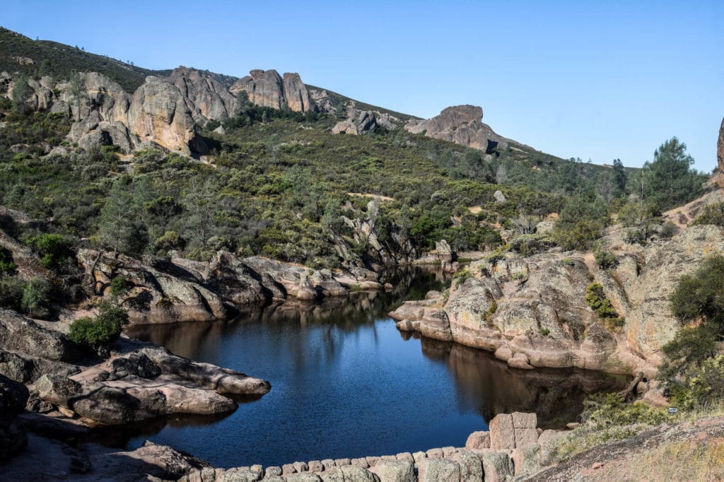
Pinnacles National Park
Drive time: 4-hours 45-minutes Northwest via the 101 North.
Pinnacles National Park is located 80-miles southeast of San Jose, CA in northern California. Originally a monument established by President Theodore Roosevelt in 1908, it was redesignated a national park on January 10, 2013. The Pinnacles are part of the Neenach Volcano that were split away during an eruption along the San Andreas Fault 23-million years ago near the city of Lancaster, 200-miles to the south.
The park can be accessed from the west entrance near Soledad and from the east entrance near Hollister. Camping facilities are available in the east side of the park and reservations can be made through the concessionaire Pinnacles Recreation. 30-miles hiking trails are located within the park boundaries ranging from moderate to strenuous. Pinnacles offers a variety of challenging climbing activities for experienced climbers. Visitors looking to explore the seasonal Bear Gulch Cave and Balconies Cave should check the official park website prior to their visit.
Get help planning your trip to Pinnacles National Park:
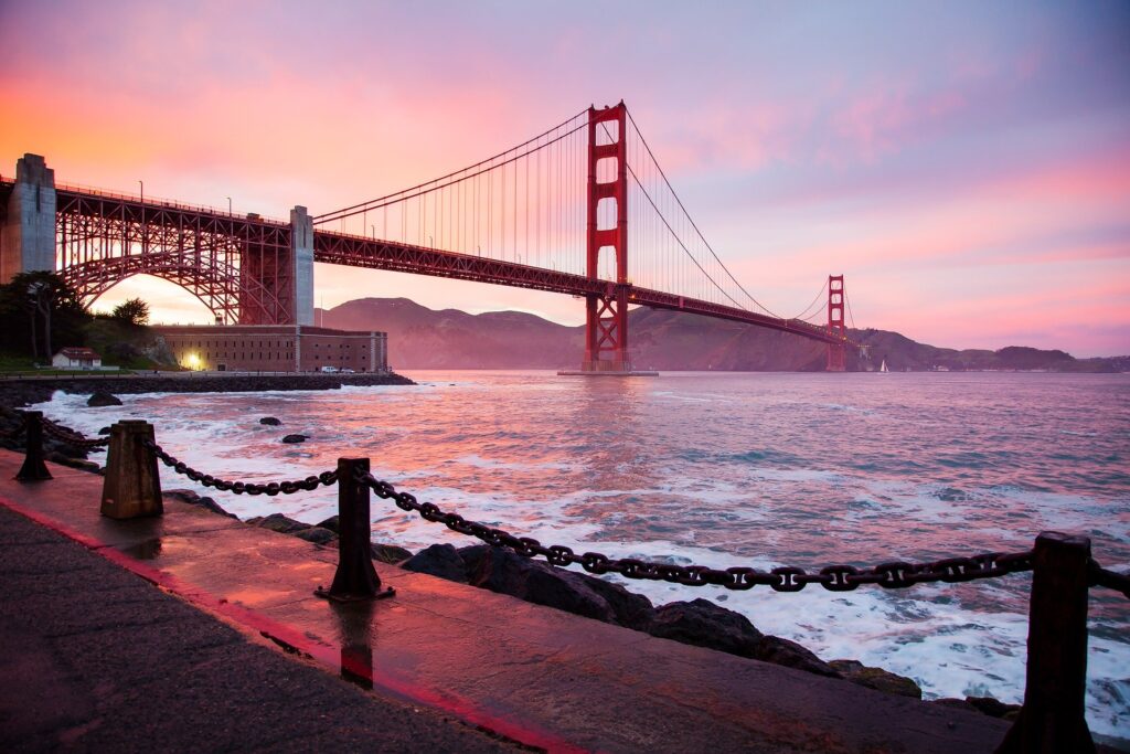
Golden Gate National Recreation Area
Drive time: 6-hours 15-minutes Northwest via the 101 North.
The Golden Gate National Recreation Area is an expansive collection of areas located within the San Mateo County, Marin County and the city of San Francisco. Established on October 27, 1972, it is the most visited National Park Site with over 15-million annual visitors. Over 30-years, the National Park Service acquired land and historic sites beginning with Alcatraz Island and Fort Mason, incorporating them into the Golden Gate National Recreation Area.
Visitors have plenty of locations in the area to choose from which include:
- Alcatraz Island – Alcatraz Cruises departs from Pier 33 Alcatraz Island in San Francisco, providing roundtrip ferry transportation to the island and “Doing Time: Alcatraz Island Cellhouse Audio Tour.” Due to its popularity, tickets should reserved be in advance for both the daytime and evening tours. Learn about the storied history of the island while visiting the famous cellblock that once housed Al Capone and “Machine Gun” Kelly.
- Muir Woods National Monument – Named for John Muir, a naturalist whose environmental campaigns helped to establish the National Park Service is located 12-miles north of San Francisco. The first monument created from the donation of private land in 1908, it protects 540 acres, the majority being coastal redwood. Due to its popularity, the NPS requires a reservation for all vehicles and shuttle riders separate from the entrance fee. Additional information is available at the official park website.
- Fort Point National Historic Site – Located beneath the Golden Gate Bridge, Fort Point is a historic fort predating the Civil War created to defend San Francisco against hostile warships. Open Friday through Sunday from 10:00 AM – 5:00 PM, various exhibits retell the history of the fort throughout its year before reaching the roof.
- Marin Headlands – Located just north of the Golden Gate Bridge, the Main Headlands is composed of multiple former military installations that housed bunkers and batteries. The most famous, Battery Spencer lies closest to the Golden Gate Bridge, providing views of San Francisco, Alcatraz Island, Angel Island, and the Bay Bridge. Parking is limited during the weekends and bringing along a light jacket in the afternoon is recommended.
- Presidio of San Francisco – A former U.S. military reservation and park, the Presidio consists of 2,347 square miles and was fortified on September 17, 1776 along the northern tip of San Francisco. The San Francisco National Cemetery, Walt Disney Family Museum, and Lucasfilm’s headquarters are located here.
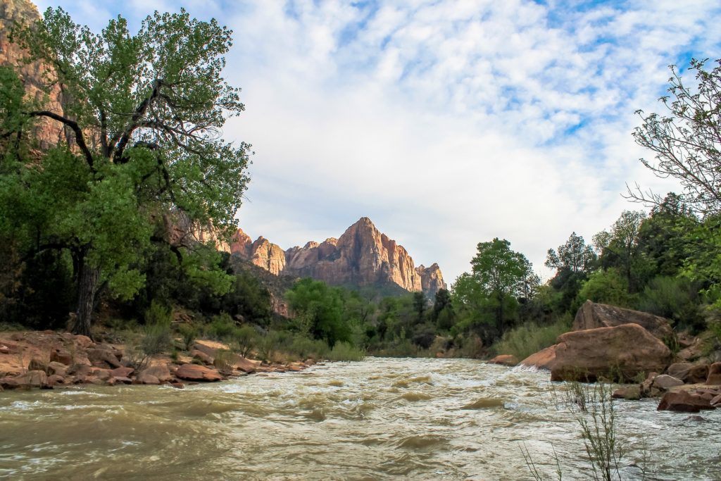
Zion National Park
Drive time: 6-hours 45-minutes Northeast via the I-15 freeway.
Zion National Park is located southwestern Utah near the city of Springdale and 2.5 hours east of Las Vegas. The park originally began as the Mukuntuweap National Monument in 1909 but was upgraded to a National Park on November 19, 1919. Zion is part of a layer of sedimentary rock layers known as the Grand Staircase that span Bryce Canyon, Grand Staircase-Escalante National Monument and Grand Canyon National Park. Winter season coats the park in a layer of snow between November and March, while the Summer season temperatures reach upwards of 100 degrees.
The first established of the “Mighty 5” collection of National Parks in Utah, Zion is a hikers paradise. The famous Angels Landing, The Narrows and The Subway hikes are located within the park boundaries, but a back country permit is required for visiting The Subway.
Private vehicles are not permitted beyond the Canyon Junction. The free Zion Canyon Shuttle provides visitors with an opportunity to experience the park from from Spring to Fall through 9 shuttle stops from the Zion Canyon Visitor Center adjacent to the park entrance to the Temple of Sinawava, the gateway to The Narrows and Virgin River. The Springdale Shuttle also provides visitors staying in the community with transportation to the park entrance. Visitors can obtain their official passport cancellation stamp at the Visitor Center and Human History Center.
Get help planning your trip to Zion National Park
- National Parks of Utah
- The Ultimate Guide to Camping in Zion National Park
- Zion Airbnbs: 17 Epic Airbnbs near Zion National Park
- A Complete Guide to Hiking Angels Landing in Zion National Park
- 1 Mighty Week in Utah National Parks ~ A Road Trip Itinerary
Pin to Save: National Parks Near Los Angeles, California

Hi, I'm Jennifer!

Welcome to the wonderful world of National Parks. I'm here to help you plan your NEXT amazing adventure through the United States National Parks and beyond. I want the national parks to be accessible to all.
I live in Tennessee, and when I'm home, you can find me hiking in the Smokies and the Cumberland Plateau.
58/63 National Parks
250+/423 National Park Units
Want to know more? Start Here.
Snag one of my National Park Ebooks and Downloadable Itineraries

Talk with an Expert

Share your love of the parks with a shirt, ornaments, hoodies, frames, and more.
