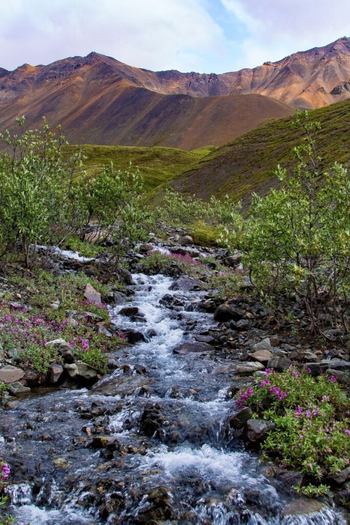
Post Summary: Best Hikes in Wrangell – St. Elias National Park
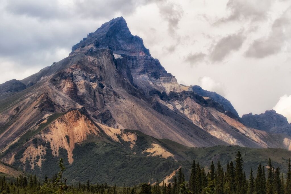
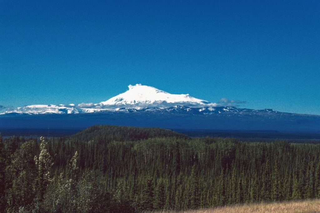
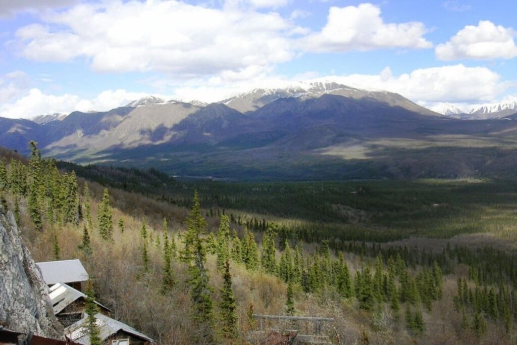
Wrangell-St. Elias National Park is located in Alaska and is America’s largest National Park. At an impressive size of 13.2 million acres, it’s the same size as Yellowstone National Park, Yosemite National Park, and the country of Switzerland combined! How crazy is that? Wrangell-St. Elias is known for its array of scenic landscapes, as the park runs from the Gulf of Alaska to one of the highest peaks in North America – Mount Elias. Aside from its dramatic scenery, the national park is also famous for its wide array of wildlife and awesome hiking opportunities.
If you are heading to Alaska, then visiting this National Park is a must. This article is going to go through the 13 BEST hikes in Wrangell-St. Elias National Park and Preserve including everything you need to know. The hikes are split up into strenuous, moderate, and easy so it’s simple to see which types of hike you’re looking for. A lot of the hikes in this list are challenging in their own way, whether that be due to their length or the fact that they require creek crossings. However, once you get to see the views of Wrangell-St. Elias for yourself it will be worth it. If you aren’t sure you should attempt some of the more challenging hikes, there are shorter hikes located within the park that still offer superb views. This list will help you weigh up the hikes, so you can decide which ones to put on your list!
Planning to explore the Alaska National Parks? Download our FREE Alaska National Park Map HERE
This post may contain affiliate links, meaning if you book or buy something through one of these links, I may earn a small commission at no extra cost to you! Read the full disclosure policy here
Quick Guide to Best Wrangell – St. Elias Hikes
| Trail Name | Region | Difficulty | Distance | Elevation |
| Bonanza Mine | Kennecott | Strenuous | 8.3 miles | 3943 ft |
| Caribou Creek Trail | Nabesna Road | Moderate | 7 miles | 1122 ft |
| Copper Lake Trail | Nabesna Road | Moderate | 5.2 miles | 656 ft |
| Crystalline Hills Trail | McCarthy Road | Moderate | 2.7 miles | 715 ft |
| Erie Mine Trail | Kennecott | Strenuous | 8 miles | ??? |
| Jumbo Mine Trail | Kennecott | Strenuous | 10 miles | 3,400 ft |
| Lost Creek Trail | Nabesna Road | Moderate | 7 miles | 4064 ft |
| McCarthy Creek Trail | McCarthy | Moderate | 12.9 miles | 2457 ft |
| Rambler Mine Trail | Nabesna Road | Moderate | 1.6 miles | 521 ft |
| Root Glacier | Kennecott | Strenuous | 5.7 miles | 793 ft |
| Skookum Volcano Trail | Nabesna | Strenuous | 4.2 miles | 1345 ft |
| Trail Creek Trail | Nabesna Road | Moderate | 20 miles | ??? |
| West Kennecott Glacier Trail | McCarthy | Easy | 2.4 miles | 442 ft |
Things to Know about Hiking in Wrangell – St. Elias National Park
- There are only two roads that head into the National Park and these are McCarthy Road which is 59 miles long, and Nabesna Road which is 42 miles long. That means for a park that’s larger than the country of Switzerland, there are only 101 miles of road throughout the whole of Wrangell – St. Elias National Park.
- If you are renting a vehicle in Alaska and planning to drive to Wrangell – St. Elias, make sure your rental vehicle is allowed to be driven on Alaska’s gravel roads.
- There is no entrance free for Wrangel – St. Elias.
- The park is open all year around, but the roads are only maintained from early June to early September and the park
- However, due to weather conditions, many local facilities close down towards the end of September so it’s important to keep that in mind.
- Whilst hiking in Wrangell-St. Elias,you are in bear country. Bears frequent many of the trails so it’s important to be ‘bear aware’.
- Your food and scented items in bear resistant food containers (BRFC).
- Make plenty of noise.
- Carry a bear spray with you.
- Speaking of Wildlife, if you are a nature lover then this is the US National Park you want to visit. There is an array of specices found within the park including bears, wolves, caribou, bison, lynx and wolverines among many others. If you head to the coastal area Wrangell-St. Elias you might also be lucky enough to spot sea lions, sea otters and whales. If that’s enough to convince you to visit, America’s national bird – the bald eagle also calls this area its home.
Best Hikes in Wrangell – St. Elias National Park
Strenuous Wrangell – St. Elias Hikes
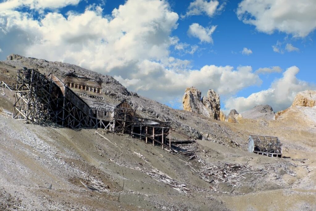
Bonanza Mine Trail
- Distance: 4.15 miles / 6.7 km one way (8.3 miles / 13.4 km round trip)
- Elevation Gain: 3943 feet (1,202m)
- Estimated Time: 6-8 hours
- Type of Trail: Out and back
- Trailhead Location: Kennecott Mill Town on the Root Glacier Trail
- Map: All Trails
The Bonanza Mine Trail is a challenging hike and with an elevation of nearly 4,000 ft, be prepared to push yourself. The first 2 miles of the hike are relatively easy, but the least interesting. However, once you get past the 2-mile mark and the trees thin out the views are incredible. From there, head along the trail until you reach Bonanza mine which is one of the highlights of this trail. The mine was built in the 1900s, and although part of it has collapsed it’s still a great sight to witness. Just make sure you don’t head inside as the building is incredibly unstable. Although difficult, this trail is incredibly rewarding and offers spectacular views of the National Park. If you feel you’re up to the task then don’t pass this hike by! It’s also important to remember you are hiking in bear country, so take all the necessary precautions.
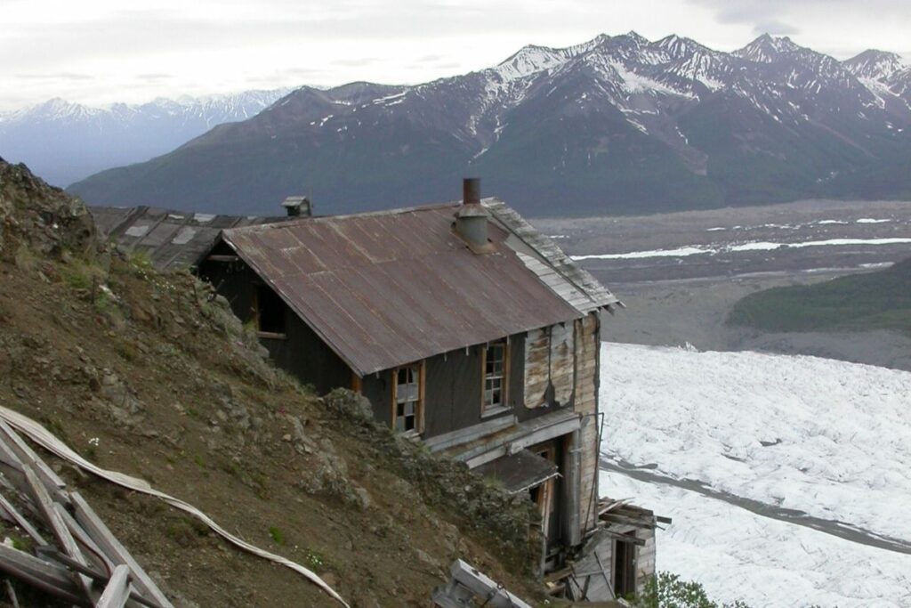
Erie Mine Trail
- Distance: 4 miles / 6.4 km one way (8 miles / 12.8 km round trip)
- Estimated Time: 6-8 hours
- Type of Trail: Out and back
- Trailhead Location: Kennecott Mill Town
After about 1.5 miles from the trailhead, you will reach the Root Glacier access trail. Once you get to the glacier, be very mindful if you decide to climb on it. It can be slippery and dangerous, especially if there has been recent rainfall so crampons are strongly recommended. As you continue past the Root Glacier you will eventually get a glimpse of the Erie Mine bunkhouse. It’s important to note that this trail does not take you all the way to the Erie mine, and it ends about 3,000 ft below the mine and bunkhouse. However, the scenery on this trail is spectacular with beautiful views of Mt. Blackburn, Regal Mountain, and Donaho Peak. Bears are known to be present along the whole of this hike so be cautious.
Jumbo Mine Trail
- Distance: 5 miles / 8 km one way (10 miles / 16 km round trip)
- Elevation Gain: 3,400 ft
- Estimated Time: 8-10 hours
- Type of Trail: Out-and-back
- Trailhead Location: Kennecott Mill Town, and then turn right following the NPS sign
- Map: NPS
Jumbo Mine is located 3,000 feet above the trailhead of Kennecott Mill Town, so as you can imagine it’s quite a hike. As you leave Kennecott Mill Town and head along the trail you will cross Bonanza Creek, see the old Jumbo transfer station and then head over Jumbo Creek to reach the mine. When you reach the Jumbo mine you will of course want to explore the area, but make sure you don’t enter the buildings. They are very unstable so it’s a big risk. Although a long hike, the views make this trail well worth it. Aside from the mine itself, you will get scenic views of the Kennicott Valley and Chugach range as you head along the trail. One of the most important things to remember about this hike is that good boots are required. The Jumbo Mine trail is very rocky in places, and some of it can become loose so it’s vital to have boots with good grip.
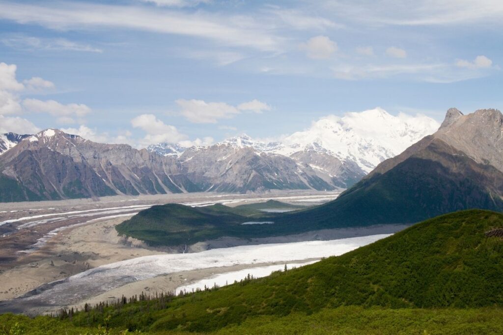
Root Glacier
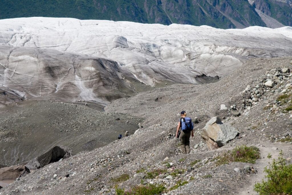
- Distance: 2.85 miles / 4.6 km one way (5.7 miles / 9.2 km round trip)
- Elevation Gain: 793 feet (242m)
- Estimated Time: 2-4 hours
- Type of Trail: Out and back
- Trailhead Location: Kennecott Mill Town
- Map: All Trails
There are over 5,000 square miles of glacial ice located in Wrangell-St. Elias National Park, but the Root Glacier is the most accessible. From the trailhead to the start of the glacier is around 1.5 miles, so it isn’t a long hike to reach it. However, if you are continuing onto the glacier it’s recommended to wear ice spikes or crampons and go with an experienced guide. That’s because the glacier can be very treacherous due to its slippery surface. It’s also important not to walk along the edge of the glacier as rotting ice and swift, cold water and be incredibly dangerous. If you choose to go on this hike make sure you’re well prepared. Along this trail, you will get stunning views of Mt. Blackburn, Regal Mountain, and Donaho Peak.
Skookum Volcano Trail
- Distance: 2.1 miles / 3.4 km one way (4.2 miles / 6.8 km round trip)
- Elevation Gain: 1345 feet (410m)
- Estimated Time: 2-4 hours
- Type of Trail: Out and back
- Trailhead Location: Nabesna Road at mile 36.8
- Map: All Trails
The Skookum Volcano Trail starts out through a white spruce forest until you enter a creek bed. From here you will have to make shallow creek crossings, and the water level can change depending on the rainfall. As you wander along the trail you will get to see unique geological features that were created because of the volcano. These include vents, andesite lava flows, and dacite domes. Don’t worry about the volcano erupting during your hike either, as it was last active between 2-4 million years ago. If you’re lucky you might even spot Dall sheep, arctic ground squirrels, and ptarmigan.
Moderate Hikes in Wrangell – St. Elias
Caribou Creek Trail
- Distance: 3.5 miles / 5.65 km one way (7 miles / 11.3 km round trip)
- Elevation Gain: 1122 feet (342m)
- Estimated Time: 3-5 hours
- Type of Trail: Out and back
- Trailhead Location: Nabesna Road at mile 19.5
- Map: All Trails
The beginning of the trail goes through the valley bottom until you reach the first crossing over Caribou Creek. You will have to cross this creek several times along the hike, and although not difficult, the water level does change throughout the seasons. As you wander along the trail, you will get to see plenty of pretty wildflowers as well as wolf, bear, and moose tracks. At the end of the trail, you will come to Caribou Creek Cabin. Another cool aspect of this hike is that you can actually stay at the cabin! The duration of your stay can be up to 7 days but reservations must be made in advance with the National Park Service. As the trail is also an ATV route there may be muddy areas where you have to head off-trail, but the views make this hike worth it.
Copper Lake Trail
- Distance: 2.6 miles / 4.2 km one way (5.2 miles / 8.4 km round trip)
- Elevation Gain: 656 feet (200m)
- Estimated Time: 4-5 hours
- Type of Trail: Out and back
- Trailhead Location: Nabesna Road at mile 12.2
- Map: All Trails
The Copper Lake Trail is mainly used by off-road vehicles but is also suitable for hikers. The first 2.5 miles are relatively easy as the path is gravel and quite flat. However, as you continue along, the condition of the trail deteriorates and you will have to cross Tanada Creek. The creek is deep and swift, so it’s important to use caution as you cross. The level of water along with the condition of the trail varies with seasonal rain so make sure to use your own judgment before attempting this hike. It’s also important to note that you need to cross the creek at the established crossing only. Once you reach Copper Lake, there are opportunities for base camping, fishing, and more hiking.
Crystalline Hills Trail
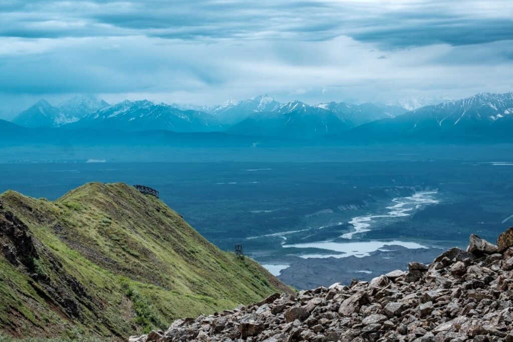
The Crystalline Hills Trail gradually climbs through dense forest and loops back along the base of the Crystalline Hills. Throughout the hike make sure you pick a place to scramble up so you can enjoy the incredible views. Once you get up you will be rewarded with scenic views of Chitina River Valley, the Chugach Mountains, and Moose Lake. If you’re feeling adventurous you can continue and climb higher into the Crystalline Hills for remote camping. This way you can get more scenic views whilst exploring the high ridges and rocky ledges in the area. This is the perfect hike if you’re looking for great views, but don’t feel like you can attempt the more strenuous hikes.
Lost Creek Trail
- Distance: 7 miles / 11.26 km round trip
- Elevation Gain: 4064 feet (1239m)
- Estimated Time: 8-10 hours
- Type of Trail: Out and back
- Trailhead Location: Lost Creek trailhead parking area at mile 31.2
- Map: NPS
Lost Creek Trail is the longest hiking route in Wrangell-St. Elias National Park. It has everything you could possibly ask for when traveling to Alaska including breathtaking scenery and the chance to spot incredible wildlife. The trail starts off in a wooded area before heading onto a wide creek bed. Although the creek bed is wide, you will have to cross over it a few times on this route. As the valley starts to narrow, start looking for a place where you can hike up the west side of the valley. From this point, there is no trail so make sure you follow the drainage back instead of looking for a path. The whole trail is very long, which can put many beginner hikers off. However, the route can also be done as an out and back trail. That means you can head back at any time and choose the length you want to hike.
McCarthy Creek Trail
- Distance: 6.45 miles / 10.45 km one way (12.9 miles / 20.9 km round trip)
- Elevation Gain: 2457 feet (749m)
- Estimated Time: 4-6 hours
- Type of Trail: Out and back
- Trailhead Location: Dowtown McCarthy, just past the historic hardware store
- Map: All Trails
After you pass the historic hardware store in McCarthy, turn left onto a short trail that leads down to the river. You will head over a footbridge and the trail starts about 182m after the bridge. The trail runs through the McCarthy Creek bed until about three miles in, where the river has washed out the route. The trail now ends at the river between an old cabin, and where the original route used to cross the creek. The main thing to remember about this trail is that McCarthy Creek is actually a fairly big river. Although it’s possible to cross the creek at low water, it can become very hazardous at a higher water volume. It’s important to use your judgment when deciding to cross, so if the river looks dangerous just turn back.
Rambler Mine Trail
- Distance: 0.8 mile / 1.35 km one way (1.6 miles / 2.7 km round trip)
- Elevation Gain: 521 feet (159m)
- Estimated Time: 1-2 hours
- Type of Trail: Out and back
- Trailhead Location: Through the Ellis property at the end of Mile 42 on Nabesna Road
- Map: All Trails
To get to the trailhead for the Rambler Mine Trail you have to go through private property. At the end of Mile 42 on Nabesna Road, you will come to the Ellis property. Continue driving past their property, and you will come to a gravel parking area about 1000ft away. This trail follows the historic mining road for about 1/3 mile until you need to turn right off onto the trail. The trail runs through a forest and will eventually lead you up to Rambler Mine. The mine was used to extract gold in the 1940s and is a cool sight to see. However, be careful when exploring this area as the mine opening, tunnels and surrounding buildings are hazardous and in disrepair. From this point, you can continue upwards for better views, but the route isn’t maintained and can be difficult to see.
Trail Creek Trail
- Distance: 10 miles / 16 km one way (20 miles / 32 km round trip)
- Estimated Time: 8-10 hours
- Type of Trail: Out and back
- Trailhead Location: Nabesna Road at mile 29.8
- Map: NPS
From the trailhead, the first 4 miles of the hike follow the creek bed. After this, you will reach the mouth of Trail Creek Canyon, and after continuing along for a further 2 miles the canyon starts to narrow. The maintained trail of this route is 6 miles one way, but if you head up to the pass it’s around 10 miles one way. As this is an out and back route, you can head back along the trail whenever you fancy shortening the hike. If you want to hike up the pass, the route follows a side canyon where you will continue to ascend towards the pass. This will get you incredible panoramic views, lots of beautiful wildflowers, and the opportunity to spot arctic ground squirrels and Dall sheep.
Easy Wrangell – St. Elias Hikes
West Kennecott Glacier Trail
- Distance: 1.2 miles / 1.95 km one way (2.4 miles / 3.9 km round trip)
- Elevation Gain: 442 feet (135m)
- Estimated Time: 1-2 hours
- Type of Trail: Out and back
- Trailhead Location: McCarthy
- Map: All Trails
If you are looking for an easy hike in Wrangell-St. Elias National Park then this is the one for you. The West Kennecott Glacier Trail is found near Chitina and is relatively flat making it a great choice for beginners. Although only a small hike, it’s one of the most rewarding in the park. With beautiful views of the surrounding mountains and the glacier in the distance, this trail needs to be on your list. Due to it’s length and location, it’s one of the best hikes to do if you only have a short amount of time in the National Park.
Frequently Asked Questions about Wrangell – St. Elias Trails?
Can you Hike in Wrangell St Elias?
Hiking in Wrangell-St. Elias National Park is one of the best things to do if you are visiting the United States. There is something about the wilderness of this place that really draws people in and it’s easy to see why!
There are a variety of hikes in the national park ranging from strenuous to easy, so there is something for every fitness level. Whether you are an advanced hiker or a beginner, you will find a trail in this park for you.
However, due to the sheer size of Wrangell-St. Elias and its mountainous terrain, access to much of the national park is limited. Although if you’re looking for an adventure, it’s possible to fly into the park for mountaineering, rafting, and of course backcountry hiking.
It’s also important to note that most of the park’s hiking trails are only maintained for the first few miles, and after that they become routes. This means that some of the trails can become more difficult to follow once you reach a certain point, so always keep a map or GPS with you.
Where is the best place to hike in Wrangell – St Elias National Park & Preserve?
The best place to hike in Wrangell-St. Elias National Park is along the McCarthy Road. The most popular day hike is Root Glacier.
What is the longest trail in Wrangell – St Elias National Park & Preserve?
The longest trail in Wrangell-St. Elias National Park and Preserve is The Goat Trail. The Goat Trail is 39.9 miles long and is typically a 2-5 day backpacking trip.
Final Thoughts on Day Hiking in the Wrangell – St. Elias
We hope this article has encouraged you to try some of the beautiful trails Wrangell – St. Elias National Park has to offer, so you can experience the mesmerizing scenery for yourself. Which is your favorite hike in Wrangell – St. Elias National Park? If it isn’t on this list, then leave a comment below to inspire other hikers or join us in talking about all things National Parks in our National Park Trip Planning Community.
More Information for your trip to Alaska
- ALASKA: National Parks of Alaska
- ALASKA NATIONAL PARK: How much does it cost to visit Alaska’s National Parks?
- DENALI: Visiting Denali National Park and Preserve: The Complete Guide
- 11 Things to Know Before Visiting Denali National Park and Preserve
- 8 Books to Read Before visiting Denali National Park
- Denali National Park Camping: The Definitive Guide to Camping in Denali National Park
- Where to Stay in Denali National Park? 14 Best Denali Hotels
- The 20 ABSOLUTE Best Hikes in Denali National Park
- 25 Amazing Denali National Park Tours
- Denali Road Lottery – Everything You Need to Know
- GLACIER BAY: Visiting Glacier Bay National Park and Preserve: The Complete Guide
- KATMAI: Visiting Katmai National Park and Preserve: The Complete Guide
- FAIRBANKS: Chena Hot Springs Resort – The best way to end your Alaska Adventure
- WRANGELL – ST. ELIAS: Visiting Wrangell – St. Elias National Park and Preserve: The Complete Guide
Pin for Later: The 13 ABSOLUTE Best Hikes in Wrangell – St. Elias National Park for 2022

Hi, I'm Jennifer!

Welcome to the wonderful world of National Parks. I'm here to help you plan your NEXT amazing adventure through the United States National Parks and beyond. I want the national parks to be accessible to all.
I live in Tennessee, and when I'm home, you can find me hiking in the Smokies and the Cumberland Plateau.
58/63 National Parks
250+/423 National Park Units
Want to know more? Start Here.
Snag one of my National Park Ebooks and Downloadable Itineraries

Talk with an Expert

Share your love of the parks with a shirt, ornaments, hoodies, frames, and more.
