Post Summary: Glacier Bay National Park Maps
In need of a map of the Glacier Bay National Park and Preserve? We have complied about 11 Glacier Bay National Park maps for you to view and download. You will find trail maps, campground maps, glaciers maps, and a range of other maps for you to view and download.
This post may contain affiliate links, meaning if you book or buy something through one of these links, I may earn a small commission at no extra cost to you! Read the full disclosure policy here
Where is Glacier Bay National Park?
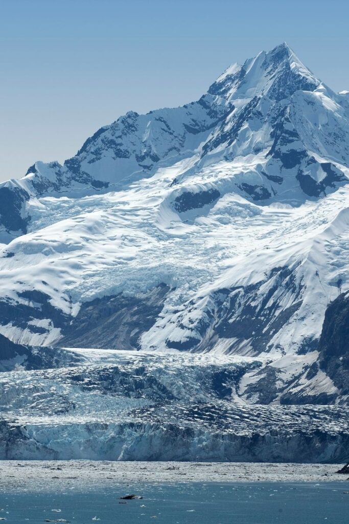
Glacier Bay National Park is located in Southeast Alaska along at the northern end of the Inside Passage.
Glacier Bay National Parks Maps
Glacier Bay Maps From Park Brochures
Complete Glacier Bay Map
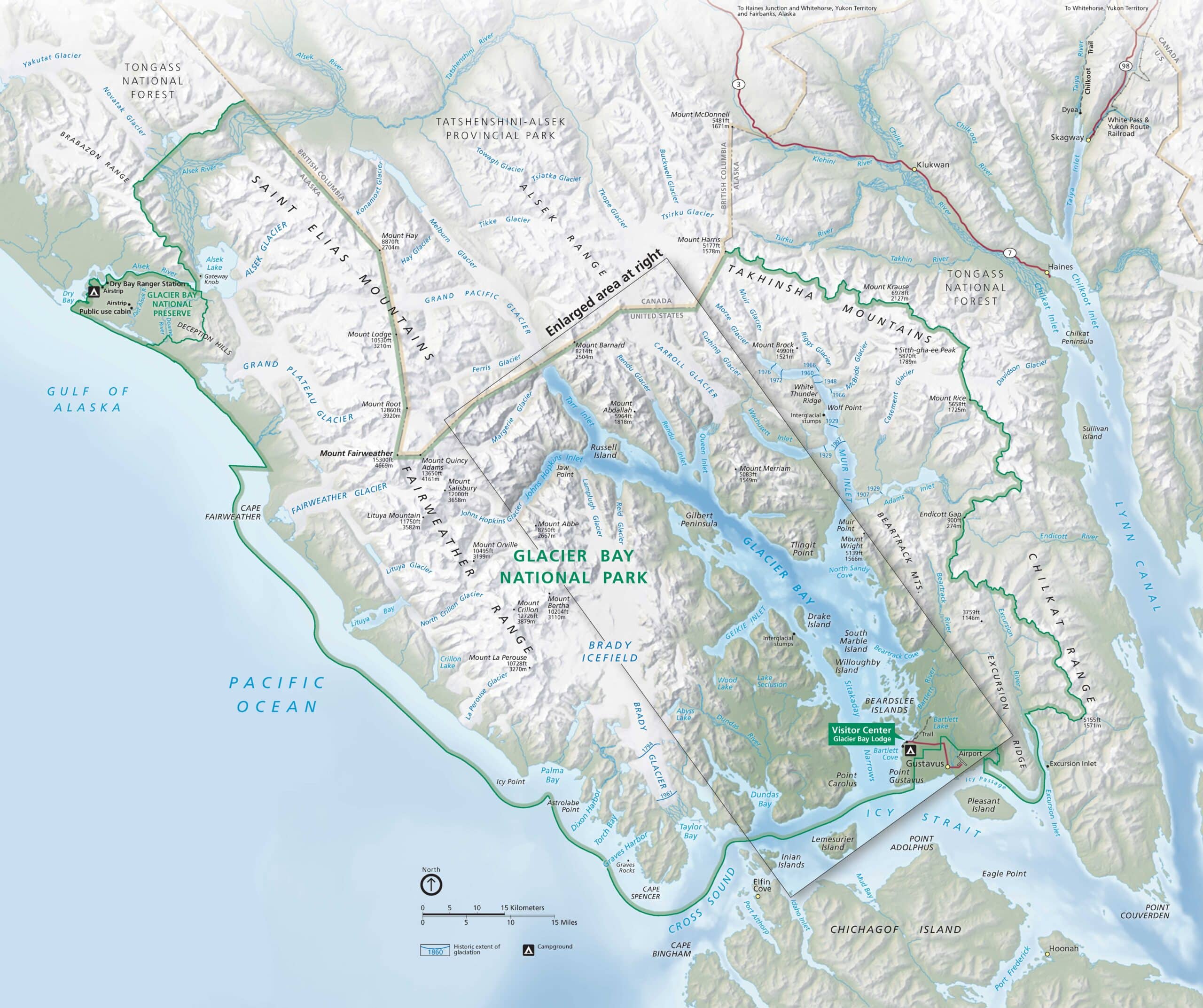
This is the complete Glacier Bay National Park Map from the official brochure. It shows the entire park and preserves along with the bays, glaciers, mountains, and ice fields.
Glacier Bay Insert Map
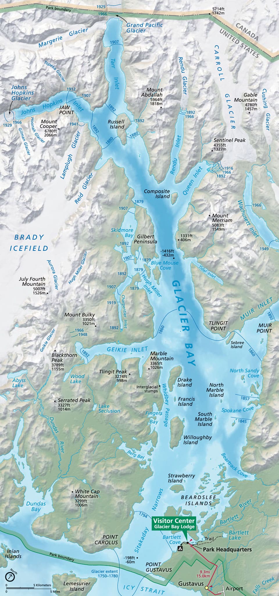
This is a zoomed-in view of Glacier Bay, the namesake bay of Glacier Bay National Park. This is the most popular area with visitors and the main area that cruise ship visitors tour. The view shows many of the named glaciers and small islands within the bay.
Regional Map of Glacier Bay
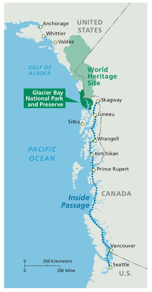
This is a regional map of the Glacier Bay National Park and Preserve area in relation to Anchorage and Alaska’s Inside Passage towns as well as the Kluane / Wrangell-St. Elias / Glacier Bay / Tatshenshini-Alsek UNESCO World Heritage Site.
Kluane / Wrangell-St. Elias / Glacier Bay / Tatshenshini-Alsek UNESCO World Heritage Site
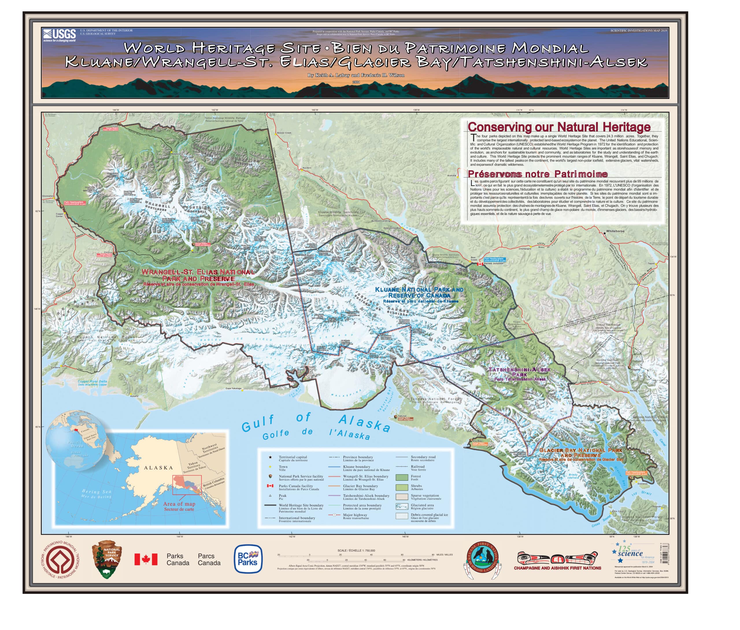
Glacier Bay National Park is part of the Kluane / Wrangell-St. Elias / Glacier Bay / Tatshenshini-Alsek UNESCO World Heritage Site. This MASSIVE UNESCO World Heritage site is the first bi-national International World Heritage Site. This site was first created in 1978 and included Wrangell-St. Elias National Park and Canada’s Kluane National Park. In 1993, the site was expanded to included Glacier Bay and Canada’s Tatshenshini-Alsek Provincial Park.
Best Glacier Bay Maps for Hiking
National Geographic Trails Illustrated Map of Glacier Bay
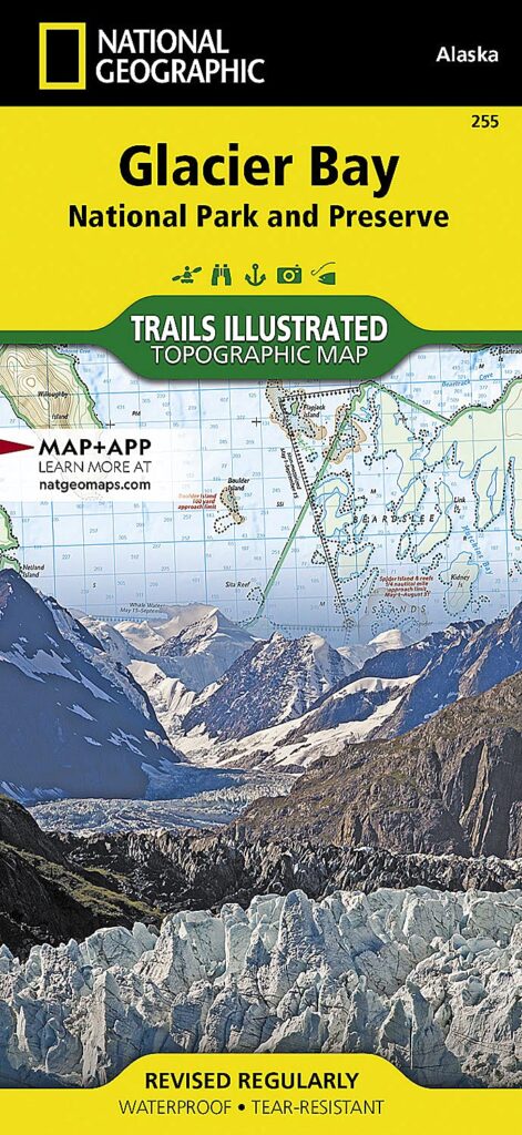
The National Park provided maps are good maps to get you an overview of the park but they shouldn’t be used for more than cursory navigation. If you are planning to do any off-trail hiking or just want a more in-depth look at the park, this map is for you. The detailed Glacier Bay National Park map includes ocean depths and topographic lines.
>>> Get the National Geographic Trails Illustrated Map Here
>>> Get the Map and the Glacier Bay Pocket Naturalist Guide Combo
Bartlett Cove Trail Guide
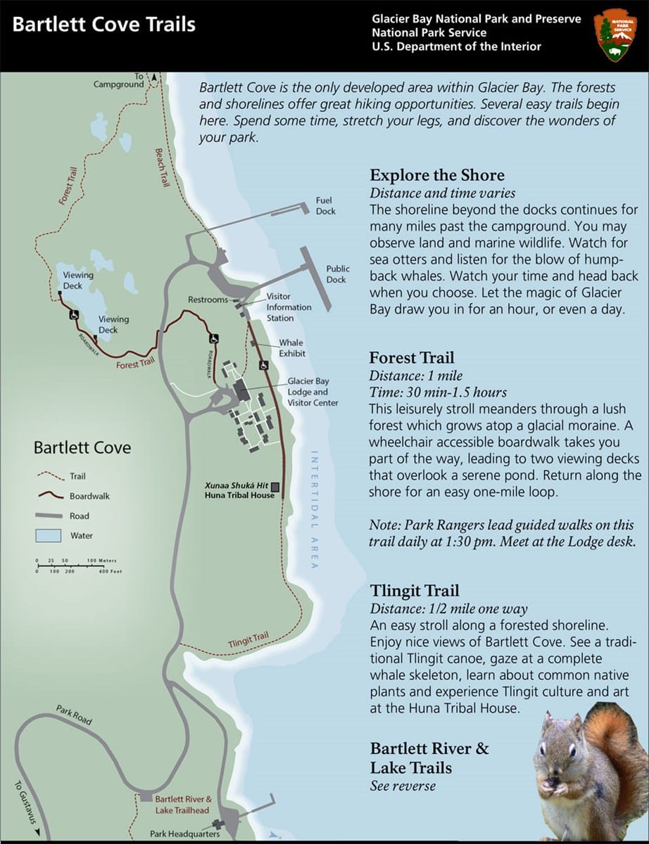
This map provides a basic overview of the hiking trails in Bartlett Cove.
Bartlett River and Lake Trail Guide
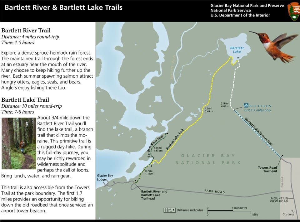
This map shows the routes of the Barlett River and Bartlett Lake trails.
Related: 5 ABSOLUTE Best Hikes in Glacier Bay National Park for 2022
Glacier Bay Campground Map
Bartlett Cove Campground
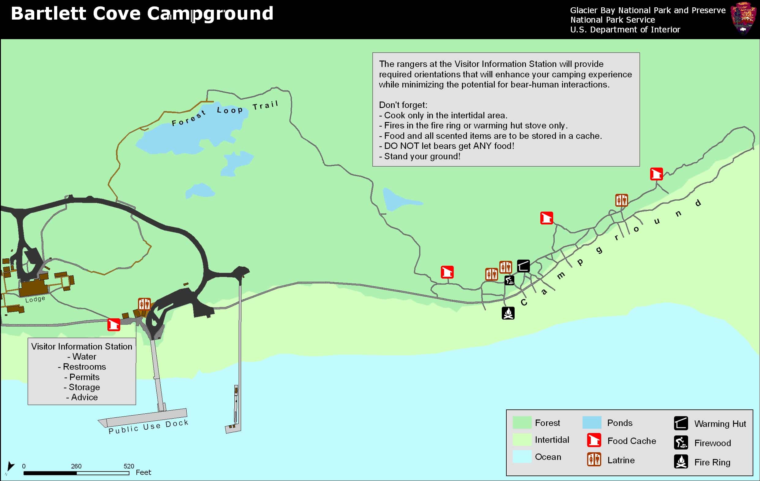
This is the map of Bartlett Cove Campground. The campground is a short walk from the visitor center and the park headquarters.
Other Glacier Bay National Park Maps
Glacier Bay 3D Map
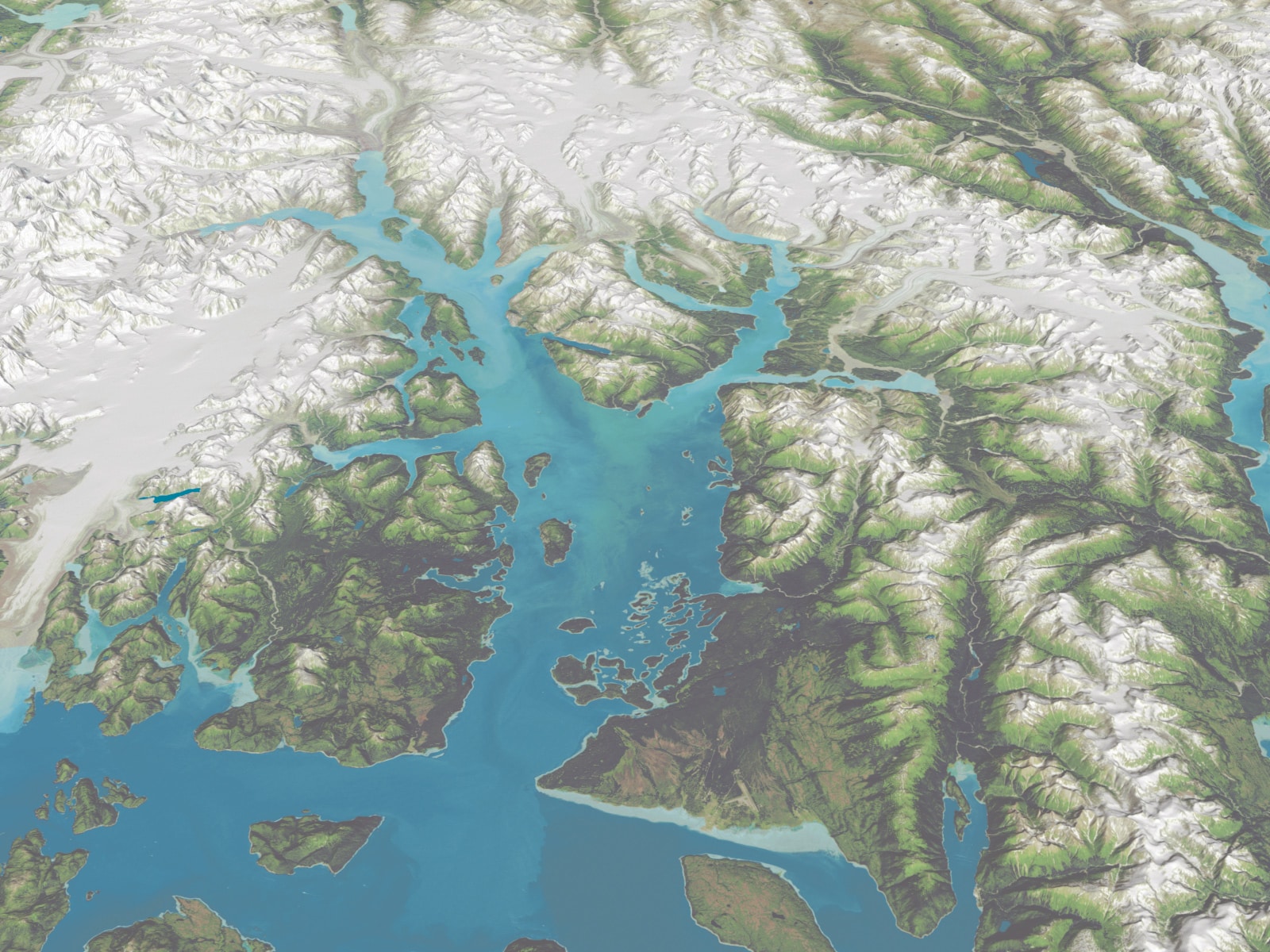
This 3D map of Glacier Bay National Park. It shows an aerial perspective of the fjords, ice sheets, bay, and glaciers of the park.
Terminus Map of Glacier Bay Glaciers
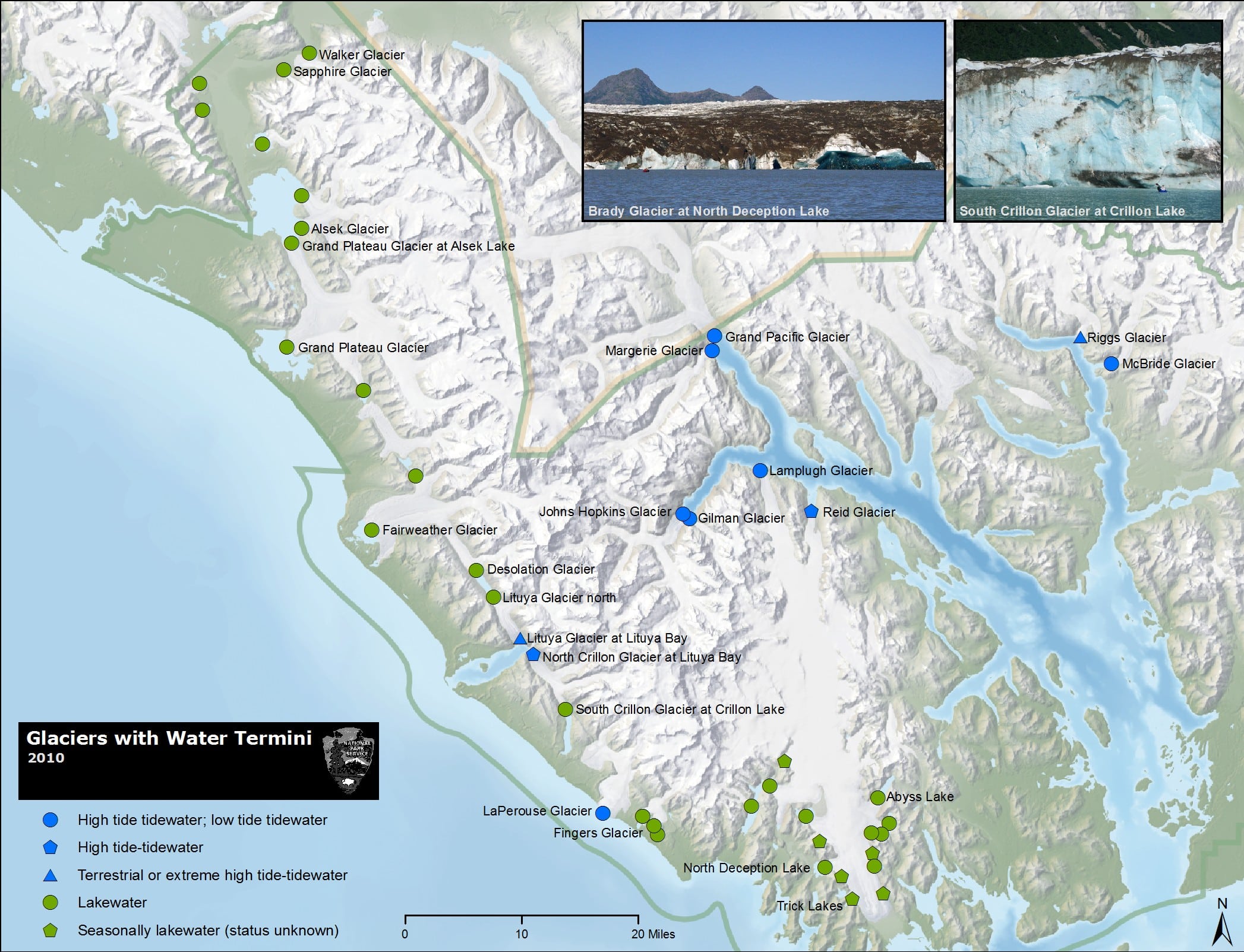
This map shows the terminus of the major glaciers of Glacier Bay National Park. It shows which glaciers are tidewater glaciers and which have a glacier lake.
Glacier Bay Land Cover Map
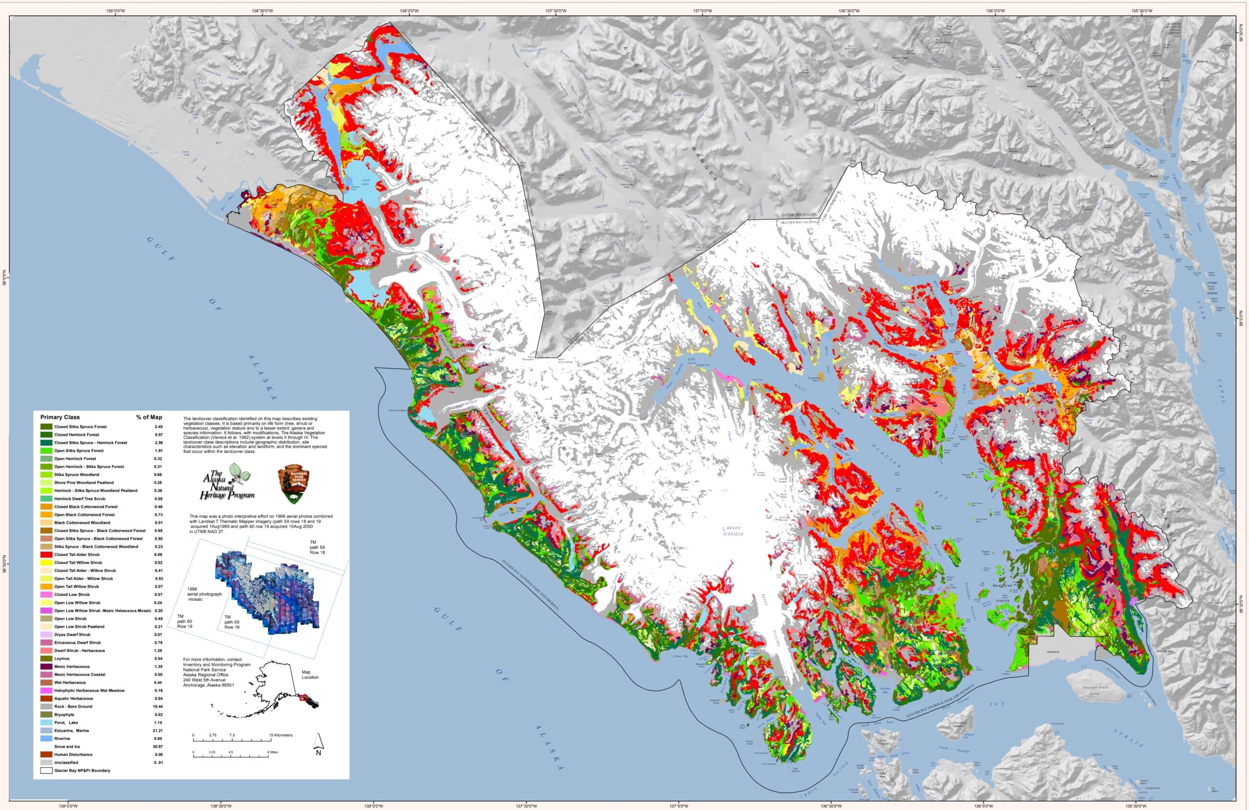
This is the complete Glacier Bay National Park Map from the official brochure. It shows the entire park and preserves along with the bays, glaciers, mountains, and ice fields.
Final Thoughts on Glacier Bay National Park Maps
We hope you have found the Glacier Bay National Park Map you were looking for. Share your favorite Glacier Bay memory in the comments below. Then join us in talking about all things National Parks in our National Park Trip Planning Community on Facebook.
More Information for your trip to Alaska
- ALASKA: National Parks of Alaska
- ALASKA NATIONAL PARK: How much does it cost to visit Alaska’s National Parks?
- DENALI: Visiting Denali National Park and Preserve: The Complete Guide
- 11 Things to Know Before Visiting Denali National Park and Preserve
- 8 Books to Read Before visiting Denali National Park
- Denali National Park Camping: The Definitive Guide to Camping in Denali National Park
- Where to Stay in Denali National Park? 14 Best Denali Hotels
- The 20 ABSOLUTE Best Hikes in Denali National Park
- 25 Amazing Denali National Park Tours
- Denali Road Lottery – Everything You Need to Know
- GLACIER BAY: Visiting Glacier Bay National Park and Preserve: The Complete Guide
- KATMAI: Visiting Katmai National Park and Preserve: The Complete Guide
- FAIRBANKS: Chena Hot Springs Resort – The best way to end your Alaska Adventure
- WRANGELL – ST. ELIAS: Visiting Wrangell – St. Elias National Park and Preserve: The Complete Guide
Pin for Later: Glacier Bay National Park Maps: The Complete Collection

Hi, I'm Jennifer!

Welcome to the wonderful world of National Parks. I'm here to help you plan your NEXT amazing adventure through the United States National Parks and beyond. I want the national parks to be accessible to all.
I live in Tennessee, and when I'm home, you can find me hiking in the Smokies and the Cumberland Plateau.
58/63 National Parks
250+/423 National Park Units
Want to know more? Start Here.
Snag one of my National Park Ebooks and Downloadable Itineraries

Talk with an Expert

Share your love of the parks with a shirt, ornaments, hoodies, frames, and more.
